|
Ein Al-Beida
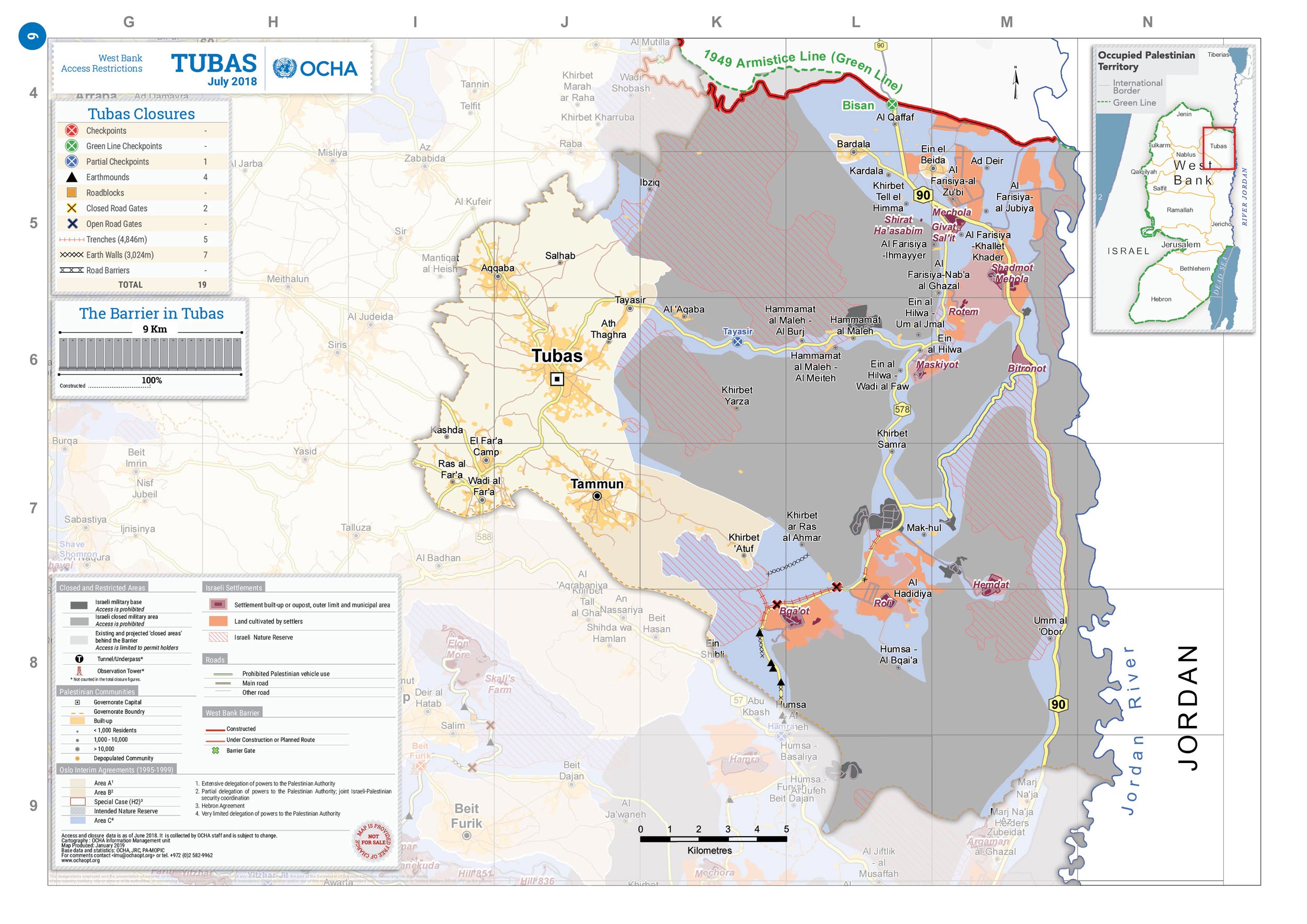
Ein al-Beida ( ar, عين البيضا) is a Palestinian village of in the Tubas Governorate in the northeastern West Bank. It has a population of about 1,050. History Ceramics from the Byzantine era have been found here. In the wake of the 1948 Arab–Israeli War, and after the 1949 Armistice Agreements, Ein al-Beida came under Jordanian rule. Ein al-Beida was reestablished in 1952 by Arab farmers belonging to the Fuquha and Daraghmah families from nearby Tubas who owned farms in the area and decided to establish a village. The village is named after a large spring in the area, ''Ein al-Beida'', which was once used to irrigate the neighboring land. In the 1961 Jordanian census Ein al-Beida's population was 573.Government of Jordan, 1964, p27/ref> Post 1967 Since the Six-Day War in 1967, Ein al-Beida has been under Israeli occupation. The spring nearby which provided some of its farmers with irrigation dried up when the Israeli water company Mekorot drilled a well nearby in ord ... [...More Info...] [...Related Items...] OR: [Wikipedia] [Google] [Baidu] |
Arabic Script
The Arabic script is the writing system used for Arabic and several other languages of Asia and Africa. It is the second-most widely used writing system in the world by number of countries using it or a script directly derived from it, and the third-most by number of users (after the Latin and Chinese scripts). The script was first used to write texts in Arabic, most notably the Quran, the holy book of Islam. With the religion's spread, it came to be used as the primary script for many language families, leading to the addition of new letters and other symbols. Such languages still using it are: Persian (Farsi/Dari), Malay ( Jawi), Uyghur, Kurdish, Punjabi (Shahmukhi), Sindhi, Balti, Balochi, Pashto, Lurish, Urdu, Kashmiri, Rohingya, Somali and Mandinka, Mooré among others. Until the 16th century, it was also used for some Spanish texts, and—prior to the language reform in 1928—it was the writing system of Turkish. The script is written from right to left in a cu ... [...More Info...] [...Related Items...] OR: [Wikipedia] [Google] [Baidu] |
Mekorot
Mekorot ( he, מקורות, lit. "Sources") is the national water company of Israel and the country's top agency for water management. Founded in 1937, it supplies Israel with 90% of its drinking water and operates a cross-country water supply network known as the National Water Carrier. Mekorot and its subsidiaries have partnered with numerous countries around the world in areas including desalination and water management. History Mekorot was established as the "''Ḥevrat ha-Mayim''" ('Water Company') on 15 February 1937 by Levi Shkolnik (later Eshkol, Prime Minister of Israel between 1963-1969), water engineer Simcha Blass, and Pinchas Koslovsky (later Sapir, Minister of Finance between 1963-1968). Water supply system Mekorot supplies 80% of Israel's drinking water and 70% of its water supplies. The company runs 3,000 installations throughout the country for water supply, water quality, infrastructure, sewage purification, desalination, rain enhancement, etc. Mekorot overse ... [...More Info...] [...Related Items...] OR: [Wikipedia] [Google] [Baidu] |
Applied Research Institute–Jerusalem
The Applied Research Institute - Jerusalem (ARIJ; ar, معهد الابحاث التطبيقية - القدس) is a Palestinian NGO founded in 1990 with its main office in Bethlehem in the West Bank. ARIJ is actively working on research projects in the fields of management of natural resources, water management, sustainable agriculture and political dynamics of development in the Palestinian Territories. Projects POICA Together with the Land Research Center (LRC), ARIJ runs a joint project named ''POICA, Eye on Palestine–Monitoring Israeli Colonizing activities in the Palestinian Territories''. The project, funded by the European Union, inspects and scrutinizes Israeli colonizing activities in the West Bank and Gaza, and disseminates the related information to policy makers in the European countries and to the general public. Sustainable waste treatment In 2011 ARIJ, along with the TTZ Bremerhaven, the University of Extremadura, and the Institute on Membrane Technolog ... [...More Info...] [...Related Items...] OR: [Wikipedia] [Google] [Baidu] |
Palestine Exploration Fund
The Palestine Exploration Fund is a British society based in London. It was founded in 1865, shortly after the completion of the Ordnance Survey of Jerusalem, and is the oldest known organization in the world created specifically for the study of the Levant region, also known as Palestine. Often simply known as the PEF, its initial objective was to carry out surveys of the topography and ethnography of Ottoman Palestine – producing the PEF Survey of Palestine – with a remit that fell somewhere between an expeditionary survey and military intelligence gathering. It had a complex relationship with Corps of Royal Engineers, and its members sent back reports on the need to salvage and modernise the region.Ilan Pappé (2004) A history of modern Palestine: one land, two peoples Cambridge University Press, pp 34-35 History Following the completion of the Ordnance Survey of Jerusalem, the Biblical archaeologists and clergymen who supported the survey financed the creation of t ... [...More Info...] [...Related Items...] OR: [Wikipedia] [Google] [Baidu] |
Palestinian Central Bureau Of Statistics
The Palestinian Central Bureau of Statistics (PCBS; ar, الجهاز المركزي للإحصاء الفلسطيني) is the official statistical institution of the State of Palestine. Its main task is to provide credible statistical figures at the national and international levels. It is a state institution that provides service to the governmental, non – governmental and private sectors in addition to research institutions and universities. It is established as an independent statistical bureau. The PCBS publishes the ''Statistical Yearbook of Palestine'' and the ''Jerusalem Statistical Yearbook'' annually. The head office of the agency is in Ein Munjed Quarter, Ramallah. Activities Besides general statistics, such as the Retail Price Index, the PCBS also carries out special projects. It conducted the first Palestinian census in 1997, although Israel prevented the national census team from surveying the population in East Jerusalem. In 2007, the second census was carried o ... [...More Info...] [...Related Items...] OR: [Wikipedia] [Google] [Baidu] |
Dunam
A dunam ( Ottoman Turkish, Arabic: ; tr, dönüm; he, דונם), also known as a donum or dunum and as the old, Turkish, or Ottoman stremma, was the Ottoman unit of area equivalent to the Greek stremma or English acre, representing the amount of land that could be ploughed by a team of oxen in a day. The legal definition was "forty standard paces in length and breadth", but its actual area varied considerably from place to place, from a little more than in Ottoman Palestine to around in Iraq.Λεξικό της κοινής Νεοελληνικής (Dictionary of Modern Greek), Ινστιτούτο Νεοελληνικών Σπουδών, Θεσσαλονίκη, 1998. The unit is still in use in many areas previously ruled by the Ottomans, although the new or metric dunam has been redefined as exactly one decare (), which is 1/10 hectare (1/10 × ), like the modern Greek royal stremma. History The name dönüm, from the Ottoman Turkish ''dönmek'' (, "to turn"), appears ... [...More Info...] [...Related Items...] OR: [Wikipedia] [Google] [Baidu] |
Israeli Settlement
Israeli settlements, or Israeli colonies, are civilian communities inhabited by Israeli citizens, overwhelmingly of Jewish ethnicity, built on lands occupied by Israel in the 1967 Six-Day War. The international community considers Israeli settlements to be illegal under international law, though Israel disputes this. Israeli settlements currently exist in the West Bank (including East Jerusalem), claimed by the State of Palestine as its sovereign territory, and in the Golan Heights, widely viewed as Syrian territory. East Jerusalem and the Golan Heights have been effectively annexed by Israel, though the international community has rejected any change of status in both territories and continues to consider each occupied territory. Although the West Bank settlements are on land administered under Israeli military rule rather than civil law, Israeli civil law is "pipelined" into the settlements, such that Israeli citizens living there are treated similarly to those livi ... [...More Info...] [...Related Items...] OR: [Wikipedia] [Google] [Baidu] |
Green Line (Israel)
The Green Line, (pre-)1967 border, or 1949 Armistice border, is the demarcation line set out in the 1949 Armistice Agreements between the armies of Israel and those of its neighbors (Egypt, Jordan, Lebanon and Syria) after the 1948 Arab–Israeli War. It served as the ''de facto'' borders of the State of Israel from 1949 until the Six-Day War in 1967. The Green Line was intended as a demarcation line rather than a permanent border. The 1949 Armistice Agreements were clear (at Arab insistence) that they were not creating permanent borders. The Egyptian–Israeli agreement, for example, stated that "the Armistice Demarcation Line is not to be construed in any sense as a political or territorial boundary, and is delineated without prejudice to rights, claims and positions of either Party to the Armistice as regards ultimate settlement of the Palestine question." [...More Info...] [...Related Items...] OR: [Wikipedia] [Google] [Baidu] |
Bardala
Bardala ( ar, بردلة) is a Palestinian village in the northern Jordan Valley of the West Bank, consisting of 1,637 inhabitants. The town lies in the Tubas Governorate, located thirteen kilometers northeast of Tubas and 28 kilometers northeast of Nablus. The Israeli settlement of Mehola lies nearby.Isabel KershnerStrategic Corridor in West Bank Remains a Stumbling Block in Mideast Talks,' New York Times, 4 January 2014. History Bardala's history dates back to 1500 BCE. The main periods of settlement evidenced by archaeological excavation are the Byzantine, Early Islamic, Medieval, Ottoman and Modern ones; Roman-period finds were also present.Zertal, 2017, pp150152Greenberg and Keinan, 2009, p36/ref> A Byzantine church was built here around the year 400. On top of the remains of the church, of which the mosaic floor and column bases were excavated, stood a bathhouse from the Early Islamic period. The name ''Bardala'' derives from ''Bardaweel'' — according to tradition the ... [...More Info...] [...Related Items...] OR: [Wikipedia] [Google] [Baidu] |
Jordan River
The Jordan River or River Jordan ( ar, نَهْر الْأُرْدُنّ, ''Nahr al-ʾUrdunn'', he, נְהַר הַיַּרְדֵּן, ''Nəhar hayYardēn''; syc, ܢܗܪܐ ܕܝܘܪܕܢܢ ''Nahrāʾ Yurdnan''), also known as ''Nahr Al-Sharieat'' ( ar, نهر الشريعة), is a river in the Middle East that flows roughly north to south through the Sea of Galilee (Hebrew: כנרת Kinneret, Arabic: Bohayrat Tabaraya, meaning Lake of Tiberias) and on to the Dead Sea. Jordan and the Golan Heights border the river to the east, while the West Bank and Israel lie to its west. Both Jordan and the West Bank take their names from the river. The river holds major significance in Judaism and Christianity. According to the Bible, the Israelites crossed it into the Promised Land and Jesus of Nazareth was baptized by John the Baptist in it. Geography The Jordan River has an upper course from its sources to the Sea of Galilee (via the Bethsaida Valley), and a lower course south of ... [...More Info...] [...Related Items...] OR: [Wikipedia] [Google] [Baidu] |
Tubas (city)
Tubas (; ar, طوباس, ''Tûbâs'') is a Palestinian city in the northeastern West Bank, located northeast of Nablus, west of the Jordan Valley. A city of over 63,000 inhabitants, it serves as the economic and administrative center of the Tubas Governorate of the State of Palestine. Its urban area consists of 2,271 dunams (227 hectares). It is governed by a municipal council of 15 members and most of its working inhabitants are employed in agriculture or public services. Tubas has been identified as the ancient town of Thebez (), a Canaanite town famous for revolting against King Abimelech. During the late 19th century, during Ottoman rule in Palestine, Arab clans living in the Jordan Valley came to live in Tubas, and it became a major town in the District of Nablus, particularly known for its timber and cheese-making. It came under the British Mandate of Palestine in 1922, was annexed by Jordan after their capture of the town in the 1948 Arab–Israeli War, and then occupi ... [...More Info...] [...Related Items...] OR: [Wikipedia] [Google] [Baidu] |
Jordan Valley (Middle East)
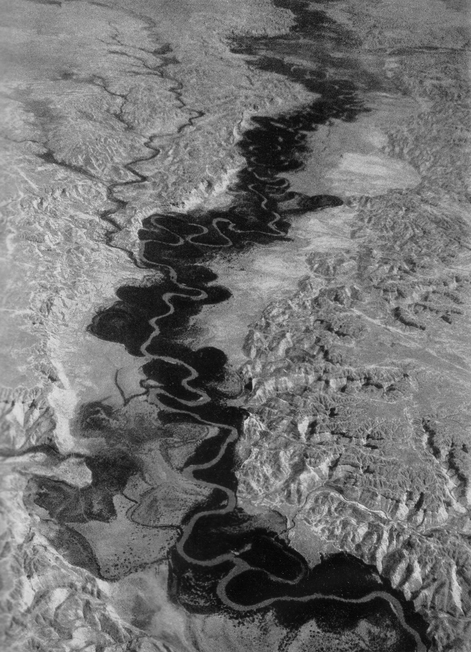
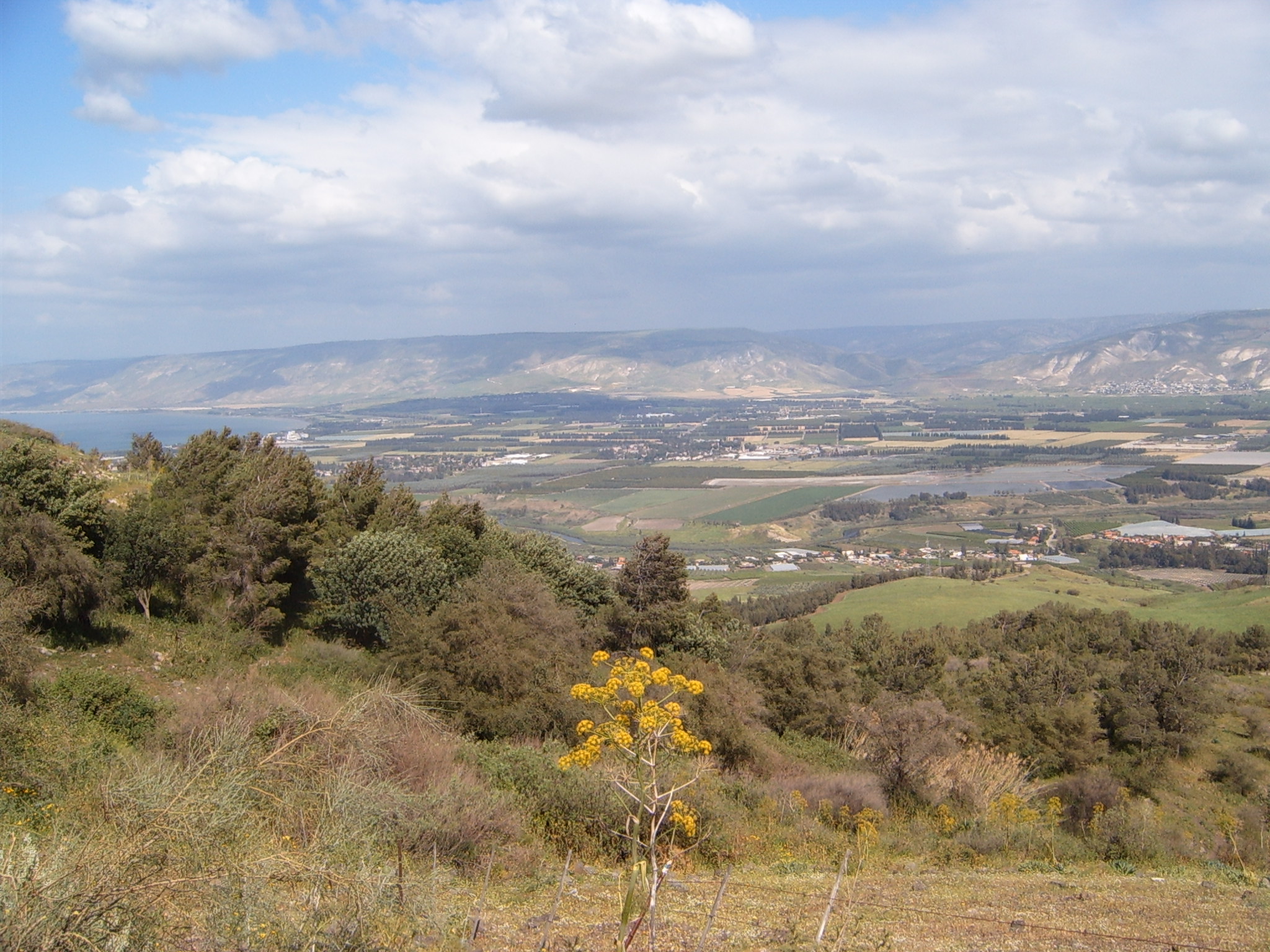
The Jordan Valley ( ar, غور الأردن, ''Ghor al-Urdun''; he, עֵמֶק הַיַרְדֵּן, ''Emek HaYarden'') forms part of the larger Jordan Rift Valley. Unlike most other river valleys, the term "Jordan Valley" often applies just to the lower course of the Jordan River, from the spot where it exits the Sea of Galilee in the north, to the end of its course where it flows into the Dead Sea in the south. In a wider sense, the term may also cover the Dead Sea basin and the Arabah valley, which is the rift valley segment beyond the Dead Sea and ending at Aqaba/Eilat, farther south. The valley, in the common, narrow sense, is a long and narrow trough, long if measured " as the crow flies", with a width averaging with some points narrowing to over most of the course, before widening out to a delta when reaching the Dead Sea. Due to meandering, the length of the river itself is . This is the valley with the lowest elevation in the world, beginning at below sea level ... [...More Info...] [...Related Items...] OR: [Wikipedia] [Google] [Baidu] |


