|
Edward Pritchard Gee
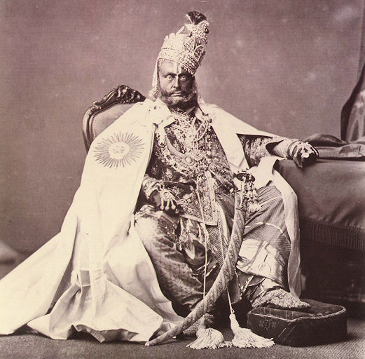
Edward Pritchard Gee (1904–1968) was a Cambridge educated, Anglo-Indian tea-planter and an amateur naturalist in Assam, India. He is credited with the 1953 discovery of Gee's golden langur. He is notable as an early influential wildlife conservationist, especially for his 1959 and 1963 surveys and recommendations resulting in the creation of Chitwan National Park, the first of nine national parks in Nepal. Conservationist Gee was the fourth son of Rev. C. G. Gee, Vicar of Lowick and his wife, daughter of a Colonel Briggs of Hylton Castle. As a tea planter, Gee was part of a highly influential group of British landowners very close to the highest levels of provincial power. Soon after India's Independence, Gee was one of the first to assess the threats to endangered species and outline conservation measures to protect them. He believed cattle had no place in a sanctuary and thought they would arouse a sense of surprise, disappointment, and revulsion in tourists who had come ... [...More Info...] [...Related Items...] OR: [Wikipedia] [Google] [Baidu] |
County Durham
County Durham ( ), officially simply Durham,UK General Acts 1997 c. 23Lieutenancies Act 1997 Schedule 1(3). From legislation.gov.uk, retrieved 6 April 2022. is a ceremonial county in North East England.North East Assembly �About North East England. Retrieved 30 November 2007. The ceremonial county spawned from the historic County Palatine of Durham in 1853. In 1996, the county gained part of the abolished ceremonial county of Cleveland.Lieutenancies Act 1997 . Retrieved 27 October 2014. The county town is the of |
Wildlife Conservation
Wildlife conservation refers to the practice of protecting wild species and their habitats in order to maintain healthy wildlife species or populations and to restore, protect or enhance natural ecosystems. Major threats to wildlife include habitat destruction, degradation, fragmentation, overexploitation, poaching, pollution and climate change. The IUCN estimates that 27,000 species of the ones assessed are at risk for extinction. Expanding to all existing species, a 2019 UN report on biodiversity put this estimate even higher at a million species. It is also being acknowledged that an increasing number of ecosystems on Earth containing endangered species are disappearing. To address these issues, there have been both national and international governmental efforts to preserve Earth's wildlife. Prominent conservation agreements include the 1973 Convention on International Trade in Endangered Species of Wild Fauna and Flora (CITES) and the 1992 Convention on Biological Diversity (C ... [...More Info...] [...Related Items...] OR: [Wikipedia] [Google] [Baidu] |
East Rapti River
The East Rapti River flows from east to west through the Chitwan Valley in Nepal, forming the northern border of the Chitwan National Park. It joins the Narayani River inside the protected area.Bhuju, U. R., Shakya, P. R., Basnet, T. B., Shrestha, S. (2007)''Nepal Biodiversity Resource Book. Protected Areas, Ramsar Sites, and World Heritage Sites''. International Centre for Integrated Mountain Development, Ministry of Environment, Science and Technology, in cooperation with United Nations Environment Programme, Regional Office for Asia and the Pacific. Kathmandu, Nepal. See also *Karra River *Kushmanda Sarowar Triveni Dham * Rapti River *Narayani River Narayani may refer to: * Narayani (deity), another name for Lakshmi * Narayani, an epithet of Yogamaya * Narayani River, or Gandaki River, in Nepal * Narayani Temple, in Narayani village, near Khalikote, Odisha, India * Narayani Zone, a former adm ... References Rivers of Bagmati Province Terai-Duar savanna and grasslands C ... [...More Info...] [...Related Items...] OR: [Wikipedia] [Google] [Baidu] |
Chitwan Valley
The Chitwan Valley ( ne, चितवन उपत्यका) is an Inner Terai valley in the south of Nepal, encompassing the districts of Makwanpur, Chitwan and Nawalpur. The valley is part of the Terai-Duar savanna and grasslands ecoregion of about length and width. Major cities are Hetauda and Ratnanagar in the easternmost part of the valley, Narayangarh and Bharatpur in its central part. The Chitwan Valley is drained by the East Rapti River, which flows from the eastern Mahabharat Range into the valley near Hetauda, where it turns west and flows along the axis of the valley. About west of Hetauda the Rapti meets the eastern border of Chitwan National Park. For the next it forms a natural boundary between human settlements on its right-hand side and protected area on its left-hand side. West of Meghauli it joins the Narayani River, a Ganges tributary called Gandaki River in India. Administrative divisions Today, Chitwan Valley is administratively divided into three d ... [...More Info...] [...Related Items...] OR: [Wikipedia] [Google] [Baidu] |
Fauna And Flora International
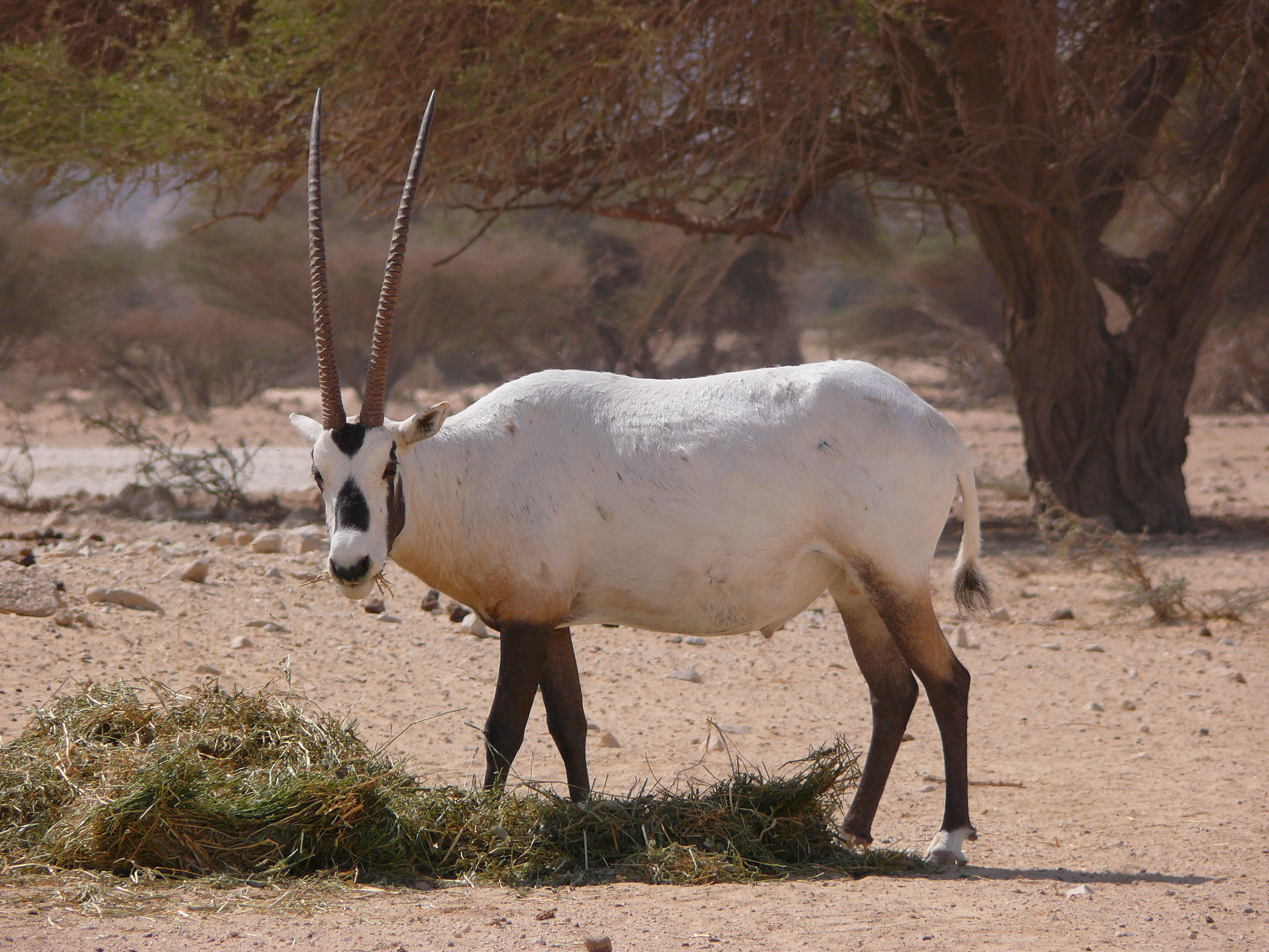
Fauna & Flora International (FFI) is an international conservation charity and non-governmental organization dedicated to protecting the planet's threatened wildlife and habitats. Founded in 1903, it is the world's oldest international conservation organisation. The logo of the society is the Arabian oryx, after the successful Operation Oryx, a flagship captive breeding and reintroduction project undertaken by the society. Founded as the Society for the Preservation of the Wild Fauna of the Empire, the society created some of the first game reserves and captive breeding programmes during the 20th century. Having since gone through several name and approach changes, FFI today coordinates conservation programmes in around 40 countries, working through local partnerships and with more focus on capacity building, community-based approaches and marine conservation than its previous iterations. The society's peer-reviewed scientific journal, now known as ''Oryx'', has been publis ... [...More Info...] [...Related Items...] OR: [Wikipedia] [Google] [Baidu] |
Kazi Rhino Edit
Kazi may refer to: * Kazi (given name), * Kaji (Nepal), Nepalese prime ministerial position (later reduced to ministers) * Kaži, cat in Vepsian * Qadi or ''Kazi'' or ''Qazi'', an Islamic legal scholar and judge * KAZI-FM, an FM radio station in Austin, Texas * Kazi (comics), a fictional character in the Marvel Comics ** Kazi (Marvel Cinematic Universe), the Marvel Cinematic Universe counterpart of the character * Kazi, an honorific title used historically in the north Indian Kingdom of Sikkim * Kazi, a mythical female healer of 8th century Czech mythology, the sister of Libuše * "Kazi", nickname of Chris Rolle, hip hop musician * '' Kazy'' is also a Kyrgyz dish and Kazakh dish * Kazi Township, Lhünzhub County (卡孜乡), Tibet Autonomous Region, People's Republic of China * Kazi Township, Namling County (卡孜乡), a township in Namling County in Tibet Autonomous Region * The Japanese surname Kaji (surname), as written in Kunrei-shiki or Nihon-shiki See also * Kaji (disambi ... [...More Info...] [...Related Items...] OR: [Wikipedia] [Google] [Baidu] |
White Tiger
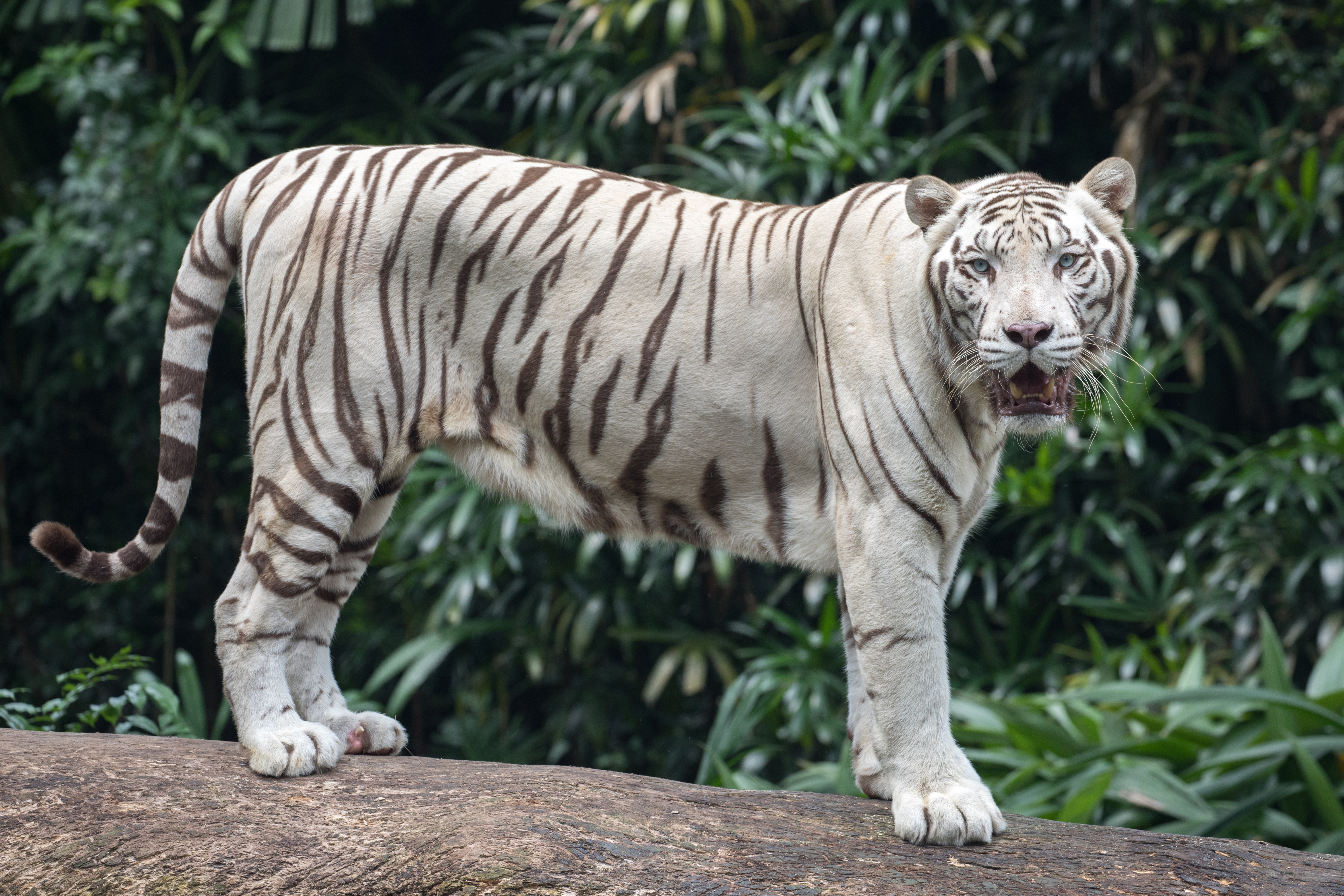
The white tiger or bleached tiger is a leucistic pigmentation variant of the Mainland tiger. It is reported in the wild from time to time in the Indian states of Madhya Pradesh, Assam, West Bengal, Bihar, Odisha, in the Sunderbans region and especially in the former State of Rewa. It has the typical black stripes of a tiger, but carries a white or near-white coat. Variation The white Bengal tigers are distinctive due to the color of their fur. The white fur caused by a lack of the pigment pheomelanin, which is found in Bengal tigers with orange color fur. When compared to Bengal tigers, the white Bengal tigers tend to grow faster and heavier than the orange Bengal tiger. They also tend to be somewhat bigger at birth, and as fully grown adults. White Bengal tigers are fully grown when they are 2–3 years of age. White male tigers reach weights of and can grow up to in length. As with all tigers, the white Bengal tiger's stripes are like fingerprints, with no two tigers ... [...More Info...] [...Related Items...] OR: [Wikipedia] [Google] [Baidu] |
Rewa (princely State)
Rewa State, also known as Rewah, was a Rajput princely state of India, surrounding its eponymous capital, the town of Rewa. With an area of about , Rewa was the largest princely state in the Bagelkhand Agency and the second largest in Central India Agency. Rewa was also the third wealthiest principality in Central India, with an average revenue of rupees 2.9 million in 1901. The Bagelkhand Agency was dissolved in 1933, following which Rewa was placed under the authority of the Indore Residency. Rewah state had a 15 gun salute. History According to legend, the kingdom of Rewa was founded around 1140 CE. On 5 October 1812, it became a British protectorate. Between 1 April 1875 and 15 October 1895, Rewa remained under the direct colonial administration of British India. The ruler of Rewa ruled from Bandhavgarh during the founding reign of Raja Vyaghra Dev, who was a direct descendant of Gujarati warrior king Vir Dhawal. In 1617, Maharaja Vikramaditya Singh moved his capi ... [...More Info...] [...Related Items...] OR: [Wikipedia] [Google] [Baidu] |
Govindgarh, Madhya Pradesh
Govindgarh, the summer capital of Mahraja Rewa, is about 18 km from Rewa in Madhya Pradesh, India. The is Rewa, with an area of about 13,000 mi², was the largest princely state in the Bagelkhand Agency and the second largest in Central India Agency. The British political agent for Bagelkhand resided at Satna, on the East Indian railway. The Bagelkhand capital establish in Rewa under the Rewa Maharaja.Bagheli is the local language of the region.It's neighbouring towns are Manikawar, Gurh and Rewa . Demographics India census, Govindgarh had a population of 9,697. Males constitute 53% of the population and females 47%. In Govindgarh, 16% of the population is under 6 years of age. Bagheli is local language of Rewa. Geography It was bordered to the north by the United Provinces, to the east by Bengal and to the south by the Central Provinces. On the west, it met other princely states of Bagelkhand, namely Maihar, Nagod, Sohawal, Kothi Baghelan and Panna. The sout ... [...More Info...] [...Related Items...] OR: [Wikipedia] [Google] [Baidu] |
Rhinos Leofleck
A rhinoceros (; ; ), commonly abbreviated to rhino, is a member of any of the five extant species (or numerous extinct species) of odd-toed ungulates in the family Rhinocerotidae. (It can also refer to a member of any of the extinct species of the superfamily Rhinocerotoidea.) Two of the extant species are native to Africa, and three to South and Southeast Asia. Rhinoceroses are some of the largest remaining megafauna: all weigh at least one tonne in adulthood. They have a herbivorous diet, small brains (400–600 g) for mammals of their size, one or two horns, and a thick (1.5–5 cm), protective skin formed from layers of collagen positioned in a lattice structure. They generally eat leafy material, although their ability to ferment food in their hindgut allows them to subsist on more fibrous plant matter when necessary. Unlike other perissodactyls, the two African species of rhinoceros lack teeth at the front of their mouths; they rely instead on their lips t ... [...More Info...] [...Related Items...] OR: [Wikipedia] [Google] [Baidu] |
Bhutan
Bhutan (; dz, འབྲུག་ཡུལ་, Druk Yul ), officially the Kingdom of Bhutan,), is a landlocked country in South Asia. It is situated in the Eastern Himalayas, between China in the north and India in the south. A mountainous country, Bhutan is known as "Druk Yul," or "Land of the Thunder Dragon". Nepal and Bangladesh are located near Bhutan but do not share a land border. The country has a population of over 727,145 and territory of and ranks 133rd in terms of land area and 160th in population. Bhutan is a Constitutional Democratic Monarchy with King as head of state and Prime Minister as head of government. Mahayana and Vajrayana Buddhism is the state religion and the Je Khenpo is the head of state religion. The subalpine Himalayan mountains in the north rise from the country's lush subtropical plains in the south. In the Bhutanese Himalayas, there are peaks higher than above sea level. Gangkhar Puensum is Bhutan's highest peak and is the highest uncl ... [...More Info...] [...Related Items...] OR: [Wikipedia] [Google] [Baidu] |
Sankosh River
Sankosh (also Mo Chu, and Svarnakosha) is a river that rises in northern Bhutan and empties into the Brahmaputra in the state of Assam in India. In Bhutan, it is known as the Puna Tsang Chu below the confluences of several tributaries near the town of Wangdue Phodrang. The two largest tributaries are the Mo Chhu and Pho Chhu, which flow together at Punakha. The Punakha dzong, which is situated immediately above the confluence of the two rivers, is one of the most beautiful dzongs in Bhutan and the winter residence of the Dratshang Lhentshog. The upper reaches of the Pho Chhu are susceptible to ice blockages, and the dzong has been damaged on several occasions by glacial lake outburst floods. After it enters in India, it flows on the border of Assam and West Bengal. At Wangdue Phodrang, elevation , the river is joined by the west flowing Tang Chuu and it enters a precipitous gorge. The highway running south from Wangdue Phodrang to Dagana follows the river for much of its cou ... [...More Info...] [...Related Items...] OR: [Wikipedia] [Google] [Baidu] |


