|
Edward Doheny
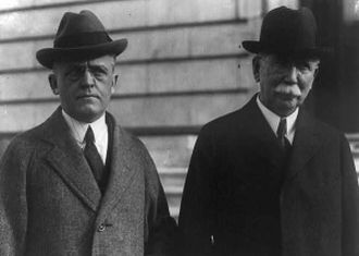
Edward Laurence Doheny (; August 10, 1856 – September 8, 1935) was an American oil tycoon who, in 1892, drilled the first successful oil well in the Los Angeles City Oil Field. His success set off a petroleum boom in Southern California, and made him a fortune when, in 1902, he sold his properties. He then began highly profitable oil operations in Tampico, Mexico's "golden belt", drilling the first well in the nation in 1901. He expanded operations during the Mexican Revolution, and opened large new oil fields in Lake Maracaibo (Venezuela). His holdings developed as the Pan American Petroleum & Transport Company, one of the largest oil companies in the world in the 1920s. In the 1920s, Doheny was implicated in the Teapot Dome Scandal and accused of offering a $100,000 bribe to United States Secretary of the Interior Albert Fall. Doheny was twice acquitted of offering the bribe, but Fall was convicted of accepting it. Doheny and his second wife and widow, Carrie Estelle ... [...More Info...] [...Related Items...] OR: [Wikipedia] [Google] [Baidu] |
Fond Du Lac, Wisconsin
Fond du Lac () is a city in Fond du Lac County, Wisconsin, Fond du Lac County, Wisconsin, United States. The population was 44,678 at the 2020 census. The city forms the core of the United States Census Bureau's Fond du Lac United States metropolitan area, Metropolitan Statistical Area, which includes all of Fond du Lac County (2020 population: 104,154). Fond du Lac is the 348th largest Metropolitan Statistical Area (MSA) in the United States. History "Fond du Lac" is French for the "bottom" or the "farthest point" "of the lake," so named because of its location at the bottom (south end) of Lake Winnebago. Native American tribes, primarily the Winnebagos but also the Potawatomi, Kickapoo people, Kickapoo, and Mascoutin lived or gathered in the area long before European explorers arrived. Although the identity of the first European to explore the southern end of Lake Winnebago is uncertain, it was probably Claude-Jean Allouez, followed by French fur trappers. James Duane Dot ... [...More Info...] [...Related Items...] OR: [Wikipedia] [Google] [Baidu] |
Upton Sinclair
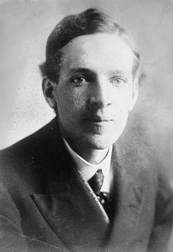
Upton Beall Sinclair Jr. (September 20, 1878 – November 25, 1968) was an American writer, muckraker, political activist and the 1934 Democratic Party nominee for governor of California who wrote nearly 100 books and other works in several genres. Sinclair's work was well known and popular in the first half of the 20th century, and he won the Pulitzer Prize for Fiction in 1943. In 1906, Sinclair acquired particular fame for his classic muck-raking novel, ''The Jungle'', which exposed labor and sanitary conditions in the U.S. meatpacking industry, causing a public uproar that contributed in part to the passage a few months later of the 1906 Pure Food and Drug Act and the Meat Inspection Act. In 1919, he published ''The Brass Check'', a muck-raking exposé of American journalism that publicized the issue of yellow journalism and the limitations of the "free press" in the United States. Four years after publication of ''The Brass Check'', the first code of ethics for journ ... [...More Info...] [...Related Items...] OR: [Wikipedia] [Google] [Baidu] |
United States Census Bureau
The United States Census Bureau (USCB), officially the Bureau of the Census, is a principal agency of the U.S. Federal Statistical System, responsible for producing data about the American people and economy. The Census Bureau is part of the U.S. Department of Commerce and its director is appointed by the President of the United States. The Census Bureau's primary mission is conducting the U.S. census every ten years, which allocates the seats of the U.S. House of Representatives to the states based on their population. The bureau's various censuses and surveys help allocate over $675 billion in federal funds every year and it assists states, local communities, and businesses make informed decisions. The information provided by the census informs decisions on where to build and maintain schools, hospitals, transportation infrastructure, and police and fire departments. In addition to the decennial census, the Census Bureau continually conducts over 130 surveys and programs ... [...More Info...] [...Related Items...] OR: [Wikipedia] [Google] [Baidu] |
Prescott, Arizona
Prescott ( ) is a city in Yavapai County, Arizona, United States. According to the 2020 Census, the city's population was 45,827. The city is the county seat of Yavapai County. In 1864, Prescott was designated as the capital of the Arizona Territory, replacing the temporary capital of Fort Whipple. The Territorial Capital was moved to Tucson in 1867. Prescott again became the Territorial Capital in 1877, until Phoenix became the capital in 1889. Prescott has a rich history as a frontier gold and silver mining town. Mining and settlers brought frequent conflict with native American tribes in the area, including the Yavapai and Apache. Prescott was the home to Fort Whipple from its inception, which acted as a base for campaigns against natives. Prescott was a stereotypical "wild west" town during the latter half of the 19th century; famous residents included Doc Holliday and Virgil Earp of the gunfight at the O.K. Corral. The makeshift wooden town burned to the ground sever ... [...More Info...] [...Related Items...] OR: [Wikipedia] [Google] [Baidu] |
1880 United States Census
The United States census of 1880 conducted by the Census Bureau during June 1880 was the tenth United States census.1880 Census: Instructions to Enumerators from , a website of the at the It was the first time that women were permitted to be [...More Info...] [...Related Items...] OR: [Wikipedia] [Google] [Baidu] |
New Mexico Territory
The Territory of New Mexico was an organized incorporated territory of the United States from September 9, 1850, until January 6, 1912. It was created from the U.S. provisional government of New Mexico, as a result of ''Santa Fe de Nuevo México, Nuevo México'' becoming part of the American frontier after the Treaty of Guadalupe Hidalgo. It existed with varying boundaries until the territory was admitted to the Union as the U.S. state of New Mexico. This jurisdiction was an organized, incorporated territory of the US for nearly 62 years, the longest period of any territory in the contiguous United States. Before the territory was organized In 1846, during the Mexican–American War, the United States established U.S. provisional government of New Mexico, a provisional government of New Mexico. Territorial boundaries were somewhat ambiguous. After the Mexican Republic formally ceded the region to the United States in 1848, this temporary wartime/military government operated u ... [...More Info...] [...Related Items...] OR: [Wikipedia] [Google] [Baidu] |
Arizona Territory
The Territory of Arizona (also known as Arizona Territory) was a territory of the United States that existed from February 24, 1863, until February 14, 1912, when the remaining extent of the territory was admitted to the Union as the state of Arizona. It was created from the western half of the New Mexico Territory during the American Civil War. History Following the expansion of the New Mexico Territory in 1853, as a result of the Gadsden Purchase, several proposals for a division of the territory and the organization of a separate Territory of Arizona in the southern half of the territory were advanced as early as 1856. These proposals arose from concerns about the ability of the territorial government in Santa Fe to effectively administer the newly acquired southern portions of the territory. The first proposal dates from a conference held in Tucson that convened on August 29, 1856. The conference issued a petition to the U.S. Congress, signed by 256 people, requesting ... [...More Info...] [...Related Items...] OR: [Wikipedia] [Google] [Baidu] |
Black Hills
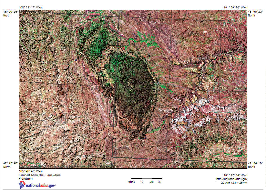
The Black Hills ( lkt, Ȟe Sápa; chy, Moʼȯhta-voʼhonáaeva; hid, awaxaawi shiibisha) is an isolated mountain range rising from the Great Plains of North America in western South Dakota and extending into Wyoming, United States. Black Elk Peak (formerly known as Harney Peak), which rises to , is the range's highest summit. The Black Hills encompass the Black Hills National Forest. The name of the hills in Lakota is ', meaning “the heart of everything that is." The Black Hills are considered a holy site. The hills are so called because of their dark appearance from a distance, as they are covered in evergreen trees. Native Americans have a long history in the Black Hills and consider it a sacred site. After conquering the Cheyenne in 1776, the Lakota took the territory of the Black Hills, which became central to their culture. In 1868, the U.S. government signed the Fort Laramie Treaty of 1868, establishing the Great Sioux Reservation west of the Missouri River, and exempt ... [...More Info...] [...Related Items...] OR: [Wikipedia] [Google] [Baidu] |
Comanche
The Comanche or Nʉmʉnʉʉ ( com, Nʉmʉnʉʉ, "the people") are a Native American tribe from the Southern Plains of the present-day United States. Comanche people today belong to the federally recognized Comanche Nation, headquartered in Lawton, Oklahoma. The Comanche language is a Numic language of the Uto-Aztecan family. Originally, it was a Shoshoni dialect, but diverged and became a separate language. The Comanche were once part of the Shoshone people of the Great Basin. In the 18th and 19th centuries, Comanche lived in most of present-day northwestern Texas and adjacent areas in eastern New Mexico, southeastern Colorado, southwestern Kansas, and western Oklahoma. Spanish colonists and later Mexicans called their historical territory ''Comanchería''. During the 18th and 19th centuries, Comanche practiced a nomadic horse culture and hunted, particularly bison. They traded with neighboring Native American peoples, and Spanish, French, and American colonists and set ... [...More Info...] [...Related Items...] OR: [Wikipedia] [Google] [Baidu] |
Kiowa
Kiowa () people are a Native American tribe and an indigenous people of the Great Plains of the United States. They migrated southward from western Montana into the Rocky Mountains in Colorado in the 17th and 18th centuries,Pritzker 326 and eventually into the Southern Plains by the early 19th century. In 1867, the Kiowa were moved to a reservation in southwestern Oklahoma. Today, they are federally recognized as Kiowa Indian Tribe of Oklahoma with headquarters in Carnegie, Oklahoma. , there were 12,000 members. The Kiowa language (Cáuijògà), part of the Tanoan language family, is in danger of extinction, with only 20 speakers as of 2012."Kiowa Tanoan" ''Ethnologue.'' Retrieved 21 June 2012. Name In the Kiowa language, Kiowa call themselves[...More Info...] [...Related Items...] OR: [Wikipedia] [Google] [Baidu] |
Labrador
, nickname = "The Big Land" , etymology = , subdivision_type = Country , subdivision_name = Canada , subdivision_type1 = Province , subdivision_name1 = Newfoundland and Labrador , subdivision_type2 = , subdivision_name2 = , subdivision_type3 = , subdivision_name3 = , subdivision_type4 = , subdivision_name4 = , image_map = File:Labrador-Region.PNG , map_caption = Labrador (red) within Canada , pushpin_map = , pushpin_relief = , pushpin_map_caption = , coordinates = , coordinates_footnotes = , established_title = Founded , established_date = 1763 , area_footnotes = , area_total_km2 = ... [...More Info...] [...Related Items...] OR: [Wikipedia] [Google] [Baidu] |
Irish Potato Famine (1845-1849)
The Great Famine ( ga, an Gorta Mór ), also known within Ireland as the Great Hunger or simply the Famine and outside Ireland as the Irish Potato Famine, was a period of starvation and disease in Ireland from 1845 to 1852 that constituted a historical social crisis which subsequently had a major impact on Irish society and history as a whole. With the most severely affected areas in the west and south of Ireland, where the Irish language was dominant, the period was contemporaneously known in Irish as , literally translated as "the bad life" (and loosely translated as "the hard times"). The worst year of the period was 1847, which became known as "Black '47".Éamon Ó Cuív – the impact and legacy of the Great Irish Famine During the Great Hunger, roughly 1 million people died and more than 1 million Irish diaspora, fled the country, causing the country's population to fall by 20–25% (in some towns falling as much as 67%) between 1841 and 1871.Carolan, MichaelÉireann's ... [...More Info...] [...Related Items...] OR: [Wikipedia] [Google] [Baidu] |


