|
Eastside Rail Corridor
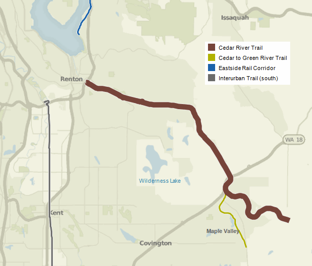
The Eastside Rail Corridor, officially Eastrail, is a rail Right of way where a rail trail is under development in the Eastside suburbs of Seattle, Washington. The corridor follows the path of the former Woodinville Subdivision from Renton to the City of Snohomish at Snohomish Junction. The northern portion was still in operation in 2017 by Eastside Freight Railroad. History Acquisition The Port of Seattle acquired the right of way of the former Woodinville Subdivision from BNSF Railway through purchase and donation in 2008. On December 10, 2012, the King County Council approved purchase of of the right-of-way from Port of Seattle. A portion of the central corridor, named the Cross Kirkland Corridor, is owned by the City of Kirkland; a spur to Redmond, named the Redmond Central Connector, is owned by the City of Redmond; a portion in downtown Bellevue was purchased by Sound Transit, and a northern portion of the corridor remains Port property for dual use as a trail and ... [...More Info...] [...Related Items...] OR: [Wikipedia] [Google] [Baidu] |
Eastside (King County, Washington)
File:Seattle-lakewashington-lakesammamish.PNG, 250px, The Eastside is to the right (east) of Seattle. # rough city boundaries poly 137 256 148 256 158 194 172 179 172 237 212 266 133 266 Renton poly 140 122 140 150 138 156 155 195 172 180 175 215 207 220 208 187 221 135 185 122 Bellevue rect 104 0 135 20 Kenmore rect 87 10 103 38 Lake Forest Park rect 134 53 173 118 Kirkland rect 110 165 145 230 Mercer Island rect 30 20 71 34 Shoreline rect 165 0 235 50 Woodinville rect 174 60 217 135 Redmond # redmond watershed rect 238 51 248 72 Redmond rect 226 203 247 240 Issaquah rect 215 114 248 199 Sammamish rect 122 125 135 150 Medina rect 41 238 133 266 Tukwila # informational "i" at bottom left desc bottom-left The Eastside of the King County, Washington area in the United States is a collective term for the suburbs of Seattle located on the east side of Lake Washington. The most common definitions of the Eastside include the cities of Bellevue, Kirkland, Redmond, Sammamish, ... [...More Info...] [...Related Items...] OR: [Wikipedia] [Google] [Baidu] |
Sound Transit
Sound Transit (ST), officially the Central Puget Sound Regional Transit Authority, is a public transit agency serving the Seattle metropolitan area in the U.S. state of Washington. It operates the Link light rail system in Seattle and Tacoma, regional Sounder commuter rail, and Sound Transit Express bus service. The agency also coordinates the regional ORCA fare card system, which is also used by local transit operators. In 2017, Sound Transit services carried a total of 47 million passengers and averaged 157,000 riders on weekdays. Sound Transit was created in 1993 by King, Pierce and Snohomish counties to build a regional rapid transit system. After an unsuccessful proposal in 1995, the agency's plan for regional light rail, commuter rail, and express bus service, named "Sound Move", was approved in November 1996. ST began operating its express bus service in September 1999, taking over existing routes from local transit agencies. The region's first commuter rail line ... [...More Info...] [...Related Items...] OR: [Wikipedia] [Google] [Baidu] |
Interurban Trail (King County)
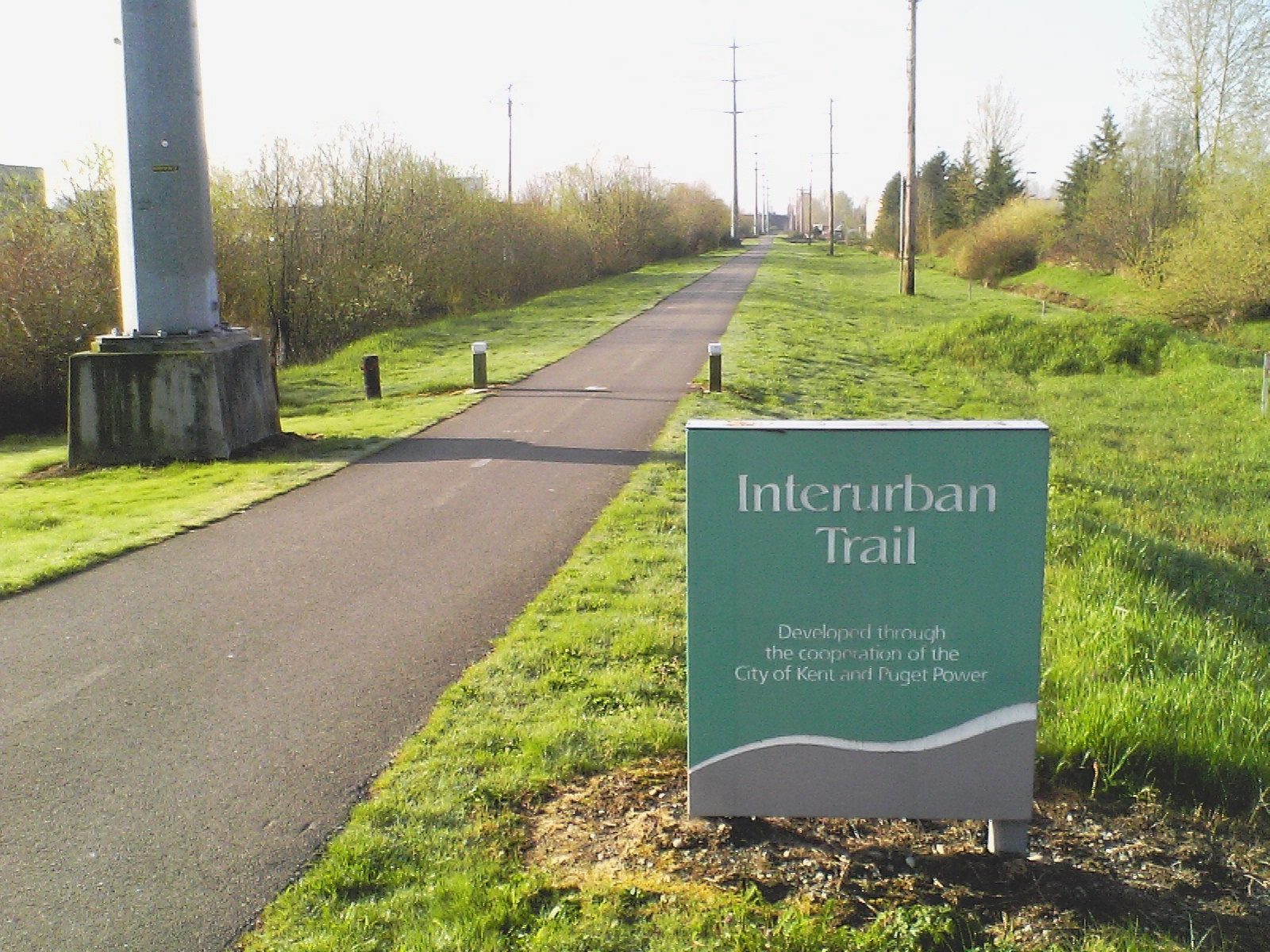
The Interurban Trail South is a rail trail in King and Pierce counties, Washington. The interurban trail North is a bicycle route running from Downtown Seattle through Shoreline and to the Snohomish County, Washington line. The Interurban Trail South is a partially paved recreational trail open for non-motorized use. It connects Tukwila to Pacific, and the towns of Kent, Auburn, and Algona along the way. Additionally, the Cities of Edgewood and Milton have completed and opened paved segments of the Interurban trail that are not yet connected to the main segment from Tukwila to Pacific, and the City of Fife has a short segment now under construction. When planned construction is completed to close the gaps in Pacific, Edgewood, and Milton, the trail will extend from Tukwila to Fife. The trail occupies an abandoned Puget Sound Electric Railway corridor and connects to the Green River Trail. In addition to the main line of the Interurban trail between Tukwila and Fife the In ... [...More Info...] [...Related Items...] OR: [Wikipedia] [Google] [Baidu] |
Green River Trail
The Green River Trail is a pedestrian and bicycle trail in King County, Washington, USA. It runs along the banks of the Duwamish and Green Rivers, crossing the river several times on bridges.Green River King County Department of Parks and Recreation. Accessed online 2009-06-13Green River Trail Dev., Ph. 1 , Washington Wildlife and Recreation Coalition. Accessed online 2009-06-13. This cites for part of the trail following the Duwamish, and for the turning basin as the start of the trail. The trail goes thro ... [...More Info...] [...Related Items...] OR: [Wikipedia] [Google] [Baidu] |
Snoqualmie Valley Trail
The Snoqualmie Valley Regional Trail is a rail trail in King County, Washington. The trail follows a portion of the former alignment of the Milwaukee Road, which was constructed in 1911 and abandoned in 1973. The trail begins at Rattlesnake Lake outside of North Bend and ends at McCormick Park in Duvall. History The Milwaukee Road constructed its Snoqualmie Valley branch in 1911, and began passenger service on April 21, 1912. Route The trail parallels Cedar Falls Road before it heads east passing Rainbow Lake and down through the Boxley Creek drainage where a trestle bridge crosses a tributary of Boxley Creek. The trail intersects the eastern edge of a subdivision and crosses the South Fork of the Snoqualmie River. The trail continues under I-90 Interstate 90 (I-90) is an east–west transcontinental freeway and the longest Interstate Highway in the United States at . It begins in Seattle, Washington, and travels through the Pacific Northwest, Mountain West, Great Pl ... [...More Info...] [...Related Items...] OR: [Wikipedia] [Google] [Baidu] |
Soos Creek Trail , a Hungarian surname
{{Disambiguation ...
Soos or SOOS may refer to: People Surname * Frank Soos, American short story writer * Ricky Soos, English retired middle-distance runner * Rozalia Șooș, Romanian former handballer Places * Soos, Iran, a village in Qazvin Province, Iran * Sooß, a town in Austria Fictional * Soos Ramirez, a character in the animated series ''Gravity Falls'' Mythological * Soos (king of Sparta), a fictitious king of Sparta Other uses * SOOS, ICAO code for Saül Airport in French Guiana * Southern Ocean Observing System (SOOS), an oceanographic initiative See also * Soós Soós may refer to: * Árpád Soós (1912–1991), Hungarian zoologist * Bela Soós (1930–2007), Romanian chess player * Edit Soós (1934–2008), Hungarian actress * Győző Soós, (1948–2015), Hungarian politician * Imre Soós Imre So ... [...More Info...] [...Related Items...] OR: [Wikipedia] [Google] [Baidu] |
Cedar River Trail
The Cedar River Regional Trail is a partially paved rail trail in Washington Washington commonly refers to: * Washington (state), United States * Washington, D.C., the capital of the United States ** A metonym for the federal government of the United States ** Washington metropolitan area, the metropolitan area centered o .... The Cedar River Trail was the former mainline of the Milwaukee Road. It is open for non-motorized use and parallels State Route 169 for much of its length. It connects Renton to Maple Valley. In Maple Valley it connects to the Cedar to Green River Trail at mile 12.3. Beyond Maple Valley the surface is crushed gravel, and the trail ends in Landsburg near a small dam and the boundary of the Cedar River Watershed. A bridge on the trail parallel to State Route 169 in Maple Valley recently underwent a renovation, and is now re-opened to foot, bike, and equestrian traffic. References External links * http://www.kingcounty.gov/recreation/parks/trails/ ... [...More Info...] [...Related Items...] OR: [Wikipedia] [Google] [Baidu] |
East Lake Sammamish Trail
The East Lake Sammamish Trail is an recreational rail trail in King County, Washington that runs along Lake Sammamish from Marymoor Park in Redmond, through Sammamish, to Gilman Boulevard in Issaquah Issaquah ( ) is a city in King County, Washington, United States. The population was 40,051 at the 2020 census. Located in a valley and bisected by Interstate 90, the city is bordered by the Sammamish Plateau to the north and the " Issaquah .... History The trail had initially encountered fierce political resistance from nearby homeowners through whose property the former BNSF Railway right-of-way runs. An interim trail, with a packed gravel surface suitable for walking and mountain biking, had been scheduled for completion by January 2006. After losing a federal lawsuit brought by the Cascade Land Conservancy and Friends of the East Lake Sammamish Trail before the U.S. Ninth Circuit Court of Appeals, however, the homeowners relented, and the trail was finally completed ... [...More Info...] [...Related Items...] OR: [Wikipedia] [Google] [Baidu] |
Sammamish River Trail
The Sammamish River Trail is a bike path and recreational rail trail in King County, Washington that runs along the Sammamish River from Blyth Park in Bothell to Marymoor Park in Redmond as part of the “Locks to Lakes Corridor.” It connects to the Burke-Gilman Trail at its northwestern end, and to the Redmond Central Connector at its southeastern end. Route The trail is paved for bicycle, inline-skate and pedestrian use and is paralleled for most of its length by an unpaved equestrian trail. It passes near the Chateau Ste. Michelle, Columbia and Silver Lake wineries in Woodinville, as well as the former site of the Redhook Ale brewery, which was leased by DeLille Cellars, Sparkman Cellars and Teatro ZinZanni. The trail has a very slight grade for its entire length. Connecting trails Other trails connecting with the Sammamish River Trail include the East Lake Sammamish Trail, Tolt Pipeline Trail The Tolt Pipeline Trail is a wide, unpaved equestrian, pedestrian and ... [...More Info...] [...Related Items...] OR: [Wikipedia] [Google] [Baidu] |
Bellevue, Washington
Bellevue ( ) is a city in the Eastside (King County, Washington), Eastside region of King County, Washington, United States, located across Lake Washington from Seattle. It is the third-largest city in the Seattle metropolitan area and has variously been characterized as a satellite city, a suburb, a boomburb, or an edge city. Its population was 122,363 at the 2010 census and 151,854 in the 2020 United States census, 2020 census. The city's name is derived from the French term ("beautiful view"). Bellevue is home to some of the world's largest technology companies. Before and after the 2008 recession, its downtown area has been undergoing rapid change with many high-rise projects being constructed. Downtown Bellevue is currently the second-largest city center in Washington state, with 1,300 businesses, 45,000 employees, and 10,200 residents. In a 2018 estimate, the city's median household income was among the top five cities in the state of Washington. In 2008, Bellevue was ... [...More Info...] [...Related Items...] OR: [Wikipedia] [Google] [Baidu] |
Spring District
The Spring District is a transit-oriented development and neighborhood that is under construction in Bellevue, Washington. The 16-block, development is centered around the Spring District/120th station on the East Link Extension, a light rail line scheduled to open in 2023. It is located in the Bel-Red area between Downtown Bellevue and Redmond, currently used for light industry, roughly bounded on the west by 120th Avenue NE and the Eastside Rail Corridor rail trail, on the north by a King County Metro bus base, on the east by 124th Avenue NE, and on the south by NE 12th Street. The Spring District is being developed by Wright Runstad & Company in a joint venture with Shorenstein Properties. NBBJ is the project's master plan architect, though individual buildings developed by Security Properties and AMLI Residential are being designed by GGLO. Plans for the neighborhood were drawn up in the late 2000s and allowed after a 2009 upzone of the Bel-Red corridor. Demolition of a ... [...More Info...] [...Related Items...] OR: [Wikipedia] [Google] [Baidu] |


.jpg)
