|
Easterside
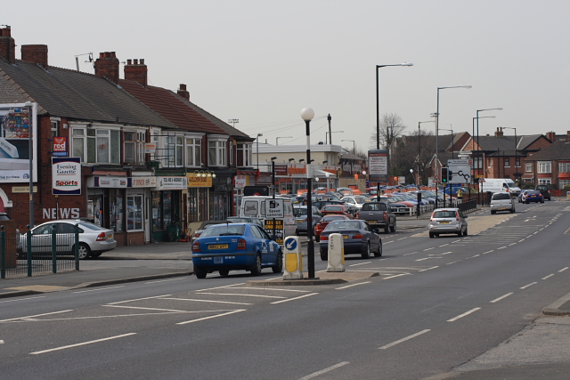
Easterside is an area in the Ladgate ward of Middlesbrough, North Yorkshire, England. It is bounded to the east by Marton Road (A172) and by B1380 (Ladgate Lane) to the south. It had a population of 2,842 in 2011. Ladgate Ward Ladgate ward is named after Ladgate Lane, the road that separates the wards two areas. Easterside has a larger centre than Tollesby, the latter is closer to the original village of Marton than it's modern centre. By postcode, Easterside is in TS4 and Tollesby is in TS7 and 8. The ward had a population of 5,583 in 2011. Middlesbrough Municipal Course is in the ward. Geography and architecture The area is south-east of the Middlesbrough town hall. The architectural style is broadly similar to the nearby Beechwood and Saltersgill in the same postcode, TS4. Much of its housing stock was built in the early to mid-1960s in an open plan style with few high walls or fences and has large green spaces in common areas. The area's centre is a small shopping stre ... [...More Info...] [...Related Items...] OR: [Wikipedia] [Google] [Baidu] |
Saltersgill
Saltersgill is an area in the Longlands and Beechwood Ward of Middlesbrough, North Yorkshire, England. In the 2011 census it had a population of 2,679. The area has a TS4 postcode. Local amenities The local shops are located along Saltersgill avenue. These include takeaway restaurants, a bakers, a betting shop and convenience stores including a Sainsbury's local. Also located on this road is the local pub The Saltersgill. Between Saltersgill and Easterside the Saltersgill playing fields. These facilities are also used and maintained by the University of Teesside. Schools Prince Bishop School – Secondary school that teaches students with emotional, behavioural and social difficulties. Beverley School – A specialist technology School for pupils with Autism aged 3–19 years. Trinity Catholic College – Catholic school and college for pupils aged 11–19. See also *Easterside *Grove Hill, Middlesbrough *Tollesby Tollesby is a residential area within the Middlesbrou ... [...More Info...] [...Related Items...] OR: [Wikipedia] [Google] [Baidu] |
Middlesbrough
Middlesbrough ( ) is a town on the southern bank of the River Tees in North Yorkshire, England. It is near the North York Moors national park. It is the namesake and main town of its local borough council area. Until the early 1800s, the area was rural farming land. By 1830, a new industrial town and port started to be developed, driven by the coal and later ironworks. Steel production and ship building began in the late 1800s, remaining associated with the town until post-industrial decline occurred in the late twentieth century. Trade (notably through ports) and digital enterprise sectors contemporarily contribute to the local economy, Teesside University and Middlesbrough College to local education. In 1853, it became a town. The motto ("We shall be" in Latin) was adopted, it reflects ("We have been") of the Bruce clan which were Cleveland's mediaeval lords. The town's coat of arms is three ships representing shipbuilding and maritime trade and an azure (blue) lion, ... [...More Info...] [...Related Items...] OR: [Wikipedia] [Google] [Baidu] |
Agnes Spencer
Thomas Spencer (7 November 1851 – 25 July 1905) was an English businessman, known for being the co-founder with Michael Marks of Marks & Spencer, a major British retailer. Early life Spencer was born on 7 November 1851 in Skipton, Yorkshire. He moved to Leeds before he was 21 and worked as a book-keeper for a wholesale company started by Isaac Jowitt Dewhirst. Marks & Spencer Spencer and Michael Marks met when Dewhirst lent Marks money to run his stalls in Leeds. In 1894, when Marks had opened a permanent store in Leeds market he invited Spencer to become a partner in what became Marks & Spencer. Spencer decided that the £300 required for a half-share in the business would be a good investment. The running of the business was split between Spencer, who managed the office and warehouse, and Marks, who continued to run the market stalls. Spencer had developed some important contacts while working for Isaac Dewhirst and these allowed him to get the best prices for goods by dea ... [...More Info...] [...Related Items...] OR: [Wikipedia] [Google] [Baidu] |
Marton Road
The A172 is a major road in North Yorkshire, and the unitary authority of Middlesbrough, England. It runs from Ingleby Arncliffe to Middlesbrough. The road derives its adumbrated number from 1969 when a thoroughfare link connected South Teesside with the Lackenby Docks in Middlesbrough. Since further urban infrastructure development it has been extended into the North Yorkshire Moors, when it transforms into A174. Marton Road Marton Road is that part of the length of the A172 that links Middlesbrough to Ladgate Lane. In 1960 Middlesbrough County Borough Council identified a need for the imposition of a speed limit to control congestion in the city. Marton Road itself runs from the centre of Middlesbrough, starting at around the site of the old St. John's Church and runs to Marton Crossroads at Ladgate Lane. Along its route the road passes several sites of local interest, including the James Cook University Hospital, and Stewart Park. The road can become congested and is f ... [...More Info...] [...Related Items...] OR: [Wikipedia] [Google] [Baidu] |
Tollesby
Tollesby is a residential area within the Middlesbrough ward of Ladgate in North Yorkshire North Yorkshire is the largest ceremonial counties of England, ceremonial county (lieutenancy area) in England, covering an area of . Around 40% of the county is covered by National parks of the United Kingdom, national parks, including most of ..., England. It is south-east of the Middlesbrough Municipal Golf Course. The area was previously a separate hamlet near Marton-in-Cleveland before being absorbed with Middlesbrough, with its neighbour. The local schools are Easterside Academy, Holmwood and St Thomas More Primary. Gallery File:Saltersgill Sports Pavilion - geograph.org.uk - 1691538.jpg, Site of the former Tollesby Farm, the current buildings on site are sport facilities File:TollesbySunset.JPG, A sunset in Tollesby File:TreeTollesby.JPG, A tree at a sunset in Tollesby File:Viking Statue - geograph.org.uk - 334979.jpg, Viking sculpture denoting Tollesby's Viking origin ... [...More Info...] [...Related Items...] OR: [Wikipedia] [Google] [Baidu] |
North Yorkshire
North Yorkshire is the largest ceremonial counties of England, ceremonial county (lieutenancy area) in England, covering an area of . Around 40% of the county is covered by National parks of the United Kingdom, national parks, including most of the Yorkshire Dales and the North York Moors. It is one of four counties in England to hold the name Yorkshire; the three other counties are the East Riding of Yorkshire, South Yorkshire and West Yorkshire. North Yorkshire may also refer to a non-metropolitan county, which covers most of the ceremonial county's area () and population (a mid-2016 estimate by the Office for National Statistics, ONS of 602,300), and is administered by North Yorkshire County Council. The non-metropolitan county does not include four areas of the ceremonial county: the City of York, Middlesbrough, Redcar and Cleveland and the southern part of the Borough of Stockton-on-Tees, which are all administered by Unitary authorities of England, unitary authorities. ... [...More Info...] [...Related Items...] OR: [Wikipedia] [Google] [Baidu] |
B1380 Road
B roads are numbered routes in Great Britain of lesser importance than A roads. See the article Great Britain road numbering scheme The Great Britain road numbering scheme is a numbering scheme used to classify and identify all roads in Great Britain. Each road is given a single letter (which represents the road's category) and a subsequent number (between 1 and 4 digits) ... for the rationale behind the numbers allocated. Zone 1 (3 digits) Zone 1 (4 digits) {{DEFAULTSORT:B Roads In Zone 1 Of The Great Britain Numbering Scheme 1 1 ... [...More Info...] [...Related Items...] OR: [Wikipedia] [Google] [Baidu] |
Marton, Middlesbrough
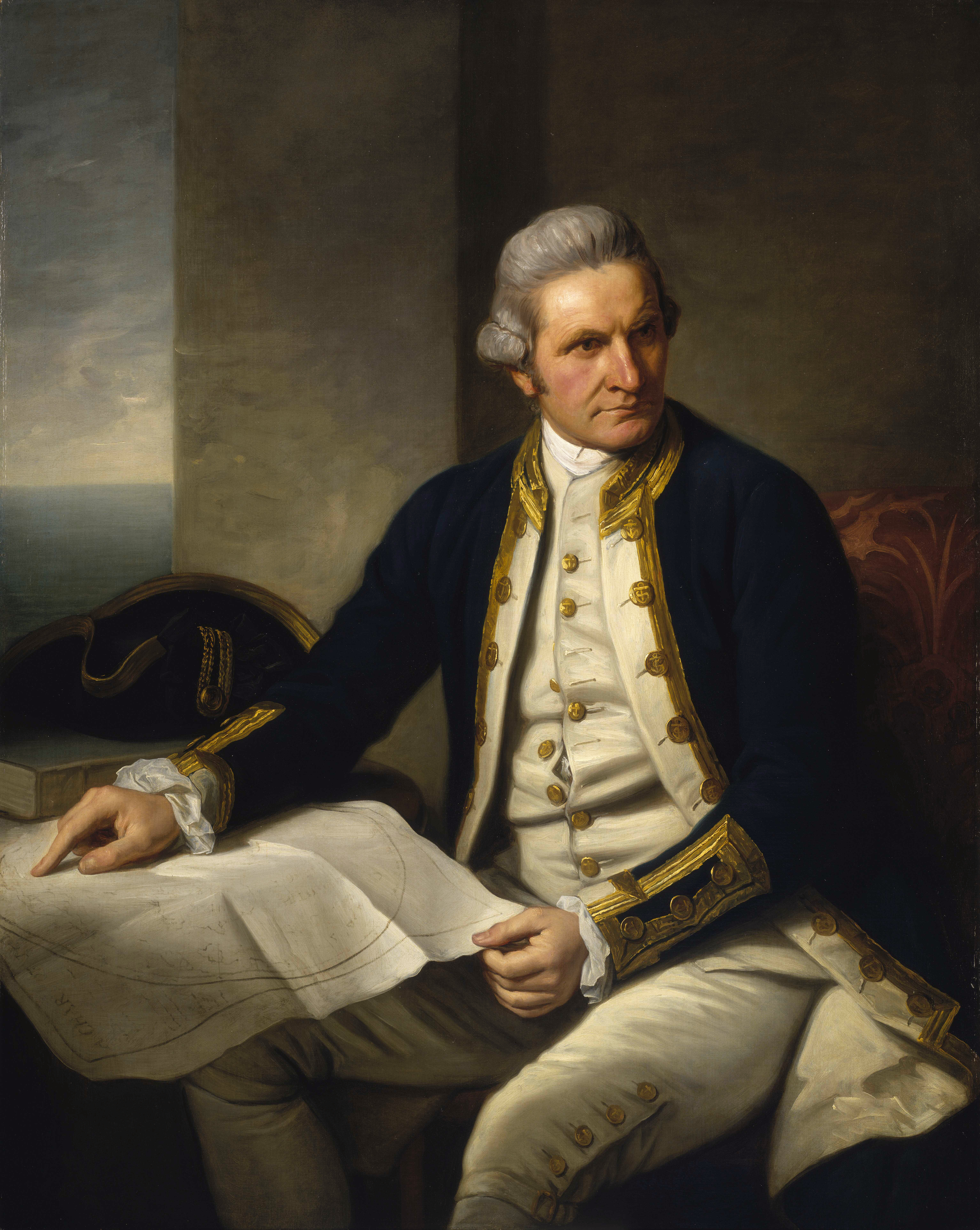
Marton (officially Marton-in-Cleveland) is an area of Middlesbrough, North Yorkshire, England. Until the 1950s, it was a small village next to the hamlet of Tollesby in Yorkshire's North Riding. The Marton parish originally stretched north to the River Tees, however with the expansion of Middlesbrough, the parish became progressively smaller, ultimately becoming a suburb of south Middlesbrough. Attractions include Stewart Park, a large public park given by a former councillor, Dormund Stewart, to the people of Middlesbrough in 1928. At the 2011 census, the Marton Ward (Marton East since 2015) had a population of 4,728 while Marton West Ward had a population of 5,305. James Cook The explorer, cartographer and navigator, Captain James Cook was born to James and Grace Cook, in a clay-built cottage in the village of Marton in 1728, and he lived for a short time in the village, until the family moved to Great Ayton.''The Captain Cook Encyclopædia'', p. 144. John Robson. Random ... [...More Info...] [...Related Items...] OR: [Wikipedia] [Google] [Baidu] |
TS Postcode Area
The TS postcode area, also known as the Cleveland postcode area,Royal Mail, ''Address Management Guide'', (2004) (or unofficially as the ''Teesside postcode area'') is a group of 29 postcode districts in northern England for ten post towns. These cover north-east North Yorkshire (post towns Middlesbrough, Redcar, Saltburn-by-the-Sea, Guisborough and Yarm) and south-east County Durham (post towns Stockton-on-Tees, Hartlepool, Billingham, Wingate and Trimdon Station). __TOC__ Coverage The approximate coverage of the postcode districts: , - ! TS1 , MIDDLESBROUGH , Middlesbrough (town centre) , Middlesbrough , - ! TS2 , MIDDLESBROUGH , St Hilda's, Port Clarence , Middlesbrough, Stockton-on-Tees , - ! TS3 , MIDDLESBROUGH , Middlesbrough's east: Brambles Farm, Thorntree, Park End, North Ormesby, Berwick Hills , Middlesbrough , - ! TS4 , MIDDLESBROUGH , Middlesbrough's centre-east: Grove Hill, Longlands , Middlesbrough , - ! TS5 , MIDDLESBROUGH , Middlesbrough's west ... [...More Info...] [...Related Items...] OR: [Wikipedia] [Google] [Baidu] |
Beechwood, Middlesbrough
Grove Hill is an area of the Middlesbrough's Longlands and Beechwood ward in the Borough of Middlesbrough, North Yorkshire, England. It is a historic part of the North Riding of Yorkshire. The area's main shopping area is off Marton Road at the junction with Marton Burn Road and Belle Vue. The majority of the area was within the civil parish of Marton before the area and Marton itself became unparished areas of the town. Marton Grove Primary School served the area for 83 years before its closure in 2011 and demolition in 2012. They are also shops on the other end of Marton Burn Road, at the roundabout with Eastborne, Valley, Bishopton and York roads. These shops formerly had the Palladium cinema, demolished in 1960. Since the early 2000s, the area was subject to a regeneration scheme which saw many houses demolished. There was also a proposal to rename the area after ant-social behaviour had left the area with a reputation. The council stated that a "...rebranding would help ... [...More Info...] [...Related Items...] OR: [Wikipedia] [Google] [Baidu] |
Whitby
Whitby is a seaside town, port and civil parish in the Scarborough borough of North Yorkshire, England. Situated on the east coast of Yorkshire at the mouth of the River Esk, Whitby has a maritime, mineral and tourist heritage. Its East Cliff is home to the ruins of Whitby Abbey, where Cædmon, the earliest recognised English poet, lived. The fishing port emerged during the Middle Ages, supporting important herring and whaling fleets, and was where Captain Cook learned seamanship and, coincidentally, where his vessel to explore the southern ocean, ''The Endeavour'' was built.Hough 1994, p. 55 Tourism started in Whitby during the Georgian period and developed with the arrival of the railway in 1839. Its attraction as a tourist destination is enhanced by the proximity of the high ground of the North York Moors national park and the heritage coastline and by association with the horror novel '' Dracula''. Jet and alum were mined locally, and Whitby jet, which was mined by th ... [...More Info...] [...Related Items...] OR: [Wikipedia] [Google] [Baidu] |


