|
East River Greenway
The East River Greenway (also called the East River Esplanade) is an approximately foreshoreway for walking or cycling on the east side of the island of Manhattan on the East River. It is part of the Manhattan Waterfront Greenway. The largest portions are operated by the New York City Department of Parks and Recreation. It is separated from motor traffic, and many sections also separate pedestrians from cyclists. The greenway is parallel to the Franklin D. Roosevelt East River Drive for a majority of its length. Parts of the greenway were built at different times. Most of the greenway was built in the 1930 to 1950s in conjunction with the nearby FDR Drive, with exceptions: * Waterside Plaza: 1973 * East River Waterfront: Late 1990s * Stuyvesant Cove: 2002 * United Nations portion (under construction): 2015–24 Route The greenway runs along the East Side, from Battery Park and past South Street Seaport to a dead end at 125th Street, East Harlem with a gap from 41st to ... [...More Info...] [...Related Items...] OR: [Wikipedia] [Google] [Baidu] |
East River At Stuyvesant Cove Park (3356237699)
East or Orient is one of the four cardinal directions or points of the compass. It is the opposite direction from west and is the direction from which the Sunrise, Sun rises on the Earth. Etymology As in other languages, the word is formed from the fact that east is the direction where the Sun rises: ''east'' comes from Middle English ''est'', from Old English ''ēast'', which itself comes from the Proto-Germanic language, Proto-Germanic *''aus-to-'' or *''austra-'' "east, toward the sunrise", from Proto-Indo-European language, Proto-Indo-European *aus- "to shine," or "dawn", cognate with Old High German ''*ōstar'' "to the east", Latin ''aurora'' 'dawn', and Greek language, Greek ''ēōs'' 'dawn, east'. Examples of the same formation in other languages include Latin Orient, oriens 'east, sunrise' from orior 'to rise, to originate', Greek language, Greek ανατολή Anatolia, anatolé 'east' from ἀνατέλλω 'to rise' and Hebrew מִזְרָח mizraḥ 'east' from זָ� ... [...More Info...] [...Related Items...] OR: [Wikipedia] [Google] [Baidu] |
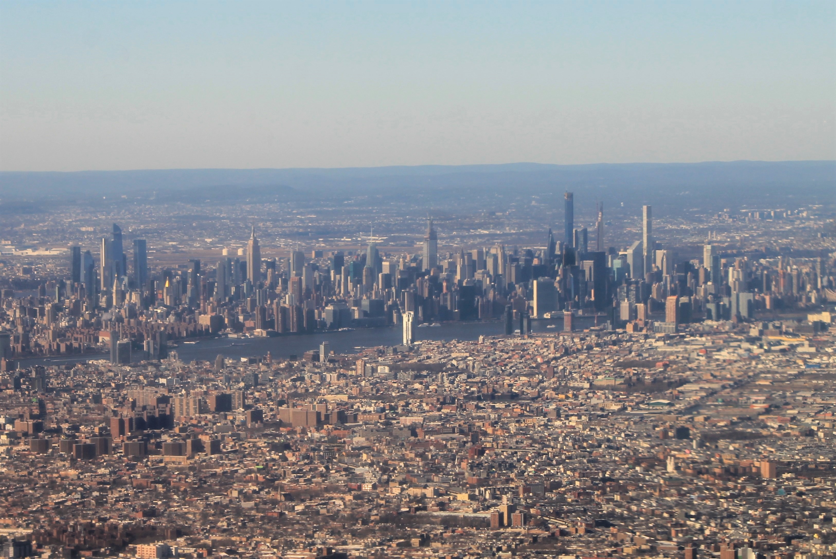
Midtown Manhattan
Midtown Manhattan is the central portion of the New York City borough of Manhattan and serves as the city's primary central business district. Midtown is home to some of the city's most prominent buildings, including the Empire State Building, the Chrysler Building, the Hudson Yards Redevelopment Project, the headquarters of the United Nations, Grand Central Terminal, and Rockefeller Center, as well as tourist destinations such as Broadway, Times Square, and Koreatown. Penn Station in Midtown Manhattan is the busiest transportation hub in the Western Hemisphere. Midtown Manhattan is the largest central business district in the world and ranks among the most expensive locations for real estate; Fifth Avenue in Midtown Manhattan commands the world's highest retail rents, with average annual rents at US in 2017. However, due to the high price of retail spaces in Midtown, there are also many vacant storefronts in the neighborhood. Midtown is the country's largest commercia ... [...More Info...] [...Related Items...] OR: [Wikipedia] [Google] [Baidu] |
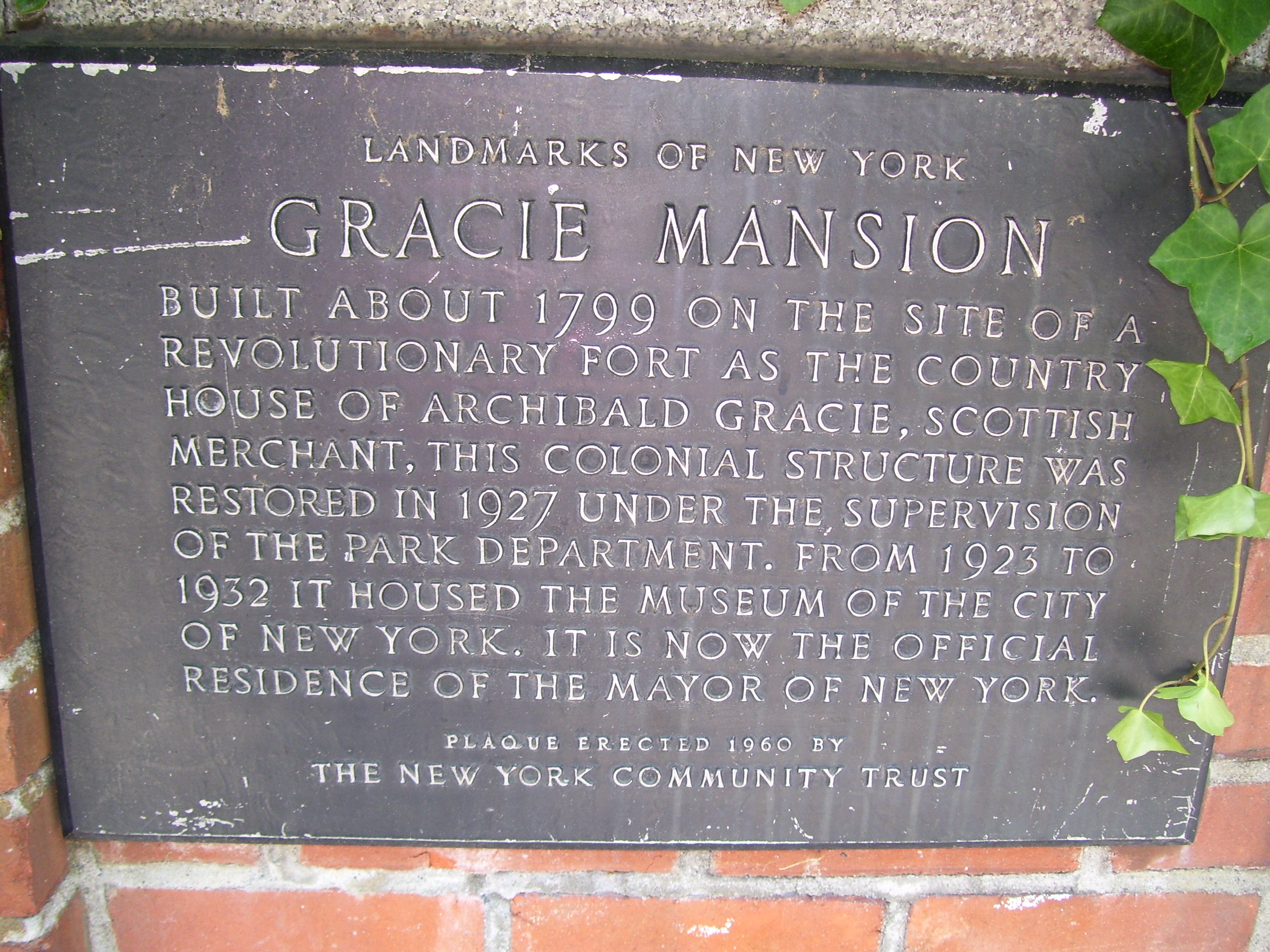
Gracie Mansion
Archibald Gracie Mansion (commonly called Gracie Mansion) is the official residence of the Mayor of New York City. Built in 1799, it is located in Carl Schurz Park, at East End Avenue and 88th Street in the Yorkville neighborhood of Manhattan. The mansion overlooks Hell Gate channel in the East River. History Before construction and early days George Washington commandeered a different building on approximately the same site during the American Revolutionary War, as it strategically overlooked Hell Gate. That building, called Belview Mansion, was the country residence of Jacob Walton, a New York merchant. The British destroyed this house during that war. Archibald Gracie then built another building, now known as Gracie Mansion, on the site in 1799, and used it as a country home until 1823, when he had to sell it to pay debts. In the fall of 1801, Gracie hosted a meeting there of New York Federalists, called by Alexander Hamilton, to raise $10,000 for starting the ''New Yo ... [...More Info...] [...Related Items...] OR: [Wikipedia] [Google] [Baidu] |
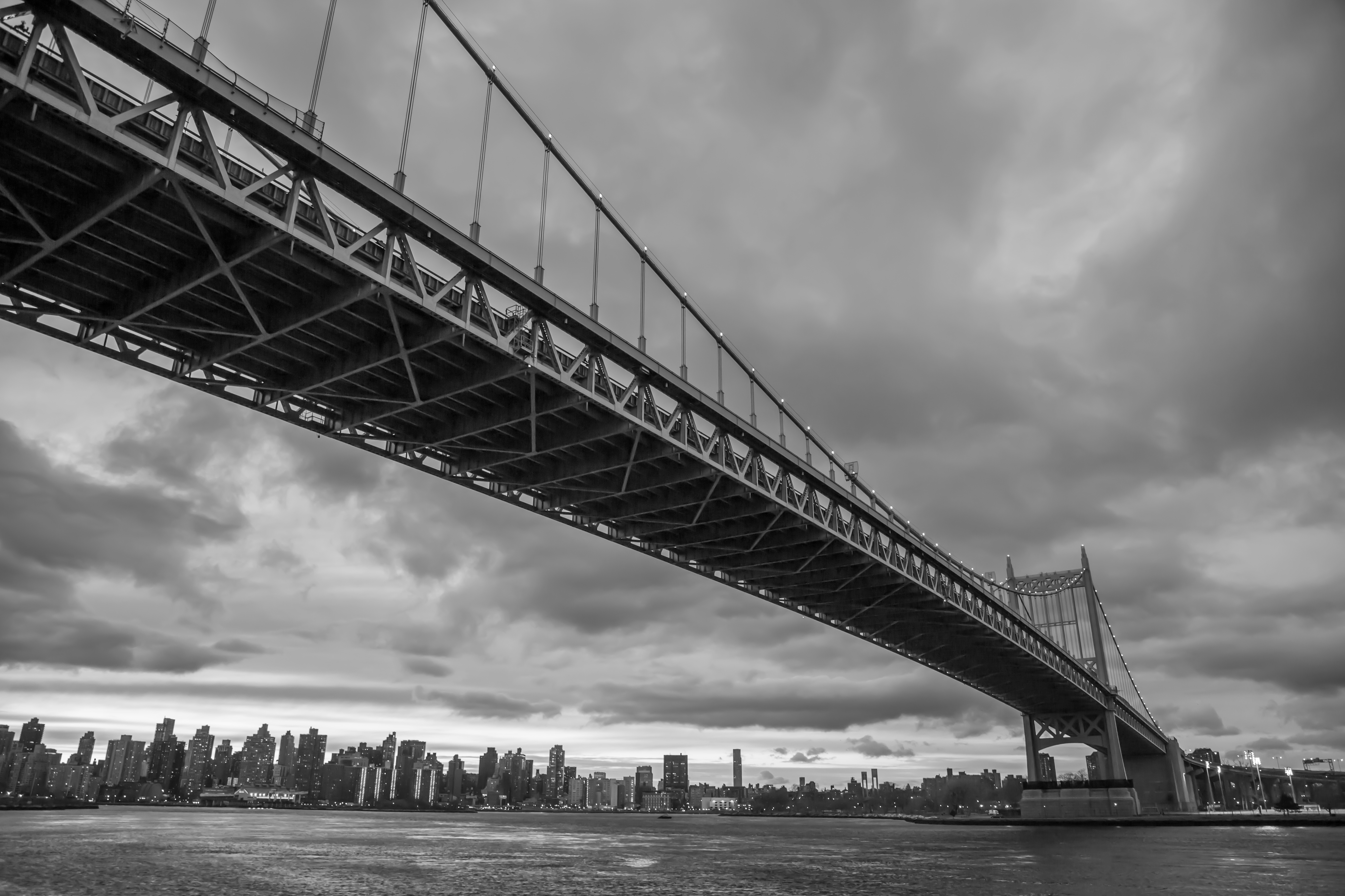
Triborough Bridge
The Robert F. Kennedy Bridge (RFK Bridge; formerly known and still commonly referred to as the Triborough Bridge) is a complex of bridges and elevated expressway viaducts in New York City. The bridges link the boroughs of Manhattan, Queens, and the Bronx. The viaducts cross Randalls and Wards Islands, previously two islands and now joined by landfill. The RFK Bridge, a toll bridge, carries Interstate 278 (I-278) as well as the unsigned highway New York State Route 900G. It connects with the FDR Drive and the Harlem River Drive in Manhattan, the Bruckner Expressway (I-278) and the Major Deegan Expressway ( Interstate 87) in the Bronx, and the Grand Central Parkway (I-278) and Astoria Boulevard in Queens. The three primary bridges of the RFK Bridge complex are: *The vertical-lift bridge over Harlem River, the largest in the world, connecting Manhattan to Randalls Island *The truss bridge over Bronx Kill, connecting Randalls Island to the Bronx *The suspension bridge over He ... [...More Info...] [...Related Items...] OR: [Wikipedia] [Google] [Baidu] |
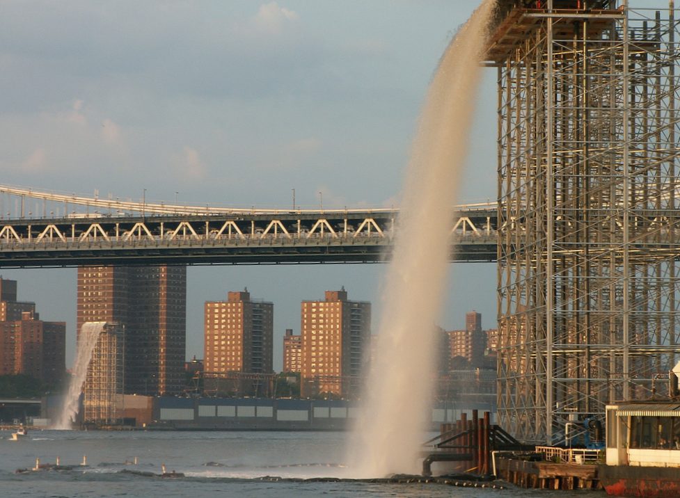
New York City Waterfalls
''New York City Waterfalls'' is a public art project by artist Olafur Eliasson, in collaboration with the Public Art Fund, consisting of four man-made waterfalls placed around New York City along the East River. The most famous was at the Brooklyn Bridge in lower Manhattan. At $15.5 million, it is the most expensive public arts project since Christo and Jeanne-Claude's installation of ''The Gates'' in Central Park. The waterfalls officially began flowing on June 26, 2008. They ran from 7 am to 10 pm (under illumination after sunset), until October 13, 2008. Background Location and construction The sites chosen for the four waterfalls were the East River Esplanade's Pier 35 in Manhattan; beneath the Brooklyn Bridge in DUMBO between piers 4 and 5, also in Brooklyn; and Governors Island to activate spaces that typically were not. Work on erecting the four support scaffolds began in mid-March, 2008. On the shore of Governors Island construction teams used pile driving to secure ... [...More Info...] [...Related Items...] OR: [Wikipedia] [Google] [Baidu] |
Brooklyn Heights Promenade
The Brooklyn Heights Promenade, also called the Esplanade, is a -long platform and pedestrian walkway cantilevered over the Brooklyn-Queens Expressway (Interstate 278) in Brooklyn Heights, Brooklyn, New York City, United States. With views of Lower Manhattan's skyline and the New York Harbor, it came about as the byproduct of competing proposals for the highway's route that were resolved in the midst of World War II. Actual construction came after the war. As a structure built over a roadway, the Promenade is owned by the NYCDOT and is not considered a park; however, NYC Parks maintains the entire Promenade. The Promenade runs from the west end of Remsen Street to the west end of Orange Street and can additionally be accessed from Montague Street and Pierrepont Place and the west ends of Pierrepont Street, Clark Street and Pineapple Street. Planning The need for a Brooklyn-Queens Expressway to connect the boroughs of Brooklyn and Queens predated World War II. A link between th ... [...More Info...] [...Related Items...] OR: [Wikipedia] [Google] [Baidu] |
East River Esplanade
The East River Greenway (also called the East River Esplanade) is an approximately foreshoreway for walking or cycling on the east side of the island of Manhattan on the East River. It is part of the Manhattan Waterfront Greenway. The largest portions are operated by the New York City Department of Parks and Recreation. It is separated from motor traffic, and many sections also separate pedestrians from cyclists. The greenway is parallel to the Franklin D. Roosevelt East River Drive for a majority of its length. Parts of the greenway were built at different times. Most of the greenway was built in the 1930 to 1950s in conjunction with the nearby FDR Drive, with exceptions: * Waterside Plaza: 1973 * East River Waterfront: Late 1990s * Stuyvesant Cove: 2002 * Headquarters of the United Nations, United Nations portion (under construction): 2015–24 Route The greenway runs along the East Side, from Battery Park and past South Street Seaport to a dead end at 125th Street, Ea ... [...More Info...] [...Related Items...] OR: [Wikipedia] [Google] [Baidu] |
FDR Drive
The Franklin D. Roosevelt East River Drive, commonly called the FDR Drive for short, is a limited-access parkway on the east side of the New York City borough of Manhattan. It starts near South and Broad Streets, just north of the Battery Park Underpass, and runs north along the East River to the 125th Street / Robert F. Kennedy Bridge / Willis Avenue Bridge interchange, where it becomes the Harlem River Drive. All of the FDR Drive is designated New York State Route 907L (NY 907L), an unsigned reference route. The FDR Drive features a mix of below-grade, at-grade, and elevated sections, as well as three partially covered tunnels. The parkway is mostly three lanes in each direction, except for several small sections. By law, the current weight limits on the FDR Drive from 23rd Street to the Harlem River Drive in both directions is posted . Buses are not allowed to use the roadway north of 23rd Street because they exceed the road's maximum clearance a ... [...More Info...] [...Related Items...] OR: [Wikipedia] [Google] [Baidu] |
Con Edison
Consolidated Edison, Inc., commonly known as Con Edison (stylized as conEdison) or ConEd, is one of the largest investor-owned energy companies in the United States, with approximately $12 billion in annual revenues as of 2017, and over $62 billion in assets. The company provides a wide range of energy-related products and services to its customers through its subsidiaries: *Consolidated Edison Company of New York, Inc. (CECONY), a regulated utility providing electric and gas service in New York City and Westchester County, New York, and steam service in the borough of Manhattan; *Orange and Rockland Utilities, Inc., a regulated utility serving customers in a area in southeastern New York and northern New Jersey; *Con Edison Solutions, an energy services company; *Con Edison Energy, a wholesale energy services company; *Con Edison Development, a company that owns and operates renewable and energy infrastructure projects, and, *Con Edison Transmission, Inc., which invests ... [...More Info...] [...Related Items...] OR: [Wikipedia] [Google] [Baidu] |
Kips Bay
Kips Bay, or Kip's Bay, is a neighborhood on the east side of the New York City borough of Manhattan. It is roughly bounded by East 34th Street to the north, the East River to the east, East 27th and/or 23rd Streets to the south, and Third Avenue to the west. Kips Bay is part of Manhattan Community District 6, and its primary ZIP Codes are 10010 and 10016. It is patrolled by the 13th and 17th Precincts of the New York City Police Department. Geography According to '' The Encyclopedia of New York City'' and the New York City Department of City Planning, Kips Bay proper is generally bounded by East 34th Street to the north, the East River to the east, East 27th Street to the south, and Third Avenue to the west. City documents have also used New York City census tract 70 (from 29th to 34th Streets, First to Third Avenues) as an approximation for Kips Bay, and referred to tract 66, immediately below it, as "Bellevue South."See alsDraft Scoping Document for an Environmental I ... [...More Info...] [...Related Items...] OR: [Wikipedia] [Google] [Baidu] |
Upper East Side
The Upper East Side, sometimes abbreviated UES, is a neighborhood in the boroughs of New York City, borough of Manhattan in New York City, bounded by 96th Street (Manhattan), 96th Street to the north, the East River to the east, 59th Street (Manhattan), 59th Street to the south, and Central Park/Fifth Avenue to the west. The area incorporates several smaller neighborhoods, including Lenox Hill, Carnegie Hill, and Yorkville, Manhattan, Yorkville. Once known as the Stocking, Silk Stocking District,The City Review Upper East Side, the Silk Stocking District it has long been the most affluent neighborhood in New York City. The Upper East Side is part of Manhattan Community Board 8, Manhattan Community District 8, and its primary ZIP Codes are 10021, 10028, 10065, 10075, and 10128. It is patrolled by the 19th Precinct ... [...More Info...] [...Related Items...] OR: [Wikipedia] [Google] [Baidu] |
.jpg)


.jpg)