|
East Gippsland
East Gippsland is the eastern region of Gippsland, Victoria, Australia covering 31,740 square kilometres (14%) of Victoria. It has a population of 80,114. Australian Bureau of Statistics2006 Census Community Profile Series: East Gippsland (Statistical Division). Released at 29/02/2008. LOCATION CODE: 250 STATE: VIC/ref> History The Shire of East Gippsland, also called Far East Gippsland, covers two-thirds (66%) of East Gippsland's area and holds half (50%) of its population. Australian Bureau of Statistics2006 Census. Community Profile Series: East Gippsland Shire (Statistical Subdivision). Released at 29/02/2008. LOCATION CODE: 25005 STATE: VIC/ref> The Shire of East Gippsland is confusingly also referred to simply as East Gippsland. It excludes the Shire of Wellington (Central Gippsland). This article (currently) refers mainly to "Far East Gippsland". East Gippsland's major towns include, from west to east, Bairnsdale (the largest town and administrative centre), Paynesville ... [...More Info...] [...Related Items...] OR: [Wikipedia] [Google] [Baidu] |
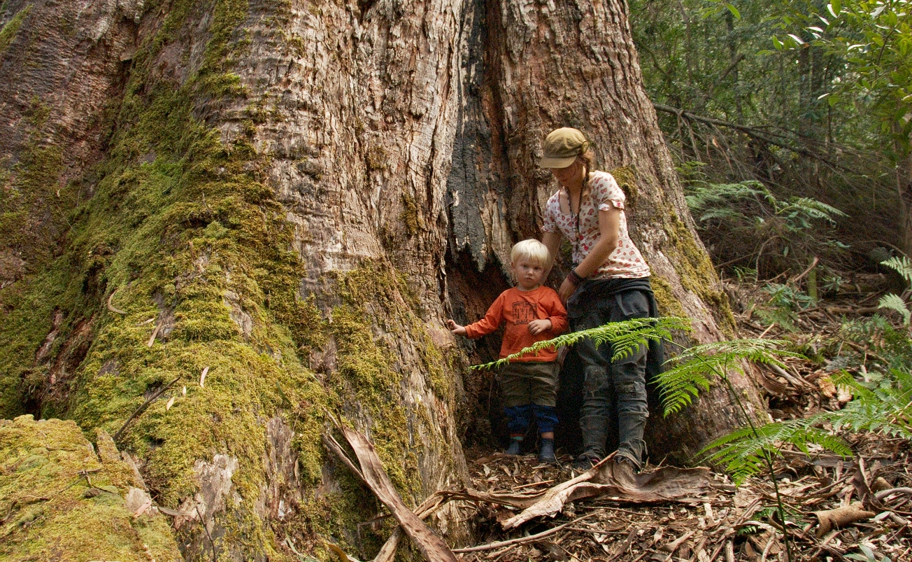
East Gippsland Enormous Old Growth 01 Pengo
East or Orient is one of the four cardinal directions or points of the compass. It is the opposite direction from west and is the direction from which the Sun rises on the Earth. Etymology As in other languages, the word is formed from the fact that east is the direction where the Sun rises: ''east'' comes from Middle English ''est'', from Old English ''ēast'', which itself comes from the Proto-Germanic *''aus-to-'' or *''austra-'' "east, toward the sunrise", from Proto-Indo-European *aus- "to shine," or "dawn", cognate with Old High German ''*ōstar'' "to the east", Latin ''aurora'' 'dawn', and Greek ''ēōs'' 'dawn, east'. Examples of the same formation in other languages include Latin oriens 'east, sunrise' from orior 'to rise, to originate', Greek ανατολή anatolé 'east' from ἀνατέλλω 'to rise' and Hebrew מִזְרָח mizraḥ 'east' from זָרַח zaraḥ 'to rise, to shine'. ''Ēostre'', a Germanic goddess of dawn, might have been a personification ... [...More Info...] [...Related Items...] OR: [Wikipedia] [Google] [Baidu] |
Mitchell River, Victoria
The Mitchell River is a perennial river of the East Gippsland catchment, located in the Australian state of Victoria. The unregulated river provides a unique example of riparian ecology, flowing generally south with the catchment area drawing from the steep mountains of the Victorian Alps to enter Lake King, one of the Gippsland Lakes, and then empty into the Bass Strait. Course and features Formed by the confluence of the Wentworth and Wonnangatta rivers and Swamp Creek near Horseshoe Bend, north of the national park that bears its name, the Mitchell River rises in Lake Tabberabbera, drained by runoff from the southern Victorian Alps of the Great Dividing Range. The river flows generally south in a highly meandering course in its upper reaches through the Mitchell River National Park, and then south by east as it spills onto the fertile Gippsland Plain west of . The river then flows generally east towards and empties into Jones Bay, part of Lake King, within the Gippsla ... [...More Info...] [...Related Items...] OR: [Wikipedia] [Google] [Baidu] |
Buchan
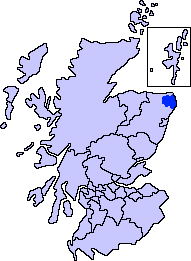
Buchan is an area of north-east Scotland, historically one of the original provinces of the Kingdom of Alba. It is now one of the six committee areas and administrative areas of Aberdeenshire Council, Scotland. These areas were created by the council in 1996, when the Aberdeenshire council area was created under the Local Government etc (Scotland) Act 1994. The council area was formed by merging three districts of the Grampian Region: Banff and Buchan, Gordon and Kincardine and Deeside. The committee area of Buchan was formed from part of the former district of Banff and Buchan. Etymology The genesis of the name ''Buchan'' is shrouded in uncertainty, but may be of Pictish origin. The name may involve an equivalent of Welsh ''buwch'' meaning "a cow". American academic Thomas Clancy has noted cautiously the similarity between the territory names ''Buchan'' and ''Marr'' to those of the Welsh commotes ''Cantref Bychan'' and ''Cantref Mawr'', meaning "small-" and "large-commote ... [...More Info...] [...Related Items...] OR: [Wikipedia] [Google] [Baidu] |
Mount Hotham
Mount Hotham is a mountain located in the Victorian Alps of the Great Dividing Range, in the Australian state of Victoria. The mountain is located approximately north east of Melbourne, from Sydney, and from Adelaide by road. The nearest major road to the mountain is the Great Alpine Road. The mountain is named after Charles Hotham, Governor of Victoria from 1854 to 1855. Mount Hotham's summit rises to an altitude of Mount Hotham Alpine Resort, a commercial alpine resort, is located on the slopes of Mount Hotham summit and nearby mountains. Administratively, the mountain is within Mount Hotham Alpine Resort unincorporated area, land which is managed by Alpine Resorts Victoria. This unincorporated area is surrounded by Alpine Shire. Climate As with most of the Australian Alps, Mount Hotham's climate is, compared to the bulk of Australia, cold throughout the year; with particularly cold maximum temperatures, and Mount Hotham is one of very few areas in Australia that fre ... [...More Info...] [...Related Items...] OR: [Wikipedia] [Google] [Baidu] |
Dinner Plain, Victoria
Dinner Plain is a town in Victoria, Australia, Victoria, Australia, located on the Great Alpine Road, 13 kilometres from Mount Hotham, Mount Hotham Alpine Resort, and 375 kilometres from Melbourne. At the , Dinner Plain had a population of 230, yet has over 200 lodges and chalets for Tourism in Australia, tourist accommodation. Dinner Plain is a thriving all-year-round resort with a wide range of summer activities such as bush walking, horse riding, mountain biking and tennis. Dinner Plain has one ski tow for use during winter. History The late Holocene (pre-Contact) Aboriginal traditional owners of the Dinner Plain region were likely the Omeo tribe of the Yaitmatang (various spellings) language group (Howitt 1904). Other groups of Aboriginal people, including neighbouring Dhuduroa, Brabalung (Gunai-Kurnai) likely passed through and visited the Alpine area of Victoria's High Country. Gunn (2002) has suggested a widespread "confederacy" of tribes existed across the Australian A ... [...More Info...] [...Related Items...] OR: [Wikipedia] [Google] [Baidu] |
Australian Alps
The Australian Alps is a mountain range in southeast Australia. It comprises an interim Australian bioregion,IBRA Version 6.1 data and is the highest mountain range in Australia. The range straddles the borders of eastern , southeastern , and the . It contains Australia's only peaks exceeding in elevation, and is the only bioregion on the Australian main ... [...More Info...] [...Related Items...] OR: [Wikipedia] [Google] [Baidu] |
Great Alpine Road
} The Great Alpine Road (B500) is a country tourist road in Victoria, Australia, running from Wangaratta in the north to Bairnsdale in the east, and passing through the Victorian Alps. The road was given its current name because it was considered the mountain equivalent to Victoria's world-famous Great Ocean Road in the south-west of the state. The road usually remains open during winter; however, vehicles travelling between Harrietville and Omeo are required to carry diamond-patternMount HothamWheel Chains/ref> snow chains during the declared snow season.Travel VictoriaGreat Alpine Road/ref> Route The Great Alpine Road links Victoria's North East with Gippsland, winding through mountains, valleys and forests, and past rivers, vineyards and farms. At a length of , it is Australia's highest year-round accessible sealed road. The section over Mount Hotham rises to an altitude of AMSL. It is blanketed with snow during winter months and must be cleared on a daily basis. Extreme weat ... [...More Info...] [...Related Items...] OR: [Wikipedia] [Google] [Baidu] |
Gippsland Lakes
The Gippsland Lakes are a network of coastal lakes, marshes and lagoons in East Gippsland, Victoria, Australia covering an overall area of about between the rural towns of Lakes Entrance, Bairnsdale and Sale. The largest of the lakes are Lake Wellington (Gunai language: ''Murla''), Lake King (Gunai: ''Ngarrang'') and Lake Victoria (Gunai: ''Toonallook''). The lakes are collectively fed by the Avon, Thomson, Latrobe, Mitchell, Nicholson and Tambo Rivers, and drain into the Bass Strait through a short canal about southwest of Lakes Entrance town centre. History The Gippsland Lakes were formed by two principal processes. The first is river delta alluvial deposition of sediment brought in by the rivers which flow into the lakes. Silt deposited by this process forms into long jetties which can run many kilometres into a lake, as exemplified by the Mitchell River silt jetties that run into Lake King. The second process is the action of sea current in Bass Strait which creat ... [...More Info...] [...Related Items...] OR: [Wikipedia] [Google] [Baidu] |
Global Warming
In common usage, climate change describes global warming—the ongoing increase in global average temperature—and its effects on Earth's climate system. Climate change in a broader sense also includes previous long-term changes to Earth's climate. The current rise in global average temperature is more rapid than previous changes, and is primarily caused by humans burning fossil fuels. Fossil fuel use, deforestation, and some agricultural and industrial practices increase greenhouse gases, notably carbon dioxide and methane. Greenhouse gases absorb some of the heat that the Earth radiates after it warms from sunlight. Larger amounts of these gases trap more heat in Earth's lower atmosphere, causing global warming. Due to climate change, deserts are expanding, while heat waves and wildfires are becoming more common. Increased warming in the Arctic has contributed to melting permafrost, glacial retreat and sea ice loss. Higher temperatures are also causing m ... [...More Info...] [...Related Items...] OR: [Wikipedia] [Google] [Baidu] |
Government Of Victoria
The Victoria State Government, also referred to as just the Victorian Government, is the state-level authority for Victoria (Australia), Victoria, Australia. Like all state governments, it is formed by three independent branches: the executive, the Supreme Court of Victoria, judicial, and the Parliament of Victoria, parliament. As a parliamentary system, parliamentary constitutional monarchy, the State Government was first formed in 1851 when Victoria first gained the right to responsible government. The Constitution of Australia regulates the relationship between the Victorian Government and the Australian Government, and cedes legislative and judicial supremacy to the federal government on conflicting matters. The Victoria State Government enforces Act of Parliament, acts passed by the parliament through government departments, statutory authorities, and other public agencies. The Government is formally presided over by the Governor of Victoria, Governor, who exercises execu ... [...More Info...] [...Related Items...] OR: [Wikipedia] [Google] [Baidu] |
Government Of Australia
The Australian Government, also known as the Commonwealth Government, is the national government of Australia, a federalism, federal parliamentary system, parliamentary constitutional monarchy. Like other Westminster system, Westminster-style systems of government, the Australian Government is made up of three branches: the executive (the Prime Minister of Australia, prime minister, the Ministers of the Crown, ministers, and government departments), the legislative (the Parliament of Australia), and the Judiciary of Australia, judicial. The legislative branch, the federal Parliament, is made up of two chambers: the House of Representatives (Australia), House of Representatives (lower house) and Australian Senate, Senate (upper house). The House of Representatives has 151 Member of parliament, members, each representing an individual electoral district of about 165,000 people. The Senate has 76 members: twelve from each of the six states and two each from Australia's internal ... [...More Info...] [...Related Items...] OR: [Wikipedia] [Google] [Baidu] |


