|
Eagle On The Hill, South Australia
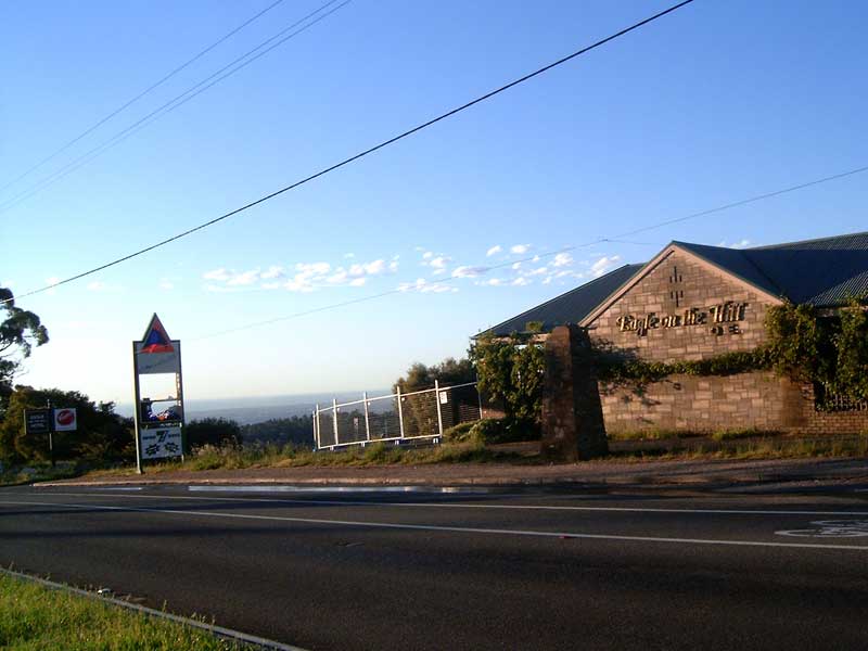
Eagle On The Hill is an unbounded locality in the Australian state of South Australia located in the suburb of Crafers West on the western face of the Adelaide Hills overlooking the Adelaide metropolitan area. The village is located on Mount Barker Road, which was formerly the connection from Adelaide to the South Eastern Freeway. Once the freeway was extended through the Heysen Tunnels in 2000, through the ridge underneath Eagle On The Hill, the locality went into a precipitous decline. It is now a relic of its former self; its restaurant, hotel, bottle shop and service stations have all closed, leaving behind a quiet suburb with a small resident population. Eagle On The Hill is now a very popular spot for downhill speedboarders who travel down the road at speeds close to 65 kilometres per hour. Hotel The Eagle on the Hill Hotel was built by George Stevenson in 1850 and initially was run as an eating-house, then opened in 1853 as an hotel by William Anderson, who named ... [...More Info...] [...Related Items...] OR: [Wikipedia] [Google] [Baidu] |
Adelaide Hills Council
Adelaide Hills Council is a local government area in the Adelaide Hills of South Australia. It is in the hills east of Adelaide, the capital of South Australia, and extends from the South Para Reservoir in the north to the Mount Bold Reservoir in the south. The council was established in 1997 by the amalgamation of the District Council of East Torrens, the District Council of Gumeracha, the District Council of Onkaparinga and the District Council of Stirling The District Council of Stirling was a local government area of South Australia from 1883 to 1997, seated at Stirling. History The council was established in 1883 from a western portion of the District Council of Echunga and an eastern portion .... Council The current council is: Suburbs The Adelaide Hills Council contains the following suburbs and localities: References External linksAdelaide Hills Council website [...More Info...] [...Related Items...] OR: [Wikipedia] [Google] [Baidu] |
Crafers West, South Australia
Crafers West is a suburb of Adelaide in the Adelaide Hills Council. It was formally named in 1985 as a separate address from Crafers. Crafers West contains the headwaters of Brown Hill Creek and is dominated by steep terrain and native scrub. It is bounded by Mount Barker Road on the northeast and the Bridgewater railway line on the south. The Eagle Mountain Bike Park is in the north of the suburb. Popular tourist spots include Clealand Conservation Park, Mt Lofty Botanic Gardens, and Belair National Park Holiday Park. The western part of the suburb of Crafers West is in the City of Mitcham; however, most settlement is in the Adelaide Hills Council. Crafers West is in the state electoral district of Waite and most is in the federal division of Mayo The Division of Mayo is an Australian electoral division located to the east and south of Adelaide, South Australia. Created in the state redistribution of 3 September 1984, the division is named after Helen Mayo, a social acti ... [...More Info...] [...Related Items...] OR: [Wikipedia] [Google] [Baidu] |
South Australia
South Australia (commonly abbreviated as SA) is a state in the southern central part of Australia. It covers some of the most arid parts of the country. With a total land area of , it is the fourth-largest of Australia's states and territories by area, and second smallest state by population. It has a total of 1.8 million people. Its population is the second most highly centralised in Australia, after Western Australia, with more than 77 percent of South Australians living in the capital Adelaide, or its environs. Other population centres in the state are relatively small; Mount Gambier, the second-largest centre, has a population of 33,233. South Australia shares borders with all of the other mainland states, as well as the Northern Territory; it is bordered to the west by Western Australia, to the north by the Northern Territory, to the north-east by Queensland, to the east by New South Wales, to the south-east by Victoria, and to the south by the Great Australian Bight.M ... [...More Info...] [...Related Items...] OR: [Wikipedia] [Google] [Baidu] |
Adelaide
Adelaide ( ) is the capital city of South Australia, the state's largest city and the fifth-most populous city in Australia. "Adelaide" may refer to either Greater Adelaide (including the Adelaide Hills) or the Adelaide city centre. The demonym ''Adelaidean'' is used to denote the city and the residents of Adelaide. The Traditional Owners of the Adelaide region are the Kaurna people. The area of the city centre and surrounding parklands is called ' in the Kaurna language. Adelaide is situated on the Adelaide Plains north of the Fleurieu Peninsula, between the Gulf St Vincent in the west and the Mount Lofty Ranges in the east. Its metropolitan area extends from the coast to the foothills of the Mount Lofty Ranges, and stretches from Gawler in the north to Sellicks Beach in the south. Named in honour of Queen Adelaide, the city was founded in 1836 as the planned capital for the only freely-settled British province in Australia. Colonel William Light, one of Adelaide's foun ... [...More Info...] [...Related Items...] OR: [Wikipedia] [Google] [Baidu] |
Mount Barker Road
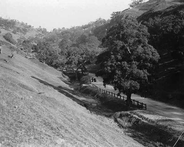
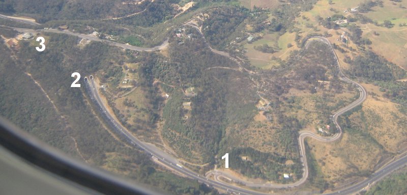
Mount Barker Road was once the main road from Adelaide through the Adelaide Hills to Mount Barker on the eastern slopes of the Mount Lofty Ranges. The main route has now been replaced, or subsumed into, the South Eastern Freeway, but two sections of it remain, and are still classified as state roads. Route A vestigial portion of Mount Barker Road exists through the "Old Toll Gate" at Glen Osmond, but has completely subsumed into the South Eastern Freeway as far as the Devil's Elbow, where a surviving western alignment of the road turns a sharp hairpin and has a winding uphill through Eagle On The Hill and rejoins South Eastern Freeway near Measday's Hill in Crafers West. The eastern portion of Mount Barker Road resumes from the freeway's Stirling exit, passing through the main shopping strips of Stirling and Aldgate as State Route B33. From Aldgate, Route B33 continues on Strathalbyn Road, while Mount Barker Road follows the railway line as Tourist Route 57 to Bridgewater an ... [...More Info...] [...Related Items...] OR: [Wikipedia] [Google] [Baidu] |
South Eastern Freeway
South Eastern Freeway is a freeway in South Australia (SA). It is a part of the National Highway network linking the state capital cities of Adelaide, SA, and Melbourne, Victoria, and signed as National Highway M1. It carries traffic over the Adelaide Hills between Adelaide and the River Murray, near Murray Bridge, where it is connected via the Swanport Bridge to the Dukes Highway, which is the main road route to Victoria. It was formerly signposted as Princes Highway, which refers to the coastal route from Adelaide to Sydney via Melbourne. It is often referred to by South Australians simply as the Freeway, as it was the first freeway in South Australia, and is still the longest, and the only one with "Freeway" in its name rather than "Expressway" or "Highway". The South Eastern Freeway includes twin-tube tunnels (the Heysen Tunnels) in the descent towards Adelaide, the first of their kind on the National Highway. Route South Eastern Freeway commences at the intersec ... [...More Info...] [...Related Items...] OR: [Wikipedia] [Google] [Baidu] |
Heysen Tunnels
The Heysen Tunnels are twin tube road tunnels which carry the South Eastern Freeway under Eagle On The Hill in the Mount Lofty Ranges in South Australia. The tunnels were excavated using a tunnelling machine normally used in heavy-duty mining operations which tunnelled through of rock for each tunnel at an average rate of per day. The tunnels were completed in 1998 and opened on 5 March 2000. Each tunnel carries three lanes of traffic. As at 2015, 45,700 vehicles passed through them daily. The maximum height of vehicles permitted in the tunnels is , the same as the Crafers and Mt Osmond interchanges. Laser height detectors monitor traffic to provide warnings to drivers before they attempt to enter the tunnel. The tunnels are named after artist Sir Hans Heysen. See also *List of tunnels in Australia This is a list of tunnels in Australia which includes any road, railway, waterway or other form of tunnel, anywhere in the country. Australian Capital Territory New South Wa ... [...More Info...] [...Related Items...] OR: [Wikipedia] [Google] [Baidu] |
Eagle On The Hill
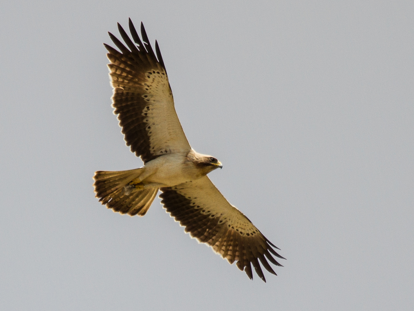
Eagle is the common name for many large birds of prey of the family Accipitridae. Eagles belong to several groups of genera, some of which are closely related. Most of the 68 species of eagle are from Eurasia and Africa. Outside this area, just 14 species can be found—2 in North America, 9 in Central and South America, and 3 in Australia. Eagles are not a natural group but denote essentially any kind of bird of prey large enough to hunt sizeable (about 50 cm long or more overall) vertebrates. Description Eagles are large, powerfully-built birds of prey, with heavy heads and beaks. Even the smallest eagles, such as the booted eagle (''Aquila pennata''), which is comparable in size to a common buzzard (''Buteo buteo'') or red-tailed hawk (''B. jamaicensis''), have relatively longer and more evenly broad wings, and more direct, faster flight – despite the reduced size of aerodynamic feathers. Most eagles are larger than any other raptors apart from some vultures. The smallest ... [...More Info...] [...Related Items...] OR: [Wikipedia] [Google] [Baidu] |
South Australian Register
''The Register'', originally the ''South Australian Gazette and Colonial Register'', and later ''South Australian Register,'' was South Australia's first newspaper. It was first published in London in June 1836, moved to Adelaide in 1837, and folded into '' The Advertiser'' almost a century later in February 1931. The newspaper was the sole primary source for almost all information about the settlement and early history of South Australia. It documented shipping schedules, legal history and court records at a time when official records were not kept. According to the National Library of Australia, its pages contain "one hundred years of births, deaths, marriages, crime, building history, the establishment of towns and businesses, political and social comment". All issues are freely available online, via Trove. History ''The Register'' was conceived by Robert Thomas, a law stationer, who had purchased for his family of land in the proposed South Australian province after be ... [...More Info...] [...Related Items...] OR: [Wikipedia] [Google] [Baidu] |
South Australian Weekly Chronicle
''The Chronicle'' was a South Australian weekly newspaper, printed from 1858 to 1975, which evolved through a series of titles. It was printed by the publishers of '' The Advertiser'', its content consisting largely of reprints of articles and Births, Marriages and Deaths columns from the parent newspaper. Its target demographic was country areas where mail delivery was infrequent, and businesses which serviced those areas. ''History'' ''South Australian Weekly Chronicle'' When ''The South Australian Advertiser'' was first published, on 12 July 1858, the editor and managing director John H. Barrow also announced the ''South Australian Weekly Chronicle'', which published on Saturdays. ''South Australian Chronicle and Weekly Mail'' On 4 January 1868, with the installation of a new steam press, the size of the paper doubled to four sheets, or sixteen pages and changed its banner to ''The South Australian Chronicle and Weekly Mail''. The editor at this time was William Hay, and i ... [...More Info...] [...Related Items...] OR: [Wikipedia] [Google] [Baidu] |
Grenfell Street, Adelaide
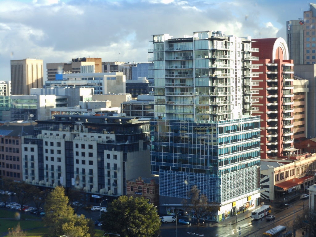
Grenfell Street () is a major street in the north-east quarter of the Adelaide city centre, South Australia. The street runs west-east from King William Street, Adelaide, King William Street to East Terrace. On the other side of King William Street, it continues as Currie Street. Its intersection with Pulteney Street is encircled by Hindmarsh Square. A dedicated bus lane runs the whole length of both Grenfell and Currie Streets, limiting private vehicles to one lane for most of its length, and carrying nearly all bus traffic traversing the city in an east-west direction. At the eastern end of Grenfell, a dedicated bus track carries buses across East Terrace into the O-Bahn tunnel under Rymill Park. History Grenfell Street was named after Pascoe St Leger Grenfell, a Cornishman, Cornish businessman and member of the South Australian Church Society. His significant donation of an acre of land on North Terrace, Adelaide, North Terrace was used for the construction of the Holy Trini ... [...More Info...] [...Related Items...] OR: [Wikipedia] [Google] [Baidu] |
