|
Erlach Family
The Erlach family was a Bernese patrician family. They first became citizens of Bern around 1300. During the 17th and 18th Centuries they were one of the leading families in Bern. For centuries the family served as senior military commanders in both Bern and in foreign armies. They were mayors of Bern and ruled over many other towns and cities in western Switzerland. Several family members received the upper nobility title "Reichsgraf". From landless knights to mayors of Bern The Erlach family is first mentioned as a ministerialis (or unfree knight) family in the service of the Counts of Nidau. Initially they were the castellans in Erlach Castle in the town of Erlach on Lake Biel. By 1300 they were citizens of Bern and had tied their fate to the city. According to the historian Conrad Justinger, in 1339 Rudolf von Erlach led the victorious Bernese forces at the Battle of Laupen. In the following year he led a Bernese army in a raid on the city of Fribourg. Before ... [...More Info...] [...Related Items...] OR: [Wikipedia] [Google] [Baidu] |
Canton Of Bern
The canton of Bern or Berne (german: Kanton Bern; rm, Chantun Berna; french: canton de Berne; it, Canton Berna) is one of the 26 cantons forming the Swiss Confederation. Its capital city, Bern, is also the ''de facto'' capital of Switzerland. The bear is the heraldic symbol of the canton, displayed on a red-yellow background. Comprising ten districts, Bern is the second-largest canton by both surface area and population. Located in west-central Switzerland, it is surrounded by eleven cantons. It borders the canton of Jura and the canton of Solothurn to the north. To the west lie the canton of Neuchâtel, the canton of Fribourg and canton of Vaud. To the south lies the canton of Valais. East of the canton of Bern lie the cantons of Uri, Nidwalden, Obwalden, Lucerne and Aargau. The geography of the canton includes a large share of all three natural regions of Switzerland: the Jura Mountains (the Bernese Jura), the Swiss Plateau (the Bernese Mittelland) and the Alps (th ... [...More Info...] [...Related Items...] OR: [Wikipedia] [Google] [Baidu] |
Battle Of Laupen
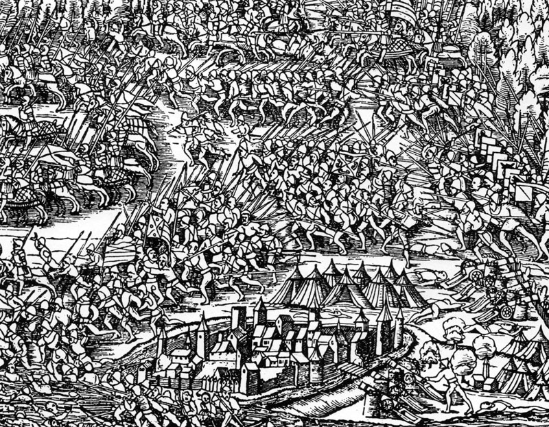
The Battle of Laupen was fought in June 1339, between Bern and its allies on one side, and Freiburg together with feudal landholders from the County of Burgundy and Habsburg territories on the other. Bern was victorious, consolidating its position in the region. As a consequence of the conflict, the relations of Bern and the Swiss Confederacy tightened, resulting in Bern's permanent accession in 1353. This is also the first battle that the white cross was documented as being used as a field sign worn by Swiss combatants. Background Prior to hostilities the free imperial city of Bern had undergone heavy expansion, however this expansion came at high expense to the feudal lords in the area and led to increasing competition with the neighbouring city of Fribourg. Bern had been allied with Fribourg since 1241, but Fribourg had been sold to the House of Habsburg in 1277. Fribourg entered a league with neighbouring feudal lords, including the County of Neuchâtel, the County of Sav ... [...More Info...] [...Related Items...] OR: [Wikipedia] [Google] [Baidu] |
Burgundian Wars
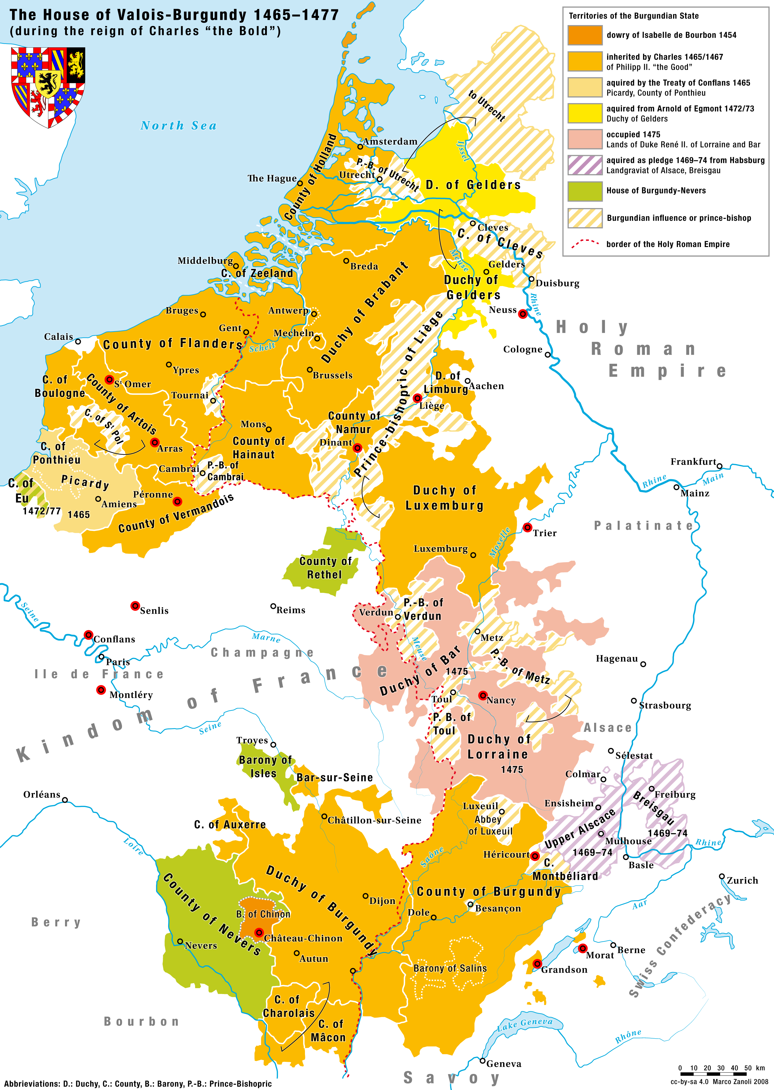
The Burgundian Wars (1474–1477) were a conflict between the Burgundian State and the Old Swiss Confederacy and its allies. Open war broke out in 1474, and the Duke of Burgundy, Charles the Bold, was defeated three times on the battlefield in the following years and was killed at the Battle of Nancy in 1477. The Duchy of Burgundy and several other Burgundian lands then became part of France, and the Burgundian Netherlands and Franche-Comté were inherited by Charles's daughter, Mary of Burgundy, and eventually passed to the House of Habsburg upon her death because of her marriage to Maximilian I, Holy Roman Emperor. Background The dukes of Burgundy had succeeded, over a period of about 100 years, in establishing their rule as a strong force between the Holy Roman Empire and France. The consolidation of regional principalities with varying wealth into the Burgundian State brought great economic opportunity and wealth to the new power. In fact, a deciding factor for many elites in ... [...More Info...] [...Related Items...] OR: [Wikipedia] [Google] [Baidu] |
Murten
Murten (German language, German) or Morat (French language, French, ; frp, Morât ) is a bilingual Municipalities of Switzerland, municipality and a city in the See (district of Fribourg), See district of the Cantons of Switzerland, canton of Fribourg (canton), Fribourg in Switzerland. It is located on the southern shores of Lake Morat (also known as Lake Murten). Morat is situated between Neuchâtel and Fribourg and is the capital of the See/Lac District of the canton of Fribourg. It is one of the municipalities with a majority (about 75%) of German speakers in the predominantly French-speaking Canton of Fribourg. On 1 January 1975 the former municipality of Burg bei Murten merged into the municipality of Murten.Nomenklaturen – Amtliches Gemeindeve ... [...More Info...] [...Related Items...] OR: [Wikipedia] [Google] [Baidu] |
Grandson, Switzerland
Grandson () is a municipality in the district of Jura-Nord Vaudois in the canton of Vaud in Switzerland. It is situated on the south-west tip of Lake Neuchâtel, about 25 km (15 miles) north of Lausanne. It was part of the Kingdom of Upper Burgundy until the death of Rudolph III of Burgundy (993-1032), also King of Lower Burgundy, the last in the male line, when it was united with the Holy Roman Empire. On 2 March 1476, during the Burgundian Wars, Charles the Bold was defeated here in the Battle of Grandson. History The Grandson family is first mentioned in the second half of the 11th century as ''Grancione''. The town was first mentioned around 1100 as ''de castro Grancione''. Around 1126 it was mentioned as ''castri Grandissoni'' and in 1154 it was called ''apud Grantionem''. Prehistoric settlements In May 1895 a farmer discovered a buried underground menhir weighing about three tons and about tall in Les Echâtelards. The monolith now stands in the vicinity of the ... [...More Info...] [...Related Items...] OR: [Wikipedia] [Google] [Baidu] |
Riggisberg
Riggisberg is a municipality in the Bern-Mittelland administrative district in the canton of Bern in Switzerland. On January 1, 2009, the municipality of Rüti bei Riggisberg became part of the municipality of Riggisberg. On 1 January 2021 the former municipality of Rümligen merged into Riggisberg. History Riggisberg is first mentioned in 1239 as ''Ricasperc''. In 1270 it was mentioned as ''Riggesberg''. The oldest trace of a settlement in the area are several Iron Age graves at Kreuzbühlhölzli. During the Roman era there was a settlement at Muriboden. During the Middle Ages the Fribourg noble family of Riggisberg was established with a seat in Riggisberg. However, the family soon lost or sold all their rights and land in the village and by the 13th century other nobles and monasteries owned parts of the village. It passed through several noble landowners until it was acquired by Petermann von Wichtrach when he married Agnes von Burgistein in 1354. In 1358 Rudolph of Neu ... [...More Info...] [...Related Items...] OR: [Wikipedia] [Google] [Baidu] |
Münchenbuchsee
Münchenbuchsee is a municipality in the Bern-Mittelland administrative district in the canton of Bern in Switzerland. It is famous as the birthplace of the painter Paul Klee. On 1 January 2023 the former municipality of Diemerswil merged to form the municipality of Münchenbuchsee. History Münchenbuchsee is first mentioned in a deed of donation in 1180 as ''Buhse'' (in Swiss German it is still known as ''Buchsi''). The oldest traces of settlements in the area are scattered neolithic and Hallstatt artifacts which were found in the marsh near Moossee Lake. Some Bronze Age items were discovered in Hofwil. Other archeological discoveries include Iron Age and High Medieval earthen fortifications at Schwandenberg, a grave mound and an Early Medieval grave in Hofwilwald. The knight Kuno von Buchsee donated his entire possessions to the Order of St. John after having returned for the third time from a pilgrimage to Jerusalem. A commandry of the order was established, which sub ... [...More Info...] [...Related Items...] OR: [Wikipedia] [Google] [Baidu] |
Hindelbank
Hindelbank is a municipality in the administrative district of Emmental in the canton of Bern in Switzerland. On 1 January 2021 the former municipality of Mötschwil merged into Hindelbank. History Hindelbank is first mentioned in 1275 as ''Hundelwanc''. The earliest human traces are some possibly neolithic items have been discovered in the village. The remains of a Roman era settlement were discovered at Lindachfeld. The village formed the center of a small lower court. Beginning in 1347 the village and its court passed through the hands of a number of local nobles as it was sold, divided and inherited repeatedly. In 1406 the village was acquired by Bern and the court continued to pass through the hands of Bernese nobles. After the 1798 French invasion, under the Helvetic Republic the local court was dissolved. Five years later, under the Act of Mediation, it became part of the district of Burgdorf. The village church was first mentioned in 1275. The old church wa ... [...More Info...] [...Related Items...] OR: [Wikipedia] [Google] [Baidu] |
Zollikofen
Zollikofen is a municipality in the Bern-Mittelland administrative district in the Swiss canton of Bern. It is a suburb of the city of Bern. It is home to the Swiss College of Agriculture (SHL). Geography Zollikofen has an area of . Of this area, or 44.3% is used for agricultural purposes, while or 12.6% is forested. Of the rest of the land, or 42.1% is settled (buildings or roads), or 1.3% is either rivers or lakes.Swiss Federal Statistical Office-Land Use Statistics 2009 data accessed 25 March 2010 Of the developed area, industrial buildings made up 4.1% of the total area while housing and buildings made up 27.1% and transportation infrastructure made up 8.0%. while parks, green belts and sports fields made up 2.2%. Out of the forested land, ... [...More Info...] [...Related Items...] OR: [Wikipedia] [Google] [Baidu] |


