|
Earcroft
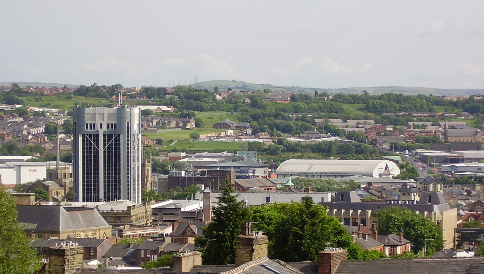
Earcroft is the northern ward in the town of Darwen, Lancashire, England. It borders Blackburn on the A666. It has a mix of residential, manufacturing and retail areas, and is serviced by both the A666 and the M65 Junction 4. It is also home to the Darwen Golf Club, A.F.C. Darwen (successor to Darwen F.C.) and Darwen Cricket Club Darwen Cricket Club is a cricket club in the Lancashire League based at the Ainsworth Lord Estates Ground in Darwen, Lancashire. They are also known as 'The Towers'. The club has played in the Ribblesdale League and were a founder member of th .... References Wards of Lancashire Darwen {{Lancashire-geo-stub ... [...More Info...] [...Related Items...] OR: [Wikipedia] [Google] [Baidu] |
Earcroft - Geograph
Earcroft is the northern ward in the town of Darwen, Lancashire, England. It borders Blackburn on the A666. It has a mix of residential, manufacturing and retail areas, and is serviced by both the A666 and the M65 Junction 4. It is also home to the Darwen Golf Club, A.F.C. Darwen (successor to Darwen F.C.) and Darwen Cricket Club Darwen Cricket Club is a cricket club in the Lancashire League based at the Ainsworth Lord Estates Ground in Darwen, Lancashire. They are also known as 'The Towers'. The club has played in the Ribblesdale League and were a founder member of th .... References Wards of Lancashire Darwen {{Lancashire-geo-stub ... [...More Info...] [...Related Items...] OR: [Wikipedia] [Google] [Baidu] |
Darwen
Darwen is a market town and civil parish in the Blackburn with Darwen borough in Lancashire, England. The residents of the town are known as "Darreners". The A666 road passes through Darwen towards Blackburn to the north, Bolton to the south and Pendlebury where it joins the A6, about north-west of Manchester. The population of Darwen stood at 28,046 in the 2011 census. The town comprises five wards and has its own town council. The town stands on the River Darwen, which flows from south to north and is visible only in the outskirts of the town, as within the town centre it runs underground. Toponym Darwen's name is Celtic in origin. In Sub Roman Britain it was within the Brythonic kingdom of Rheged, a successor to the Brigantes tribal territory. The Brythonic language name for oak is ''derw'' and this is etymologically linked to ''Derewent'' (1208), an ancient spelling for the River Darwen. Despite the area becoming part of the Anglo-Saxon Kingdom of Northumbria ... [...More Info...] [...Related Items...] OR: [Wikipedia] [Google] [Baidu] |
Darwen Golf Club
Darwen is a market town and civil parish in the Blackburn with Darwen borough in Lancashire, England. The residents of the town are known as "Darreners". The A666 road passes through Darwen towards Blackburn to the north, Bolton to the south and Pendlebury where it joins the A6, about north-west of Manchester. The population of Darwen stood at 28,046 in the 2011 census. The town comprises five wards and has its own town council. The town stands on the River Darwen, which flows from south to north and is visible only in the outskirts of the town, as within the town centre it runs underground. Toponym Darwen's name is Celtic in origin. In Sub Roman Britain it was within the Brythonic kingdom of Rheged, a successor to the Brigantes tribal territory. The Brythonic language name for oak is ''derw'' and this is etymologically linked to ''Derewent'' (1208), an ancient spelling for the River Darwen. Despite the area becoming part of the Anglo-Saxon Kingdom of Northumbria by ... [...More Info...] [...Related Items...] OR: [Wikipedia] [Google] [Baidu] |
Darwen F
Darwen is a market town and civil parish in the Blackburn with Darwen borough in Lancashire, England. The residents of the town are known as "Darreners". The A666 road passes through Darwen towards Blackburn to the north, Bolton to the south and Pendlebury where it joins the A6, about north-west of Manchester. The population of Darwen stood at 28,046 in the 2011 census. The town comprises five wards and has its own town council. The town stands on the River Darwen, which flows from south to north and is visible only in the outskirts of the town, as within the town centre it runs underground. Toponym Darwen's name is Celtic in origin. In Sub Roman Britain it was within the Brythonic kingdom of Rheged, a successor to the Brigantes tribal territory. The Brythonic language name for oak is ''derw'' and this is etymologically linked to ''Derewent'' (1208), an ancient spelling for the River Darwen. Despite the area becoming part of the Anglo-Saxon Kingdom of Northumbria by th ... [...More Info...] [...Related Items...] OR: [Wikipedia] [Google] [Baidu] |
Wards And Electoral Divisions Of The United Kingdom
The wards and electoral divisions in the United Kingdom are electoral districts at sub-national level, represented by one or more councillors. The ward is the primary unit of English electoral geography for civil parishes and borough and district councils, the electoral ward is the unit used by Welsh principal councils, while the electoral division is the unit used by English county councils and some unitary authorities. Each ward/division has an average electorate of about 5,500 people, but ward population counts can vary substantially. As of 2021 there are 8,694 electoral wards/divisions in the UK. England The London boroughs, metropolitan boroughs and non-metropolitan districts (including most unitary authorities) are divided into wards for local elections. However, county council elections (as well as those for several unitary councils which were formerly county councils, such as the Isle of Wight and Shropshire Councils) instead use the term ''electoral division''. In s ... [...More Info...] [...Related Items...] OR: [Wikipedia] [Google] [Baidu] |
Lancashire
Lancashire ( , ; abbreviated Lancs) is the name of a historic county, ceremonial county, and non-metropolitan county in North West England. The boundaries of these three areas differ significantly. The non-metropolitan county of Lancashire was created by the Local Government Act 1972. It is administered by Lancashire County Council, based in Preston, and twelve district councils. Although Lancaster is still considered the county town, Preston is the administrative centre of the non-metropolitan county. The ceremonial county has the same boundaries except that it also includes Blackpool and Blackburn with Darwen, which are unitary authorities. The historic county of Lancashire is larger and includes the cities of Manchester and Liverpool as well as the Furness and Cartmel peninsulas, but excludes Bowland area of the West Riding of Yorkshire transferred to the non-metropolitan county in 1974 History Before the county During Roman times the area was part of the Bri ... [...More Info...] [...Related Items...] OR: [Wikipedia] [Google] [Baidu] |
Blackburn
Blackburn () is an industrial town and the administrative centre of the Blackburn with Darwen borough in Lancashire, England. The town is north of the West Pennine Moors on the southern edge of the Ribble Valley, east of Preston and north-northwest of Manchester. Blackburn is the core centre of the wider unitary authority area along with the town of Darwen. It is one of the largest districts in Lancashire, with commuter links to neighbouring cities of Manchester, Salford, Preston, Lancaster, Liverpool, Bradford and Leeds. At the 2011 census, Blackburn had a population of 117,963, whilst the wider borough of Blackburn with Darwen had a population of 150,030. Blackburn had a population of 117,963 in 2011, with 30.8% being people of ethnic backgrounds other than white British. A former mill town, textiles have been produced in Blackburn since the middle of the 13th century, when wool was woven in people's houses in the domestic system. Flemish weavers who settled in t ... [...More Info...] [...Related Items...] OR: [Wikipedia] [Google] [Baidu] |
A666 Road
The A666 is a major road in Greater Manchester and Lancashire, England. Route The road runs from its junction with the A6, and A580 at the Irlams o' th' Height boundary with Pendlebury near Manchester, through Pendlebury, Clifton, Kearsley, Farnworth, Bolton, Darwen and Blackburn before meeting the A59 at Langho. Along the route are the West Pennine Moors, the Turton and Entwistle reservoir and the Entwistle reservoir forest. Road names Most common names The road is mostly known as Manchester Road, Bolton Road, or Blackburn Road, depending on which area it is in. Devil's Causeway It is sometimes referred to as the Devil's Highway or the Devil's Road because of Biblical associations of its number 666, and its high accident rate on the moors between Egerton and Darwen. St Peter's Way Officially, a short length from the A666(M) motorway and bypassing Farnworth to central Bolton is calleSt. Peter's Way Crash rate Because of a crash rate that was three times higher than ... [...More Info...] [...Related Items...] OR: [Wikipedia] [Google] [Baidu] |
M65 Motorway
The M65 is a motorway in Lancashire, England. It runs from just south of Preston through the major junction of the M6 and M61 motorways, east past Darwen, Blackburn, Accrington, Burnley, Brierfield, Nelson and ends at Colne. History The M65 was opened in the following sections: *Junctions 1a to 6 M6 to Whitebirk in 1997 *Junctions 6 to 7 (Whitebirk to Accrington/Hyndburn) in 1984 *Junctions 7 to 10 (Hyndburn to Burnley) in 1983 *Junctions 10 to 12 (Burnley to Brierfield) in 1981 *Junctions 12 to 13 (Brierfield to Nelson) in 1983 *Junctions 13 to 14 (Nelson to Colne) in 1988 The first section of the motorway was opened in 1981, connecting Burnley to Brierfield. Over the years, several extensions were made, the largest being the link from Whitebirk to the M6 and M61 motorways in 1997. This extension was the scene of a standoff between construction security workers and protesters forming part of the environmental direct action movement. Protesters occupied abandoned bui ... [...More Info...] [...Related Items...] OR: [Wikipedia] [Google] [Baidu] |
Darwen Cricket Club
Darwen Cricket Club is a cricket club in the Lancashire League based at the Ainsworth Lord Estates Ground in Darwen, Lancashire. They are also known as 'The Towers'. The club has played in the Ribblesdale League and were a founder member of the Northern Cricket League in 1952, joining the Lancashire League in 2017. For the 2022 season the captain is Scott Friend. History A Darwen club played for a brief period in the Central Lancashire League and Ribblesdale League in the late 1800s before disbanding. The current team was founded as Darwen Etrurians Cricket Club in 1901. The club re-joined the Ribblesdale League in 1909, changing their name to Darwen Cricket Club in 1910. After sharing a ground at Barley Bank, the former home of Darwen FC, the club moved to their present ground at Birch Hall in 1920. They switched to the Northern League for its inaugural season in 1952. From start of the 2017 season Darwen, along with Clitheroe and Great Harwood, moved to the Lancashire Lea ... [...More Info...] [...Related Items...] OR: [Wikipedia] [Google] [Baidu] |
Wards Of Lancashire
Ward may refer to: Division or unit * Hospital ward, a hospital division, floor, or room set aside for a particular class or group of patients, for example the psychiatric ward * Prison ward, a division of a penal institution such as a prison * Ward (electoral subdivision), electoral district or unit of local government ** Ward (KPK), local government in Khyber Pakhtunkhwa, Pakistan ** Ward (South Africa) ** Wards of Bangladesh ** Wards of Germany ** Wards of Japan ** Wards of Myanmar ** Wards and electoral divisions of the United Kingdom ** Ward (United States) *** Wards of New Orleans * Ward (fortification), part of a castle * Ward (LDS Church), a local congregation of The Church of Jesus Christ of Latter-day Saints * Ward (Vietnam), a type of third-tier subdivision of Vietnam Entertainment, arts and media * WOUF (AM), a radio station (750 AM) licensed to serve Petoskey, Michigan, United States, which held the call sign WARD from 2008 to 2021 * Ward Cleaver, a ... [...More Info...] [...Related Items...] OR: [Wikipedia] [Google] [Baidu] |


