|
Dyksterhuzen
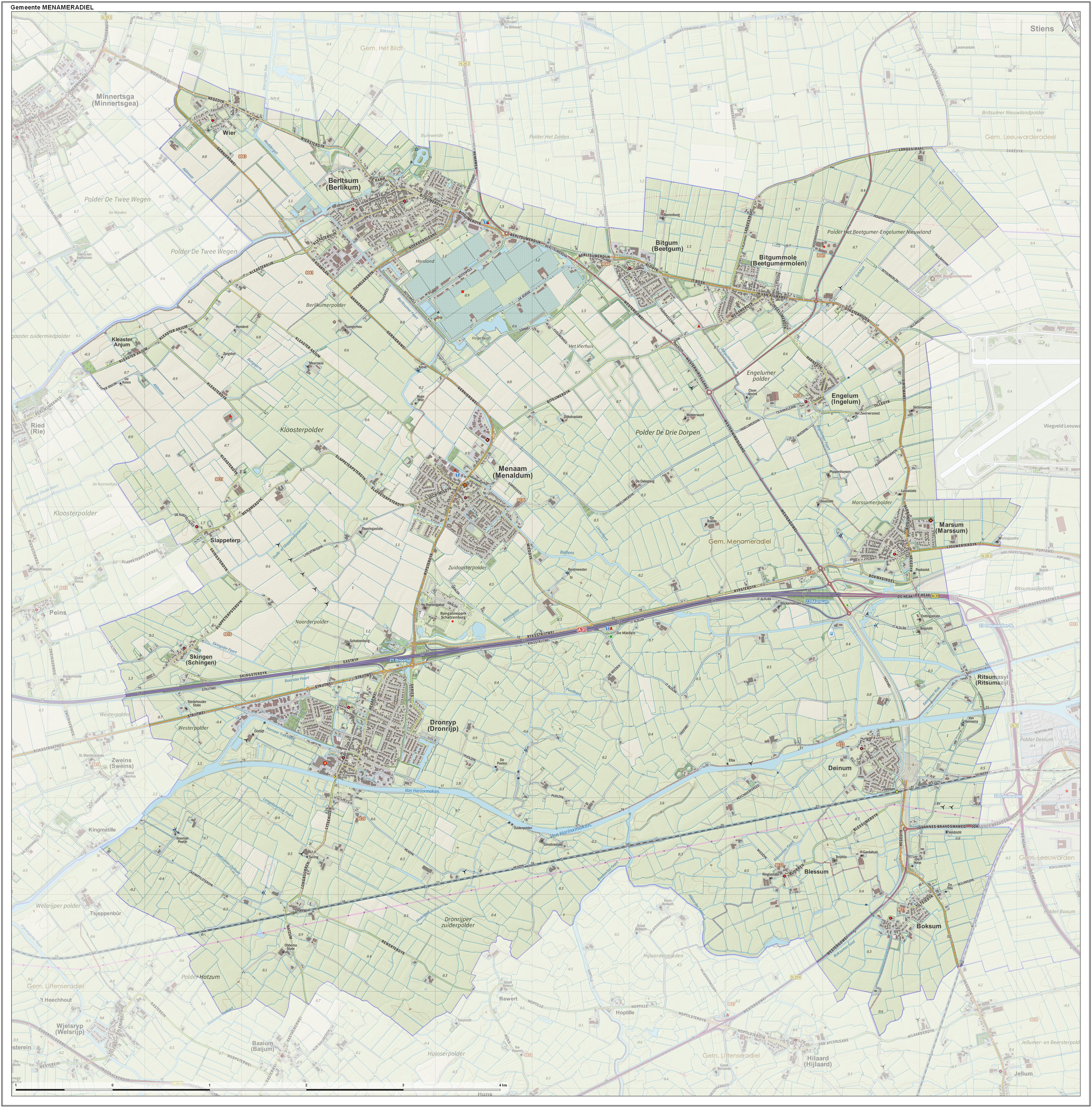
Dyksterhuzen ( nl, Dijksterhuizen; ) is a hamlet in the Dutch municipality of Waadhoeke in the province of Friesland. It is located northwest of Ingelum and east of Bitgummole, of which it is a part administratively. The settlement of the hamlet is located on the eponymous road, Dyksterhuzen. The residences are both houses and farms. The N398, a trunk road, forms the division between the hamlet and the village of Bitgummole. History Dyksterhuzen is actually the original center from which Bitgummole emerged. Dyksterhuzen was a small road village located east of the village area of Bitgum, on the dyke of the Middelzee. The place was mentioned in 1502 as ''Dyckstrahusen''. In the 16th century, a corn mill and rye mill was built near the border with Bitgum by the residents of the Groot Terhorne '' stins''. This created a new core of habitation. This new center was referred to in 1622 as ''Beetgumer Meulen''. Dyksterhuzen itself was cited as ''Dijctra-huysen'' in that year and i ... [...More Info...] [...Related Items...] OR: [Wikipedia] [Google] [Baidu] |
Waadhoeke
Waadhoeke is a municipality of Friesland in the northern Netherlands. It was established 1 January 2018 and consists of the former municipalities of Franekeradeel, het Bildt, Menameradiel and parts of Littenseradiel, all four of which were dissolved on the same day. The municipality is located in the province of Friesland, in the north of the Netherlands. Waadhoeke is bordered by Harlingen, Terschelling, Ferwerderadiel, Leeuwarden and Súdwest-Fryslân. The population in January 2019 was 46,133. It is Friesland's sixth-most-populous municipality. The largest population centre (2018 population, 12,793) is Franeker. The residents speak Dutch, West Frisian or Bildts (a dialect in the former municipality het Bildt). Etymology The municipality is named after the Wadden Sea ( fry, Waadsee). The municipality is a part or corner ( fry, hoeke) of the province of Friesland. Population centres The municipality consists of 41 settlements of which Franeker is the seat o ... [...More Info...] [...Related Items...] OR: [Wikipedia] [Google] [Baidu] |
Hamlet (place)
A hamlet is a human settlement that is smaller than a town or village. Its size relative to a parish can depend on the administration and region. A hamlet may be considered to be a smaller settlement or subdivision or satellite entity to a larger settlement. The word and concept of a hamlet has roots in the Anglo-Norman settlement of England, where the old French ' came to apply to small human settlements. Etymology The word comes from Anglo-Norman ', corresponding to Old French ', the diminutive of Old French ' meaning a little village. This, in turn, is a diminutive of Old French ', possibly borrowed from (West Germanic) Franconian languages. Compare with modern French ', Dutch ', Frisian ', German ', Old English ' and Modern English ''home''. By country Afghanistan In Afghanistan, the counterpart of the hamlet is the qala ( Dari: قلعه, Pashto: کلي) meaning "fort" or "hamlet". The Afghan ''qala'' is a fortified group of houses, generally with its own co ... [...More Info...] [...Related Items...] OR: [Wikipedia] [Google] [Baidu] |
West Frisian Language
West Frisian, or simply Frisian ( fy, link=no, Frysk or ; nl, Fries , also ), is a West Germanic language spoken mostly in the province of Friesland () in the north of the Netherlands, mostly by those of Frisian ancestry. It is the most widely spoken of the Frisian languages. In the study of the evolution of English, West Frisian is notable as being the most closely related foreign tongue to the various dialects of Old English spoken across the Heptarchy, these being part of the Anglo-Frisian branch of the West Germanic family. Name The name "West Frisian" is only used outside the Netherlands, to distinguish this language from the closely related Frisian languages of Saterland Frisian and North Frisian spoken in Germany. Within the Netherlands, however, "West Frisian" refers to the West Frisian dialect of the Dutch language while the West Frisian language is almost always just called "Frisian" (in Dutch: for the Frisian language and for the Dutch dialect). The un ... [...More Info...] [...Related Items...] OR: [Wikipedia] [Google] [Baidu] |
Menameradiel
Menameradiel (; nl, Menaldumadeel ) is a former municipality in Friesland, Netherlands. On 1 January 2018 it merged with the municipalities of Franekeradeel, het Bildt and parts of Littenseradiel to form the new municipality Waadhoeke. Population centres Population centres as of 1 January 2007: * Beetgum (754) * Beetgumermolen (944) * Berlikum (2,492) * Blessum (92) * Boksum (449) * Deinum (1,071) * Dronryp (3,427) * Engelum (415) * Kleaster-Anjum (50) * Marssum Marsum or Marssum is a village in Waadhoeke in the province of Friesland, the Netherlands. It had a population of around 1,052 in January 2017. Before 2018, the village was part of the Menameradiel municipality. Every year a Marsumer of the yea ... (1,156) * Menaam (2,612) * Schingen (108) * Slappeterp (80) * Wier (207). Topography ''Dutch Topographic map of the former municipality of Menaldumadeel, June 2015'' References External links * Waadhoeke Former municipalities of Friesland ... [...More Info...] [...Related Items...] OR: [Wikipedia] [Google] [Baidu] |
Stins
A stins (Dutch, pl. ''stinsen''; from West Frisian ''stienhûs'' utch ''steenhuis''"stone house", shortened to ''stins'', pl. ''stinzen'') is a former stronghold or villa in the province of Friesland, the Netherlands. Many stinsen carry the name "''state''" (related to English 'estate'). Stinsen used to belong to noblemen or prominent citizens. Most stinsen were demolished in the 19th century, when maintenance became too expensive. Several surviving stinsen are now used as museums. Stinsen also appear in East Frisia, and are known as ''borg'' (pl. ''borgen'') in the province of Groningen. See also * List of stins in Friesland * List of castles in the Netherlands This is a list of castles in the Netherlands per province. Overview of castles in the Netherlands Drenthe See also ''List of havezates in Drenthe'' Flevoland Friesland See ''List of stins in Friesland'' Gelderland Groningen See ''List o ... References External links Stinsen in Friesland {{Expand Dutch, ... [...More Info...] [...Related Items...] OR: [Wikipedia] [Google] [Baidu] |
Corn Mill
A gristmill (also: grist mill, corn mill, flour mill, feed mill or feedmill) grinds cereal grain into flour and middlings. The term can refer to either the grinding mechanism or the building that holds it. Grist is grain that has been separated from its chaff in preparation for grinding. History Early history The Greek geographer Strabo reports in his ''Geography'' a water-powered grain-mill to have existed near the palace of king Mithradates VI Eupator at Cabira, Asia Minor, before 71 BC. The early mills had horizontal paddle wheels, an arrangement which later became known as the " Norse wheel", as many were found in Scandinavia. The paddle wheel was attached to a shaft which was, in turn, attached to the centre of the millstone called the "runner stone". The turning force produced by the water on the paddles was transferred directly to the runner stone, causing it to grind against a stationary "bed", a stone of a similar size and shape. This simple arrangement requ ... [...More Info...] [...Related Items...] OR: [Wikipedia] [Google] [Baidu] |
Middelzee
The Middelzee (Dutch for "middle sea"; fry, Middelsee), also called Bordine, was the estuary mouth of the River Boorne (West Frisian: ''Boarn'') now in the Dutch province of Friesland. It ran from as far south as Sneek northward to the Wadden Sea and marked the border between main Frisian regions of Westergoa (Westergo) and Eastergoa (Oostergo). Other historical names for the Middelzee include Bordaa, Borndiep, Boerdiep, and Bordena. The names like Bordine, mean "border". Pre-history Back in the Pleistocene the Boorne was a river that had a drainage basin in Friesland, Drenthe, and Groningen. It flowed from Saalien glacial till plateau in a southwest direction, and met the sea west of Het Bildt. The Boorne passed the current location of Akkrum and Rauwerd. The connection to the Wadden Sea became blocked by sand dunes in the Weichselian time period, and the mouth of the river was forced more and more easterly, until it was heading in a north-northwest direction from Akkrum. ... [...More Info...] [...Related Items...] OR: [Wikipedia] [Google] [Baidu] |
Dyke (embankment)
A levee (), dike (American English), dyke ( Commonwealth English), embankment, floodbank, or stop bank is a structure that is usually earthen and that often runs parallel to the course of a river in its floodplain or along low-lying coastlines. The purpose of a levee is to keep the course of rivers from changing and to protect against flooding of the area adjoining the river or coast. Levees can be naturally occurring ridge structures that form next to the bank of a river, or be an artificially constructed fill or wall that regulates water levels. Ancient civilizations in the Indus Valley, ancient Egypt, Mesopotamia and China all built levees. Today, levees can be found around the world, and failures of levees due to erosion or other causes can be major disasters. Etymology Speakers of American English (notably in the Midwest and Deep South) use the word ''levee'', from the French word (from the feminine past participle of the French verb , 'to raise'). It originated ... [...More Info...] [...Related Items...] OR: [Wikipedia] [Google] [Baidu] |


