|
Dun Skeig
Dun Skeig is an oval Iron Age dun (fort) complex which is perched atop a rocky outcropping about above sea level overlooking West Loch Tarbert in Kintyre, Argyll and Bute, Scotland, about northwest of the village of Clachan. The dun site includes a collection of prehistoric buildings and evidence of human habitation. Most notable of the buildings on the site are a rocky Iron Age fort and a vitrified fort that has been grown over with ground vegetation. The Iron Age fort measures about in diameter with an outer wall of thick and has a single entrance. The moderately challenging climb to the peak and the views of the surrounding landscape that the vantage point offers make it clear why the site was selected as a defensive position. Other nearby prehistoric sites Other nearby sites on the Kintyre Peninsula include: * Avinagillan Standing Stone The Avinagillan standing stone is a prehistoric menhir on the Kintyre Peninsula of Scotland. The stone is near the hamlet of Avinag ... [...More Info...] [...Related Items...] OR: [Wikipedia] [Google] [Baidu] |
Dun Skeig From The Beach - Geograph
A dun is an ancient or medieval fort. In Ireland and Britain it is mainly a kind of hillfort and also a kind of Atlantic roundhouse. Etymology The term comes from Irish ''dún'' or Scottish Gaelic ''dùn'' (meaning "fort"), and is cognate with Old Welsh ''din'' (whence Welsh ''dinas'' "city" comes). In certain instances, place-names containing ''Dun-'' or similar in Northern England and Southern Scotland, may be derived from a Brittonic cognate of the Welsh form ''din''. In this region, substitution of the Brittonic form by the Gaelic equivalent may have been widespread in toponyms. The Dacian dava (hill fort) is probably etymologically cognate. Details In some areas duns were built on any suitable crag or hillock, particularly south of the Firth of Clyde and the Firth of Forth. There are many duns on the west coast of Ireland and they feature in Irish mythology. For example, the tale of the ''Táin Bó Flidhais'' features Dún Chiortáin and Dún Chaocháin. Duns ... [...More Info...] [...Related Items...] OR: [Wikipedia] [Google] [Baidu] |
Iron Age
The Iron Age is the final epoch of the three-age division of the prehistory and protohistory of humanity. It was preceded by the Stone Age (Paleolithic, Mesolithic, Neolithic) and the Bronze Age (Chalcolithic). The concept has been mostly applied to Iron Age Europe and the Ancient Near East, but also, by analogy, to other parts of the Old World. The duration of the Iron Age varies depending on the region under consideration. It is defined by archaeological convention. The "Iron Age" begins locally when the production of iron or steel has advanced to the point where iron tools and weapons replace their bronze equivalents in common use. In the Ancient Near East, this transition took place in the wake of the Bronze Age collapse, in the 12th century BC. The technology soon spread throughout the Mediterranean Basin region and to South Asia (Iron Age in India) between the 12th and 11th century BC. Its further spread to Central Asia, Eastern Europe, and Central Europe is somewhat dela ... [...More Info...] [...Related Items...] OR: [Wikipedia] [Google] [Baidu] |
West Loch Tarbert, Argyll
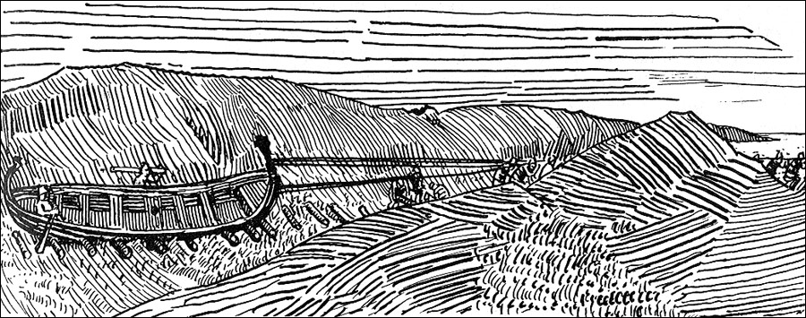
West Loch Tarbert, Argyll is a long and narrow sea loch on the western side of the Kintyre peninsula in Scotland. Geography The head of the loch lies near the village of Tarbert and it reaches the open sea at Ardpatrick Point some distant. The island of Eilean Ceann na Creige, off the south shore, is connected to the mainland by a causeway. It is the ferry terminal for Islay. History Around the year 1093, Magnus Barefoot, King of Norway had his longship dragged across the isthmus at Tarbert between West Loch Tarbert and East Loch Tarbert as part of a campaign to increase his possessions in the Hebrides. He made an arrangement with King Malcolm III of Scotland that he could take possession of land on the west coast around which a ship could sail. Magnus declared that Kintyre had "better land than the best of the Hebrides", and by taking command of his ship's tiller and "sailing" across the isthmus he was able to claim the entire peninsula, which remained under Norse rule for mo ... [...More Info...] [...Related Items...] OR: [Wikipedia] [Google] [Baidu] |
Kintyre
Kintyre ( gd, Cinn Tìre, ) is a peninsula in western Scotland, in the southwest of Argyll and Bute. The peninsula stretches about , from the Mull of Kintyre in the south to East and West Loch Tarbert in the north. The region immediately north of Kintyre is known as Knapdale. Kintyre is long and narrow, at no point more than from west coast to east coast, and is less than wide where it connects to Knapdale. The east side of the Kintyre Peninsula is bounded by Kilbrannan Sound, with a number of coastal peaks such as Torr Mor. The central spine of the peninsula is mostly hilly moorland, the highest point being Beinn an Tuirc at .Ordnance Survey. Landranger 1:50,000 Map Sheet 68 (South Kintyre & Cambeltown) The coastal areas and hinterland, however, are rich and fertile. Kintyre has long been a prized area for settlers, including the early Scots who migrated from Ulster to western Scotland and the Vikings or Norsemen who conquered and settled the area just before the start of t ... [...More Info...] [...Related Items...] OR: [Wikipedia] [Google] [Baidu] |
Argyll And Bute
Argyll and Bute ( sco, Argyll an Buit; gd, Earra-Ghàidheal agus Bòd, ) is one of 32 unitary authority council areas in Scotland and a lieutenancy area. The current lord-lieutenant for Argyll and Bute is Jane Margaret MacLeod (14 July 2020). The administrative centre for the council area is in Lochgilphead at Kilmory Castle, a 19th-century Gothic Revival building and estate. The current council leader is Robin Currie, a councillor for Kintyre and the Islands. Description Argyll and Bute covers the second-largest administrative area of any Scottish council. The council area adjoins those of Highland, Perth and Kinross, Stirling and West Dunbartonshire. Its border runs through Loch Lomond. The present council area was created in 1996, when it was carved out of the Strathclyde region, which was a two-tier local government region of 19 districts, created in 1975. Argyll and Bute merged the existing Argyll and Bute district and one ward of the Dumbarton district. The Dumbart ... [...More Info...] [...Related Items...] OR: [Wikipedia] [Google] [Baidu] |
Scotland
Scotland (, ) is a country that is part of the United Kingdom. Covering the northern third of the island of Great Britain, mainland Scotland has a border with England to the southeast and is otherwise surrounded by the Atlantic Ocean to the north and west, the North Sea to the northeast and east, and the Irish Sea to the south. It also contains more than 790 islands, principally in the archipelagos of the Hebrides and the Northern Isles. Most of the population, including the capital Edinburgh, is concentrated in the Central Belt—the plain between the Scottish Highlands and the Southern Uplands—in the Scottish Lowlands. Scotland is divided into 32 administrative subdivisions or local authorities, known as council areas. Glasgow City is the largest council area in terms of population, with Highland being the largest in terms of area. Limited self-governing power, covering matters such as education, social services and roads and transportation, is devolved from the Scott ... [...More Info...] [...Related Items...] OR: [Wikipedia] [Google] [Baidu] |
Clachan, Kintyre
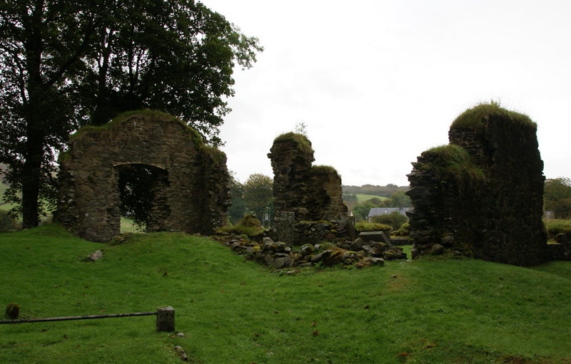
Clachan is a small village in North Kintyre, Argyll & Bute, Scotland. Clachan is the site of an old church, which was the principal church for the North Kintyre area. The church is surrounded by carved stone statues of the Chiefs of the Clan Alasdair. Another group of standing stones (the tallest of which is 3.4 metres), and a burial cist, are found to the south of Clachan, near Ballochroy Farm. In 1971 it had a population of 108. The last major battle to be fought in Kintyre took place on the steep slopes of Loup Hill in May 1689, when the local forces of MacDonald of Largie, McAlester of Loup and McNeill of Gallichoille, all strong supporters of King James VII, were defeated by a Government force. Clachan is also the site of Balinakill House. Once the home of Coll McAlester, who led the first large settlement of highlanders in North Carolina at Cross Creek in the Cape Fear River valley in 1739, and later the home of Sir William MacKinnon Sir William Mackinnon, 1st Baronet ... [...More Info...] [...Related Items...] OR: [Wikipedia] [Google] [Baidu] |
Vitrified
Vitrification (from Latin ''vitreum'', "glass" via French ''vitrifier'') is the full or partial transformation of a substance into a glass, that is to say, a non-crystalline amorphous solid. Glasses differ from liquids structurally and glasses possess a higher degree of connectivity with the same Hausdorff dimensionality of bonds as crystals: dimH = 3. In the production of ceramics, vitrification is responsible for its impermeability to water. Vitrification is usually achieved by heating materials until they liquidize, then cooling the liquid, often rapidly, so that it passes through the glass transition to form a glassy solid. Certain chemical reactions also result in glasses. In terms of chemistry, vitrification is characteristic for amorphous materials or disordered systems and occurs when bonding between elementary particles ( atoms, molecules, forming blocks) becomes higher than a certain threshold value. Thermal fluctuations break the bonds; therefore, the ... [...More Info...] [...Related Items...] OR: [Wikipedia] [Google] [Baidu] |
Kintyre Peninsula
Kintyre ( gd, Cinn Tìre, ) is a peninsula in western Scotland, in the southwest of Argyll and Bute. The peninsula stretches about , from the Mull of Kintyre in the south to East and West Loch Tarbert in the north. The region immediately north of Kintyre is known as Knapdale. Kintyre is long and narrow, at no point more than from west coast to east coast, and is less than wide where it connects to Knapdale. The east side of the Kintyre Peninsula is bounded by Kilbrannan Sound, with a number of coastal peaks such as Torr Mor. The central spine of the peninsula is mostly hilly moorland, the highest point being Beinn an Tuirc at .Ordnance Survey. Landranger 1:50,000 Map Sheet 68 (South Kintyre & Cambeltown) The coastal areas and hinterland, however, are rich and fertile. Kintyre has long been a prized area for settlers, including the early Scots who migrated from Ulster to western Scotland and the Vikings or Norsemen who conquered and settled the area just before the start of th ... [...More Info...] [...Related Items...] OR: [Wikipedia] [Google] [Baidu] |
Avinagillan Standing Stone
The Avinagillan standing stone is a prehistoric menhir on the Kintyre Peninsula of Scotland. The stone is near the hamlet of Avinagillan.Megalithic Portal See also * Kilbrannan Sound Kilbrannan Sound (Scottish Gaelic: ''An Caolas Branndanach'') is a marine water body that separates the Kintyre Peninsula of Scotland from the island of Arran. Kilbrannan Sound is the western arm of the Firth of Clyde. See also * Dippen Bay * Ki ... Line notes References * Megalithic Porta''Avinagillan standing stone'' Megalithic monuments in Scotland History of Argyll and Bute Stone Age Scotland Kintyre {{Scotland-hist-stub ... [...More Info...] [...Related Items...] OR: [Wikipedia] [Google] [Baidu] |
Ballochroy
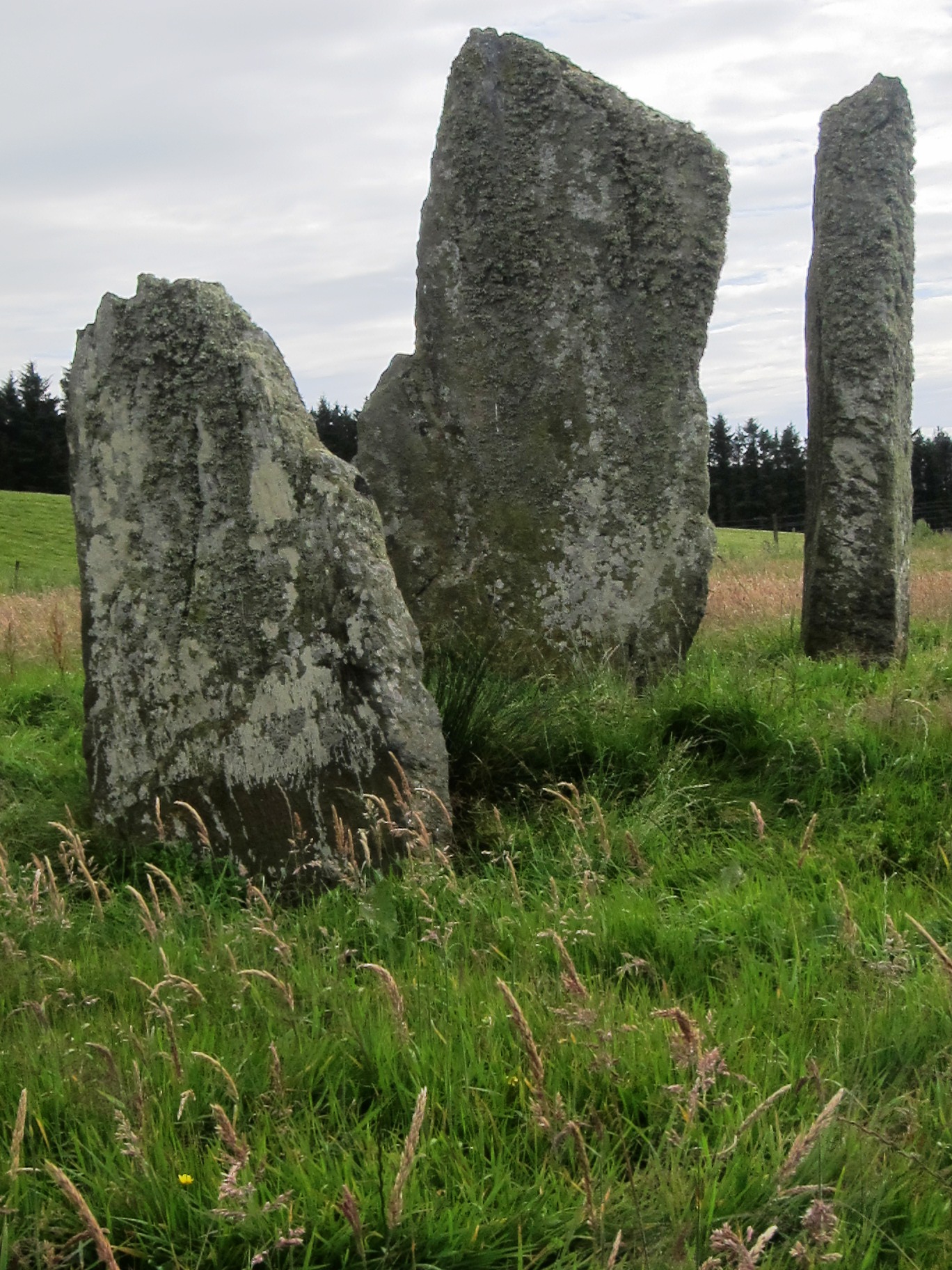
Ballochroy is a megalithic site in Kintyre on the Argyll peninsula in Scotland. It consists of three vertical stones, side by side, aligned with various land features away. Alexander Thom, known for his work on Stonehenge, maintained that the great length between the stones and the features of distant landscape lent precision to pinpointing the midsummer and winter solstices for ancient observers. These three stones are considered the most spectacular set of megalithic monuments that cluster around south Argyll. The three mica schist stones were measured at in height. It is possible that this last, smallest, stone may have been broken off at the top. The line of stones is orientated north-east to south-west. The flat face of the central stone (at right angles to the alignment) indicates the mountain of Cora Bheinn, on the island of Jura, which is away. The shortest stone also faces across the alignment, and points to Beinn a' Chaolais, the southernmost of the three Paps of ... [...More Info...] [...Related Items...] OR: [Wikipedia] [Google] [Baidu] |
Buildings And Structures In Argyll And Bute
A building, or edifice, is an enclosed structure with a roof and walls standing more or less permanently in one place, such as a house or factory (although there's also portable buildings). Buildings come in a variety of sizes, shapes, and functions, and have been adapted throughout history for a wide number of factors, from building materials available, to weather conditions, land prices, ground conditions, specific uses, prestige, and aesthetic reasons. To better understand the term ''building'' compare the list of nonbuilding structures. Buildings serve several societal needs – primarily as shelter from weather, security, living space, privacy, to store belongings, and to comfortably live and work. A building as a shelter represents a physical division of the human habitat (a place of comfort and safety) and the ''outside'' (a place that at times may be harsh and harmful). Ever since the first cave paintings, buildings have also become objects or canvasses of much artis ... [...More Info...] [...Related Items...] OR: [Wikipedia] [Google] [Baidu] |


