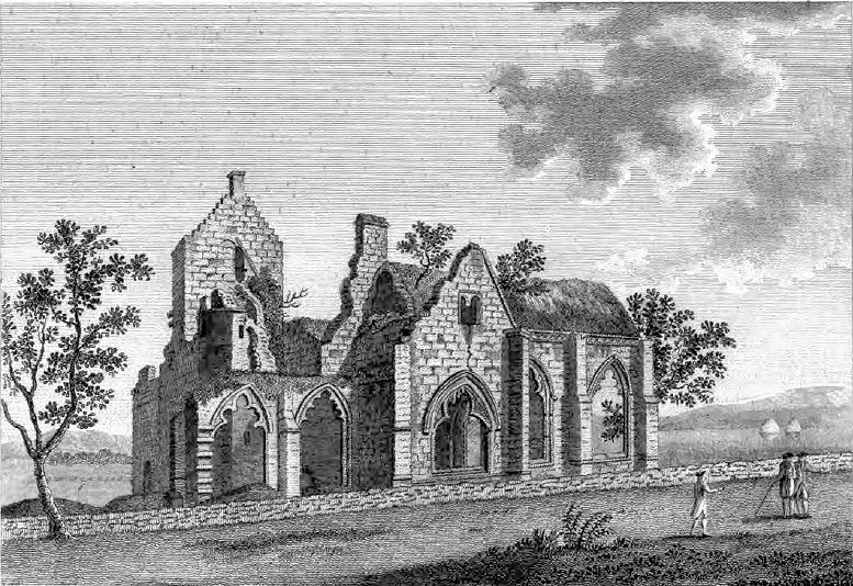
Dumfries And Galloway
   HOME
*


picture info

Dumfries And Galloway
Dumfries and Galloway ( sco, Dumfries an Gallowa; gd, Dùn Phrìs is Gall-Ghaidhealaibh) is one of 32 unitary council areas of Scotland and is located in the western Southern Uplands. It covers the counties of Scotland, historic counties of Dumfriesshire, Kirkcudbrightshire, and Wigtownshire, the latter two of which are collectively known as Galloway. The administrative centre and largest settlement is the town of Dumfries. The second largest town is Stranraer, on the North Channel (Great Britain and Ireland), North Channel coast, some to the west of Dumfries. Following the 1975 reorganisation of local government in Scotland, the three counties were joined to form a single regions and districts of Scotland, region of Dumfries and Galloway, with four districts within it. The districts were abolished in 1996, since when Dumfries and Galloway has been a unitary local authority. For lieutenancy areas of Scotland, lieutenancy purposes, the area is divided into three lieutenancy a ...
[...More Info...]      
[...Related Items...]     OR:     [Wikipedia]   [Google]   [Baidu]  


picture info

Dumfries And Galloway In Scotland
Dumfries ( ; sco, Dumfries; from gd, Dùn Phris ) is a market town and former royal burgh within the Dumfries and Galloway council area of Scotland. It is located near the mouth of the River Nith into the Solway Firth about by road from the Anglo-Scottish border and just away from Cumbria by air. Dumfries is the county town of the Counties of Scotland, historic county of Dumfriesshire. Before becoming King of Scots, Robert the Bruce killed his rival the John Comyn III of Badenoch, Red Comyn at Greyfriars Kirk in the town on 10 February 1306. The Young Pretender had his headquarters here during a 3-day sojourn in Dumfries towards the end of 1745. During the World War II, Second World War, the bulk of the Norwegian Army during their years Norwegian Armed Forces in exile, in exile in Britain consisted of a brigade in Dumfries. Dumfries is nicknamed ''Queen of the South''. This is also the name of the town's Queen of the South F.C., professional football club. People from Dumf ...
[...More Info...]      
[...Related Items...]     OR:     [Wikipedia]   [Google]   [Baidu]  


picture info

Southern Uplands
The Southern Uplands ( gd, Na Monaidhean a Deas) are the southernmost and least populous of mainland Scotland's three major geographic areas (the other two being the Central Lowlands and the Grampian Mountains and the Highlands, as illustrated in the accompanying map). The term is used both to describe the geographical region and to collectively denote the various ranges of hills and mountains within this region. An overwhelmingly rural and agricultural region, the Southern Uplands are partly forested and contain many areas of open moorland - the hill names in the area are congruent with these characteristics. Geology The Southern Uplands consist mainly of Silurian sedimentary deposits deposited in the Iapetus Ocean 420 million years ago. These rocks were pushed up from the sea bed into an accretionary wedge during the Caledonian orogeny, roughly 400 million years ago ( Ma), when the continents and terranes of Laurentia, Baltica and Avalonia collided. The Caledonian orog ...
[...More Info...]      
[...Related Items...]     OR:     [Wikipedia]   [Google]   [Baidu]  


picture info

Cumbria
Cumbria ( ) is a ceremonial and non-metropolitan county in North West England, bordering Scotland. The county and Cumbria County Council, its local government, came into existence in 1974 after the passage of the Local Government Act 1972. Cumbria's county town is Carlisle, in the north of the county. Other major settlements include Barrow-in-Furness, Kendal, Whitehaven and Workington. The administrative county of Cumbria consists of six districts ( Allerdale, Barrow-in-Furness, Carlisle, Copeland, Eden and South Lakeland) and, in 2019, had a population of 500,012. Cumbria is one of the most sparsely populated counties in England, with 73.4 people per km2 (190/sq mi). On 1 April 2023, the administrative county of Cumbria will be abolished and replaced with two new unitary authorities: Westmorland and Furness (Barrow-in-Furness, Eden, South Lakeland) and Cumberland ( Allerdale, Carlisle, Copeland). Cumbria is the third largest ceremonial county in England by area. It i ...
[...More Info...]      
[...Related Items...]     OR:     [Wikipedia]   [Google]   [Baidu]  


picture info

Scottish Borders
The Scottish Borders ( sco, the Mairches, 'the Marches'; gd, Crìochan na h-Alba) is one of 32 council areas of Scotland. It borders the City of Edinburgh, Dumfries and Galloway, East Lothian, Midlothian, South Lanarkshire, West Lothian and, to the south-west, south and east, the English counties of Cumbria and Northumberland. The administrative centre of the area is Newtown St Boswells. The term Scottish Borders, or normally just "the Borders", is also used to designate the areas of southern Scotland and northern England that bound the Anglo-Scottish border. Geography The Scottish Borders are in the eastern part of the Southern Uplands. The region is hilly and largely rural, with the River Tweed flowing west to east through it. The highest hill in the region is Broad Law in the Manor Hills. In the east of the region, the area that borders the River Tweed is flat and is known as 'The Merse'. The Tweed and its tributaries drain the entire region with the river flowi ...
[...More Info...]      
[...Related Items...]     OR:     [Wikipedia]   [Google]   [Baidu]  


picture info

South Lanarkshire
gd, Siorrachd Lannraig a Deas , image_skyline = , image_flag = , image_shield = Arms_slanarkshire.jpg , image_blank_emblem = Slanarks.jpg , blank_emblem_type = Council logo , image_map = , map_caption = , coordinates = , seat_type = Admin HQ , seat = Hamilton , government_footnotes = , governing_body = South Lanarkshire Council , leader_title = Control , leader_name = Labour minority (council NOC) , leader_title1 = MPs , leader_name1 = *David Mundell (Dumfriesshire, Clydesdale and Tweeddale) *Lisa Cameron ( East Kilbride, Strathaven and Lesmahagow) *Angela Crawley (Lanark and Hamilton East) *Margaret Ferrier (Rutherglen and Hamilton West) , subdivision_type = Sovereign state , subdivision_name = United Kingdom , subdivision_type1 = , subdivisio ...
[...More Info...]      
[...Related Items...]     OR:     [Wikipedia]   [Google]   [Baidu]  


picture info

South Ayrshire
South Ayrshire ( sco, Sooth Ayrshire; gd, Siorrachd Àir a Deas, ) is one of thirty-two council areas of Scotland, covering the southern part of Ayrshire. It borders onto Dumfries and Galloway, East Ayrshire and North Ayrshire. On 30 June 2020, the population of South Ayrshire was 112,140. Overview and history Creation and history The administrative boundaries were formed in 1996 as a direct successor to the Kyle and Carrick district council area, with the district of Dalmellington – located along the south-east of Kyle and Carrick – being transferred over to the newly formed East Ayrshire Council area. South Ayrshire's Headquarters, County Buildings, are located in Wellington Square, Ayr. The former council offices, Burns House on Burns Square and Parkhouse Street, were demolished in 2021, creating a new open space, landscaped with funding from the Scottish Government. Geography and climate Geographically, South Ayrshire is located on the western coast of Scotland, s ...
[...More Info...]      
[...Related Items...]     OR:     [Wikipedia]   [Google]   [Baidu]  


picture info

East Ayrshire
East Ayrshire ( sco, Aest Ayrshire; gd, Siorrachd Àir an Ear) is one of thirty-two council areas of Scotland. It shares borders with Dumfries and Galloway, East Renfrewshire, North Ayrshire, South Ayrshire and South Lanarkshire. The headquarters of the council are located on London Road, Kilmarnock. With South Ayrshire and the mainland areas of North Ayrshire, it formed the former county of Ayrshire. The wider geographical region of East Ayrshire has a population of 122,100 at the last 2011 census, making it the 16th most populous local authority in Scotland. Spanning a geographical area of , East Ayrshire is the 14th-largest local authority in Scotland in terms of geographical area. The majority of the population of East Ayrshire live within and surrounding the main town, Kilmarnock, having a population of over 46,000 people at the 2011 census. Other large population areas in East Ayrshire include Cumnock, the second-largest town in terms of population and area, and smalle ...
[...More Info...]      
[...Related Items...]     OR:     [Wikipedia]   [Google]   [Baidu]  


picture info

Lieutenancy Areas Of Scotland
The lieutenancy areas of Scotland are the areas used for the ceremonial lord-lieutenants, the monarch's representatives, in Scotland. The lord-lieutenants' titles chosen by the monarch and his legal advisers are mainly based on placenames of the traditional counties of Scotland. In 1794 permanent lieutenancies were established by Royal Warrant. By the Militia Act 1797 (37 Geo.3, C.103), the lieutenants appointed "for the Counties, Stewartries, Cities, and Places" were given powers to raise and command County Militia Units. While in their lieutenancies, lord lieutenants are among the few individuals in Scotland officially permitted to fly a banner of the Royal Arms of Scotland, the "Lion Rampant" as it is more commonly known. Lieutenancy areas are different from the current local government council areas and their committee areas. They also differ from other subdivisions of Scotland including sheriffdoms and former regions and districts. The Lord Provosts of Aberdeen, Dunde ...
[...More Info...]      
[...Related Items...]     OR:     [Wikipedia]   [Google]   [Baidu]  


picture info

Regions And Districts Of Scotland
In geography, regions, otherwise referred to as zones, lands or territories, are areas that are broadly divided by physical characteristics (physical geography), human impact characteristics (human geography), and the interaction of humanity and the environment ( environmental geography). Geographic regions and sub-regions are mostly described by their imprecisely defined, and sometimes transitory boundaries, except in human geography, where jurisdiction areas such as national borders are defined in law. Apart from the global continental regions, there are also hydrospheric and atmospheric regions that cover the oceans, and discrete climates above the land and water masses of the planet. The land and water global regions are divided into subregions geographically bounded by large geological features that influence large-scale ecologies, such as plains and features. As a way of describing spatial areas, the concept of regions is important and widely used among the many branches o ...
[...More Info...]      
[...Related Items...]     OR:     [Wikipedia]   [Google]   [Baidu]  


picture info

North Channel (Great Britain And Ireland)
The North Channel (known in Irish and Scottish Gaelic as , in Scots as the ) is the strait between north-eastern Northern Ireland and south-western Scotland. It begins north of the Isle of Man, where the Irish Sea ends, and runs north-west into the Atlantic Ocean. Geography The North Channel connects the Irish Sea with the Atlantic Ocean and is part of the marine area officially classified as the "Inner Seas off the West Coast of Scotland" by the International Hydrographic Organization (IHO). The Straits of Moyle ( in Irish and Scottish Gaelic) or Sea of Moyle is the name given to the narrowest expanse of sea in the North Channel between north-eastern Northern Ireland (County Antrim) and south-western highlands of Scotland (Mull of Kintyre). The distance between the two shores is approximately at its closest point, and thus it is possible to see across in clear weather conditions. The straits gave their name to Moyle District Council, a local government area in Northern Ire ...
[...More Info...]      
[...Related Items...]     OR:     [Wikipedia]   [Google]   [Baidu]  


picture info

Stranraer
Stranraer ( , in Scotland also ; gd, An t-Sròn Reamhar ), also known as The Toon, is a town in Dumfries and Galloway, Scotland. It is located in the historical parish of Inch in the historic county of Wigtownshire. It lies on the shores of Loch Ryan, on the northern side of the isthmus joining the Rhins of Galloway to the mainland. Stranraer is Dumfries and Galloway's second-largest town, with a population including the immediate surrounding area of nearly 13,000 inhabitants. Stranraer is an administrative centre for the West Galloway Wigtownshire area of Dumfries and Galloway. It was formerly a ferry port, connecting Scotland with Belfast and Larne in Northern Ireland; the last service was transferred to nearby Cairnryan in November 2011. It lies by road southwest of Glasgow, miles southwest of Ayr and to the west of Dumfries. The name comes from Scottish Gaelic '' An t-Sròn Reamhar'' meaning "the broad headland" or "the fat nose". History The Battle of Loch Ryan was ...
[...More Info...]      
[...Related Items...]     OR:     [Wikipedia]   [Google]   [Baidu]  


picture info

Administrative Centre
An administrative center is a seat of regional administration or local government, or a county town, or the place where the central administration of a commune is located. In countries with French as administrative language (such as Belgium, Luxembourg, Switzerland and many African countries), a (, plural form , literally 'chief place' or 'main place'), is a town or city that is important from an administrative perspective. Algeria The capital of an Algerian province is called a chef-lieu. The capital of a district, the next largest division, is also called a chef-lieu, whilst the capital of the lowest division, the municipalities, is called agglomération de chef-lieu (chef-lieu agglomeration) and is abbreviated as A.C.L. Belgium The chef-lieu in Belgium is the administrative centre of each of the ten provinces of Belgium. Three of these cities also give their name to their province ( Antwerp, Liège and Namur). France The chef-lieu of a département is known as the ''pr ...
[...More Info...]      
[...Related Items...]     OR:     [Wikipedia]   [Google]   [Baidu]