|
Dumble
Dumble is a dialect word meaning a wooded valley. Dumble is a dialect word mainly (but not exclusively) confined to the north and east Midlands both as a place-name element and as a lexical item. It seems to contain the Old English ''dumbel'' or ''dymbel'', 'hollow; wooded valley; deep cut water course'. ''The English Dialect Dictionary'' finds the word in Cheshire, Derbyshire, Nottinghamshire, Leicestershire, Warwickshire (where 'doomble' is also found) and in Shropshire, with the meaning of a wooded valley, a belt of trees along the bed of a small stream; a ravine through which a watercourse runs; sometimes the word appears in the plural.J. Wright, ''The English dialect dictionary'' (in five vols), (Oxford, 1898-1905), vol.2, p.206 There are fine examples close to Lambley and to the south of Southwell both in Nottinghamshire where the clay bedrock plateau made up of Mercia Mudstone is dissected by a number of streams, forming steep sided, wooded valleys. This gives a pleasin ... [...More Info...] [...Related Items...] OR: [Wikipedia] [Google] [Baidu] |
Halloughton
Halloughton is a village in Nottinghamshire, England, 9 miles west of Newark-on-Trent. It lies in the civil parish of Southwell and the district of Newark and Sherwood. Most of the property there was owned by the Church Commissioners until 1952. Historic buildings The parish church of St James was rebuilt in 1879–1882. Halloughton Manor House is a 13th-century prebendal house of the college of Southwell. Its medieval tower house is now incorporated into a farmhouse built in the late 18th century. Most of the farms and properties in the parish were owned by the Church Commissioners until 1952, when they were put for sale to their sitting tenants. Governance Halloughton, as a small village, holds an annual parish meeting, rather than running a parish council. It lies in the district of Newark and Sherwood and the UK parliamentary constituency of Newark. Location and transport The village stands at an altitude of about 65 metres (213 ft). Its population is included with Sou ... [...More Info...] [...Related Items...] OR: [Wikipedia] [Google] [Baidu] |
Lambley, Nottinghamshire
Lambley is an English village and civil parish near Nottingham, England, hardly touched by urbanisation, as it lies in a green belt. The population recorded in the 2011 census was 1,247. Its proximity to Nottingham () has tended to raise the price of its real estate. Governance and environment Lambley comes under the Lambley Parish Council and Gedling Borough Council. Lambley Dumbles are secluded places noted for their geology and ancient woodland rich in flowers and ferns. They are accessed along three marked village trails. Wicketwood Hill was a wood in medieval times south of Lambley village, then a hamlet on the downhill part of Spring Lane. Newer maps show it as a wider residential area west of Wood Farm. Heritage Toponymy The name Lambley contains the Old English words ''lamb'' and ''lēah'' meaning a forest, wood, glade, clearing and later pasture. The name means "lamb's meadow". History Flint tools found in fields near Lambley point to Neolithic and Bronze Age settlem ... [...More Info...] [...Related Items...] OR: [Wikipedia] [Google] [Baidu] |
Southwell, Nottinghamshire
Southwell (, ) is a minster and market town in the district of Newark and Sherwood in Nottinghamshire, England. It is home to the grade-I listed Southwell Minster, the cathedral of the Anglican Diocese of Southwell and Nottingham. The population of the town was recorded at 7,558 in the 2021 Census. The town is on the River Greet and is located geographically west of Newark on Trent, north-east of Nottingham, south-east of Mansfield and south-east of Worksop. Toponymy The origin of the name is unclear. Several sites claim to be the original "well", notably at GR where a plaque has been placed; in the ''Admiral Rodney'' pub; on the south side of the Minster, known as Lady Well in the 19th century; and one by the cloisters called Holy Well. Norwell, north-west, may support the idea of a pair of "south" and "north" wells. Early history The remains of an opulent Roman villa were excavated beneath the Minster and its churchyard in 1959. Part of a mural from the excavation i ... [...More Info...] [...Related Items...] OR: [Wikipedia] [Google] [Baidu] |
Old English
Old English (, ), or Anglo-Saxon, is the earliest recorded form of the English language, spoken in England and southern and eastern Scotland in the early Middle Ages. It was brought to Great Britain by Anglo-Saxon settlement of Britain, Anglo-Saxon settlers in the mid-5th century, and the first Old English literature, Old English literary works date from the mid-7th century. After the Norman conquest of 1066, English was replaced, for a time, by Anglo-Norman language, Anglo-Norman (a langues d'oïl, relative of French) as the language of the upper classes. This is regarded as marking the end of the Old English era, since during this period the English language was heavily influenced by Anglo-Norman, developing into a phase known now as Middle English in England and Early Scots in Scotland. Old English developed from a set of Anglo-Frisian languages, Anglo-Frisian or Ingvaeonic dialects originally spoken by Germanic peoples, Germanic tribes traditionally known as the Angles, Sa ... [...More Info...] [...Related Items...] OR: [Wikipedia] [Google] [Baidu] |
Mercia Mudstone Group
The Mercia Mudstone Group is an early Triassic lithostratigraphic group (a sequence of rock strata) which is widespread in Britain, especially in the English Midlands – the name is derived from the ancient kingdom of Mercia which corresponds to that area. It is frequently encountered in older literature as the Keuper Marl or Keuper Marl Series. The Mercia Mudstone Group is now divided into five formations recognised and mappable across its entire outcrop and subcrop. The formations are a mix of mudstones, siltstones, sandstones and halites. Historically this sequence of rocks has been subdivided in different ways with different names in each of the basinal areas in which it is found. Increasing knowledge of the sequences and the more recent development of seamless electronic mapping by the British Geological Survey (BGS) necessitated a reappraisal of these divisions. A report published by BGS in 2008 recommended the abandonment of previous divisions and naming schemes in favour o ... [...More Info...] [...Related Items...] OR: [Wikipedia] [Google] [Baidu] |
Common Bluebell
''Hyacinthoides non-scripta'' (formerly ''Endymion non-scriptus'' or ''Scilla non-scripta'') is a bulbous perennial plant, found in Atlantic areas from north-western Spain to the British Isles, and also frequently used as a garden plant. It is known in English as the common bluebell or simply bluebell, a name which is used in Scotland to refer to the harebell, ''Campanula rotundifolia''. In spring, ''H. non-scripta'' produces a nodding, one-sided inflorescence of 5–12 tubular, sweet-scented violet–blue flowers, with strongly recurved tepals, and 3–6 long, linear, basal leaves. ''H. non-scripta'' is particularly associated with ancient woodland where it may dominate the understorey to produce carpets of violet–blue flowers in "bluebell woods", but also occurs in more open habitats in western regions. It is protected under UK law, and in some other parts of its range. A related species, '' H. hispanica'' has also been introduced to the British Isles and hybr ... [...More Info...] [...Related Items...] OR: [Wikipedia] [Google] [Baidu] |
Yellow Archangel
''Lamium galeobdolon'', commonly known as yellow archangel, artillery plant, aluminium plant, or yellow weasel-snout, is a widespread wildflower in Europe, and has been introduced elsewhere as a garden plant. It displays the zygomorphic flower morphology, opposite leaves, and square stems typical of the mint family, Lamiaceae. The flowers are soft yellow and borne in axial clusters, with a prominent 'hood' (the dorsal lobe of the corolla). It spreads easily and so has been commonly used as an ornamental ground cover. It can be invasive in places where it is not native and caution must be taken when planting in these areas. Description Yellow archangel is a large-leaved perennial plant with underground runners growing to a height of about . The paired opposite leaves are stalked, broadly ovate with a cordate base and toothed margin. The underside of the leaves is often purplish. The flowers grow in whorls in a terminal spike. The calyx is five-lobed. The corolla is yellow, lo ... [...More Info...] [...Related Items...] OR: [Wikipedia] [Google] [Baidu] |
Ramsons
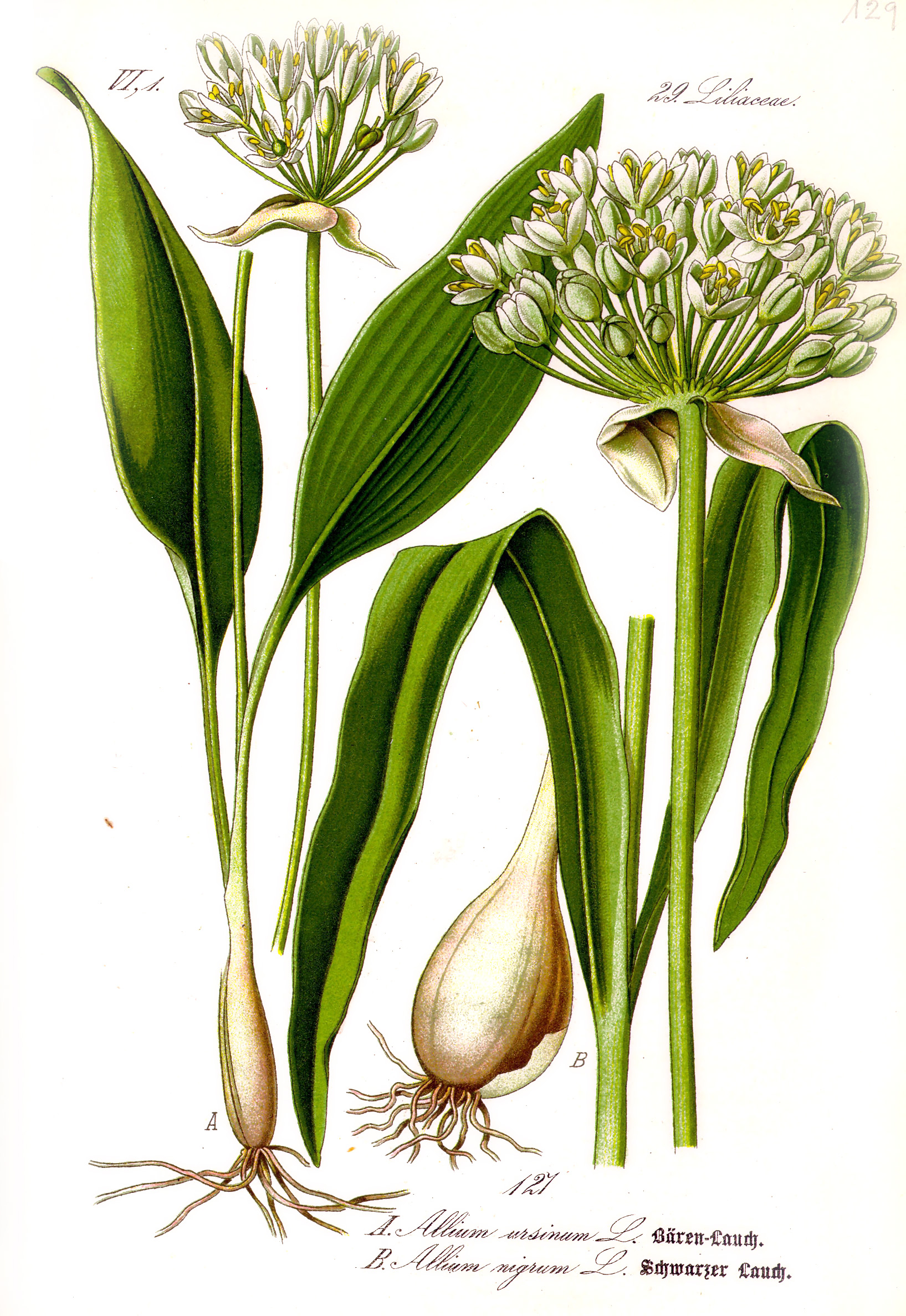
''Allium ursinum'', known as wild garlic, ramsons, cowleekes, cows's leek, cowleek, buckrams, broad-leaved garlic, wood garlic, bear leek, Eurasian wild garlic or bear's garlic, is a bulbous perennial flowering plant in the amaryllis family Amaryllidaceae. It is native to Europe and Asia, where it grows in moist woodland. It is a wild relative of onion and garlic, all belonging to the same genus, ''Allium''. There are two recognized subspecies: ''A. ursinum'' subsp. ''ursinum'' and ''A. ursinum'' subsp. ''ucrainicum''. Etymology The Latin specific name ''ursinum'' translates to 'bear' and refers to the supposed fondness of the brown bear for the bulbs; folk tales describe the bears consuming them after awakening from hibernation. Another theory is that the "''ursinum''" may refer to Ursa Major, as ''A. ursinum'' was perhaps one of the most northerly distributed ''Allium'' species known to the ancient Greeks, though this hypothesis is disputed. Common names for th ... [...More Info...] [...Related Items...] OR: [Wikipedia] [Google] [Baidu] |
Dog's Mercury
''Mercurialis perennis'', commonly known as dog's mercury, is a poisonous woodland plant found in much of Europe as well as in Algeria, Iran, Turkey, and the Caucasus, but almost absent from Ireland, Orkney and Shetland. includes photos, drawings, and a European distribution map A member of the spurge family (Euphorbiaceae), it is a herbaceous plant, herbaceous, downy perennial with erect stems bearing simple, serrate leaves. The dioecious inflorescences are green, bearing inconspicuous flowers from February to April. It characteristically forms dense, extensive carpets Understory, on the floor of woodlands and beneath hedgerows. Growth and location [...More Info...] [...Related Items...] OR: [Wikipedia] [Google] [Baidu] |
Sweet Woodruff
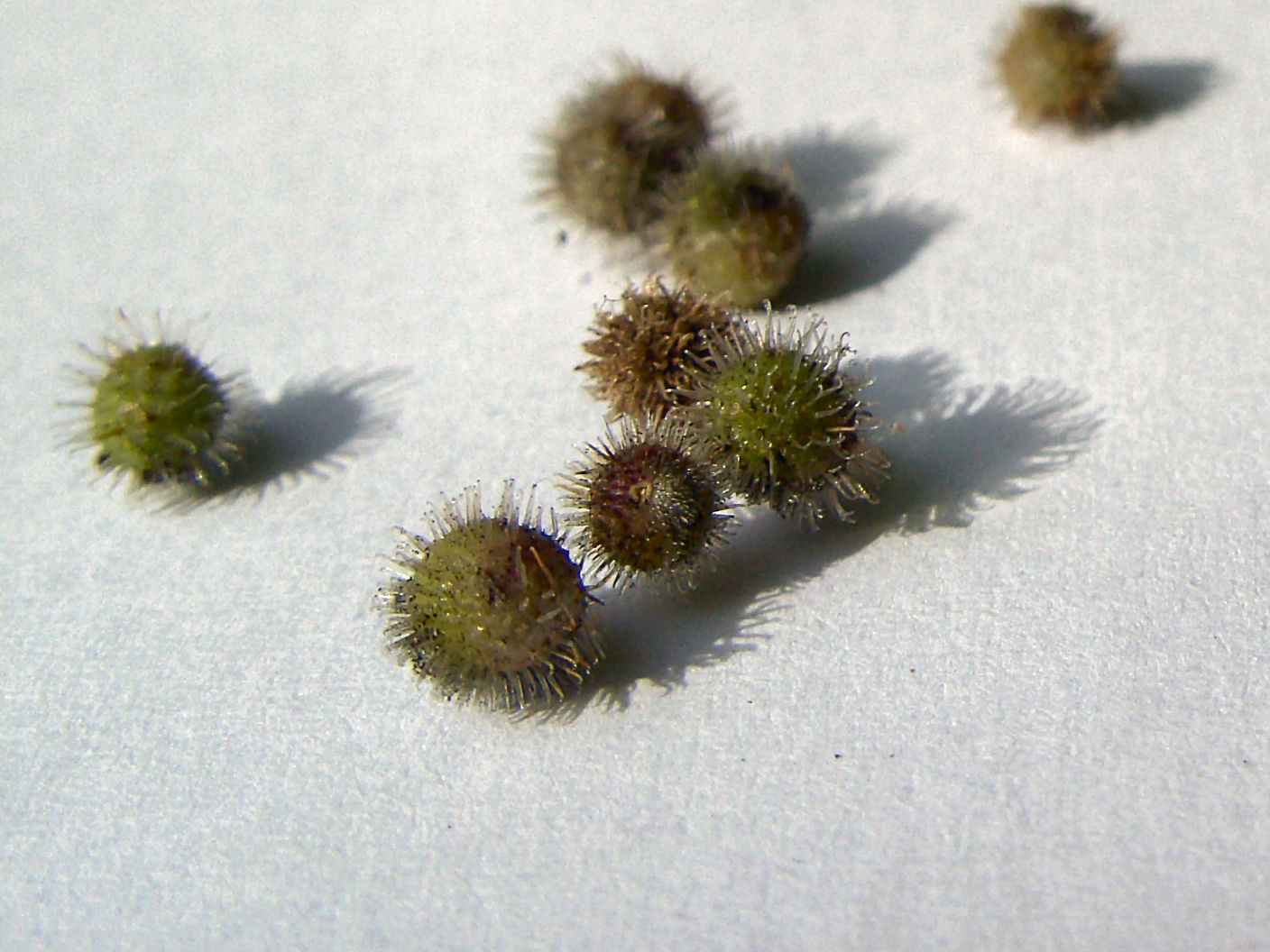
''Galium odoratum'', the sweet woodruff or sweetscented bedstraw, is a flowering perennial plant in the family Rubiaceae, native to much of Europe from Spain and Ireland to Russia, as well as Western Siberia, Turkey, Iran, the Caucasus, China and Japan. It is also sparingly naturalized in scattered locations in the United States and Canada. It is widely cultivated for its flowers and its sweet-smelling foliage. A herbaceous plant, it grows to long, often lying flat on the ground or supported by other plants. It owes its sweet smell to the odoriferous agent coumarin, and is sometimes used as a flavouring agent due to its chemical content. Description The leaves are simple, lanceolate, glabrous, long, and borne in whorls of 6–9. The small (4–7 mm diameter) flowers are produced in cymes, each white with four petals joined together at the base. The fruits are 2–4 mm diameter, produced singly, and each is covered in tiny hooked bristles which help disperse them by ... [...More Info...] [...Related Items...] OR: [Wikipedia] [Google] [Baidu] |
Ordnance Survey
, nativename_a = , nativename_r = , logo = Ordnance Survey 2015 Logo.svg , logo_width = 240px , logo_caption = , seal = , seal_width = , seal_caption = , picture = , picture_width = , picture_caption = , formed = , preceding1 = , dissolved = , superseding = , jurisdiction = Great BritainThe Ordnance Survey deals only with maps of Great Britain, and, to an extent, the Isle of Man, but not Northern Ireland, which has its own, separate government agency, the Ordnance Survey of Northern Ireland. , headquarters = Southampton, England, UK , region_code = GB , coordinates = , employees = 1,244 , budget = , minister1_name = , minister1_pfo = , chief1_name = Steve Blair , chief1_position = CEO , agency_type = , parent_agency = , child1_agency = , keydocument1 = , website = , footnotes = , map = , map_width = , map_caption = Ordnance Survey (OS) is the national mapping agency for Great Britain. The agency's name indicates its original military purpose (se ... [...More Info...] [...Related Items...] OR: [Wikipedia] [Google] [Baidu] |


.jpg)


