|
Duhonw
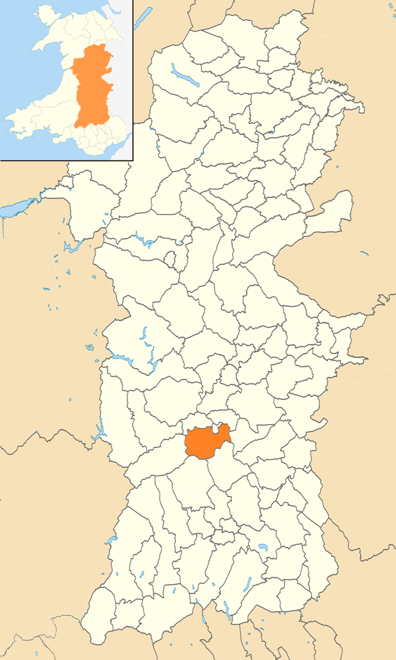
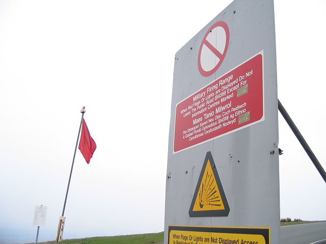
Duhonw is a rural community in Powys, Wales, to the south of Builth Wells ( cy, Llanfair ym Muallt), in the historic county of Breconshire. Covering an area of and including scattered farms and dwellings, it is bounded to its north by the Afon Irfon, to its south by Mynydd Epynt and Banc y Celyn (472m) and to its east the rivers Duhonw and Wye (). Llangammarch Wells' ( cy, Llangamarch) is to its west. Its population was 294, according to the 2011 census; a 2% fall since the 300 people noted in 2001. The 2011 census showed 14.6% of the population could speak Welsh, a rise from 9.2% in 2001. Duhonw Community Council was created following a 1985 review by the Local Government Boundary Commission for Wales, amalgamating the four small communities of Llanddewi'r Cwm, Llangynog, Llanynis and Maesmynis. Duhonw is part of the Sennybridge Training Area, and is listed as a Site of Special Scientific Interest. See also *Buellt Buellt or Builth was a cantref in medieval Wales, l ... [...More Info...] [...Related Items...] OR: [Wikipedia] [Google] [Baidu] |
Mynydd Epynt
Mynydd Epynt () is a former community and upland area in Powys, Wales. The Ministry of Defence controversially evicted the community of Mynydd Epynt in 1940, creating what is now the core of the Sennybridge Training Area (SENTA), the largest military training zone in Wales. Etymology The name of the area is often given as Mynydd Eppynt or Eppynt in historical sources and it appears under this spelling in the 1911 ''Encyclopædia Britannica''. ''Mynydd'' is the Welsh word for "mountain" or "upland area" but the meaning of ''Epynt'' is less certain. The most commonly stated etymology is "a pathway for horses", deriving from the P-Celtic root ''epos'', meaning "horse" (as in ''ebol'', meaning "a foal" in Modern Welsh). However, Thomas Morgan suggested the name may be interpreted as a place where "the way (referring to the ancient mountain trackway) rises abruptly", deriving from ''eb-'' ("an issuing out") and ''-hynt'' (a "way" or "course"). A ridge continuing south-west from Myn ... [...More Info...] [...Related Items...] OR: [Wikipedia] [Google] [Baidu] |
Powys County Council
Powys County Council ( cy, Cyngor Sir Powys) is the local authority for Powys, one of the administrative areas of Wales. The County Hall is in Llandrindod Wells. History The county of Powys was created on 1 April 1974 under the Local Government Act 1972, covering the area of the three administrative counties of Brecknockshire, Montgomeryshire, and Radnorshire, which were abolished at the same time. From 1974 until 1996 there were two principal tiers of local government, with Powys County Council as the upper tier authority and three district councils below it, each of which corresponded to one of the pre-1974 counties: Brecknock Borough Council, Montgomeryshire District Council, and Radnorshire District Council. The three districts were abolished under the Local Government (Wales) Act 1994, with Powys County Council becoming a unitary authority with effect from 1 April 1996, taking on the functions formerly performed by the district councils. Political control The first el ... [...More Info...] [...Related Items...] OR: [Wikipedia] [Google] [Baidu] |
Powys Wales Communities - Duhonw Locator
Powys (; ) is a county and preserved county in Wales. It is named after the Kingdom of Powys which was a Welsh successor state, petty kingdom and principality that emerged during the Middle Ages following the end of Roman rule in Britain. Geography Powys covers the historic counties of Montgomeryshire and Radnorshire, most of Brecknockshire, and part of historic Denbighshire. With an area of about , it is now the largest administrative area in Wales by land and area (Dyfed was until 1996 before several former counties created by the Local Government Act 1972 were abolished). It is bounded to the north by Gwynedd, Denbighshire and Wrexham County Borough; to the west by Ceredigion and Carmarthenshire; to the east by Shropshire and Herefordshire; and to the south by Rhondda Cynon Taf, Merthyr Tydfil County Borough, Caerphilly County Borough, Blaenau Gwent, Monmouthshire and Neath Port Talbot. The largest towns are Newtown, Ystradgynlais, Brecon, Welshpool, Llandrindod W ... [...More Info...] [...Related Items...] OR: [Wikipedia] [Google] [Baidu] |
United Kingdom Census 2001
A nationwide census, known as Census 2001, was conducted in the United Kingdom on Sunday, 29 April 2001. This was the 20th UK census and recorded a resident population of 58,789,194. The 2001 UK census was organised by the Office for National Statistics (ONS) in England and Wales, the General Register Office for Scotland (GROS) and the Northern Ireland Statistics and Research Agency (NISRA). Detailed results by region, council area, ward and output area are available from their respective websites. Organisation Similar to previous UK censuses, the 2001 census was organised by the three statistical agencies, ONS, GROS, and NISRA, and coordinated at the national level by the Office for National Statistics. The Orders in Council to conduct the census, specifying the people and information to be included in the census, were made under the authority of the Census Act 1920 in Great Britain, and the Census Act (Northern Ireland) 1969 in Northern Ireland. In England and Wales these re ... [...More Info...] [...Related Items...] OR: [Wikipedia] [Google] [Baidu] |
Buellt
Buellt or Builth was a cantref in medieval Wales, located west of the River Wye. Unlike most cantrefs, it was not part of any of the major Welsh kingdoms for most of its history, but was instead ruled by an autonomous local dynasty. During the Norman era it was associated with Rhwng Gwy a Hafren, a region independent of the Welsh monarchies and controlled by Norman Marcher Lords. In the 16th century, it was reorganized as a hundred and joined with the former kingdom of Brycheiniog to form the county of Brecknockshire. Description The name ''Buellt'', also rendered ''Buallt'', comes from the Welsh words ''bu'', meaning " ox", and ''gellt'' (later ''gwellt''), meaning pasture. This was later anglicized to ''Builth'', as in the modern town of Builth Wells. Situated in the valley of Afon Irfon, Buellt's boundaries were roughly the Cambrian Mountains to the north, the River Wye to the east, the Mynydd Epynt range to the south, and Ceredigion to the west. It was closely associated wit ... [...More Info...] [...Related Items...] OR: [Wikipedia] [Google] [Baidu] |
Site Of Special Scientific Interest
A Site of Special Scientific Interest (SSSI) in Great Britain or an Area of Special Scientific Interest (ASSI) in the Isle of Man and Northern Ireland is a conservation designation denoting a protected area in the United Kingdom and Isle of Man. SSSI/ASSIs are the basic building block of site-based nature conservation legislation and most other legal nature/geological conservation designations in the United Kingdom are based upon them, including national nature reserves, Ramsar sites, Special Protection Areas, and Special Areas of Conservation. The acronym "SSSI" is often pronounced "triple-S I". Selection and conservation Sites notified for their biological interest are known as Biological SSSIs (or ASSIs), and those notified for geological or physiographic interest are Geological SSSIs (or ASSIs). Sites may be divided into management units, with some areas including units that are noted for both biological and geological interest. Biological Biological SSSI/ASSIs may ... [...More Info...] [...Related Items...] OR: [Wikipedia] [Google] [Baidu] |
Royal Commission On The Ancient And Historical Monuments Of Wales
The Royal Commission on the Ancient and Historical Monuments of Wales (RCAHMW; cy, Comisiwn Brenhinol Henebion Cymru; ), established in 1908, is a Welsh Government sponsored body concerned with some aspects of the archaeological, architectural and historic environment of Wales. It is based in Aberystwyth. The RCAHMW maintains and curates the National Monuments Record of Wales (NMRW), an archive with an online platform called Coflein. Professor Nancy Edwards is Chair of the Commissioners. Mission statement The Royal Commission has a national role in the management of the archaeological, built and maritime heritage of Wales, as an originator, curator and supplier of information for individual, corporate and governmental decision-makers, researchers and the general public. To this end it: * Surveys, interprets and records the man-made environment of Wales * Compiles, maintains and curates the National Monuments Record of Wales * Promotes an understanding of this information by ... [...More Info...] [...Related Items...] OR: [Wikipedia] [Google] [Baidu] |
Sennybridge Training Area
The Sennybridge Training Area (SENTA) is a UK Ministry of Defence military training area near the village of Sennybridge in Powys, Wales. It consists of approximately 31,000 acres (12,000 ha) of Ministry of Defence freehold land and 6,000 acres (2,500 ha) of land leased from Forest Enterprise. The training area is the third largest military training area in the United Kingdom. It covers 12 miles (19 km) south west to north east and 5 miles (8 km) south east to north west. It lies to the north of the Brecon Beacons National Park on Mynydd Eppynt. The site was acquired by the War Office The War Office was a department of the British Government responsible for the administration of the British Army between 1857 and 1964, when its functions were transferred to the new Ministry of Defence (MoD). This article contains text from ... in 1939. Units * Soldier Development Wing - part of ATC Pirbright. * Queen's Division Courses - Divisional Training Team Delivering Di ... [...More Info...] [...Related Items...] OR: [Wikipedia] [Google] [Baidu] |
Local Democracy And Boundary Commission For Wales
The Local Democracy and Boundary Commission for Wales ( cy, Comisiwn Ffiniau a Democratiaeth Leol Cymru) is a Welsh Government sponsored body, responsible for defining borders for local elections and government in Wales. The name of the commission was changed in 2013 from the Local Government Boundary Commission for Wales ( cy, Comisiwn Ffiniau Llywodraeth Leol i Gymru), as a result of the Local Government (Democracy) (Wales) Act 2013 ( cy, Deddf Llywodraeth Leol (Democratiaeth) (Cymru) 2013 ). Established in 1974, its role is to keep under review all local government areas in Wales, and the electoral arrangements for the principal areas, and to make such proposals to the Welsh Government as seem desirable in the interests of effective and convenient local government. Electoral arrangements in six authorities were reviewed after the penultimate round of Welsh local elections in 1999, and the changes were implemented at the elections on 10 June 2004. In 2002, the commission also ... [...More Info...] [...Related Items...] OR: [Wikipedia] [Google] [Baidu] |
Welsh Language Commissioner
The Welsh Language Commissioner () is a Welsh Government officer, overseeing an independent advisory body of the same name. The position was created following the passing of the ''Welsh Language (Wales) Measure 2011'', effective on 1 April 2012, with the aim of promoting and facilitating the use of the Welsh language. This entails raising awareness of the official status of the Welsh language in Wales and by imposing standards on organisations. This, in turn, will lead to the establishment of rights for Welsh speakers. According to the Commissioner's website, there are two principles that underpin the work of the Commissioner, namely: * Welsh should not be treated less favourably than the English language in Wales * People should be able to live their lives in Wales through the medium of Welsh if they so wish. The Commissioner's work is politically independent, and the position of a commissioner lasts seven years. Commissioners * Meri Huws (2012–2019) * Aled Roberts (201 ... [...More Info...] [...Related Items...] OR: [Wikipedia] [Google] [Baidu] |
Welsh Language
Welsh ( or ) is a Celtic language family, Celtic language of the Brittonic languages, Brittonic subgroup that is native to the Welsh people. Welsh is spoken natively in Wales, by some in England, and in Y Wladfa (the Welsh colony in Chubut Province, Argentina). Historically, it has also been known in English as "British", "Cambrian", "Cambric" and "Cymric". The Welsh Language (Wales) Measure 2011 gave the Welsh language official status in Wales. Both the Welsh and English languages are ''de jure'' official languages of the Welsh Parliament, the Senedd. According to the 2021 United Kingdom census, 2021 census, the Welsh-speaking population of Wales aged three or older was 17.8% (538,300 people) and nearly three quarters of the population in Wales said they had no Welsh language skills. Other estimates suggest that 29.7% (899,500) of people aged three or older in Wales could speak Welsh in June 2022. Almost half of all Welsh speakers consider themselves fluent Welsh speakers ... [...More Info...] [...Related Items...] OR: [Wikipedia] [Google] [Baidu] |
Llangammarch Wells
Llangammarch Wells or simply Llangammarch ( cy, Llangamarch) is a village in the community of Llangamarch in Powys, Wales, lying on the Afon Irfon, and in the historic county of Brecknockshire (Breconshire). It is the smallest of the four spa villages of mid-Wales, alongside Llandrindod Wells, Builth Wells and Llanwrtyd Wells. The spa was focused on a barium well, which is now closed. The old village is centred on the parish church of St Cadmarch, which is a grade II* listed building. Llangammarch station is on the Heart of Wales Line with trains provided by Transport for Wales. It lies on Route 43 of the National Cycle Network. Llangammarch Wells Golf Club (now defunct) was founded in 1904. The club and course disappeared in the 1950s. “Golf’s ... [...More Info...] [...Related Items...] OR: [Wikipedia] [Google] [Baidu] |

_(cropped).jpg)


