|
Duchy Of Saxe-Merseburg
The Duchy of Saxe-Merseburg was a duchy of the Holy Roman Empire, with Merseburg as its capital. It existed from 1656 or 1657 to 1738 and was owned by an Albertine secundogeniture of the Saxon House of Wettin. History The Wettin Elector John George I of Saxony stipulated in his will dated 20 July 1652 that his three younger sons should receive secundogeniture principalities. After the elector died on 8 October 1656, his sons concluded the "friend-brotherly main treaty" in the Saxon residence of Dresden on 22 April 1657 and a further treaty in 1663 delineating their territories and sovereign rights definitively. The treaties created three duchies: Saxe-Zeitz, Saxe-Weissenfels, and Saxe-Merseburg. Prince Christian, the third eldest son, received, among other properties, the estates of the former Bishopric of Merseburg, secularised in 1565: the castles, cities and districts of Merseburg, Plagwitz, Rückmarsdorf, Delitzsch (with Delitzsch Castle), Bad Lauchstädt, Schkeuditz ... [...More Info...] [...Related Items...] OR: [Wikipedia] [Google] [Baidu] |
States Of The Holy Roman Empire
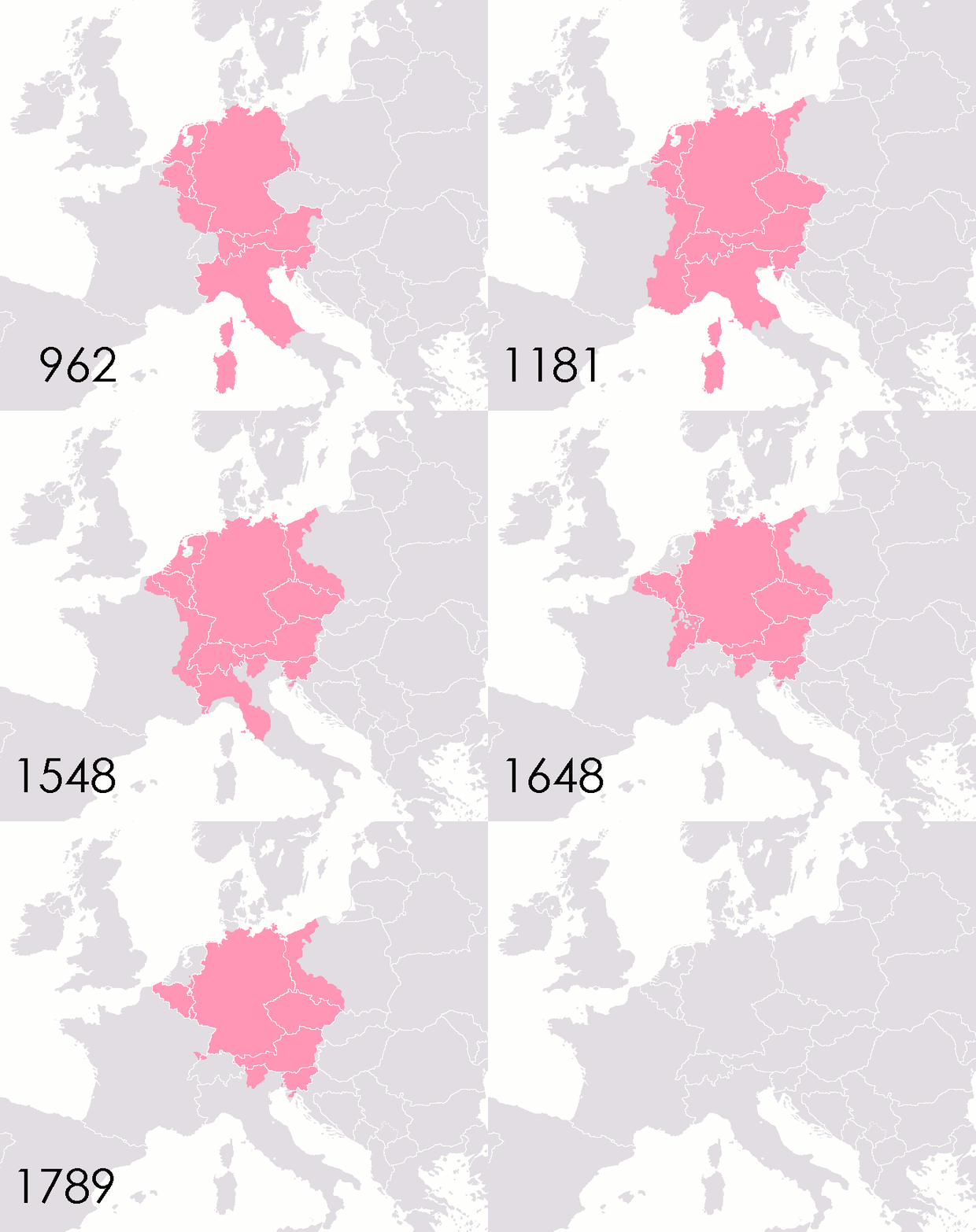
This list of states in the Holy Roman Empire includes any territory ruled by an authority that had been granted imperial immediacy, as well as many other feudal entities such as lordships, sous-fiefs and allodial fiefs. The Holy Roman Empire was a complex political entity that existed in central Europe for most of the medieval and early modern periods and was generally ruled by a German-speaking Emperor. The states that composed the Empire, while enjoying a unique form of territorial authority (called '' Landeshoheit'') that granted them many attributes of sovereignty, were never fully sovereign states in the sense that term is understood today. In the 18th century, the Holy Roman Empire consisted of approximately 1,800 such territories, the majority being tiny estates owned by the families of Imperial Knights. This page does not directly contain the list but discusses the format of the various lists and offers some background to understand the complex organisation of the Holy R ... [...More Info...] [...Related Items...] OR: [Wikipedia] [Google] [Baidu] |
Saxe-Zeitz
The Duchy of Saxe-Zeitz (german: Herzogtum Sachsen-Zeitz) was a territory of the Holy Roman Empire established in 1656–57 as a secundogeniture of the Electoral Saxon house of House of Wettin. Its capital was Zeitz. The territory fell back to the Wettin electoral line in 1718. History On 20 July 1652, the Saxon elector John George I stipulated in his will that, while the electoral dignity passes to his eldest son John George II, his three younger brothers should receive secundogeniture principalities upon his death. After the elector died on 8 October 1656, his sons concluded the "friend-brotherly main treaty" in the Saxon residence of Dresden on 22 April 1657 and a further treaty in 1663 delineating their territories and sovereign rights definitely. These treaties created three duchies: * Saxe-Zeitz, * Saxe-Weissenfels and * Saxe-Merseburg. Prince Maurice, the fourth-oldest son received the districts of Zeitz, Naumburg and Haynsburg in the former Bishopric of Naumburg-Zei ... [...More Info...] [...Related Items...] OR: [Wikipedia] [Google] [Baidu] |
Doberlug-Kirchhain
Doberlug-Kirchhain ( dsb, Dobrjoług-Góstkow) is a Germany, German town in the district of Elbe-Elster, Lower Lusatia, Brandenburg. History 937. The town of Kirchhain was built by Margrave Gero. A document written in 1005 mentions the town Doberlug (''Dobraluh'') for the first time. In 1165 the Cistercians, Cistercian Dobrilugk Abbey was founded by Margrave Dietrich of Landsberg. 1235. Kirchhain received market-rights. In 1431 the Hussites destroyed the town of Doberlug and the abbey was devastated. In 1637 and 1643 the Sweden, Swedes destroyed Kirchhain. From 1815 to 1947, Doberlug and Kirchhain were part of the Prussia, Prussian Province of Brandenburg. 1848. The jurisdictions of Doberlug and Kirchhain were unified, but the actual merger of the two towns did not take place until over one hundred years later, in 1950. During World War II, Kirchhain was taken by the Red Army on 23 April 1945. From 1952 to 1990, Doberlug-Kirchhain was part of the Bezirk Cottbus of East Germany ... [...More Info...] [...Related Items...] OR: [Wikipedia] [Google] [Baidu] |
Lübben (Spreewald)
Lübben (Spreewald) ( dsb, Lubin (Błota)) is a town of 14,000 people, capital of the Dahme-Spreewald district in the Lower Lusatia region of Brandenburg, Germany. Administrative structure Districts of the town are: * Lübben Stadt (Lower Sorbian: ''Lubin město'') * Hartmannsdorf (''Hartmanojce'') * Lubolz (''Lubolc'') ** Groß Lubolz (''Wjelike Lubolce'') ** Klein Lubolz (''Małe Lubolce'') * Neuendorf (''Nowa Wjas'') * Radensdorf (''Radom''; ''Radowašojce'') * Steinkirchen (''Kamjena'') * Treppendorf (''Ranchow'') History The castle of ''Lubin'' in the March of Lusatia was first mentioned in an 1150 register of Nienburg Abbey and had received town privileges according to Magdeburg law by 1220. From 1301 the town in the centre of the Spreewald floodplain was in the possession of the monks of Dobrilugk Abbey, who sold it to Duke Rudolph I of Saxe-Wittenberg in 1329. After several conflicts with the Wittelsbach margraves of Brandenburg the March of Lusatia was finally acquired ... [...More Info...] [...Related Items...] OR: [Wikipedia] [Google] [Baidu] |
Lower Lusatia
Lower Lusatia (; ; ; szl, Dolnŏ Łużyca; ; ) is a historical region in Central Europe, stretching from the southeast of the German state of Brandenburg to the southwest of Lubusz Voivodeship in Poland. Like adjacent Upper Lusatia in the south, Lower Lusatia is a settlement area of the West Slavic Sorbs whose endangered Lower Sorbian language is related to Upper Sorbian and Polish. Geography This sparsely inhabited area within the North European Plain (Northern Lowland) is characterised by extended pine forests, heathlands and meadows. In the north it is confined by the middle Spree River with Lake Schwielochsee and its eastern continuation across the Oder at Fürstenberg to Chlebowo. In the glacial valley between Lübben and Cottbus, the Spree River branches out into the Spreewald ("Spree Woods") riparian forest. Other rivers include the Berste and Oelse tributaries as well as the Schlaube and the Oder–Spree Canal opened in 1891. In the east, the Bóbr River from Ł ... [...More Info...] [...Related Items...] OR: [Wikipedia] [Google] [Baidu] |
County Of Brehna
Brehna is a town and a former municipality in the district of Anhalt-Bitterfeld, in Saxony-Anhalt, Germany. Since 1 July 2009, it is part of the town Sandersdorf-Brehna. It is situated southwest of Bitterfeld. Important in this city is the church where Katharina von Bora, the wife of Martin Luther Martin Luther (; ; 10 November 1483 – 18 February 1546) was a German priest, theologian, author, hymnwriter, and professor, and Augustinian friar. He is the seminal figure of the Protestant Reformation and the namesake of Lutherani ... lived. File:BrehnaAltesRathaus.jpg, old town hall File:BrehnaNeuesRathWinter.jpg, new town hall File:BrehnaKirche.jpg, church Former municipalities in Saxony-Anhalt Sandersdorf-Brehna {{AnhaltBitterfeld-geo-stub ... [...More Info...] [...Related Items...] OR: [Wikipedia] [Google] [Baidu] |
Zörbig
Zörbig () is a town in the district of Anhalt-Bitterfeld in Saxony-Anhalt, Germany. It is situated approximately 15 km west of Bitterfeld, and 20 km northeast of Halle (Saale). Zörbig is well known for its molasses made from sugar beets. Geography The town Zörbig consists of the following ''Ortschaften'' or municipal divisions:Hauptsatzung der Stadt Zörbig § 15, 17 June 2021. *Cösitz *Göttnitz *Großzöberitz *Löberitz *Quetzdölsdorf *Salzfurtkapelle * Schortewitz *Schrenz *Spören *Stumsdorf *Zörbig People * |
Bitterfeld
Bitterfeld () is a town in the district of Anhalt-Bitterfeld, Saxony-Anhalt, Germany. Since 1 July 2007 it has been part of the town of Bitterfeld-Wolfen. It is situated approximately 25 km south of Dessau, and 30 km northeast of Halle (Saale). At the end of 2016, it had 40,964 inhabitants. History and description The name Bitterfeld most likely comes from the Middle High German words ''bitter'' and ''Feld'' and so means "boggy land". Bitterfeld was built by a colony of Flemish immigrants in 1153. The first documentary mention is from 1224. It was captured by the landgrave of Meissen in 1476, and belonged thenceforth to Saxony, until it was ceded to Prussia in 1815. By 1900, Bitterfeld station was an important junction of the Berlin–Halle and the Magdeburg–Leipzig railways. The population at that time was 11,839; it manufactured drainpipes, paper roofing, and machinery, and had sawmills. There were also several coal mines in the vicinity. Owing to its pleasant s ... [...More Info...] [...Related Items...] OR: [Wikipedia] [Google] [Baidu] |
Lützen
is a town in the Burgenlandkreis district of Saxony-Anhalt, Germany. Geography Lützen is situated in the Leipzig Bay, approximately southwest of the Leipzig city limits and northeast of Weißenfels. The town has access to the Bundesstraße 87 road from Leipzig to Weißenfels as well as to the Bundesautobahn 9 (at the Bad Dürrenberg junction) and the Bundesautobahn 38. The municipal area comprises the following ''Ortschaften'' or municipal divisions:Hauptsatzung der Stadt Lützen § 17, January 2011. *Lützen *Meuchen, incorporated in 1973 * Röcken, incorporated in 2009 * Großgörschen, [...More Info...] [...Related Items...] OR: [Wikipedia] [Google] [Baidu] |
Schkeuditz
Schkeuditz () is a Große Kreisstadt in the district of Nordsachsen, in Saxony, Germany. It is situated on the White Elster river, 12 km northwest of Leipzig. Leipzig/Halle Airport is located in Schkeuditz. The letter processing center for the greater Leipzig region is also located in Schkeuditz. "Schkeuditzer Kreuz", the first cloverleaf exchange in Germany was opened in 1936 and is today the intersection between the autobahns A9 and A14. History Schkeuditz was first documented in the year 981 as a church in Merseburg Merseburg () is a town in central Germany in southern Saxony-Anhalt, situated on the river Saale, and approximately 14 km south of Halle (Saale) and 30 km west of Leipzig. It is the capital of the Saalekreis district. It had a diocese ... bishopric with the name "scudici". Population over time The population development over time is given in the following table. Like many towns in east Germany, the population is lower today than just afte ... [...More Info...] [...Related Items...] OR: [Wikipedia] [Google] [Baidu] |
Bad Lauchstädt
(until 1925 ''Lauchstädt''), officially Goethestadt Bad Lauchstädt, is a town in the district Saalekreis, Saxony-Anhalt, Germany, 13 km southwest of Halle. Population 8,781 (2020). Lauchstädt was a popular watering-place in the 18th century, the dukes of Saxe-Merseburg often making it their summer residence. From 1789 to 1811 the Weimar court theatrical company gave performances here of the plays of Friedrich Schiller and Johann Wolfgang von Goethe, an attraction which greatly contributed to the well-being of the town. Further reading noted there: * Maak, ''Das Goethetheater in Lauchstädt'' (Lauchstädt, 1905); * Nasemann, ''Bad Lauchstädt'' (Halle, 1885). During the 19th century, its industries included malting, vinegar-making and brewing. In January 2008, Bad Lauchstädt incorporated the former municipalities Schafstädt, Delitz am Berge and Klobikau. On 1 January 2010 Milzau was also incorporated, [...More Info...] [...Related Items...] OR: [Wikipedia] [Google] [Baidu] |
Delitzsch
Delitzsch (; Slavic: ''delč'' or ''delcz'' for hill) is a town in Saxony in Germany, 20 km north of Leipzig and 30 km east of Halle (Saale). With 24,850 inhabitants at the end of 2015, it is the largest town in the district of Nordsachsen. Archaeological evidence outside the town limits points to a settlement dating from the Neolithic Age. The first documented mention of Delitzsch dates from 1166 and it later became the Elector of Saxony's residence in the 17th and 18th centuries. The old town is well preserved, with several plazas, citizens' and patrician houses, towers, a baroque castle and the town's fortifications. Delitzsch and its surrounding area contain water areas, hiking and cycling networks and nature reserves. Geography Location Delitzsch is located in the northwestern part of Nordsachsen in Saxony, at an altitude of 94 meters above sea level. Due to its location on the border with Saxony-Anhalt, Delitzsch is the northernmost town in Saxony. It is situ ... [...More Info...] [...Related Items...] OR: [Wikipedia] [Google] [Baidu] |


