|
Drum (Wales)
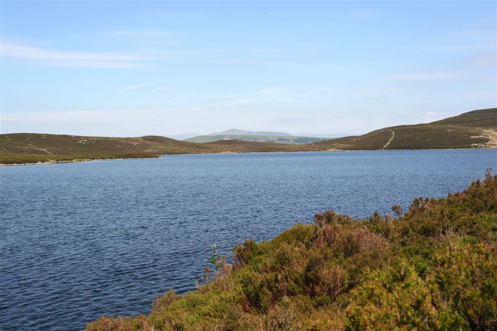
Drum () (Welsh language, Welsh: Y Drum = ''the ridge'') is a summit in the Carneddau mountains in Wales, 2 km north-east of Foel-fras. It is 771 m (2,526 ft) high. It is also known as Carnedd Penyborth-Goch. Its eastern slopes are drained by the Afon Tafolog, a tributary of Afon Roe which flows through the village of Rowen before joining the River Conwy.Nuttall, John & Anne (1999). The Mountains of England & Wales - Volume 1: Wales (2nd edition ed.). Milnthorpe, Cumbria: Cicerone. . See also * Blue Joker, an experimental airborne early-warning radar, tested from a site high on the mountain in 1956 References Mountains and hills of Snowdonia Hewitts of Wales Nuttalls Mountains and hills of Conwy County Borough Mountains and hills of Gwynedd Abergwyngregyn Caerhun {{Gwynedd-geo-stub ... [...More Info...] [...Related Items...] OR: [Wikipedia] [Google] [Baidu] |
Carnedd Y Ddelw
Carnedd y Ddelw is a summit in the Carneddau mountains in Wales, north-east of Foel-fras. It is the Nuttall top of Drum (Wales). Its eastern slopes are drained by the Afon Tafolog, a tributary of Afon Roe that flows through the village of Rowen before joining the River Conwy. It is also the final top on Carnedd Llewelyn's long northern spur. To the north-west is Tal y Fan, the most northerly 2000 foot tall mountain in the Carneddau and Wales. The summit has two large shelter cairns, hollowed out from a large Bronze Age burial cairn.Nuttall, John & Anne (1999). The Mountains of England & Wales - Volume 1: Wales (2nd edition ed.). Milnthorpe, Cumbria: Cicerone. . References [...More Info...] [...Related Items...] OR: [Wikipedia] [Google] [Baidu] |
Afon Roe
The Afon Roe is a small river in Snowdonia in north-west Wales. Its tributary is the Afon Tafolog, which drains the eastern slopes of Drum, a mountain in the Carneddau range. The river flows through the village of Rowen before joining the River Conwy , name_etymology = , image = Boats in River Conwy.jpg , image_size = 300 , image_caption = Boats in the river estuary at Conwy , map = , map_size = , map_caption = , push .... References {{Authority control Caerhun Rivers of Conwy County Borough Rivers of Snowdonia ... [...More Info...] [...Related Items...] OR: [Wikipedia] [Google] [Baidu] |
Mountains And Hills Of Gwynedd
A mountain is an elevated portion of the Earth's crust, generally with steep sides that show significant exposed bedrock. Although definitions vary, a mountain may differ from a plateau in having a limited summit area, and is usually higher than a hill, typically rising at least 300 metres (1,000 feet) above the surrounding land. A few mountains are isolated summits, but most occur in mountain ranges. Mountains are formed through tectonic forces, erosion, or volcanism, which act on time scales of up to tens of millions of years. Once mountain building ceases, mountains are slowly leveled through the action of weathering, through slumping and other forms of mass wasting, as well as through erosion by rivers and glaciers. High elevations on mountains produce colder climates than at sea level at similar latitude. These colder climates strongly affect the ecosystems of mountains: different elevations have different plants and animals. Because of the less hospitable terrain ... [...More Info...] [...Related Items...] OR: [Wikipedia] [Google] [Baidu] |
Mountains And Hills Of Conwy County Borough
A mountain is an elevated portion of the Earth's crust, generally with steep sides that show significant exposed bedrock. Although definitions vary, a mountain may differ from a plateau in having a limited summit area, and is usually higher than a hill, typically rising at least 300 metres (1,000 feet) above the surrounding land. A few mountains are isolated summits, but most occur in mountain ranges. Mountains are formed through tectonic forces, erosion, or volcanism, which act on time scales of up to tens of millions of years. Once mountain building ceases, mountains are slowly leveled through the action of weathering, through slumping and other forms of mass wasting, as well as through erosion by rivers and glaciers. High elevations on mountains produce colder climates than at sea level at similar latitude. These colder climates strongly affect the ecosystems of mountains: different elevations have different plants and animals. Because of the less hospitable terrain and ... [...More Info...] [...Related Items...] OR: [Wikipedia] [Google] [Baidu] |
Nuttalls
Nuttall may refer to: People * Nuttall (name) * Nuttall baronets Nature * Nuttall's oak, a fast-growing large deciduous oak tree native to North America * Nuttall's woodpecker, a species of woodpecker found in oak woodlands of California * Nuttall sandstone, a very hard type of sandstone; see New River Gorge National River * Nuttall's toothwort, a species of cardamine flower. Places * Nuttall, Virginia, United States * Nuttall railway station, Nuttall village, Nasirabad, Balochistan, Pakistan * Nuttalls, hills in England and Wales that are over with a prominence above Other uses * BAM Nuttall, a British construction company * Blackman–Nuttall window, a mathematical function used in signal processing—see Window function * Codex Zouche-Nuttall, a pre-Columbian piece of Mixtec writing * Geiger–Nuttall law, a rule in nuclear physics stating that short-lived isotopes emit more energetic alpha particles than long-lived ones * Nuttall Ornithological Club, the oldest ornitho ... [...More Info...] [...Related Items...] OR: [Wikipedia] [Google] [Baidu] |
Mountains And Hills Of Snowdonia
A mountain is an elevated portion of the Earth's crust, generally with steep sides that show significant exposed bedrock. Although definitions vary, a mountain may differ from a plateau in having a limited summit area, and is usually higher than a hill, typically rising at least 300 metres (1,000 feet) above the surrounding land. A few mountains are isolated summits, but most occur in mountain ranges. Mountains are formed through tectonic forces, erosion, or volcanism, which act on time scales of up to tens of millions of years. Once mountain building ceases, mountains are slowly leveled through the action of weathering, through slumping and other forms of mass wasting, as well as through erosion by rivers and glaciers. High elevations on mountains produce colder climates than at sea level at similar latitude. These colder climates strongly affect the ecosystems of mountains: different elevations have different plants and animals. Because of the less hospitable terrain and ... [...More Info...] [...Related Items...] OR: [Wikipedia] [Google] [Baidu] |
Blue Joker
Blue Joker was an experimental moored balloon-mounted, airborne early-warning radar project developed by the Royal Radar Establishment (RRE) starting in 1953. The idea was to position the radar high in the air in order to extend its radar horizon and allow it to see low-flying aircraft. Ground reflections were filtered out using a moving target indicator (MTI) system. Two examples were built and tested in the late 1950s, but the project was cancelled in 1960 as part of the Linesman/Mediator efforts. Development Basic concepts During the early 1950s the Royal Air Force was in the midst of deploying its ROTOR radar network based on the AMES Type 80 (Green Garlic) radars. These were powerful S-band radars able to detect high-flying bombers at ranges as great as . However, due to the curvature of the earth, they were subject to the local radar horizon so low-flying aircraft were not visible until they approached much more closely. In the early 1950s, there was some concern that Sovie ... [...More Info...] [...Related Items...] OR: [Wikipedia] [Google] [Baidu] |
River Conwy
, name_etymology = , image = Boats in River Conwy.jpg , image_size = 300 , image_caption = Boats in the river estuary at Conwy , map = , map_size = , map_caption = , pushpin_map = , pushpin_map_size = , pushpin_map_caption= , subdivision_type1 = Country , subdivision_name1 = Wales , subdivision_type2 = , subdivision_name2 = , subdivision_type3 = , subdivision_name3 = , subdivision_type4 = District , subdivision_name4 = County Borough of Conwy , subdivision_type5 = City , subdivision_name5 = Conwy , length = , width_min = , width_avg = , width_max = , depth_min = , depth_avg = , depth_max = , discharge1_location= Cwm Llanerch , discharge1_min = , discharge1_avg = , discharge1_max = , source1 = , source1_location = Migneint moor where a number of small s ... [...More Info...] [...Related Items...] OR: [Wikipedia] [Google] [Baidu] |
Rowen
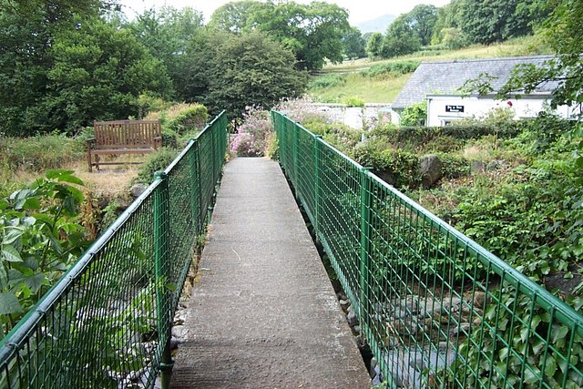
Rowen is a village on the western slopes of the Conwy valley in the parish of Caerhun and the former County of Caernarfonshire in Wales. It lies off the B5106 road, between Tal y Bont and the Groes Inn. ''Buildings of Gwynedd'' 2009 refers to the River Roe probably following the Roman route from Caerhun to Abergwyngregyn. Rowen has won tidiest village awards several times. In recent times the name of the village has been variously spelled as "Y Wy-Wen" (white river), "Rowen", "Ro-wen" "Roe Wen" and "Roewen". Although the Religious Census of 1851 records the name "Ro-wen", most early 20th-century maps simply use the name "Y Ro", Welsh for "gravel" or "pebbles". ''Wen'' means "white", or could mean "holy". The Afon Roe, a tributary of the River Conwy, flows through the village. A tributary of Afon Roe is Afon Tafolog, which drains the eastern slopes of Drum, a mountain in the Carneddau mountains. In the book ''Crwydro Arfon'' (1959, by Alun Llewelyn-Williams), Rowen is de ... [...More Info...] [...Related Items...] OR: [Wikipedia] [Google] [Baidu] |
Afon Tafolog
The Afon Tafolog is a small river in Snowdonia in north-west Wales. It is fed by a number of streams which drain the eastern slopes of Drum, a mountain in the Carneddau range. It is a tributary of Afon Roe which then flows through the village of Rowen before joining the River Conwy , name_etymology = , image = Boats in River Conwy.jpg , image_size = 300 , image_caption = Boats in the river estuary at Conwy , map = , map_size = , map_caption = , push .... References {{authority control Caerhun Tafolog Tafolog ... [...More Info...] [...Related Items...] OR: [Wikipedia] [Google] [Baidu] |
Foel-fras
Foel-fras (944 m) is a mountain in the Carneddau range, about 10 km east of Bethesda in Wales. It lies on the border between the counties of Gwynedd and Conwy. With a summit elevation of 944 m it is officially the eleventh-highest summit in Wales. Foel-fras is located at the northern end of the main ridge of the Carneddau, between Drum to the north and Foel Grach to the south, with the subsidiary summit of Garnedd Uchaf (925 m) between it and Foel Grach. Due south and 400 m below lies the reservoir of Llyn Dulyn, while the smaller reservoir of Llyn Anafon lies to the north. Because of its position, it is the first of the Welsh 3000s reached when doing this walk from the northern end. It can be climbed by driving up the small road signposted "Aber Falls" in the village of Abergwyngregyn, passing the car park for the falls and continuing to a small car park at the end of the road. From there it is possible to take the track bearing left, later turning r ... [...More Info...] [...Related Items...] OR: [Wikipedia] [Google] [Baidu] |


