|
Downtown Ossining Historic District
The Downtown Ossining Historic District is located at the central crossroads of Ossining, New York, United States, and the village's traditional business district known as the Crescent. Among its many late 19th- and early 20th-century commercial buildings are many of the village's major landmarks—three bank buildings, four churches, its village hall, former post office and high school. It was recognized as a historic district in 1989 and listed on the National Register of Historic Places, as one of the few downtowns in Westchester County with its social and historical development intact. One of its contributing properties, the First Baptist Church of Ossining, was previously listed on the Register in 1973. The Old Croton Aqueduct, a portion of which passes through the district, was listed on the Register the following year and designated a National Historic Landmark in 1992. Among the architects represented in the district are Robert W. Gibson, Isaac G. Perry and James Gamble ... [...More Info...] [...Related Items...] OR: [Wikipedia] [Google] [Baidu] |
Ossining (village), New York
Ossining is a village in Westchester County, New York, United States. The population at the 2020 United States census was 27,551, an increase over 25,060 at the 2010 census. As a village, it is located in the town of Ossining. Geography Ossining borders the eastern shores of the widest part of the Hudson River, the Tappan Zee. According to the United States Census Bureau, the village has a total area of 6.3 square miles (16.4 km2), of which 3.2 square miles (8.3 km2) is land and 3.1 square miles (8.1 km2) (49.37%) is water. Demographics As of the 2010 United States Census, there were 25,060 people living in the village. The racial makeup of the village was 61.8% White, 15.6% Black, 0.1% Native American, 4.2% Asian, <0.1% Pacific Islander, 0.4% from some other race and 1.3% from two or more races. 41.4% were Hispanic or Latino of any race. According to the 2020 |
Administrative Divisions Of New York
The administrative divisions of New York are the various units of government that provide local services in the State of New York. The state is divided into boroughs, counties, cities, townships called "towns", and villages. (The only boroughs, the five boroughs of New York City, have the same boundaries as their respective counties.) They are municipal corporations, chartered (created) by the New York State Legislature, as under the New York Constitution the only body that can create governmental units is the state. All of them have their own governments, sometimes with no paid employees, that provide local services. Centers of population that are not incorporated and have no government or local services are designated hamlets. Whether a municipality is defined as a borough, city, town, or village is determined not by population or land area, but rather on the form of government selected by the residents and approved by the New York Legislature. Each type of local government ... [...More Info...] [...Related Items...] OR: [Wikipedia] [Google] [Baidu] |
Topography
Topography is the study of the forms and features of land surfaces. The topography of an area may refer to the land forms and features themselves, or a description or depiction in maps. Topography is a field of geoscience and planetary science and is concerned with local detail in general, including not only relief, but also natural, artificial, and cultural features such as roads, land boundaries, and buildings. In the United States, topography often means specifically ''relief'', even though the USGS topographic maps record not just elevation contours, but also roads, populated places, structures, land boundaries, and so on. Topography in a narrow sense involves the recording of relief or terrain, the three-dimensional quality of the surface, and the identification of specific landforms; this is also known as geomorphometry. In modern usage, this involves generation of elevation data in digital form (DEM). It is often considered to include the graphic representation of t ... [...More Info...] [...Related Items...] OR: [Wikipedia] [Google] [Baidu] |
New York State Route 133
New York State Route 133 (NY 133) is an long state highway in Westchester County, New York, in the United States. It begins at U.S. Route 9 (US 9) in the village of Ossining, goes through several hamlets in the town of New Castle ( Millwood and Tompkins Corners), and ends at NY 117 in the village of Mount Kisco. NY 133 between Ossining and the junction with NY 100 in New Castle was part of the Croton Turnpike, which connected Ossining to the hamlet of Somers, established in 1807. Dissolved by the state in 1849, the turnpike become a public road, and the section was added to the state highway system between 1903 and 1917. The portion of NY 133 from NY 100 to Mount Kisco became a state highway in 1908, after construction by William McCabe, a local general contractor. The alignment was designated as NY 133 in the 1930 state highway renumbering. Route description NY 133 begins in the downtown of Ossining village at an int ... [...More Info...] [...Related Items...] OR: [Wikipedia] [Google] [Baidu] |
Land Lot
In real estate, a lot or plot is a tract or parcel of land owned or meant to be owned by some owner(s). A plot is essentially considered a parcel of real property in some countries or immovable property (meaning practically the same thing) in other countries. Possible owner(s) of a plot can be one or more person(s) or another legal entity, such as a company/corporation, organization, government, or trust. A common form of ownership of a plot is called fee simple in some countries. A small area of land that is empty except for a paved surface or similar improvement, typically all used for the same purpose or in the same state is also often called a plot. Examples are a paved car park or a cultivated garden plot. This article covers plots (more commonly called lots in some countries) as defined parcels of land meant to be owned as units by an owner(s). Like most other types of property, lots or plots owned by private parties are subject to a periodic property tax payable by th ... [...More Info...] [...Related Items...] OR: [Wikipedia] [Google] [Baidu] |
Highland Cottage
Highland Cottage, also known as Squire House, is located on South Highland Avenue (U.S. Route 9) in Ossining, New York, United States. It was the first concrete house in Westchester County, built in the 1870s in the Gothic Revival architectural style. In 1982 it was listed on the National Register of Historic Places; almost 30 years later, it was added to the nearby Downtown Ossining Historic District as a contributing property. Built by a prominent local man with an interest in new construction techniques, it has seen several different uses over the years. It was a sanitarium in the early 20th century, then a hospital and later a restaurant. For most of that century, the Squire family ran a local business school there. Since then it has returned to residential use. Building The property is on the southwest corner of the intersection of South Highland and Maple Place, across the former from Ossining High School and the latter from the brick 1870 First Presbyterian Church desi ... [...More Info...] [...Related Items...] OR: [Wikipedia] [Google] [Baidu] |
Mixed-use Development
Mixed-use is a kind of urban development, urban design, urban planning and/or a zoning type that blends multiple uses, such as residential, commercial, cultural, institutional, or entertainment, into one space, where those functions are to some degree physically and functionally integrated, and that provides pedestrian connections. Mixed-use development may be applied to a single building, a block or neighborhood, or in zoning policy across an entire city or other administrative unit. These projects may be completed by a private developer, (quasi-) governmental agency, or a combination thereof. A mixed-use development may be a new construction, reuse of an existing building or brownfield site, or a combination. Use in North America vs. Europe Traditionally, human settlements have developed in mixed-use patterns. However, with industrialization, governmental zoning regulations were introduced to separate different functions, such as manufacturing, from residential areas. Public ... [...More Info...] [...Related Items...] OR: [Wikipedia] [Google] [Baidu] |
Zoning In The United States
Zoning in the United States includes various land use laws falling under the police power rights of state governments and local governments to exercise authority over privately owned real property. Zoning laws in major cities originated with the Los Angeles zoning ordinances of 1904 and the New York City 1916 Zoning Resolution. Early zoning regulations were in some cases motivated by racism and classism, particularly with regard to those mandating single-family housing. Zoning ordinances did not allow African-Americans moving into or using residences that were occupied by majority whites due to the fact that their presence would decrease the value of home. The constitutionality of zoning ordinances was upheld by the Supreme Court of the United States in ''Village of Euclid, Ohio v. Ambler Realty Co.'' in 1926. According to the ''New York Times'', "single-family zoning is practically gospel in America," as a vast number of cities zone land extensively for detached single-family ho ... [...More Info...] [...Related Items...] OR: [Wikipedia] [Google] [Baidu] |
Comprehensive Plan
Comprehensive planning is an ordered process that determines community goals and aspirations in terms of community development. The end product is called a comprehensive plan, also known as a general plan, or master plan. This resulting document expresses and regulates public policies on transportation, utilities, land use, recreation, and housing. Comprehensive plans typically encompass large geographical areas, a broad range of topics, and cover a long-term time horizon. The term comprehensive plan is most often used by urban planners in the United States. Each city and county adopts and updates their plan to guide the growth and land development of their community, for both the current period and the long term. This "serious document" is then the foundation for establishing goals, purposes, zoning and activities allowed on each land parcel to provide compatibility and continuity to the entire region as well as each individual neighborhood. It has been one of the most important i ... [...More Info...] [...Related Items...] OR: [Wikipedia] [Google] [Baidu] |
Immigration To The United States
Immigration has been a major source of population growth and Culture of the United States, cultural change throughout much of the history of the United States. In absolute numbers, the United States has a larger immigrant population than any other country in the world, with 47 million immigrants as of 2015. This represents 19.1% of the 244 million international migrants worldwide, and 14.4% of the United States' population. According to the 2016 Yearbook of Immigration Statistics, the United States admitted a total of 1.18 million legal immigrants (618k new arrivals, 565k status adjustments) in 2016. Of these, 48% were the immediate relatives of United States citizens, 20% were family-sponsored, 13% were refugees or asylum seekers, 12% were employment-based preferences, 4.2% were part of the Diversity Immigrant Visa program, 1.4% were victims of a crime (U1) or their family members were (U2 to U5), and 1.0% who were granted the Special Immigrant Visa (SIV) for Iraqis and Af ... [...More Info...] [...Related Items...] OR: [Wikipedia] [Google] [Baidu] |
Portugese American
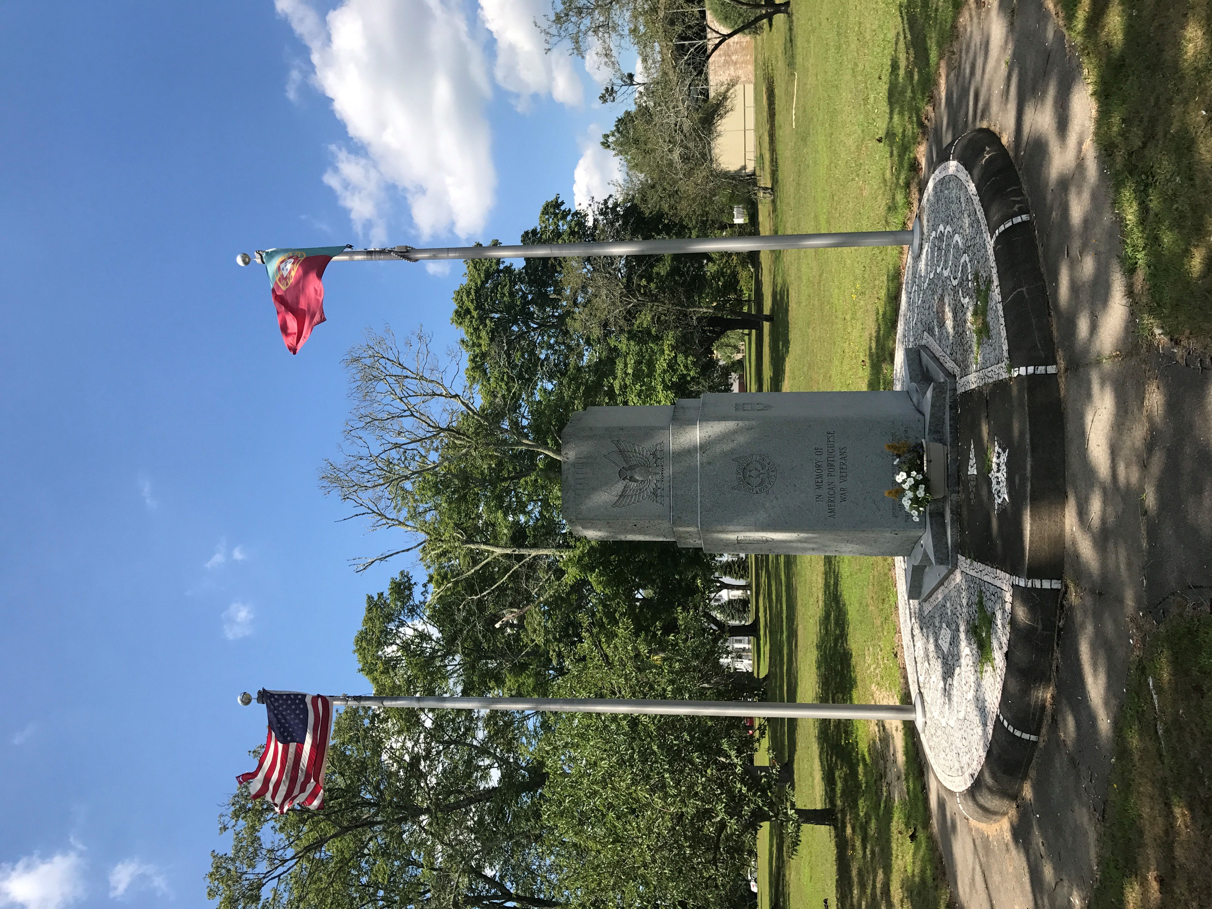
Portuguese Americans ( pt, português-americanos), also known as Luso-Americans (''luso-americanos''), are citizens and residents of the United States who are connected to the country of Portugal by birth, ancestry, or citizenship. Americans and others who are not native Europeans from Portugal but originate from countries that were former colonies of Portugal do not necessarily self-identify as "Portuguese-American", but rather as their post-colonial nationalities, although many refugees (referred to as '' retornados'') from former Portuguese colonies, as well as many white Brazilians, are ethnically or ancestrally Portuguese. In 2017, an estimated 48,158 Portuguese nationals were living in the United States. Some Melungeon communities in rural Appalachia have historically self-identified as Portuguese. Given their complex ancestry, individual Melungeons may descend from Portuguese people, but not all do. History Bilateral ties date from the earliest years of the United St ... [...More Info...] [...Related Items...] OR: [Wikipedia] [Google] [Baidu] |
Latin American People
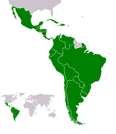
Latin Americans ( es, Latinoamericanos; pt, Latino-americanos; ) are the citizens of Latin American countries (or people with cultural, ancestral or national origins in Latin America). Latin American countries and their diasporas are multi-ethnic and multi-racial. Latin Americans are a pan-ethnicity consisting of people of different ethnic and national backgrounds. As a result, some Latin Americans do not take their nationality as an ethnicity, but identify themselves with a combination of their nationality, ethnicity and their ancestral origins. Aside from the Indigenous Amerindian population, all Latin Americans have some Old World ancestors who arrived since 1492. Latin America has the largest diasporas of Spaniards, Portuguese, Africans, Italians, Lebanese and Japanese in the world. The region also has large German (second largest after the United States), French, Palestinian (largest outside the Arab states), Chinese and Jewish diasporas. The specific ethnic and/or racia ... [...More Info...] [...Related Items...] OR: [Wikipedia] [Google] [Baidu] |


.jpg)

.jpg)

