|
Doubling Point Light
Doubling Point Light is a lighthouse on the Kennebec River in Arrowsic, Maine. It was established in 1898, fifteen years after the founding of the Bath Iron Works, a major shipbuilder, upriver. It was part of a major upgrade of the river's lights — the Doubling Point Light and the separate Doubling Point Range Lights, Range Lights on the point, Perkins Island Light, and Squirrel Point Light were all built at the same time. The light was listed on the National Register of Historic Places as Doubling Point Light Station on January 21, 1988. It remains an active aid to navigation. Description and history The Doubling Point Light is located on the lower Kennebec River, at a point where the normally south-flowing river makes a sharp turn to the east, followed by a turn back to the south. The light is set at the inside corner of the first of these turns, on the west side of Arrowsic Island, roughly opposite the mouth of Winnegance Creek. The light station includes a tower ... [...More Info...] [...Related Items...] OR: [Wikipedia] [Google] [Baidu] |
Kennebec River
The Kennebec River (Abenaki language, Abenaki: ''Kinəpékʷihtəkʷ'') is a U.S. Geological Survey. National Hydrography Dataset high-resolution flowline dataThe National Map , accessed June 30, 2011 river within the U.S. state of Maine. It rises in Moosehead Lake in west-central Maine. The East and West Outlets join at Indian Pond and the river flows southward. Harris Station Dam, the largest hydroelectric dam in the state, was constructed near that confluence. The river is joined at The Forks, Maine, The Forks by its tributary the Dead River (Kennebec River), Dead River, also called the West Branch. It continues south past the cities of Madison, Maine, Madison, Skowhegan, Maine, Skowhegan, Waterville, Maine, Waterville, and the state capital Augusta, Maine, Augusta. At Richmond, Maine, Richmond, it flows into Merrymeeting Bay, a freshwater tidal bay into which also flow the Androscoggin River and five smaller rivers. The Kennebec runs past the shipbuilding center of Bath, ... [...More Info...] [...Related Items...] OR: [Wikipedia] [Google] [Baidu] |
Augusta, Maine
Augusta is the capital of the U.S. state of Maine and the county seat of Kennebec County. The city's population was 18,899 at the 2020 census, making it the tenth-most populous city in Maine, and third-least populous state capital in the United States after Montpelier, Vermont, and Pierre, South Dakota. Located on the Kennebec River at the head of tide, it is the principal city in the Augusta-Waterville Micropolitan Statistical Area and home to the University of Maine at Augusta. History The area was first explored by the English of the short-lived Popham Colony in September 1607. 21 years later, English settlers from the Plymouth Colony settled in the area in 1628 as part of a trading post on the Kennebec River. The settlement was known by its Native American name ''Cushnoc'' (or Coussinoc or Koussinoc), meaning "head of the tide." Fur trading was at first profitable, but because of Native uprisings and declining revenues, Plymouth Colony sold the Kennebec Patent in 1 ... [...More Info...] [...Related Items...] OR: [Wikipedia] [Google] [Baidu] |
Lighthouses In Sagadahoc County, Maine
A lighthouse is a tower, building, or other type of physical structure designed to emit light from a system of lamps and lenses and to serve as a beacon for navigational aid, for maritime pilots at sea or on inland waterways. Lighthouses mark dangerous coastlines, hazardous shoals, reefs, rocks, and safe entries to harbors; they also assist in aerial navigation. Once widely used, the number of operational lighthouses has declined due to the expense of maintenance and has become uneconomical since the advent of much cheaper, more sophisticated and effective electronic navigational systems. History Ancient lighthouses Before the development of clearly defined ports, mariners were guided by fires built on hilltops. Since elevating the fire would improve the visibility, placing the fire on a platform became a practice that led to the development of the lighthouse. In antiquity, the lighthouse functioned more as an entrance marker to ports than as a warning signal for reefs and ... [...More Info...] [...Related Items...] OR: [Wikipedia] [Google] [Baidu] |
Lighthouses On The National Register Of Historic Places In Maine
A lighthouse is a tower, building, or other type of physical structure designed to emit light from a system of lamps and lens (optics), lenses and to serve as a beacon for navigational aid, for maritime pilots at sea or on inland waterways. Lighthouses mark dangerous coastlines, hazardous shoals, reefs, rocks, and safe entries to harbors; they also assist in aerial navigation. Once widely used, the number of operational lighthouses has declined due to the expense of maintenance and has become uneconomical since the advent of much cheaper, more sophisticated and effective electronic navigational systems. History Ancient lighthouses Before the development of clearly defined ports, mariners were guided by fires built on hilltops. Since elevating the fire would improve the visibility, placing the fire on a platform became a practice that led to the development of the lighthouse. In antiquity, the lighthouse functioned more as an entrance marker to ports than as a warning signa ... [...More Info...] [...Related Items...] OR: [Wikipedia] [Google] [Baidu] |
Lighthouses Completed In 1898
A lighthouse is a tower, building, or other type of physical structure designed to emit light from a system of lamps and lenses and to serve as a beacon for navigational aid, for maritime pilots at sea or on inland waterways. Lighthouses mark dangerous coastlines, hazardous shoals, reefs, rocks, and safe entries to harbors; they also assist in aerial navigation. Once widely used, the number of operational lighthouses has declined due to the expense of maintenance and has become uneconomical since the advent of much cheaper, more sophisticated and effective electronic navigational systems. History Ancient lighthouses Before the development of clearly defined ports, mariners were guided by fires built on hilltops. Since elevating the fire would improve the visibility, placing the fire on a platform became a practice that led to the development of the lighthouse. In antiquity, the lighthouse functioned more as an entrance marker to ports than as a warning signal for reefs and ... [...More Info...] [...Related Items...] OR: [Wikipedia] [Google] [Baidu] |
National Register Of Historic Places Listings In Sagadahoc County, Maine
This is a list of the National Register of Historic Places listings in Sagadahoc County, Maine. This is intended to be a complete list of the properties and districts on the National Register of Historic Places in Sagadahoc County, Maine, United States. Latitude and longitude coordinates are provided for many National Register properties and districts; these locations may be seen together in a map. There are 60 properties and districts listed on the National Register in the county. One property was once listed, but has since been removed. Current listings Former listing See also * List of National Historic Landmarks in Maine __NOTOC__ This is a complete List of National Historic Landmarks in Maine. The United States National Historic Landmark program is operated under the auspices of the National Park Service, and recognizes structures, districts, objects, and similar ... * National Register of Histor ... [...More Info...] [...Related Items...] OR: [Wikipedia] [Google] [Baidu] |
Lighthouses In The United States
This is a list of lighthouses in the United States. The United States has had approximately a thousand lights as well as light towers, range lights, and pier head lights. Michigan has the most lights of any state with over 150 past and present lights. Lighthouses that are in former U.S. territories are not listed here. Most of the lights in the United States have been built and maintained by the Coast Guard (since 1939) and its predecessors, the United States Lighthouse Service (1910–1939) and the United States Lighthouse Board (1852–1910). Before the Lighthouse Board was established, local collectors of customs were responsible for lighthouses under Stephen Pleasonton. As their importance to navigation has declined and as public interest in them has increased, the Coast Guard has been handing over ownership and in some cases responsibility for running them to other parties, the chief of them being the National Park Service under the National Historic Lighthouse Preservation ... [...More Info...] [...Related Items...] OR: [Wikipedia] [Google] [Baidu] |
NOAA
The National Oceanic and Atmospheric Administration (abbreviated as NOAA ) is an United States scientific and regulatory agency within the United States Department of Commerce that forecasts weather, monitors oceanic and atmospheric conditions, charts the seas, conducts deep sea exploration, and manages fishing and protection of marine mammals and endangered species in the U.S. exclusive economic zone. Purpose and function NOAA's specific roles include: * ''Supplying Environmental Information Products''. NOAA supplies to its customers and partners information pertaining to the state of the oceans and the atmosphere, such as weather warnings and forecasts via the National Weather Service. NOAA's information services extend as well to climate, ecosystems, and commerce. * ''Providing Environmental Stewardship Services''. NOAA is a steward of U.S. coastal and marine environments. In coordination with federal, state, local, tribal and international authorities, NOAA manages the ... [...More Info...] [...Related Items...] OR: [Wikipedia] [Google] [Baidu] |
Fresnel Lens
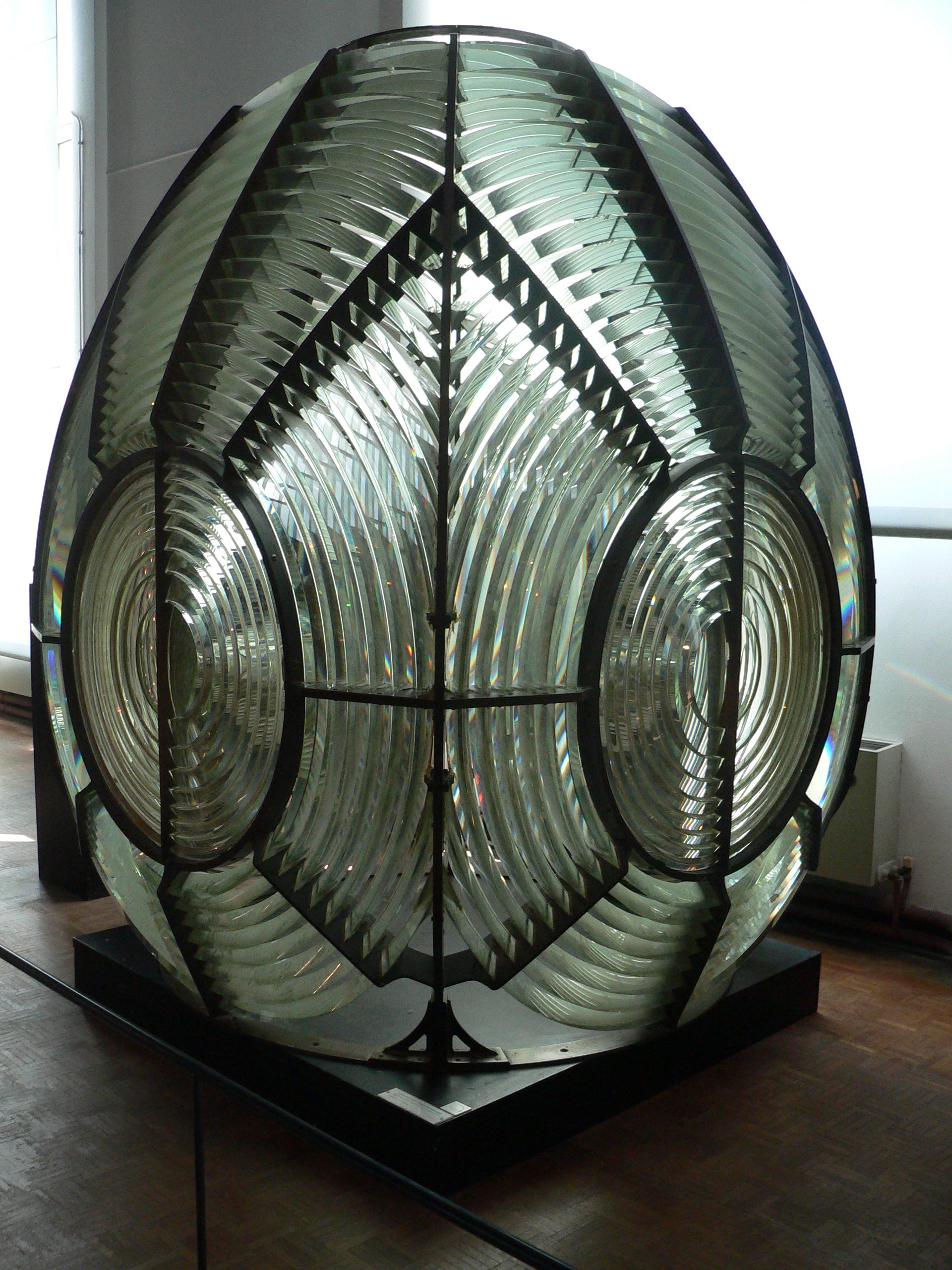
A Fresnel lens ( ; ; or ) is a type of composite compact lens developed by the French physicist Augustin-Jean Fresnel (1788–1827) for use in lighthouses. It has been called "the invention that saved a million ships." The design allows the construction of lenses of large aperture and short focal length without the mass and volume of material that would be required by a lens of conventional design. A Fresnel lens can be made much thinner than a comparable conventional lens, in some cases taking the form of a flat sheet. The simpler dioptric (purely refractive) form of the lens was first proposed by Count Buffon and independently reinvented by Fresnel. The ''catadioptric'' form of the lens, entirely invented by Fresnel, has outer elements that use total internal reflection as well as refraction; it can capture more oblique light from a light source and add it to the beam of a lighthouse, making the light visible from greater distances. Description The Fresnel lens redu ... [...More Info...] [...Related Items...] OR: [Wikipedia] [Google] [Baidu] |
United States Lighthouse Board
The United States Lighthouse Board was the second agency of the U.S. federal government, under the Department of Treasury, responsible for the construction and maintenance of all lighthouses and navigation aids in the United States, between 1852 and 1910. The new agency was created following complaints of the shipping industry of the previous administration of lighthouses under the Treasury's Lighthouse Establishment, which had had jurisdiction since 1791, and since 1820, been under the control of Stephen Pleasonton. The quasi-military board first met on April 28, 1851, and with its establishment, the administration of lighthouses and other aids to navigation would take their largest leap toward modernization since the inception of federal government control.Amy K. Marshall "Frequently Close to the Point of Peril: A History of Buoys and Tenders in U.S. Coastal Waters, 1789–1939'", A Master's Thesis In 1910, the Lighthouse Board was disestablished in favor of a more civilian Li ... [...More Info...] [...Related Items...] OR: [Wikipedia] [Google] [Baidu] |
Aid To Navigation
In international relations, aid (also known as international aid, overseas aid, foreign aid, economic aid or foreign assistance) is – from the perspective of governments – a voluntary transfer of resources from one country to another. Aid may serve one or more functions: it may be given as a signal of diplomatic approval, or to strengthen a military ally, to reward a government for behavior desired by the donor, to extend the donor's cultural influence, to provide infrastructure needed by the donor for resource extraction from the recipient country, or to gain other kinds of commercial access. Countries may provide aid for further diplomatic reasons. Humanitarian and altruistic purposes are often reasons for foreign assistance. Aid may be given by individuals, private organizations, or governments. Standards delimiting exactly the types of transfers considered "aid" vary from country to country. For example, the United States government discontinued the reporting of mili ... [...More Info...] [...Related Items...] OR: [Wikipedia] [Google] [Baidu] |
Arrowsic, Maine
Arrowsic is a New England town, town in Sagadahoc County, Maine, United States. The population is 477 as of the 2020 United States Census. It is part of the Portland, Maine, Portland–South Portland, Maine, South Portland–Biddeford, Maine, Biddeford, Maine Portland-South Portland-Biddeford metropolitan area, metropolitan statistical area. During the French and Indian Wars, Arrowsic was site of a succession of important and embattled colonial settlements. It is a favorite with artists and birdwatching, birdwatchers. History Abenaki Indigenous peoples of the Americas, Indians called the island Arrowseag, meaning "place of obstruction," a reference to Upper Hell Gate on the Sasanoa River. Until it was widened by the United States Army Corps of Engineers, Army Corps of Engineers in 1898 and 1908, the stretch was choked with boulders and reef, ledges. Indian canoe passage would have been risky in the swift current between Merrymeeting Bay and Sheepscot Bay. In 1649, John Richards ... [...More Info...] [...Related Items...] OR: [Wikipedia] [Google] [Baidu] |


