|
Don Mills LRT
The Don Mills LRT was a proposed light rail line in Toronto, Ontario, Canada. It was part of the Transit City proposal announced March 16, 2007, to be operated by the Toronto Transit Commission (TTC). It was expected to cost approximately $675 million, with construction to begin in 2012, and an expected opening in 2016. It would have been the fifth of the seven Transit City lines to be complete after the Sheppard East, Finch West, Waterfront West, and Eglinton lines. Ridership was estimated to be 21.2 million trips in 2021. Mayor Rob Ford cancelled the line after taking office in December 2010. While LRT lines on Sheppard East, Finch West, and Eglinton were revived through a new agreement between the City of Toronto and Metrolinx, the Don Mills LRT was not included. The 925 Don Mills Express bus follows a similar routing to the proposed LRT. The Don Mills LRT is still included in Metrolinx's regional transportation plan ''The Big Move'' under the 15-year horizon. Metrolinx ... [...More Info...] [...Related Items...] OR: [Wikipedia] [Google] [Baidu] |
Relief Line (Toronto)
The Relief Line (formerly the Downtown Relief Line or DRL) was a proposed rapid transit line for the Toronto subway system, intended to provide capacity relief to the Yonge segment of Line 1 and Bloor–Yonge station and extend subway service coverage in the city's east end. Several plans for an east–west downtown subway line date back to the early 20th century, most of which ran along Queen Street. Since the early 21st century, studies proposed a line that would run south from Line 2 Bloor–Danforth at a point east of the Don River, before bending westward along Queen Street into Downtown Toronto. The Relief Line was included in the regional transportation plan ''The Big Move'' and is one of Metrolinx's top 15 transit priorities. In August 2018, an alignment was approved by the Ontario Ministry of Environment, Conservation, and Parks. In April 2019, the Government of Ontario under Premier Doug Ford announced that the Ontario Line, a provincially funded, automated rapid tr ... [...More Info...] [...Related Items...] OR: [Wikipedia] [Google] [Baidu] |
407 Transitway
The 407 Transitway is a bus rapid transit system (BRT) being planned along Ontario Highway 407, spanning the Greater Toronto Area between Brant Street in Burlington, and Enfield Road in Durham Region. Planning for the 407 Transitway has occurred for five segments: * Brant Street to Hurontario Street * Hurontario Street to Highway 400 * Highway 400 to Kennedy Road * Kennedy Road to Brock Road * Brock Road to Enfield Road The Government of Ontario does not intend on opening the segment between Highway 400 to Kennedy Road until 2023. The project is listed in the regional transportation plan ''The Big Move'' within the 25-year timeframe. See also * Highway 427 BRT A bus rapid transit (BRT) corridor is proposed on Highway 427 as part of Metrolinx's regional transportation plan for the Greater Toronto and Hamilton Area, ''The Big Move''. This BRT line would be established in two separate segments. The sout ... References External links * Proposed public transport i ... [...More Info...] [...Related Items...] OR: [Wikipedia] [Google] [Baidu] |
Steeles Rapid Transit
A rapid transit corridor is proposed along Steeles Avenue in Toronto, Ontario, Canada, which would be operated by the Toronto Transit Commission. It has not been determined if this corridor would be a bus rapid transit or a light rail transit line. It is identified by Metrolinx in its regional transportation plan The Big Move as a project to be completed in its 25-year plan. In February 2016, City of Toronto and TTC planners recommended implementing the Steeles BRT/LRT within a 15-year horizon. At a meeting on February 20, 2020, the Metrolinx board of directors endorsed a prioritization framework for a proposed Frequent Rapid Transit Network that included a proposed BRT from Pioneer Village station Pioneer Village is a subway station on the Line 1 Yonge–University of the Toronto subway. It is located under the intersection of Northwest Gate and Steeles Avenue, at the city boundaries of Toronto and Vaughan, Ontario, Canada. A Toronto Trans ... to McCowan Road. The proposed 20. ... [...More Info...] [...Related Items...] OR: [Wikipedia] [Google] [Baidu] |
Line 4 Sheppard
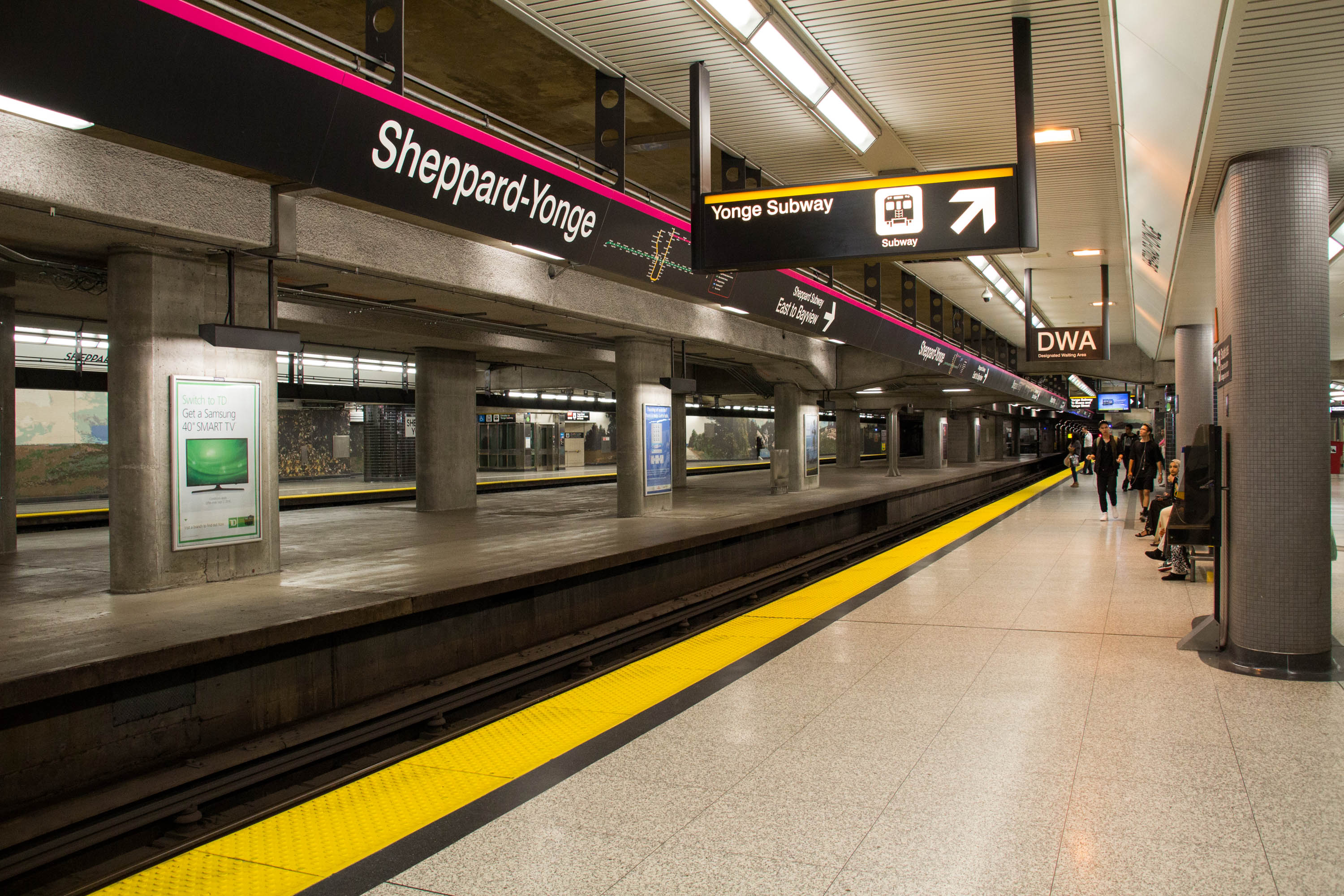
Line 4 Sheppard is the newest and shortest subway line of the Toronto subway system, operated by the Toronto Transit Commission (TTC). It opened on November 22, 2002, and has five stations along of track, which is built without any open sections in the district of North York along Sheppard Avenue East between Yonge Street and Don Mills Road. All stations are wheelchair accessible and are decorated with unique public art. The Government of Ontario has announced plans to extend the line east to Sheppard Avenue and McCowan Road in Scarborough to meet up with an extended Line 2 Bloor–Danforth. Name When the line opened in 2002, it was officially given the name "Sheppard Subway". In October 2013, the TTC announced plans to give the lines official numbers to help riders and visitors navigate the system. The Sheppard line was renamed "Line 4 Sheppard" and new signage reflecting this began being gradually implemented in March 2014. The Toronto Rocket trains also use the numerical ... [...More Info...] [...Related Items...] OR: [Wikipedia] [Google] [Baidu] |
Science Centre Station
Science Centre is an underground light rail transit (LRT) station and mobility hub under construction on Line 5 Eglinton, a new line that is part of the Toronto subway system. It will be located in the Flemingdon Park neighbourhood at the intersection of Don Mills Road and Eglinton Avenue. It is scheduled to open in 2023. During the planning stages for Line 5 Eglinton, the station was given the working name "Don Mills". On November 23, 2015, a report to the TTC Board recommended giving a unique name to each station in the subway system (including Line 5 Eglinton). Thus, it was given its current name to both be more descriptive of the nearby Ontario Science Centre (in the same vein as Museum station), and to avoid confusion with the pre-existing Don Mills station on Line 4 Sheppard. On April 10, 2019, the Ontario Government announced that Science Centre station would be the northern terminus for the proposed Ontario Line, construction of which started in March 2022. Descript ... [...More Info...] [...Related Items...] OR: [Wikipedia] [Google] [Baidu] |
Metrolinx Mobility Hubs
Metrolinx mobility hubs are locations with significant levels of planned transit service in the Canadian province of Ontario, as identified by the regional planning transportation agency Metrolinx under The Big Move. A mobility hub consists of a major transit station and the immediate surrounding area, where different forms of transportation come together, serving as the origin, destination or transfer point for a significant amount of trips. It is also a concentrated point of employment, housing, and recreation, making them places of significant economic development and activity where office buildings, hospitals, educational institutions, government service and information centres, shopping malls and restaurants can be located. Mobility hubs in the GTHA There are 51 mobility hubs in the Greater Toronto and Hamilton Area The Greater Toronto and Hamilton Area (GTHA) is a contiguous urban region that is composed of some of the largest cities and metropolitan areas by population i ... [...More Info...] [...Related Items...] OR: [Wikipedia] [Google] [Baidu] |
Regional Municipality Of York
The Regional Municipality of York, also called York Region, is a regional municipality in Southern Ontario, Canada, between Lake Simcoe and Toronto. The region was established after the passing of then Bill 102, An Act to Establish The Regional Municipality of York, in 1970. It replaced the former York County in 1971, and is part of the Greater Toronto Area and the inner ring of the Golden Horseshoe. The regional government is headquartered in Newmarket. The 2021 census population was 1,173,334, with a growth rate of 5.7% from 2016. The Government of Ontario expects its population to surpass 1.5 million residents by 2031. The largest cities in York Region are Markham, Vaughan and Richmond Hill. History At a meeting in Richmond Hill on May 6, 1970, officials representing the municipalities of York County approved plans for the creation of a regional government entity to replace York County. The plan had been presented in 1969 by Darcy McKeough, the Ontario Minister of Muni ... [...More Info...] [...Related Items...] OR: [Wikipedia] [Google] [Baidu] |
Ontario Highway 7
King's Highway 7, commonly referred to as Highway 7 and historically as the Northern Highway, is a provincially maintained highway in the Canadian province of Ontario. At its peak, Highway 7 measured in length, stretching from Highway 40 east of Sarnia in Southwestern Ontario to Highway 17 west of Ottawa in Eastern Ontario. However, due in part to the construction of Highways 402 and 407, the province transferred the sections of Highway 7 west of London and through the Greater Toronto Area to county and regional jurisdiction. The highway is now long; the western segment begins at Highway 4 north of London and extends to Georgetown, while the eastern segment begins at Donald Cousens Parkway in Markham and extends to Highway 417 in Ottawa. Highway 7 was first designated in 1920 between Sarnia and Guelph and extended to Brampton the following year. Between 1927 and 1932, the highway was more than doubled in length as it was gradually ... [...More Info...] [...Related Items...] OR: [Wikipedia] [Google] [Baidu] |
Leaside Bridge
The Leaside Bridge, formerly the East York Leaside Viaduct, and officially commemorated as the Confederation Bridge, spans the Don River in the City of Toronto, Ontario. The Truss bridge carrying Millwood Road was built to connect the then Town of Leaside, including Thorncliffe Park, to the then Township of East York, and was completed on October 29, 1927. The construction time of only 10 months was record breaking at the time. History During the 1920s, as the new communities surrounding Toronto grew rapidly, several bridges were constructed to overcome the barrier of the Don Valley. Among these were the Vale of Avoca ( St. Clair Avenue east of Yonge Street) and the East York – Leaside Viaduct. The town of Leaside, built by Canadian Northern Railway in the late teens and early 1920s, sought to attract investors and homebuyers. A connection over the Don Valley to the town of Todmorden Mills and on to Toronto would provide this. Sod was turned in mid-December and active co ... [...More Info...] [...Related Items...] OR: [Wikipedia] [Google] [Baidu] |
Thorncliffe Park
Thorncliffe Park is a neighbourhood in Toronto, Ontario, Canada, in the former Borough of East York. The City of Toronto recognizes Thorncliffe Park's boundaries as the Don River on the south side; Leaside Bridge, Millwood Road, and Laird Drive on the west side; the West Don River on the east side; and Eglinton Avenue East on the north side. History The site of Thorncliffe Park was a farm owned by Robert T. Davies, the wealthy founder of the Dominion Brewing Co. An avid participant in horse racing, under the banner of Thorncliffe Stable, he raced both Thoroughbred and Standardbred horses. After Davies' death in 1916 his estate sold the property to a group of investors from Baltimore, Maryland, who built the Thorncliffe Park Raceway racetrack. The track was home to thoroughbred horse racing and harness racing from 1917 until 1952 when it was sold for real estate development. Today, the old racetrack site is commemorated by two streets named Grandstand Place and Milepost ... [...More Info...] [...Related Items...] OR: [Wikipedia] [Google] [Baidu] |
Don Mills Road
Don, don or DON and variants may refer to: Places *County Donegal, Ireland, Chapman code DON *Don (river), a river in European Russia *Don River (other), several other rivers with the name *Don, Benin, a town in Benin *Don, Dang, a village and hill station in Dang district, Gujarat, India *Don, Nord, a ''commune'' of the Nord ''département'' in northern France *Don, Tasmania, a small village on the Don River, located just outside Devonport, Tasmania *Don, Trentino, a commune in Trentino, Italy * Don, West Virginia, a community in the United States *Don Republic, a temporary state in 1918–1920 *Don Jail, a jail in Toronto, Canada People Role or title *Don (honorific), a Spanish, Portuguese, and Italian title, given as a mark of respect *Don, a crime boss, especially in the Mafia , ''Don Konisshi'' (コニッシー) *Don, a resident assistant at universities in Canada and the U.S. *University don, in British and Irish universities, especially at Oxford, Cambridge, St An ... [...More Info...] [...Related Items...] OR: [Wikipedia] [Google] [Baidu] |


