|
Dog Island Light
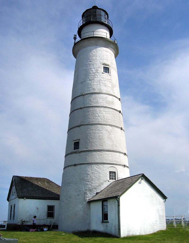
Several lighthouses called Dog Island Light were constructed on the western tip of Dog Island south of Carrabelle, Florida. They marked the "middle entrance to St. George's Sound," between St. George and Dog Islands, during the nineteenth century, until its collapse by a hurricane in 1873. History The first lighthouse, a brick tower, was completed in 1839. A storm in 1842 destroyed the keeper's house and badly damaged the lighthouse tower. A wooden tower was completed in 1843 to replace the brick tower. This second tower was destroyed by a hurricane in 1851. A brick tower was built in 1851. This is the lighthouse in the photo above. The obsolete lamp and reflector system in the light was replaced by a Forward drop lens in 1856, which was more efficient. During the Civil War, Confederate forces burned the stairs in the tower and damaged the lens to prevent the tower from being used as a lighthouse or a watchtower. The light was repaired and put back into service after the w ... [...More Info...] [...Related Items...] OR: [Wikipedia] [Google] [Baidu] |
Dog Island (Florida)
Dog Island is located in the northwestern Florida Gulf coast, just off-shore from Carrabelle, Florida, Carrabelle, in Franklin County, Florida. There is, by reservation, ferry transportation to Dog Island on weekends. There are no stores, restaurants, or public restrooms on Dog Island. A hotel, the Pelican Inn, closed in 2016. The island is less than one mile wide at its widest, and just under seven miles long. The bulk of the island is owned by the Nature Conservancy and is a wilderness preserve. Bird nesting sites on several areas of the east end and west end of the island are strictly off-limits for people and pets. There is a volunteer fire department. Electricity and trash pickup are available. For some years in the early 21st century, there was a White Trash Bash on Dog Island on Memorial Day. Airport Dog Island Airport is an un-towered, private use airport located by the Eastern bay of Dog Island. The airport opened in 1930. Origin The island and its two small neigh ... [...More Info...] [...Related Items...] OR: [Wikipedia] [Google] [Baidu] |
Florida State University
Florida State University (FSU) is a public research university in Tallahassee, Florida. It is a senior member of the State University System of Florida. Founded in 1851, it is located on the oldest continuous site of higher education in the state of Florida. Florida State University comprises 16 separate colleges and more than 110 centers, facilities, labs and institutes that offer more than 360 programs of study, including professional school programs. In 2021, the university enrolled 45,493 students from all 50 states and 130 countries. Florida State is home to Florida's only national laboratory, the National High Magnetic Field Laboratory, and is the birthplace of the commercially viable anti-cancer drug Taxol. Florida State University also operates the John & Mable Ringling Museum of Art, the State Art Museum of Florida and one of the largest museum/university complexes in the nation. The university is accredited by the Southern Association of Colleges and Schools (SACS). ... [...More Info...] [...Related Items...] OR: [Wikipedia] [Google] [Baidu] |
Lighthouses In Florida
This is a list of existing and past lighthouses in the state of Florida in the United States. See also *Unmanned reef lights of the Florida Keys *List of lighthouses in the United States *List of lighthouses in the United States by height *Maritime history of Florida Notes :A. The first tower was built around 1737. Archival records are inconclusive as to whether the Spanish used the tower as a lighthouse. While it seems likely, not enough has been gathered to place it as a fact. :B. The tower was washed away in 1851. :C. In 1960, the lighthouse was replaced with a skeletal steel tower. The old structure moved multiple times as a private residence before it was returned to St. Joseph Bay in 1979. While the old light remains a private residence, its current owner has restored its former appearance with a rebuilt lantern room. References Sources *National Park Service,Inventory of Historic Light Stations - Florida Lighthouses. Maritime Heritage Program. Retrieved on 2010-09-28. ... [...More Info...] [...Related Items...] OR: [Wikipedia] [Google] [Baidu] |
Transportation Buildings And Structures In Franklin County, Florida
Transport (in British English), or transportation (in American English), is the intentional movement of humans, animals, and goods from one location to another. Modes of transport include air, land ( rail and road), water, cable, pipeline, and space. The field can be divided into infrastructure, vehicles, and operations. Transport enables human trade, which is essential for the development of civilizations. Transport infrastructure consists of both fixed installations, including roads, railways, airways, waterways, canals, and pipelines, and terminals such as airports, railway stations, bus stations, warehouses, trucking terminals, refueling depots (including fueling docks and fuel stations), and seaports. Terminals may be used both for interchange of passengers and cargo and for maintenance. Means of transport are any of the different kinds of transport facilities used to carry people or cargo. They may include vehicles, riding animals, and pack an ... [...More Info...] [...Related Items...] OR: [Wikipedia] [Google] [Baidu] |
Lighthouses Completed In 1851
A lighthouse is a tower, building, or other type of physical structure designed to emit light from a system of lamps and lenses and to serve as a beacon for navigational aid, for maritime pilots at sea or on inland waterways. Lighthouses mark dangerous coastlines, hazardous shoals, reefs, rocks, and safe entries to harbors; they also assist in aerial navigation. Once widely used, the number of operational lighthouses has declined due to the expense of maintenance and has become uneconomical since the advent of much cheaper, more sophisticated and effective electronic navigational systems. History Ancient lighthouses Before the development of clearly defined ports, mariners were guided by fires built on hilltops. Since elevating the fire would improve the visibility, placing the fire on a platform became a practice that led to the development of the lighthouse. In antiquity, the lighthouse functioned more as an entrance marker to ports than as a warning signal for ree ... [...More Info...] [...Related Items...] OR: [Wikipedia] [Google] [Baidu] |
Lighthouses Completed In 1843
A lighthouse is a tower, building, or other type of physical structure designed to emit light from a system of lamps and lens (optics), lenses and to serve as a beacon for navigational aid, for maritime pilots at sea or on inland waterways. Lighthouses mark dangerous coastlines, hazardous shoals, reefs, rocks, and safe entries to harbors; they also assist in aerial navigation. Once widely used, the number of operational lighthouses has declined due to the expense of maintenance and has become uneconomical since the advent of much cheaper, more sophisticated and effective electronic navigational systems. History Ancient lighthouses Before the development of clearly defined ports, mariners were guided by fires built on hilltops. Since elevating the fire would improve the visibility, placing the fire on a platform became a practice that led to the development of the lighthouse. In antiquity, the lighthouse functioned more as an entrance marker to ports than as a warning signa ... [...More Info...] [...Related Items...] OR: [Wikipedia] [Google] [Baidu] |
Lighthouses Completed In 1839
A lighthouse is a tower, building, or other type of physical structure designed to emit light from a system of lamps and lenses and to serve as a beacon for navigational aid, for maritime pilots at sea or on inland waterways. Lighthouses mark dangerous coastlines, hazardous shoals, reefs, rocks, and safe entries to harbors; they also assist in aerial navigation. Once widely used, the number of operational lighthouses has declined due to the expense of maintenance and has become uneconomical since the advent of much cheaper, more sophisticated and effective electronic navigational systems. History Ancient lighthouses Before the development of clearly defined ports, mariners were guided by fires built on hilltops. Since elevating the fire would improve the visibility, placing the fire on a platform became a practice that led to the development of the lighthouse. In antiquity, the lighthouse functioned more as an entrance marker to ports than as a warning signal for reefs and ... [...More Info...] [...Related Items...] OR: [Wikipedia] [Google] [Baidu] |
List Of Lighthouses In The United States
This is a list of lighthouses in the United States. The United States has had approximately a thousand lights as well as light towers, range lights, and pier head lights. Michigan has the most lights of any state with over 150 past and present lights. Lighthouses that are in former U.S. territories are not listed here. Most of the lights in the United States have been built and maintained by the Coast Guard (since 1939) and its predecessors, the United States Lighthouse Service (1910–1939) and the United States Lighthouse Board (1852–1910). Before the Lighthouse Board was established, local collectors of customs were responsible for lighthouses under Stephen Pleasonton. As their importance to navigation has declined and as public interest in them has increased, the Coast Guard has been handing over ownership and in some cases responsibility for running them to other parties, the chief of them being the National Park Service under the National Historic Lighthouse Preservation ... [...More Info...] [...Related Items...] OR: [Wikipedia] [Google] [Baidu] |
List Of Lighthouses In Florida
This is a list of existing and past lighthouses in the state of Florida in the United States. See also *Unmanned reef lights of the Florida Keys *List of lighthouses in the United States *List of lighthouses in the United States by height *Maritime history of Florida Notes :A. The first tower was built around 1737. Archival records are inconclusive as to whether the Spanish used the tower as a lighthouse. While it seems likely, not enough has been gathered to place it as a fact. :B. The tower was washed away in 1851. :C. In 1960, the lighthouse was replaced with a skeletal steel tower. The old structure moved multiple times as a private residence before it was returned to St. Joseph Bay in 1979. While the old light remains a private residence, its current owner has restored its former appearance with a rebuilt lantern room. References Sources *National Park Service,Inventory of Historic Light Stations - Florida Lighthouses. Maritime Heritage Program. Retrieved on 2010-09-28. ... [...More Info...] [...Related Items...] OR: [Wikipedia] [Google] [Baidu] |
Side-scan Sonar
Side-scan sonar (also sometimes called side scan sonar, sidescan sonar, side imaging sonar, side-imaging sonar and bottom classification sonar) is a category of sonar system that is used to efficiently create an image of large areas of the sea floor. Uses Side-scan sonar may be used to conduct surveys for marine archaeology; in conjunction with seafloor samples it is able to provide an understanding of the differences in material and texture type of the seabed. Side-scan sonar imagery is also a commonly used tool to detect debris items and other obstructions on the seafloor that may be hazardous to shipping or to seafloor installations by the oil and gas industry. In addition, the status of pipelines and cables on the seafloor can be investigated using side-scan sonar. Side-scan data are frequently acquired along with bathymetric soundings and sub-bottom profiler data, thus providing a glimpse of the shallow structure of the seabed. Side-scan sonar is also used for fisheries ... [...More Info...] [...Related Items...] OR: [Wikipedia] [Google] [Baidu] |
Charles T
Charles is a masculine given name predominantly found in English and French speaking countries. It is from the French form ''Charles'' of the Proto-Germanic name (in runic alphabet) or ''*karilaz'' (in Latin alphabet), whose meaning was "free man". The Old English descendant of this word was '' Ċearl'' or ''Ċeorl'', as the name of King Cearl of Mercia, that disappeared after the Norman conquest of England. The name was notably borne by Charlemagne (Charles the Great), and was at the time Latinized as ''Karolus'' (as in ''Vita Karoli Magni''), later also as '' Carolus''. Some Germanic languages, for example Dutch and German, have retained the word in two separate senses. In the particular case of Dutch, ''Karel'' refers to the given name, whereas the noun ''kerel'' means "a bloke, fellow, man". Etymology The name's etymology is a Common Germanic noun ''*karilaz'' meaning "free man", which survives in English as churl (< Old English ''ċeorl''), which developed its depr ... [...More Info...] [...Related Items...] OR: [Wikipedia] [Google] [Baidu] |
Carrabelle, Florida
Carrabelle is a city in Franklin County along Florida's Panhandle, United States. The population was 2,778 as of the 2010 census. Carrabelle is located east of Apalachicola at the mouth of the Carrabelle River on the Gulf of Mexico. Geography Carrabelle is located east of the center of Franklin County along the Carrabelle River and on St. James Island, between St. George Sound to the south and the Crooked and New rivers to the north. To the south is Dog Island, separating St. George Sound from the Gulf of Mexico. U.S. Route 98 passes through Carrabelle, leading west to Apalachicola and northeast to Medart. Tallahassee, the state capital, is to the northeast. According to the United States Census Bureau, Carrabelle has a total area of , of which is land and , or 20.12%, is water. Carrabelle is the eastern terminus of the Gulf Intracoastal Waterway. Demographics The population of Carrabelle rose from 1,303 in 2000 to 2,778 in 2010 with the expansion of the city lim ... [...More Info...] [...Related Items...] OR: [Wikipedia] [Google] [Baidu] |


