|
District Of West Augusta
The District of West Augusta was a short-lived (1774–76) historical region of Colonial Virginia that encompassed much of what is now northern West Virginia and southwestern Pennsylvania. History Before the Colony of Virginia and the Province of Pennsylvania agreed to extend the Mason-Dixon line westward from the western boundary line of the Province of Maryland, both claimed a large area of what is now southwestern Pennsylvania. The area was sparsely populated in the years following the French and Indian War (1754–63), and neither colony made any serious attempts at forming a local government until the early 1770s. Virginia administered the region as a part of Augusta County, Virginia. Pennsylvania later established Westmoreland County, Pennsylvania, Westmoreland County with its seat at Hannastown, Pennsylvania, Hannastown, overlapping Virginia's claims. Virginia's governor, John Murray, 4th Earl of Dunmore, Lord Dunmore, traveled to Pittsburgh, which Virginia claimed ... [...More Info...] [...Related Items...] OR: [Wikipedia] [Google] [Baidu] |
Map Of Ohio, Monongalia, & Yohogania Counties
A map is a symbolic depiction emphasizing relationships between elements of some space, such as objects, regions, or themes. Many maps are static, fixed to paper or some other durable medium, while others are dynamic or interactive. Although most commonly used to depict geography, maps may represent any space, real or fictional, without regard to context or scale, such as in brain mapping, DNA mapping, or computer network topology mapping. The space being mapped may be two dimensional, such as the surface of the earth, three dimensional, such as the interior of the earth, or even more abstract spaces of any dimension, such as arise in modeling phenomena having many independent variables. Although the earliest maps known are of the heavens, geographic maps of territory have a very long tradition and exist from ancient times. The word "map" comes from the , wherein ''mappa'' meant 'napkin' or 'cloth' and ''mundi'' 'the world'. Thus, "map" became a shortened term referring to ... [...More Info...] [...Related Items...] OR: [Wikipedia] [Google] [Baidu] |
Washington County, Pennsylvania
Washington County is a county in the Commonwealth of Pennsylvania. As of the 2020 census, the population was 209,349. Its county seat is Washington. Washington County is part of the Pittsburgh, PA Metropolitan Statistical Area. The county is home to Washington County Airport, three miles (5 km) southwest of Washington. History The county was created on March 28, 1781, from part of Westmoreland County. The city and county were both named after American Revolutionary War leader George Washington, who eventually became the first President of the United States. The town of Charleroi got its name from the Belgian city of Charleroi. There lived many Belgian immigrants in the Monongahela area at the end of the 19th century, some of whom were glass makers. Geography According to the U.S. Census Bureau, the county has a total area of , of which is land and (0.5%) is water. Surrounding counties * Beaver County (north) * Allegheny County (NNE-northeast) * Westmoreland Cou ... [...More Info...] [...Related Items...] OR: [Wikipedia] [Google] [Baidu] |
Former Regions And Territories Of The United States
A former is an object, such as a template, gauge or cutting die, which is used to form something such as a boat's hull. Typically, a former gives shape to a structure that may have complex curvature. A former may become an integral part of the finished structure, as in an aircraft fuselage, or it may be removable, being using in the construction process and then discarded or re-used. Aircraft formers Formers are used in the construction of aircraft fuselage, of which a typical fuselage has a series from the nose to the empennage, typically perpendicular to the longitudinal axis of the aircraft. The primary purpose of formers is to establish the shape of the fuselage and reduce the column length of stringers to prevent instability. Formers are typically attached to longerons, which support the skin of the aircraft. The "former-and-longeron" technique (also called stations and stringers) was adopted from boat construction, and was typical of light aircraft built until the ... [...More Info...] [...Related Items...] OR: [Wikipedia] [Google] [Baidu] |
Geography Of Virginia
The natural environment of Virginia encompasses the physical geography and biology of the U.S. state of Virginia. Virginia has a total area of , including of water, making it the 35th- largest state by area. Forests cover 65% of the state, wetlands and water cover 6% of the land in the state, while 5% of the state is a mixture of commercial, residential, and transitional. Virginia is bordered by Maryland and Washington, D.C. to the north and east; by the Atlantic Ocean to the east; by North Carolina and Tennessee to the south; by Kentucky to the west; and by West Virginia to the north and west. Due to a peculiarity of Virginia's original charter, its boundary with Maryland and Washington, D.C. does not extend past the low-water mark of the south shore of the Potomac River (unlike many boundaries that split a river down the middle). The southern border is defined as the 36° 30′ parallel north, though surveyor error led to deviations of as much as three arcminutes. The stat ... [...More Info...] [...Related Items...] OR: [Wikipedia] [Google] [Baidu] |
Brooke County, West Virginia
Brooke County is a county in the Northern Panhandle of the U.S. state of West Virginia. As of the 2020 census, the population was 22,559. Its county seat is Wellsburg. The county was created in 1797 from part of Ohio County and named in honor of Robert Brooke, Governor of Virginia from 1794 to 1796. Brooke County is part of the Weirton-Steubenville, WV-OH Metropolitan Statistical Area, which is also included in the Pittsburgh-New Castle-Weirton, PA-WV-OH Combined Statistical Area. History The Ohio Company of Virginia petitioned the British King for 500,000 acres of land in the Ohio River Valley in 1747, but the first settlers to this area, in what later became known as West Virginia's Northern Panhandle, were brothers Jonathan, Israel and Friend Cox. They staked a " tomahawk claim" to 1200 acres (400 acres for each brother) at the mouth of Buffalo Creek and extending along the Ohio River. Their cousin George Cox staked an adjacent claim a few years later. In 1788 Char ... [...More Info...] [...Related Items...] OR: [Wikipedia] [Google] [Baidu] |
Hancock County, West Virginia
Hancock County is a county in the U.S. state of West Virginia. As of the 2020 census, the population was 29,095. Its county seat is New Cumberland and its largest city is Weirton. The county was created from Brooke County in 1848 and named for John Hancock, first signer of the Declaration of Independence. Hancock County is the northernmost point in both West Virginia and, by some definitions, the Southern United States; being at the tip of the state's Northern Panhandle. Hancock County is part of the Weirton-Steubenville, WV-OH Metropolitan Statistical Area, which is also included in the Pittsburgh-New Castle-Weirton, PA-WV-OH Combined Statistical Area. History Hancock County was formed from Brooke County in 1848, some 15 years before West Virginia became a state. Both counties were once part of Ohio County, Virginia, which had been formed from the District of West Augusta in 1776. Hancock County has significant Revolutionary-period roots due to its location on the Ohio Riv ... [...More Info...] [...Related Items...] OR: [Wikipedia] [Google] [Baidu] |
Beaver County, Pennsylvania
Beaver County is a county in the Commonwealth of Pennsylvania. As of the 2020 census, the population was 168,215. Its county seat is Beaver. The county was created on March 12, 1800, from parts of Allegheny and Washington counties. It took its name from the Beaver River. Beaver County is part of the Pittsburgh, PA Metropolitan Statistical Area. History The original townships at the date of the erection of Beaver County (1800) were North Beaver, east and west of the Big Beaver Creek; South Beaver, west of the Big Beaver; and Sewickley, east of the Big Beaver—all north of the Ohio River; and Hanover, First Moon, and Second Moon, south of the Ohio. Geography According to the U.S. Census Bureau, the county has a total area of , of which is land and (2.1%) is water. It has a humid continental climate (''Dfa''/''Dfb'') and average monthly temperatures in the Beaver/Rochester vicinity range from 29.4 °F in January to 73.2 °F in July. Bodies of water * The Ohio ... [...More Info...] [...Related Items...] OR: [Wikipedia] [Google] [Baidu] |
Allegheny County, Pennsylvania
Allegheny County () is a county in the Commonwealth of Pennsylvania. It is located in Southwestern Pennsylvania. As of the 2020 census, the population was 1,250,578, making it the state's second-most populous county, following Philadelphia County. The county seat is Pittsburgh. Allegheny County is included in the Pittsburgh, PA Metropolitan Statistical Area, and in the Pittsburgh Designated Market Area. Allegheny was the first county in Pennsylvania to be given a Native American name. It was named after the Lenape word for the Allegheny River. The meaning of "Allegheny" is uncertain. It is usually said to mean "fine river". Stewart says that the name may come from a Lenape account of an ancient mythical tribe called ''"Allegewi"'', who lived along the river before being taken over by the Lenape. History Prior to European contact, this area was settled for thousands of years by succeeding cultures of indigenous peoples. During the colonial era, historic native groups kno ... [...More Info...] [...Related Items...] OR: [Wikipedia] [Google] [Baidu] |
Fayette County, Pennsylvania
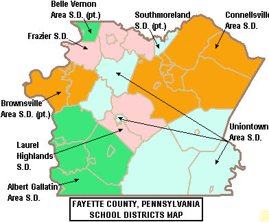
Fayette County is a county in the Commonwealth of Pennsylvania. It is located in southwestern Pennsylvania, adjacent to Maryland and West Virginia. As of the 2020 census, the population was 128,804. Its county seat is Uniontown. The county was created on September 26, 1783, from part of Westmoreland County and named after the Marquis de Lafayette. Fayette County is part of the Pittsburgh, PA Metropolitan Statistical Area. The southern border of Fayette County is the southern border of Pennsylvania at both the Pennsylvania–Maryland state line (the Mason–Dixon line) and the Pennsylvania–West Virginia state line. History The first Europeans in Fayette County were explorers, who had used an ancient American Indian trail that bisected the county on their journey across the Appalachian Mountains. In 1754, when control of the area was still in dispute between France and Great Britain, 22-year-old George Washington fought against the French at the Battle of Jumonville Glen ... [...More Info...] [...Related Items...] OR: [Wikipedia] [Google] [Baidu] |
Yohogania County
Yohogania County was created by the new state of Virginia in 1776, in an area long disputed between Virginia and Pennsylvania. The county ceased to exist after the border dispute between the two states was resolved in the 1780s. Thus, it is sometimes referred to as a "lost county," although 1.5 million people live within the territory it once claimed, which encompasses two entire counties and parts of four others in two states. The problem arose through the complex and conflicting manner of granting territory and defining boundaries during the Colonial period. The North American continent was not surveyed until long after various land grants were made to individual colonies, and such land grants and even governmental entities frequently overlapped. Conflicting claims Virginia's claim was for a wedge from their coastal area all the way to the Pacific Ocean. Pennsylvania's was for 5 degrees of longitude west of the Delaware River. By the 1770s it was obvious that the two claims ov ... [...More Info...] [...Related Items...] OR: [Wikipedia] [Google] [Baidu] |


