|
Devil's Dyke (other)
Devil's Dyke may refer to: * Devil's Dykes, a series of Roman fortifications between Hungary and Serbia *Devil's Dyke, Cambridgeshire, an earthen barrier in eastern Cambridgeshire *Devil's Dyke, Hertfordshire, a prehistoric defensive ditch in Hertfordshire *Devil's Dyke, Sussex Devil's Dyke is a 100 metre deep V-shaped dry valley on the South Downs in Sussex in southern England, north-west of Brighton. It is managed by the National Trust, and is also part of the Beeding Hill to Newtimber Hill Site of Special Scienti ..., a valley on the South Downs Way See also: * Deil's Dyke, earthwork in Scotland {{Disambig ... [...More Info...] [...Related Items...] OR: [Wikipedia] [Google] [Baidu] |
Devil's Dykes
The Devil's Dykes (Hungarian: ''Ördög árok''), also known as the ''Csörsz árka'' ("Csörsz Ditch") or the ''Limes Sarmatiae'' (Latin for "Sarmatian border"), are several lines of Roman fortifications built mostly during the reign of Constantine the Great (306–337), stretching between today's Hungary, Romania and Serbia. History The fortifications consisted of a series of defensive earthen ramparts-and-ditches surrounding the plain of the ''Tisia'' (Tisza) river. They stretched from Aquincum (within modern Budapest) eastwards along the line of the northern Carpathian mountains to the vicinity of Debrecen, and then southwards to Viminacium (near modern Stari Kostolac). They were probably designed to protect the Iazyges, a Sarmatian tribe that inhabited the Tisza plain and had been reduced to tributary status by Constantine, from incursions by the surrounding Goths and Gepids. Some elements of the fortifications, however, date from the 2nd century AD, and probably const ... [...More Info...] [...Related Items...] OR: [Wikipedia] [Google] [Baidu] |
Devil's Dyke, Cambridgeshire
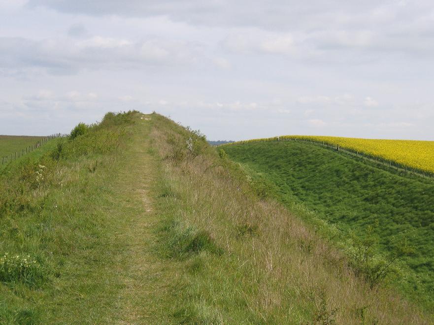
Devil's Dyke or Devil's Ditch is a linear earthen barrier, thought to be of Anglo-Saxon origin, in eastern Cambridgeshire and Suffolk. It runs for in an almost straight line from Reach to Woodditton, with a ditch and bank system facing southwestwards, blocking the open chalkland between the marshy fens to the north and the formerly wooded hills to the south. It is a Scheduled Monument, a biological Site of Special Scientific Interest and a Special Area of Conservation. Description The name ''Devil's Ditch'' or ''Dyke'' is a post- medieval one. In medieval times it was simply called the ''dic'' ("the ditch"), or ''le Micheldyche'' or ''magnum fossatum'' ("great ditch"). Devil's Dyke is over long and is the largest of a series of ancient dykes in Cambridgeshire. In some places the bank measures high and across. The highest point along the Devil's Dyke is at Gallows Hill, where it measures from the bottom of the ditch to the top of the earth wall. Since the 19th centu ... [...More Info...] [...Related Items...] OR: [Wikipedia] [Google] [Baidu] |
Devil's Dyke, Hertfordshire
Devil's Dyke is the remains of a prehistoric defensive ditch which lies at the east side of the village of Wheathampstead, Hertfordshire, England. It is protected as a Scheduled Monument. It is generally agreed to have been part of the defences of an Iron Age settlement belonging to the Catuvellauni tribe of Ancient Britain. It has possible associations with Julius Caesar's second invasion of Britain (54 BC) Description Historic England refers to the Devil's Dyke as being part of a much larger site. Other sources are more specific as to what sort of earthwork it may be, suggesting that the dyke protects one side of an oppidum (a large fortified Iron Age settlement) covering about 40 ha. The area is marked as a "Belgic oppidum" on Ordnance Survey maps. Although recent archaeological studies have proven the main 'devil's dyke' ditch, the deepest part of what was assumed to be defensive ditches, around the settlement, was in fact the only part to have such ditches. It was thou ... [...More Info...] [...Related Items...] OR: [Wikipedia] [Google] [Baidu] |
Devil's Dyke, Sussex
Devil's Dyke is a 100 metre deep V-shaped dry valley on the South Downs in Sussex in southern England, north-west of Brighton. It is managed by the National Trust, and is also part of the Beeding Hill to Newtimber Hill Site of Special Scientific Interest. Devil's Dyke was a major local tourist attraction in the late 19th and early 20th centuries. It is now a popular viewpoint and site for walking, model aircraft flying and hang gliding. The South Downs Way passes the site. Geological history The Dyke is formed in rocks of the Chalk Group which originated as marine sediments during the Cretaceous period. It is a misconception common amongst local residents of Brighton that the valley was formed by some kind of glacial action, the myth of a 'glacier' being a misunderstanding of accounts such as this one from the ''Encyclopaedia of Brighton'' by Timothy Carder (1990): "In reality the 300-foot-deep valley was carved by tremendous amounts of water running off the Downs during t ... [...More Info...] [...Related Items...] OR: [Wikipedia] [Google] [Baidu] |


