|
Deserters Canyon
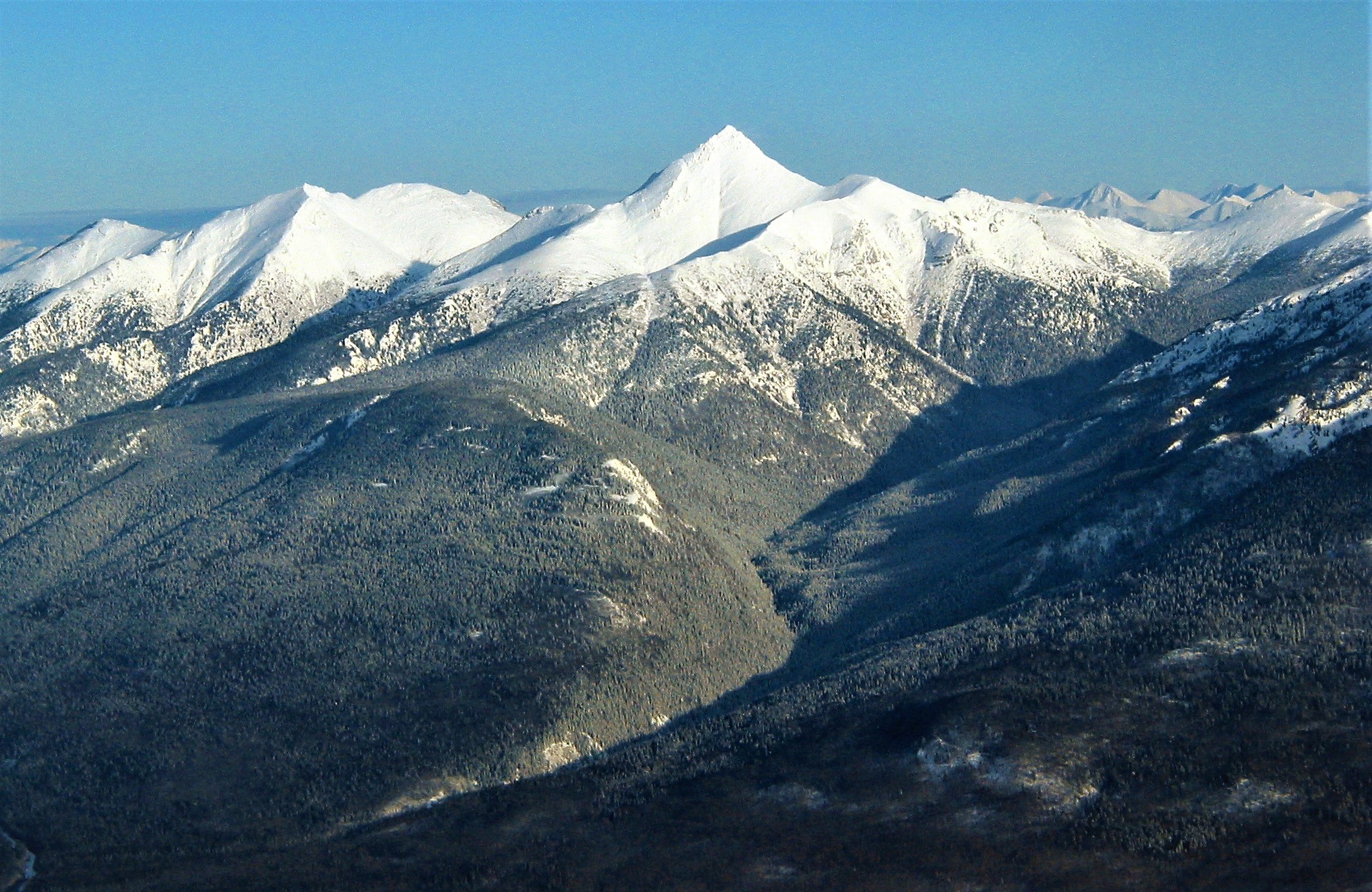
Deserters Canyon is a canyon on the Finlay River in the Northern Interior of British Columbia, Canada. It is located just upstream (north) from the head of the Finlay Arm of Lake Williston, the reservoir created by WAC Bennett Dam on the lower Peace River. The name refers to two men in the exploration party of Samuel Black in 1824 who deserted at this location during an expedition to find the headwaters of the Finlay, which is the North Fork of the Peace River The Peace River (french: links=no, rivière de la Paix) is a river in Canada that originates in the Rocky Mountains of northern British Columbia and flows to the northeast through northern Alberta. The Peace River joins the Athabasca River in th .... Deserters Creek and Deserters Peak are in the same area and has the same name-origin. References * Canyons and gorges of British Columbia Northern Interior of British Columbia History of British Columbia Fur trade {{BritishColumbiaInterior-geo-stub ... [...More Info...] [...Related Items...] OR: [Wikipedia] [Google] [Baidu] |
Canyon
A canyon (from ; archaic British English spelling: ''cañon''), or gorge, is a deep cleft between escarpments or cliffs resulting from weathering and the erosive activity of a river over geologic time scales. Rivers have a natural tendency to cut through underlying surfaces, eventually wearing away rock layers as sediments are removed downstream. A river bed will gradually reach a baseline elevation, which is the same elevation as the body of water into which the river drains. The processes of weathering and erosion will form canyons when the river's headwaters and estuary are at significantly different elevations, particularly through regions where softer rock layers are intermingled with harder layers more resistant to weathering. A canyon may also refer to a rift between two mountain peaks, such as those in ranges including the Rocky Mountains, the Alps, the Himalayas or the Andes. Usually, a river or stream carves out such splits between mountains. Examples of mountain-type ... [...More Info...] [...Related Items...] OR: [Wikipedia] [Google] [Baidu] |
Finlay River
The Finlay River is a 402 km long river in north-central British Columbia flowing north and thence south from Thutade Lake in the Omineca Mountains to Williston Lake, the impounded waters of the Peace River formed by the completion of the W.A.C. Bennett Dam in 1968. Prior to this, the Finlay joined with the Parsnip River to form the Peace. The headwaters of the Finlay at Thutade Lake are considered the ultimate source of the Mackenzie River. Deserters Canyon is located just north of Williston Lake. The Finlay drains an area of 43,000 square kilometres and discharges at a mean rate of 600 cubic metres per second. Major tributaries of the Finlay inc ... [...More Info...] [...Related Items...] OR: [Wikipedia] [Google] [Baidu] |
British Columbia Interior
, settlement_type = Region of British Columbia , image_skyline = , nickname = "The Interior" , subdivision_type = Country , subdivision_name = , subdivision_type1 = Province , subdivision_name1 = , parts_type = Principal cities , p1 = Kelowna , p2 = Kamloops , p3 = Prince George , p4 = Vernon , p5 = Penticton , p6 = West Kelowna , p7 = Fort St. John , p8 = Cranbrook , area_blank1_title = 14 Districts , area_blank1_km2 = 669,648 , area_footnotes = , elevation_max_m = 4671 , elevation_min_m = 127 , elevation_max_footnotes = Mt. Fairweather , elevation_min_footnotes = Fraser River , population_as_of = 2016 , population = 961,155 , population_density_km2 ... [...More Info...] [...Related Items...] OR: [Wikipedia] [Google] [Baidu] |
Lake Williston
Williston Lake is a reservoir created by the W. A. C. Bennett Dam and is located in the Northern Interior of British Columbia, Canada. Geography The lake fills the basin of the upper Peace River, backing into the Rocky Mountain Trench which is where the Parsnip and Finlay met at Finlay Forks to form the Peace. The lake includes three reaches, the Peace Reach (formerly the Peace Canyon), and the Parsnip and Finlay Reaches, which are the lowermost basins of those rivers, and covers a total area of , being the largest lake in British Columbia and the seventh largest reservoir (by volume) in the world. The reservoir is fed by the Finlay, Omineca, Ingenika, Ospika, Parsnip, Manson, Nation and Nabesche Rivers and by Clearwater Creek, Carbon Creek, and other smaller creeks. Several provincial parks are maintained on the shore of the lake, including Muscovite Lakes Provincial Park, Butler Ridge Provincial Park, Heather-Dina Lakes Provincial Park and Ed Bird-Estella Provincial Park. ... [...More Info...] [...Related Items...] OR: [Wikipedia] [Google] [Baidu] |
WAC Bennett Dam
The W. A. C. Bennett Dam is a large hydroelectric dam on the Peace River in northern British Columbia, Canada. At high, it is one of the world's highest earth fill dams. Construction of the dam began in 1961 and culminated in 1968. At the dam, the Finlay, the Parsnip and the Peace Rivers feed into Williston Lake, also referred to as Williston Reservoir. It is the third largest artificial lake in North America (after the Smallwood Reservoir and Manicouagan Reservoir) as well as the largest body of fresh water in British Columbia. Williston Lake runs 250 kilometres north–south and 150 kilometres east–west. The construction of the dam cost $750 million, making it the largest project of its kind in the province of BC. The dam was named after Premier W. A. C. Bennett because his vision played a major role in the project initiation, development, and realization; the reservoir was named after the premier's trusted cabinet colleague: Ray Williston. The Gordon M. Shrum Generation S ... [...More Info...] [...Related Items...] OR: [Wikipedia] [Google] [Baidu] |
Peace River (Canada)
The Peace River (french: links=no, rivière de la Paix) is a river in Canada that originates in the Rocky Mountains of northern British Columbia and flows to the northeast through northern Alberta. The Peace River joins the Athabasca River in the Peace-Athabasca Delta to form the Slave River, a tributary of the Mackenzie River. The Finlay River, the main headwater of the Peace River, is regarded as the ultimate source of the Mackenzie River. The combined Finlay–Peace–Slave–Mackenzie river system is the 13th longest river system in the world. History The regions along the river are the traditional home of the Danezaa people, called the Beaver by the Europeans. The fur trader Peter Pond is believed to have visited the river in 1785. In 1788 Charles Boyer of the North West Company established a fur trading post at the river's junction with the Boyer River. In 1792 and 1793, the explorer Alexander Mackenzie travelled up the river to the Continental Divide. Mackenzie ... [...More Info...] [...Related Items...] OR: [Wikipedia] [Google] [Baidu] |
Samuel Black
Samuel Black (May 3, 1780 – February 8, 1841) was a Scottish fur trader and explorer, a clerk in the New North Nest Company (XYC) and Wintering Partner in the North West Company (NWC), and later clerk, chief trader, and chief factor in the Hudson's Bay Company (HBC) for the Columbia District. In 1824, he explored the Finlay River and its tributaries in present-day north-central British Columbia, Canada, including the Muskwa, Omineca and Stikine for the HBC. His journals were published by the Hudson's Bay Record Society in 1955. Early life and career Black was born in Tyrie, Aberdeenshire, Scotland, the oldest and only son to John Black, from the parish on Tyrie, and Mary Leith, from the parish of Bodichell. Black also had two sisters, Ann and Mary. His baptism was witnessed by George Leith and Janet Black. It is noted in the baptism record that Black was "illegitimate," though, on June 24, 1781, John Black and Mary Leith are noted in the parish marriage records in Pitsligo as ... [...More Info...] [...Related Items...] OR: [Wikipedia] [Google] [Baidu] |
Deserters Peak
Deserters Peak is a mountain summit in British Columbia British Columbia (commonly abbreviated as BC) is the westernmost province of Canada, situated between the Pacific Ocean and the Rocky Mountains. It has a diverse geography, with rugged landscapes that include rocky coastlines, sandy beaches, ..., Canada. Description Deserters Peak, elevation 2,274-meters (7,461-feet), is the highest point of the Deserters Range, which is a subrange of the Muskwa Ranges of the Northern Rocky Mountains. It is situated along the east side of the Rocky Mountain Trench near the northern end of Williston Lake. Precipitation Surface runoff, runoff from the peak drains into Deserters Creek and Rubyred Creek which are both tributaries of the Finlay River. Topographic relief is significant as the summit rises approximately 1,600 meters (5,250 ft) above the Finlay River in . Etymology The mountain's toponym was officially adopted June 4, 1953, by the Geographical Names Board of Cana ... [...More Info...] [...Related Items...] OR: [Wikipedia] [Google] [Baidu] |
Canyons And Gorges Of British Columbia
A canyon (from ; archaic British English spelling: ''cañon''), or gorge, is a deep cleft between escarpments or cliffs resulting from weathering and the erosive activity of a river over geologic time scales. Rivers have a natural tendency to cut through underlying surfaces, eventually wearing away rock layers as sediments are removed downstream. A river bed will gradually reach a baseline elevation, which is the same elevation as the body of water into which the river drains. The processes of weathering and erosion will form canyons when the river's headwaters and estuary are at significantly different elevations, particularly through regions where softer rock layers are intermingled with harder layers more resistant to weathering. A canyon may also refer to a rift between two mountain peaks, such as those in ranges including the Rocky Mountains, the Alps, the Himalayas or the Andes. Usually, a river or stream carves out such splits between mountains. Examples of mountain-type ... [...More Info...] [...Related Items...] OR: [Wikipedia] [Google] [Baidu] |
Northern Interior Of British Columbia
Northern may refer to the following: Geography * North, a point in direction * Northern Europe, the northern part or region of Europe * Northern Highland, a region of Wisconsin, United States * Northern Province, Sri Lanka * Northern Range, a range of hills in Trinidad Schools * Northern Collegiate Institute and Vocational School (NCIVS), a school in Sarnia, Canada * Northern Secondary School, Toronto, Canada * Northern Secondary School (Sturgeon Falls), Ontario, Canada * Northern University (other), various institutions * Northern Guilford High School, a public high school in Greensboro, North Carolina Companies * Arriva Rail North, a former train operating company in northern England * Northern Bank, commercial bank in Northern Ireland * Northern Foods, based in Leeds, England * Northern Pictures, an Australian-based television production company * Northern Rail, a former train operating company in northern England * Northern Railway of Canada, a defunct railway i ... [...More Info...] [...Related Items...] OR: [Wikipedia] [Google] [Baidu] |
History Of British Columbia
The history of British Columbia covers the period from the arrival of Paleo-Indians thousands of years ago to the present day. Prior to European colonization, the lands encompassing present-day British Columbia were inhabited for millennia by a number of First Nations in Canada, First Nations. Several European expeditions to the region were undertaken in the late 18th and early 19th centuries. After the Oregon dispute, Oregon boundary dispute between the UK and US government was resolved in 1846, the colony of Vancouver Island, colonies of Vancouver Island and Colony of British Columbia (1858–1866), colony of British Columbia were established; the former in 1849 and the latter in 1858. The two colonies were merged to form a Colony of British Columbia (1866–1871), single colony in 1866, which later joined the Canadian Confederation on 20 July 1871. An influential historian of British Columbia, Margaret Ormsby, presented a structural model of the province's history in ''Briti ... [...More Info...] [...Related Items...] OR: [Wikipedia] [Google] [Baidu] |


