|
DeWitt, New York
DeWitt is a town in Onondaga County, New York, United States. As of the 2020 census, the town's population was 26,074. The town is named after Major Moses DeWitt, a judge and soldier. An eastern suburb of Syracuse, DeWitt also is "the site of most of the campus and all of the academic buildings of Le Moyne College". History DeWitt was part of the Central New York Military Tract. The first settlers arrived around 1789. The original Erie Canal progressed through the town in 1825. DeWitt was formed in 1835 from the Town of Manlius and was named in honor of Moses DeWitt, a Major in the militia, judge of the county courts and one of the first settlers of the county. Geography According to the United States Census Bureau, the town has a total area of , of which is land and (0.15%) is water. Highways Interstate 481 is the major highway in DeWitt crossing the center of the town, turning northward along the eastern side of DeWitt. I-481 intersects Interstate 690 in the ea ... [...More Info...] [...Related Items...] OR: [Wikipedia] [Google] [Baidu] |
Administrative Divisions Of New York
The administrative divisions of New York are the various units of government that provide local services in the State of New York. The state is divided into boroughs, counties, cities, townships called "towns", and villages. (The only boroughs, the five boroughs of New York City, have the same boundaries as their respective counties.) They are municipal corporations, chartered (created) by the New York State Legislature, as under the New York Constitution the only body that can create governmental units is the state. All of them have their own governments, sometimes with no paid employees, that provide local services. Centers of population that are not incorporated and have no government or local services are designated hamlets. Whether a municipality is defined as a borough, city, town, or village is determined not by population or land area, but rather on the form of government selected by the residents and approved by the New York Legislature. Each type of local government ... [...More Info...] [...Related Items...] OR: [Wikipedia] [Google] [Baidu] |
Syracuse, New York
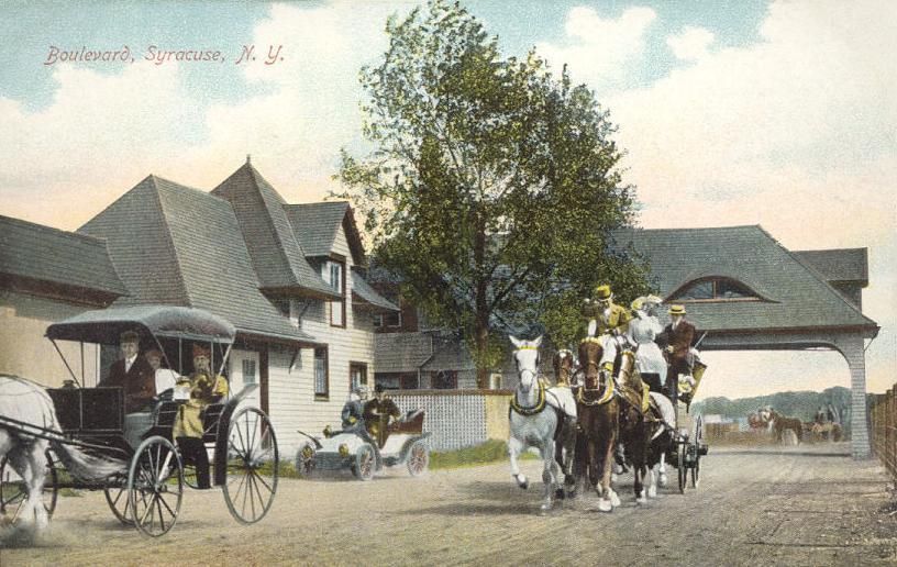
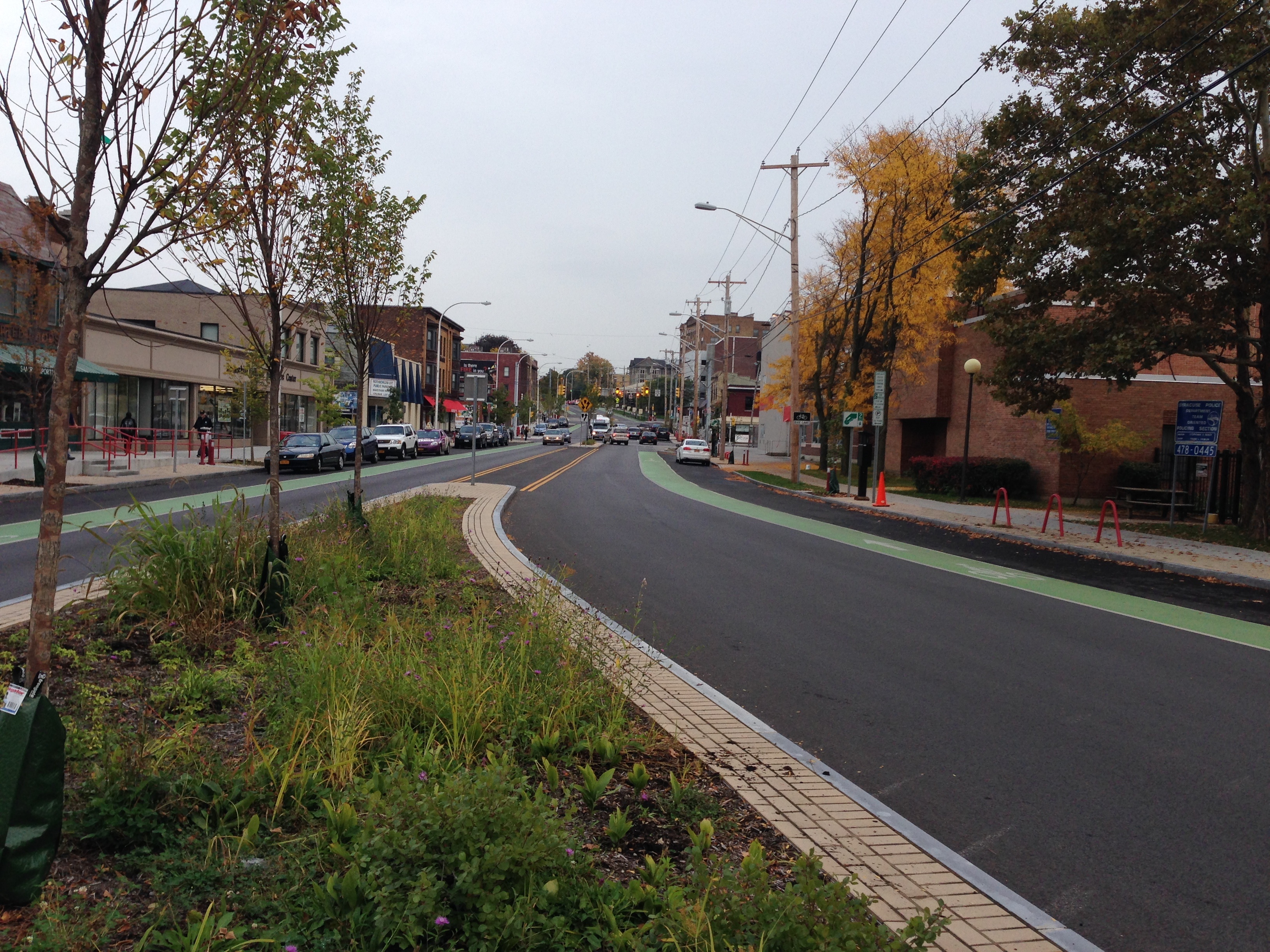
Syracuse ( ) is a City (New York), city in and the county seat of Onondaga County, New York, Onondaga County, New York, United States. It is the fifth-most populous city in the state of New York following New York City, Buffalo, New York, Buffalo, Yonkers, New York, Yonkers, and Rochester, New York, Rochester. At the United States Census 2020, 2020 census, the city's population was 148,620 and its Syracuse metropolitan area, metropolitan area had a population of 662,057. It is the economic and educational hub of Central New York, a region with over one million inhabitants. Syracuse is also well-provided with convention sites, with a Oncenter, downtown convention complex. Syracuse was named after the classical Greek city Syracuse, Sicily, Syracuse (''Siracusa'' in Italian), a city on the eastern coast of the Italian island of Sicily. Historically, the city has functioned as a major Crossroads (culture), crossroads over the last two centuries, first between the Erie Canal and its ... [...More Info...] [...Related Items...] OR: [Wikipedia] [Google] [Baidu] |
New York State Route 5
New York State Route 5 (NY 5) is a state highway that extends for across the state of New York in the United States. It begins at the Pennsylvania state line in the Chautauqua County town of Ripley and passes through Buffalo, Syracuse, Utica, Schenectady, and several other smaller cities and communities on its way to downtown Albany in Albany County, where it terminates at U.S. Route 9 (US 9), here routed along the service roads for Interstate 787 (I-787). Prior to the construction of the New York State Thruway, it was one of two main east–west highways traversing upstate New York, the other being US 20. West of New York, the road continues as Pennsylvania Route 5 (PA 5) to Erie. NY 5 overlaps with US 20 twice along its routing. The second, a overlap through western and central New York, is the second-longest concurrency in the state, stretching from Avon in Livingston County east to the city of Auburn in Cayu ... [...More Info...] [...Related Items...] OR: [Wikipedia] [Google] [Baidu] |
New York State Route 92
New York State Route 92 (NY 92) is a state highway located in central New York in the United States. The western terminus of the route is at an intersection with U.S. Route 11 (US 11, named State Street) in downtown Syracuse. Its eastern terminus is at a junction with US 20 west of the village of Cazenovia. NY 92 is known as East Genesee Street through Syracuse and DeWitt; from DeWitt to Cazenovia, its name varies by location. It heads generally eastward through Syracuse to DeWitt, where it crosses Interstate 481 (I-481) while concurrent with NY 5. At the east end of the overlap, it splits off follows a more southeasterly routing through the village of Manlius to Cazenovia. NY 92 was assigned as part of the 1930 renumbering of state highways in New York; however, it originally began in Fayetteville. At the time, the portion of Genesee Street in eastern Syracuse was part of NY 5. NY 92 was extended westward into Syracus ... [...More Info...] [...Related Items...] OR: [Wikipedia] [Google] [Baidu] |
New York State Thruway
{{Infobox road , state = NY , type = NYST , alternate_name = Governor Thomas E. Dewey Thruway , maint = NYSTA , map = {{maplink, frame=yes, plain=yes, frame-align=center, frame-width=290, type=line, stroke-width=2, type2=line, from2=New York State Thruway Spur Routes.map , map_custom = yes , map_notes = Map of New York with the Thruway mainline in red; other components of the Thruway system are in blue , length_mi = 496.00 , length_ref = , length_notes = Mainline only , established = {{Start date, June 24, 1954 , restrictions = No explosives (including in cargo) between exits 9 and 11 No commercial vehicles allowed on the Garden State Parkway Connector , allocation = {{plainlist, 1= * {{jct, state=NY, I-Toll, 87 between The Bronx and Albany * {{jct, state=NY, I-Toll, 287 between Elmsford and Suffern * {{jct, state=NY, I-Toll, 90 between Albany and Ripley and the Berkshire Connector * {{jct, state=NY, I-Toll, 95 on the New England Thruway , direction_a = South ... [...More Info...] [...Related Items...] OR: [Wikipedia] [Google] [Baidu] |
Interstate 90 In New York
Interstate 90 (I-90) is a part of the Interstate Highway System that runs from Seattle, Washington, to Boston, Massachusetts. In the US state of New York, I-90 extends from the Pennsylvania state line at Ripley to the Massachusetts state line at Canaan, and is the second-longest highway in the state after New York State Route 17 (NY 17). Although most of the route is part of the tolled New York State Thruway, two non-tolled sections exist along I-90 (the first, situated outside of Buffalo, is included in the Thruway system; the second, situated in the Capital District, is not part of the Thruway system and links Albany and its eastern suburbs). Within New York, I-90 has a complete set of auxiliary Interstates, which means that there are Interstates numbered I-190 through I-990 in the state, with no gaps in between. For most of its length in New York, I-90 runs parallel to the former Erie Canal route, NY 5, US Route 20 (US 20) and the CSX Transp ... [...More Info...] [...Related Items...] OR: [Wikipedia] [Google] [Baidu] |
Interstate 690
Interstate 690 (I-690) is an auxiliary Interstate Highway that extends for through the vicinity of Syracuse, New York, in the United States. It is a spur of I-90 (here part of the New York State Thruway) that travels southeast from Thruway exit 39 in Van Buren to I-481 in DeWitt. In between, I-690 passes through the western suburbs of Syracuse before heading east through the city itself, where it meets I-81 in Downtown Syracuse. The expressway continues northwest of the thruway as New York State Route 690 (NY 690). Route description I-690 begins at a double trumpet interchange with the New York State Thruway (I-90) in the town of Van Buren. The six-lane, fully-shouldered limited-access highway continues north toward Baldwinsville as NY 690 while I-690 travels east from the junction. Even though I-690 continues north of the thruway as NY 690, the numbering system on I-690 does not continue with the route. The interchange with the thruway is labeled ... [...More Info...] [...Related Items...] OR: [Wikipedia] [Google] [Baidu] |
Interstate 481
Interstate 481 (I-481) is an auxiliary Interstate Highway that serves as an eastern bypass of Syracuse, New York, in the US. It begins at its parent, I-81, in the city's southern end and travels through the eastern Syracuse suburbs of Jamesville, DeWitt, and Cicero before rejoining I-81 in the suburb of North Syracuse. After crossing I-81 in North Syracuse, I-481 continues northwest to Fulton and Oswego as New York State Route 481 (NY 481). I-481 is part of the Veterans Memorial Highway, which extends northward onto NY 481. Route description I-481 begins at I-81's exit 16A, a directional T interchange in the South Valley section of the city of Syracuse. Immediately crossing under NY 173, I-481 proceeds eastward alongside Rock Cut Road (unsigned County Route 103 R 103, which meets the freeway at exit 1 heading east. I-481 crosses out of Syracuse and into the town of Onondaga, paralleling Rock Cut Road into Clark Reservation ... [...More Info...] [...Related Items...] OR: [Wikipedia] [Google] [Baidu] |
United States Census Bureau
The United States Census Bureau (USCB), officially the Bureau of the Census, is a principal agency of the U.S. Federal Statistical System, responsible for producing data about the American people and economy. The Census Bureau is part of the U.S. Department of Commerce and its director is appointed by the President of the United States. The Census Bureau's primary mission is conducting the U.S. census every ten years, which allocates the seats of the U.S. House of Representatives to the states based on their population. The bureau's various censuses and surveys help allocate over $675 billion in federal funds every year and it assists states, local communities, and businesses make informed decisions. The information provided by the census informs decisions on where to build and maintain schools, hospitals, transportation infrastructure, and police and fire departments. In addition to the decennial census, the Census Bureau continually conducts over 130 surveys and programs ... [...More Info...] [...Related Items...] OR: [Wikipedia] [Google] [Baidu] |
Manlius (town), New York
Manlius is a town in Onondaga County, east of the city of Syracuse, New York, United States. The population was 33,712 at the 2020 census, making it the third largest suburb in metropolitan Syracuse. In 2005, the town was ranked 98th on CNN's list of Best Places to Live. The town of Manlius includes a village also named Manlius, along with the villages of Fayetteville and Minoa. It is located on the eastern border of Onondaga County. History The town was a township of the former Central New York Military Tract. Manlius is the name of several important Romans, but exactly which one was being honored is no longer known. The current town was first settled around 1790. The town of Manlius was created in 1794, along with Onondaga County, as a much larger entity, which was decreased by the formation, in part or in whole, of new towns ( DeWitt, Onondaga, Salina) and part of Syracuse. The economy related to trade generated by the Erie Canal contributed to the early developmen ... [...More Info...] [...Related Items...] OR: [Wikipedia] [Google] [Baidu] |


