|
Davis Sea
Davis Sea is an area of the sea along the coast of East Antarctica between West Ice Shelf in the west and the Shackleton Ice Shelf in the east, or between 82° and 96°E. The name "Davis Sea" appears in most leading geographically authoritative publications such as the 2014 10th edition World Atlas from the National Geographic Society and the 2014 12th edition of the ''Times Atlas of the World'', unlike neighboring proposed water body names such as the Russian-proposed Cooperation Sea to the west. According to the ''Great Soviet Encyclopedia'', it stretches from 87°E to 98°E, and is up to deep. Its area is given as only . Other authorities such as National Geographic assign it a much smaller extent. The sea borders the Leopold and Astrid Coast portion of Princess Elizabeth Land, then Kaiser Wilhelm II Land, Pravda Coast and Queen Mary Land. The never-approved 2002 draft fourth edition of ''Limits of Oceans and Seas'' identifies that the Tryoshnikova Gulf (named after ... [...More Info...] [...Related Items...] OR: [Wikipedia] [Google] [Baidu] |
Drygalski Island
Drygalski Island is an ice-capped island that is long and rises to in the Davis Sea of the Southern Ocean, about north of the coast of Queen Mary Land and north-northeast of Cape Filchner. The island has an area of . Drygalski Island was first viewed from the continental Antarctic coast in November 1912 by members of the Western Base Party of the Australian Antarctic Expedition (1911-1914), and observed more closely from Sir Douglas Mawson's ship Aurora on the homeward journey in January 1914. Because Drygalski Island was thought to be "Drygalski's High Land", charted by Professor Erich von Drygalski of the German Antarctic Expedition (1901-1903) in 1902, Drygalski's name was given by Sir Douglas Mawson to the island. A temporary field station named Mir was opened from 20 May to 6 August in 1960 on the island by the Soviet Union to study meteorological conditions. See also * Composite Antarctic Gazetteer * List of Antarctic and sub-Antarctic islands * List of Antarctic ... [...More Info...] [...Related Items...] OR: [Wikipedia] [Google] [Baidu] |
Tressler Bank
Tressler Bank () is a submarine bank with a least depth of 56 fathoms, extending from about 94 to 96E in the eastern part of the Davis Sea. The bank was sounded by the USS Burton Island and Willis L. Tressler of the U.S. Navy Hydrographic Office. Tressler carried on oceanographic studies in the Antarctic aboard the USS Tressler and was a scientific leader at Wilkes Station Wilkes Station was an Antarctic research station established 29 January 1957 by the United States as one of seven U.S. stations established for the International Geophysical Year (IGY) program in Antarctica. It was taken over by Australia on ... in 1958. References Undersea banks of the Southern Ocean {{marine-geo-stub ... [...More Info...] [...Related Items...] OR: [Wikipedia] [Google] [Baidu] |
Davis Station
The Davis Station, commonly called Davis, is one of three permanent bases and research outposts in Antarctica managed by the Australian Antarctic Division (AAD). Davis is situated on the coast of Cooperation Sea in Princess Elizabeth Land, Ingrid Christensen Coast in the Australian Antarctic Territory, a territory claimed by Australia. Davis lies in the Antarctic oasis, a remarkable ice free area known as the Vestfold Hills. Davis was named in honour of Captain John King Davis. Davis was listed on the Register of the National Estate on 26 October 1999 and has been included on the Commonwealth Heritage List as an indicative place, due to the condition of buildings and structures that varies from no longer exists/demolished due to poor condition, through to very good condition. Purpose Davis is a base for scientific research programs including the study of viruses and bacteria using molecular genetic techniques in glacial lakes, the impact of environmental change and pollution ... [...More Info...] [...Related Items...] OR: [Wikipedia] [Google] [Baidu] |
John King Davis
John King Davis (19 February 1884 – 8 May 1967) was an English-born Australian explorer and navigator notable for his work captaining exploration ships in Antarctic waters as well as for establishing meteorological stations on Macquarie Island in the subantarctic and on Willis Island in the Coral Sea. Early life Davis's formal education, at Colet Court, London, and at Burford Grammar School, Oxfordshire, ended in 1900, when he and his father left London for Cape Town, South Africa. Career Early exploration work Davis served as chief officer of the during Ernest Shackleton's Antarctic expedition in 1908–1909. He was captain of the and second in command of Douglas Mawson's Australasian Antarctic expedition in 1911–1914. First World War At the outbreak of World War I in August 1914, Davis volunteered for active service, and was put in charge of the troop transport , carrying troops and horses to Egypt and England. Later exploration work He also served as Cap ... [...More Info...] [...Related Items...] OR: [Wikipedia] [Google] [Baidu] |
Douglas Mawson
Sir Douglas Mawson OBE FRS FAA (5 May 1882 – 14 October 1958) was an Australian geologist, Antarctic explorer, and academic. Along with Roald Amundsen, Robert Falcon Scott, and Sir Ernest Shackleton, he was a key expedition leader during the Heroic Age of Antarctic Exploration. Mawson was born in England and came to Australia as an infant. He completed degrees in mining engineering and geology at the University of Sydney. In 1905 he was made a lecturer in petrology and mineralogy at the University of Adelaide. Mawson's first experience in the Antarctic came as a member of Shackleton's ''Nimrod'' Expedition (1907–1909), alongside his mentor Edgeworth David. They were part of the expedition's northern party, which became the first to attain the South Magnetic Pole and to climb Mount Erebus. After his participation in Shackleton's expedition, Mawson became the principal instigator of the Australasian Antarctic Expedition (1911–1914). The expedition explored thousand ... [...More Info...] [...Related Items...] OR: [Wikipedia] [Google] [Baidu] |
Australian Antarctic Expedition
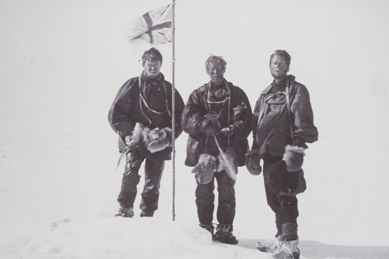
The Australasian Antarctic Expedition was a 1911–1914 expedition headed by Douglas Mawson that explored the largely uncharted Antarctic coast due south of Australia. Mawson had been inspired to lead his own venture by his experiences on Ernest Shackleton's ''Nimrod'' expedition in 1907–1909. During its time in Antarctica, the expedition's sledging parties covered around of unexplored territory, while its ship, , navigated of unmapped coastline. Scientific activities included meteorological measurements, magnetic observations, an expansive oceanographic program, and the collection of many biological and geological samples, including the discovery of the first meteorite found in Antarctica. The expedition was the first to establish and maintain wireless contact between Antarctica and Australia. Another planned innovation – the use of an aircraft – was thwarted by an accident before the expedition sailed. The plane's fuselage was adapted to form a motorised sledge or " ... [...More Info...] [...Related Items...] OR: [Wikipedia] [Google] [Baidu] |
Gillies Islands
The Gillies Islands () are three small, rocky islands protruding above Shackleton Ice Shelf 3 nautical miles (6 km) north of Cape Moyes. Discovered by the Western Base Party of the Australasian Antarctic Expedition under Douglas Mawson, 1911–14, and named for F.J. Gillies, chief engineer of the ship ''Aurora''. Astronomical control was established on the central island An island (or isle) is an isolated piece of habitat that is surrounded by a dramatically different habitat, such as water. Very small islands such as emergent land features on atolls can be called islets, skerries, cays or keys. An island ... by U.S. Navy Operation Windmill personnel in January 1948. See also * List of antarctic and sub-antarctic islands References Islands of Queen Mary Land {{QueenMaryLand-geo-stub ... [...More Info...] [...Related Items...] OR: [Wikipedia] [Google] [Baidu] |
Bigelow Rock
Bigelow Rock () is a low, ice-covered rock about long, with numerous rock exposures close above sea level, lying immediately west of Shackleton Ice Shelf, about northeast of Junction Corner. It was delineated from aerial photographs taken by U.S. Navy Operation Highjump (OpHjp), 1946–47. An astronomical control station was established on the rock by U.S. Navy Operation Windmill (OpWml), 1947–48. It was named by the Advisory Committee on Antarctic Names for Technical Sergeant George H. Bigelow, United States Marine Corps The United States Marine Corps (USMC), also referred to as the United States Marines, is the maritime land force service branch of the United States Armed Forces responsible for conducting expeditionary and amphibious operations through combi ..., a tractor driver-mechanic with OpHjp and OpWml. References Rock formations of Queen Mary Land {{QueenMaryLand-geo-stub ... [...More Info...] [...Related Items...] OR: [Wikipedia] [Google] [Baidu] |
Roscoe Glacier
Roscoe Glacier () is an Antarctic channel glacier, 12 nautical miles (22 km) long and 3 to 5 nautical miles (9 km) wide, debouching from a small valley onto the west portion of Shackleton Ice Shelf, midway between Cape Moyes and Junction Corner. Charted as a valley depression during a southern reconnaissance in March 1912 by F. Wild and other members of the Western Base Party of the Australasian Antarctic Expedition under Mawson. Delineated from aerial photographs taken by U.S. Navy Operation Highjump, 1946–47, and named by the Advisory Committee on Antarctic Names (US-ACAN) for John H. Roscoe, geographer, author of Antarctic Bibliography (Washington, 1951), and scientific advisor to the director of United States Antarctic Program. Roscoe served as photogrammetrist with the central task group of U.S. Navy Operation Highjump, 1946–47, and with U.S. Navy Operation Windmill, 1947–48, and assisted the latter group in establishing astronomical control stations alon ... [...More Info...] [...Related Items...] OR: [Wikipedia] [Google] [Baidu] |
Mirny Station
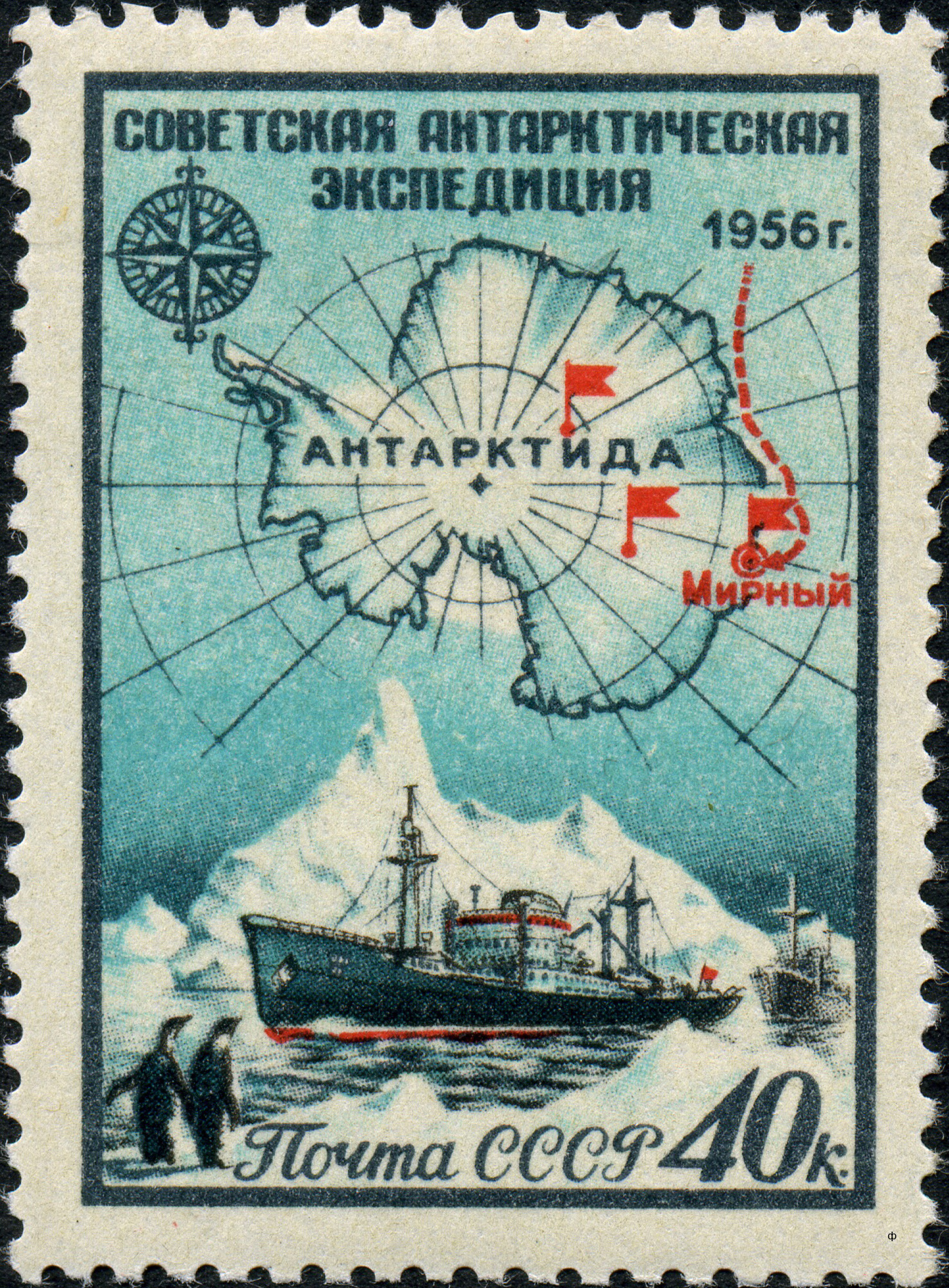
The Mirny Station (russian: Мирный, literally ''Peaceful'') is a Russian (formerly Soviet) first Antarctic science station located in Queen Mary Land, Antarctica, on the Antarctic coast of the Davis Sea. The station is managed by the Arctic and Antarctic Research Institute and was named after the support vessel '' Mirny'' captained by Mikhail Lazarev during the First Russian Antarctic Expedition, led by Fabian Gottlieb von Bellingshausen on ''Vostok''. Mirny Station was damaged by a fire on Sunday 21 June 2020. Purpose and facilities The station was opened on February 13, 1956, by the 1st Soviet Antarctic Expedition. It was originally used as main base for the Vostok Station located from the coast, this function is now served by Progress Station. In summer, it hosts up to 169-200 people in 30 buildings, in winter about 40-50 scientists and technicians. The average temperature at the location is , and on more than 200 days per year the wind is stronger than , with occa ... [...More Info...] [...Related Items...] OR: [Wikipedia] [Google] [Baidu] |
Russia
Russia (, , ), or the Russian Federation, is a List of transcontinental countries, transcontinental country spanning Eastern Europe and North Asia, Northern Asia. It is the List of countries and dependencies by area, largest country in the world, with its internationally recognised territory covering , and encompassing one-eighth of Earth's inhabitable landmass. Russia extends across Time in Russia, eleven time zones and shares Borders of Russia, land boundaries with fourteen countries, more than List of countries and territories by land borders, any other country but China. It is the List of countries and dependencies by population, world's ninth-most populous country and List of European countries by population, Europe's most populous country, with a population of 146 million people. The country's capital and List of cities and towns in Russia by population, largest city is Moscow, the List of European cities by population within city limits, largest city entirely within E ... [...More Info...] [...Related Items...] OR: [Wikipedia] [Google] [Baidu] |


