|
Dag Ismail Khel
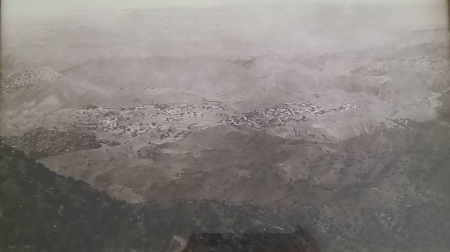
Dak Ismail Khel is a village in Pabbi Tehsil of Nowshera District of Khyber Pakhtunkhwa, Pakistan. It is surrounded by other small villages i.e. Chapri, Saleh Khana, Spin Khak Spin Khak is a village in Pabbi Tehsil of Nowshera District of Khyber Pakhtunkhwa, Pakistan. It is located at 33°52'0N 71°46'0E and lies 45 kilometres south of Peshawar Peshawar (; ps, پېښور ; hnd, ; ; ur, ) is the sixth most ..., Jaroba and Jalozai. Dak Ismail Khel is the largest village with respect to both area and population in the region. Villages named Chapri, Spinkhak and Jaroba are originated from the village Dak Ismail Khel. References {{Coord, 33, 51, N, 71, 49, E, display=title, region:PK_type:city_source:GNS-enwiki Populated places in Nowshera District ... [...More Info...] [...Related Items...] OR: [Wikipedia] [Google] [Baidu] |
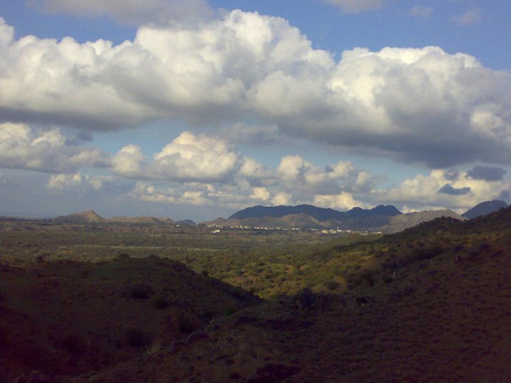
Beautiful View , Dak Ismail Khel 2014-01-14 11-36
Beautiful, an adjective used to describe things as possessing beauty, may refer to: Film and theater * ''Beautiful'' (2000 film), an American film directed by Sally Field * ''Beautiful'' (2008 film), a South Korean film directed by Juhn Jai-hong * ''Beautiful'' (2009 film), an Australian film directed by Dean O'Flaherty * ''Beautiful'' (2011 film), an Indian Malayalam-language film directed by V. K. Prakash * '' Beautiful: The Carole King Musical'', a 2014 Broadway musical Music * The Beautiful (band), an American rock band 1988–1993 Albums * ''Beautiful'' (Candido Camero album) or the title song, 1970 *''Beautiful!'', by Charles McPherson, 1975 * ''Beautiful'' (David Tao album), 2006 * ''Beautiful'' (Fantastic Plastic Machine album), 2001 * ''Beautiful'' (Fish Leong album), 2003 * ''Beautiful'' (Jessica Mauboy album) or the title song (see below), 2013 * ''Beautiful'' (Meg album) or the title song, 2009 * ''Beautiful'' (The Reels album), 1982 * ''Beautiful'' (Te ... [...More Info...] [...Related Items...] OR: [Wikipedia] [Google] [Baidu] |
Pabbi Tehsil
Pabbi is a tehsil located in Nowshera District, Khyber-Pakhtunkhwa, Pakistan. The tehsil is named after the Pabbi town, which is located on the GT Road. Overview Pabbi become tehsil in 2008, when NWFP (now Khyber Pakhtunkhwa) caretaker chief minister Shamsul Mulk declared it a tehsil of Nowshera district. The head quarter of Pabbi tehsil is Pabbi town, which is located on Grand Trunk (GT) road. Pabbi tehsil covers the jurisdiction from Taro Jabba to Azakhel Payan and Cherat. Pabbi is 20 kilometers (12 miles) from Peshawar, the capital of Khyber Pukhtunkhwa province. Pabbi is a birthplace of Gul Hassan Khan was a former lieutenant-general and the last Commander-in-Chief of Pakistan Army. Pabbi is hub of precast concrete industries located at main GT road in Chowki Mumraiz. Currently, there are 43 precast concrete industries are functional in Pabbi which supply different items to the entire Khyber Paktunkhwa and to some parts of the Punjab. Administration Pabbi is a par ... [...More Info...] [...Related Items...] OR: [Wikipedia] [Google] [Baidu] |
Nowshera District
Nowshera District ( ps, نوښار ولسوالۍ, ur, ) is a district in Peshawar Division of Khyber Pakhtunkhwa province in Pakistan. The capital and district headquarter is Nowshera city. Overview and history Nowshera was a tehsil (sub division) of Peshawar until 1988, when it became a district. It is bordered by Peshawar District to the West, Mardan District to the North, Charsadda District to the North West, Swabi District to the North East, Kohat District to the South, Orakzai Agency to the South West & Attock District to the East. Previously it was known as Nowkhaar Province till it was annexed into British India via the Durand Line Agreement. Prior to its establishment as a separate district in 1990, Nowshera was part of Peshawar District. The district was also part of the Peshawar Division until the reforms of The Government of Pakistan. Total area of Nowshera is 1,748 km². The population density is 608 persons per square kilometre. The total agricultural a ... [...More Info...] [...Related Items...] OR: [Wikipedia] [Google] [Baidu] |
Khyber Pakhtunkhwa
Khyber Pakhtunkhwa (; ps, خېبر پښتونخوا; Urdu, Hindko: خیبر پختونخوا) commonly abbreviated as KP or KPK, is one of the Administrative units of Pakistan, four provinces of Pakistan. Located in the Geography of Pakistan, northwestern region of the country, Khyber Pakhtunkhwa is the smallest province of Pakistan by land area and the Demographics of Pakistan, third-largest province by population after Punjab, Pakistan, Punjab and Sindh. It shares land borders with the Pakistani provinces of Balochistan, Pakistan, Balochistan to the south, Punjab, Pakistan, Punjab to the south-east and province of Gilgit-Baltistan to the north and north-east, as well as Islamabad Capital Territory to the east, Azad Jammu and Kashmir, Autonomous Territory of Azad Jammu and Kashmir to the north-east. It shares an Durand Line, international border with Afghanistan to the west. Khyber Pakhtunkhwa is known as a tourist hot spot for adventurers and explorers and has a varied landsca ... [...More Info...] [...Related Items...] OR: [Wikipedia] [Google] [Baidu] |
Chapri, Nowshera
Chapri is a hill station in Pabbi Tehsil of Nowshera District, Khyber Pakhtunkhwa province of Pakistan. Known locally as Sapara in Pashtoo and called Chapri in Urdu and English, it is one of the far-flung villages of the Nowshera District. It lies roughly from Main GT Road Tehsel Pabbi. The People of Chapri are a very straightforward people. Village Chapri is surrounded by big mountains. Other settlements, i.e. Dak Ismail Khel, Saleh Khana, Spin Khak, Jaroba, and Cherat Cantonment are neighbouring villages. Chapri is a small village with respect to population in the area. Village Chapri originated from Village Dak Ismail Khel. The people of Chapri are engaged in various businesses, public/private services, and jobs/services abroad. History British Period During British rule Cherat & Chapri was important as a hill cantonment and sanitarium for British troops in what was then the Nowshera Tehsil of the Peshawar District of British India. Cherat was first used as a sanitarium for ... [...More Info...] [...Related Items...] OR: [Wikipedia] [Google] [Baidu] |
Saleh Khana
Saleh Khana is a large village in the Nowshera District of the Khyber Pakhtunkhwa Province located just below the Cherat mountains, The people of this village are Pashtuns of the Khattak tribe. Like other parts of Pakistan, many people live overseas for work, the people of this village are spread throughout the world, with 60% living abroad. Among the countries where one can find residents of this village are, to name a few, the United Kingdom, UK, United States, USA, United Arab Emirates, UAE, Canada, Australia, and Malaysia. The majority can be found in the UK, mainly in Birmingham, Manchester, and Aylesbury. This has earned the village the name of "little England" due to most of its residents having dual citizenship in the UK. Originally, the residents moved aboard during the early 1960s to earn and send income back home. However, as time passed, many decided to stay abroad settling with dual citizenship and regularly travelling back and forth occasionally. The villag ... [...More Info...] [...Related Items...] OR: [Wikipedia] [Google] [Baidu] |
Spin Khak
Spin Khak is a village in Pabbi Tehsil of Nowshera District of Khyber Pakhtunkhwa, Pakistan. It is located at 33°52'0N 71°46'0E and lies 45 kilometres south of Peshawar Peshawar (; ps, پېښور ; hnd, ; ; ur, ) is the sixth most populous city in Pakistan, with a population of over 2.3 million. It is situated in the north-west of the country, close to the International border with Afghanistan. It is ... at an altitude of 483 metres (1587 feet). References Populated places in Nowshera District {{NowsheraPK-geo-stub ... [...More Info...] [...Related Items...] OR: [Wikipedia] [Google] [Baidu] |
Jalozai
Jalozai ( ps, جلوزی), also Jallozai, Jailozai, and Jelazee, is a village located in Nowshera District of Khyber Pakhtunkhwa Pakistan. Jalozai is famous for an Afghan refugee camp which is located about 35 kilometres southeast of Peshawar near the Afghanistan–Pakistan border. Summarized transcript (.pdf) from Adel Hassan Hamad's ''Administrative Review Board hearing'' - page 248 Overview Jalozai is located in Pabbi Tehsil of Nowshera District in Khyber Pakhtunkhwa Pakistan. The most notable attraction of Jalozai are the University of Engineering and Technology Peshawar campus, which was constructed at the cost of Rs.5.56 Billion on a 400-acre land, and the Jalozai Refugee Camp. Jalozai Refugee Camp It was one of the largest of 150 refugee or transit camps in Pakistan, holding Afghan refugees from the 1980s Soviet invasion of Afghanistan. It had an estimated 70,000 refugees at its peak. New Jalozai adjoined the original Jalozai camp in November 2000, taking in a new wav ... [...More Info...] [...Related Items...] OR: [Wikipedia] [Google] [Baidu] |

