|
Děvín In Moravia (Pavlov Hills)
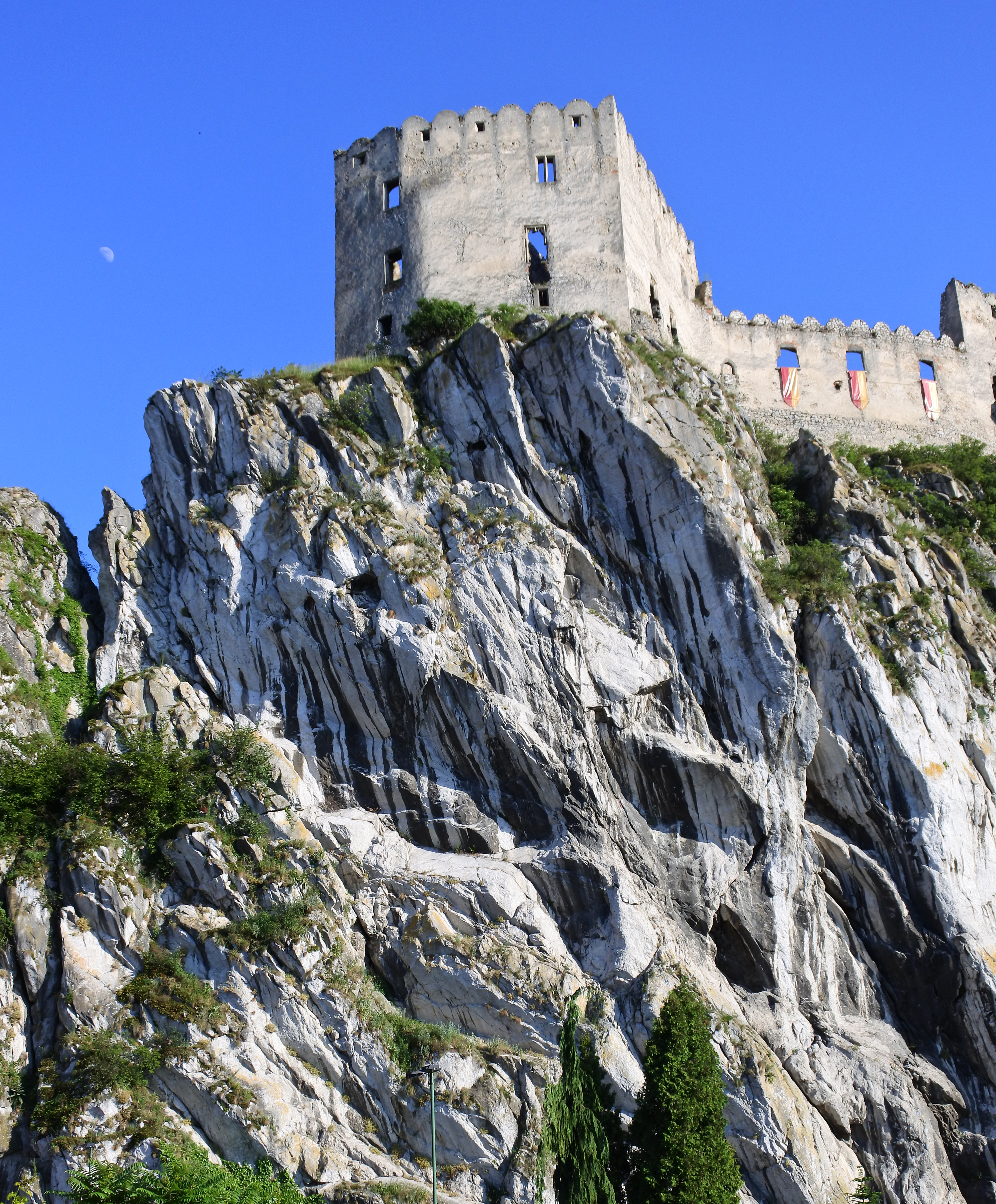
Děvín (german: Mayden Berg) is a double peak mountain in the Pavlov municipality in the South Moravian Region of the Czech Republic. With an elevation of , it is the highest mountain of the Pavlov Hills within the Mikulov Highlands, and of the Pálava Protected Landscape Area. It is located right on trace where runs line of drainage divide of Upper Thaya drainage and Thaya/Morava mesodrainage. History The summit of Děvín has the remains of a huge Iron Age hill fort, while the ancient Amber Route runs neighbors of the mountains base, and all archaic roads in landscape, originally created by animals and later overtaken by humans. The area around base of the mountain is permanently settled longer than last 30,000 years. Since Cromagnos hunters, ower Celtic tribes settlement, Roman fortress, Great Moravia hillforts ( Strachotín and Děvín). Geology The entire Děvín massif consists mainly by Jurassic limestone, i.e. series of rocks generated during sedimentation. The b ... [...More Info...] [...Related Items...] OR: [Wikipedia] [Google] [Baidu] |
Pavlov (Břeclav District)
Pavlov (german: Pollau) is a municipality and village in Břeclav District in the South Moravian Region of the Czech Republic. It has about 600 inhabitants. Geography Pavlov lies approximately northwest of Břeclav and south of Brno. It lies in the Pavlov Hills within the Mikulov Highlands. The village lies under the Děvín mountain, which is the highest mountain of the municipality and of the entire region with an elevation of . Pavlov is located in the Pálava Protected Landscape Area. See also *Pavlovian culture The Pavlovian is an Upper Paleolithic culture, a variant of the Gravettian, that existed in the region of Moravia, northern Austria and southern Poland around 29,000–25,000 years BP. The culture used sophisticated stone age technology to survive ... References Villages in Břeclav District {{SouthMoravia-geo-stub ... [...More Info...] [...Related Items...] OR: [Wikipedia] [Google] [Baidu] |
Great Moravia
Great Moravia ( la, Regnum Marahensium; el, Μεγάλη Μοραβία, ''Meghálī Moravía''; cz, Velká Morava ; sk, Veľká Morava ; pl, Wielkie Morawy), or simply Moravia, was the first major state that was predominantly West Slavs, West Slavic to emerge in the area of Central Europe, possibly including territories which are today part of the Czech Republic, Slovakia, Hungary, Austria, Germany, Poland, Romania, Croatia, Serbia and Ukraine. The only formation preceding it in these territories was Samo's Empire, Samo's tribal union known from between 631 and 658 AD. Its core territory is the region now called Moravia in the eastern part of the Czech Republic alongside the Morava (river), Morava River, which gave its name to the kingdom. The kingdom saw the rise of the first ever Slavic literary culture in the Old Church Slavonic language as well as the expansion of Christianity, first via missionaries from East Francia, and later after the arrival of Saints Cyril and Metho ... [...More Info...] [...Related Items...] OR: [Wikipedia] [Google] [Baidu] |
Northern Limestone Alps
The Northern Limestone Alps (german: Nördliche Kalkalpen), also called the Northern Calcareous Alps, are the ranges of the Eastern Alps north of the Central Eastern Alps located in Austria and the adjacent Bavarian lands of southeastern Germany. The distinction from the latter group, where the higher peaks are located, is based on differences in geological composition. Geography If viewed on a west–east axis, the Northern Limestone Alps extend from the Rhine valley and the Bregenz Forest in Vorarlberg, Austria in the west extending along the border between the German federal-state of Bavaria and Austrian Tyrol, through Salzburg, Upper Austria, Styria and Lower Austria and finally ending at the Wienerwald at the city-limits of Vienna in the east. The highest peaks in the Northern Limestone Alps are the Parseierspitze () in the Lechtal Alps,Reynolds, Kev (2010). ''Walking in the Alps'', Cicerone, . and the Hoher Dachstein (). Other notable peaks in this range include the Zugs ... [...More Info...] [...Related Items...] OR: [Wikipedia] [Google] [Baidu] |
Flysch
Flysch () is a sequence of sedimentary rock layers that progress from deep-water and turbidity flow deposits to shallow-water shales and sandstones. It is deposited when a deep basin forms rapidly on the continental side of a mountain building episode. Examples are found near the North American Cordillera, the Alps, the Pyrenees and the Carpathians. Sedimentological properties Flysch consists of repeated sedimentary cycles with upwards fining of the sediments. There are sometimes coarse conglomerates or breccias at the bottom of each cycle, which gradually evolve upwards into sandstone and shale/mudstone. Flysch typically consists of a sequence of shales rhythmically interbedded with thin, hard, graywacke-like sandstones. Typically the shales do not contain many fossils, while the coarser sandstones often have fractions of micas and glauconite. Tectonics In a continental collision, a subducting tectonic plate pushes on the plate above it, making the rock fold, often to th ... [...More Info...] [...Related Items...] OR: [Wikipedia] [Google] [Baidu] |
Klentnice
Klentnice (german: Klentnitz) is a municipality and village in Břeclav District in the South Moravian Region of the Czech Republic. It has about 500 inhabitants. Geography Klentnice lies about northwest of Břeclav. It lies in the Pavlov Hills within the Mikulov Highlands. The village is situated on the eastern slope of the hill Stolová hora ( above sea level). The highest point of the municipality is the slope of the hill Obora with an elevation of about . Klentnice is located in the Pálava Protected Landscape Area. History Grave findings of the La Tène culture are documents of an early settlement. In the times of Great Moravia, the area was inhabited by Slavs. After the empire fell, the inhabitants were replaced by German colonists. The first written mention of Klentnice is from 1322, when it was part of the Mikulov estate. As a part of the Mikulov estate, it was owned by the House of Liechtenstein. They contributed to cultural and ethnic enrichment when they invited Jews ... [...More Info...] [...Related Items...] OR: [Wikipedia] [Google] [Baidu] |
Claystone
Mudrocks are a class of fine-grained siliciclastic sedimentary rocks. The varying types of mudrocks include siltstone, claystone, mudstone, slate, and shale. Most of the particles of which the stone is composed are less than and are too small to study readily in the field. At first sight, the rock types appear quite similar; however, there are important differences in composition and nomenclature. There has been a great deal of disagreement involving the classification of mudrocks. A few important hurdles to their classification include the following: # Mudrocks are the least understood and among the most understudied sedimentary rocks to date. # Studying mudrock constituents is difficult due to their diminutive size and susceptibility to weathering on outcrops. # And most importantly, scientists accept more than one classification scheme. Mudrocks make up 50% of the sedimentary rocks in the geologic record and are easily the most widespread deposits on Earth. Fine sedimen ... [...More Info...] [...Related Items...] OR: [Wikipedia] [Google] [Baidu] |
Calcareous
Calcareous () is an adjective meaning "mostly or partly composed of calcium carbonate", in other words, containing lime or being chalky. The term is used in a wide variety of scientific disciplines. In zoology ''Calcareous'' is used as an adjectival term applied to anatomical structures which are made primarily of calcium carbonate, in animals such as gastropods, i.e., snails, specifically about such structures as the operculum, the clausilium, and the love dart. The term also applies to the calcium carbonate tests of often more or less microscopic Foraminifera. Not all tests are calcareous; diatoms and radiolaria have siliceous tests. The molluscs are calcareous, as are calcareous sponges ( Porifera), that have spicules which are made of calcium carbonate. In botany ''Calcareous grassland'' is a form of grassland characteristic of soils containing much calcium carbonate from underlying chalk or limestone rock. In medicine The term is used in pathology, for example i ... [...More Info...] [...Related Items...] OR: [Wikipedia] [Google] [Baidu] |
Ernstbrunn Formation
The Ernstbrunn Formation is a geologic formation in Austria and the Czech Republic. It preserves fossils dated to the Jurassic The Jurassic ( ) is a Geological period, geologic period and System (stratigraphy), stratigraphic system that spanned from the end of the Triassic Period million years ago (Mya) to the beginning of the Cretaceous Period, approximately Mya. The J ... period. See also * List of fossiliferous stratigraphic units in Austria References * Geologic formations of Austria Geologic formations of the Czech Republic Jurassic Austria Jurassic System of Europe Tithonian Stage {{Jurassic-stub ... [...More Info...] [...Related Items...] OR: [Wikipedia] [Google] [Baidu] |
Late Jurassic
The Late Jurassic is the third epoch of the Jurassic Period, and it spans the geologic time from 163.5 ± 1.0 to 145.0 ± 0.8 million years ago (Ma), which is preserved in Upper Jurassic strata.Owen 1987. In European lithostratigraphy, the name "Malm" indicates rocks of Late Jurassic age. In the past, ''Malm'' was also used to indicate the unit of geological time, but this usage is now discouraged to make a clear distinction between lithostratigraphic and geochronologic/chronostratigraphic units. Subdivisions The Late Jurassic is divided into three ages, which correspond with the three (faunal) stages of Upper Jurassic rock: Paleogeography During the Late Jurassic Epoch, Pangaea broke up into two supercontinents, Laurasia to the north, and Gondwana to the south. The result of this break-up was the spawning of the Atlantic Ocean. However, at this time, the Atlantic Ocean was relatively narrow. Life forms of the epoch This epoch is well known for many famous types of dinosau ... [...More Info...] [...Related Items...] OR: [Wikipedia] [Google] [Baidu] |
White Limestone Group
The White Limestone Group is a geologic group in Jamaica. It preserves fossils dating back to the Paleogene period. See also * List of fossiliferous stratigraphic units in Jamaica The Paleobiology Database lists no known fossiliferous stratigraphic units in Dominica, Saint Kitts and Nevis, Saint Lucia, Saint Vincent and the Grenadines. The database also records no fossiliferous stratigraphic units within several regions of t ... References * Limestone formations Paleogene Jamaica Geologic groups of North America Geologic formations of Jamaica Geologic formations of the Caribbean {{Jamaica-geologic-formation-stub ... [...More Info...] [...Related Items...] OR: [Wikipedia] [Google] [Baidu] |
Klippe
350px, Schematic overview of a thrust system. The shaded material is called a window_(geology).html"_;"title="nappe._The_erosional_hole_is_called_a__window_(geology)">window_or_fenster._The_klippe_is_the_isolated_block_of_the_nappe_overlying_autochthonous_material. A_klippe_(German_language.html" "title="window (geology)">window or fenster. The klippe is the isolated block of the nappe overlying autochthonous material.">window_(geology).html" ;"title="nappe. The erosional hole is called a window (geology)">window or fenster. The klippe is the isolated block of the nappe overlying autochthonous material. A klippe (German language">German for cliff or crag) is a geological feature of thrust fault terrains. The klippe is the remnant portion of a nappe after erosion has removed connecting portions of the nappe. This process results in an outlier of exotic, often nearly horizontally translated strata overlying autochthonous strata. Examples of klippes include: *Chief Mountain, Mont ... [...More Info...] [...Related Items...] OR: [Wikipedia] [Google] [Baidu] |
Sedimentation
Sedimentation is the deposition of sediments. It takes place when particles in suspension settle out of the fluid in which they are entrained and come to rest against a barrier. This is due to their motion through the fluid in response to the forces acting on them: these forces can be due to gravity, centrifugal acceleration, or electromagnetism. Settling is the falling of suspended particles through the liquid, whereas sedimentation is the final result of the settling process. In geology, sedimentation is the deposition of sediments which results in the formation of sedimentary rock. The term is broadly applied to the entire range of processes that result in the formation of sedimentary rock, from initial erosion through sediment transport and settling to the lithification of the sediments. However, the strict geological definition of sedimentation is the mechanical deposition of sediment particles from an initial suspension in air or water. Sedimentation may pertain to ob ... [...More Info...] [...Related Items...] OR: [Wikipedia] [Google] [Baidu] |


