|
Divisions Of Uttar Pradesh
The northern Indian state of Uttar Pradesh, which borders Nepal, comprises 18 administrative divisions. Within these 18 divisions, there are a total of 75 districts. The following table shows the name of each division, its administrative capital city, its constituent districts, and a map of its location. See also * Districts of Uttar Pradesh Uttar Pradesh, the most populous state in India, has 75 districts. These districts, most of which have populations above 10 lakhs, and are grouped into 18 divisions for administrative convenience. Division wise listing of districts Area-w ... * List of RTO districts in Uttar Pradesh {{DEFAULTSORT:Divisions Of Uttar Pradesh ... [...More Info...] [...Related Items...] OR: [Wikipedia] [Google] [Baidu] |
Allahabad Division
Allahabad division, officially known as Prayagraj division, is an administrative unit of Indian state of Uttar Pradesh. In 2000, when Uttar Pradesh was reorganised by forming Uttaranchal out of its northern areas, Allahabad division and the district was majorly reorganised too. The Etawah, Farrukhabad and Kanpur district districts of the Allahabad division were made into a separate Kanpur division. Parts of the western areas of Allahabad district were carved out to create a new district named Kaushambi. At the same time, Pratapgarh district, that falls in Awadh, was included in the Allahabad division. Since 2000 Allahabad division consists of the following districts: * Allahabad district (officially known as Prayagraj district since October 2018) * Fatehpur district * Kaushambi district * Pratapgarh district Prior to 2000 Allahabad division consisted of all the districts of the lower Doab: * Allahabad district * Etawah district * Farrukhabad district * Fatehpur dis ... [...More Info...] [...Related Items...] OR: [Wikipedia] [Google] [Baidu] |
Bareilly
Bareilly () is a city in Bareilly district in the Indian state of Uttar Pradesh. It is among the largest metropolises in Western Uttar Pradesh and is the centre of the Bareilly division as well as the historical region of Rohilkhand. The city lies in the Indo-Gangetic Plains, about north west of the state capital, Lucknow, and east of the national capital, New Delhi. With a population of 898,167 in 2011, it is the eighth most populous city in the state, seventeenth in northern India and fifty-fourth in India. It is located on the bank of Ramganga River and is the site of the Ramganga Barrage built for canal irrigation. The earliest settlement in what is now Bareilly was established in 1537 by Jagat Singh Katehriya who named it 'Bans-Bareli' after his two sons Bansaldev and Bareldev. The town came under the rule of Mughals in 1569 and had become the capital of a local pargana by 1596. The foundation of the modern city of Bareilly was laid by Mughal governor Mukrand ... [...More Info...] [...Related Items...] OR: [Wikipedia] [Google] [Baidu] |
Bareilly Division
Bareilly division is an administrative geographical unit of Uttar Pradesh state of India. Bareilly is the administrative headquarters of the division. Part of the Rohilkhand region, Bareilly division has four major cities in west Uttar Pradesh - Bareilly, Badaun, Pilibhit and Shahjahanpur. Bareilly is the medical hub of Uttar Pradesh, one of the biggest industrial areas and the third fastest developing city of Uttar Pradesh. Budaun is a politically sensational and historical city and has many historical sites, one of the oldest existing city of India, and was the capital of India during Iltutmish's rule. It is also the sixth fastest developing city in Uttar Pradesh. Shahjahanpur is also one of the main cities of west Uttar Pradesh. Currently (2005), the division consists of the districts of * Bareilly District * Badaun District * Pilibhit District * Shahjahanpur District Major cities * Bareilly * Budaun * Shahjahanpur * Ujhani * Pilibhit * Puranpur * Faridpur * S ... [...More Info...] [...Related Items...] OR: [Wikipedia] [Google] [Baidu] |
Mau District
Mau district is one of the districts of Uttar Pradesh state of India, and Mau town is the district headquarters which is also one of the few remaining areas of handloom saree production in eastern Uttar Pradesh, specializing in Sadiya silk sarees. Mau was carved out as a separate district from Azamgarh on 19 November 1988. It is situated in the south-eastern part of the state with headquarters in Maunath Bhanjan. The district is surrounded by Ghazipur district on the south, Ballia district in the east, Azamgarh district in the west, and by Gorakhpur and Deoria districts on the north. History From historical and archaeological point of views, Mau is one of the oldest place in the region. Ancient cultural and archaeological remains have been found at multiple places in the area giving enough evidence of long history of human habitat in the area. The known archaeological history of Mau is about 1500 years old, when the entire area was covered under thick dense forest. T ... [...More Info...] [...Related Items...] OR: [Wikipedia] [Google] [Baidu] |
Ballia District
Ballia district is one of the districts of Uttar Pradesh, India. Ballia district is a part of Azamgarh division situated in the east of Uttar Pradesh. The main economic activity is agriculture. City is the district headquarters and commercial market of this district. It is the birthplace of former prime minister of India Chandra Sekhar Singh There are six tehsils in this district: Ballia, Bansdih, Rasra, Bairia, Sikandarpur and Belthara. Rasra is the second major commercial area of the district, having a government sugar mill and a cotton weaving industry. Though Ballia's core occupation is agriculture there are some additional small industries. Maniar is known for its bindi industry and is a major supplier. History There is a temple of Kameshwar Dham in Ballia district of Uttar Pradesh. The specialty of this temple is that here Lord Shiva got angry and consumed Kamadeva. Lord Shri Ram, Lakshmana had come along with Maharishi Vishvamitra to this land. Sage Durvas ... [...More Info...] [...Related Items...] OR: [Wikipedia] [Google] [Baidu] |
Azamgarh District
Azamgarh district is one of the three districts of Azamgarh division in the Indian state of Uttar Pradesh. Etymology The district is named after its headquarters town, Azamgarh. Azam, a son of Vikramajit, founded the town in 1665. Vikramajit, a descendant of Gautam of Mehnagar in pargana Nizamabad, had embraced the faith of Islam. He had two sons, namely, Azam and Azmat. It is also known as land of the sage Durvasa whose ashram was located in Phulpur sub-district, near the confluence of Tons and Majhuee river, north from the Phulpur sub-district headquarters. History Towards the end of the 16th century, a Gautam Rajput from Azamgarh district was assimilated into the Mughal court at Delhi, where he had gone in search of greater influence. His mission was a success, with the royal court eventually awarding him 22 parganas in the Azamgarh region that marked the establishment of a family line which culminated in his descendants becoming rajas of the area. This was a typical ... [...More Info...] [...Related Items...] OR: [Wikipedia] [Google] [Baidu] |
Azamgarh
Azamgarh is a city in the Indian state of Uttar Pradesh. It is the headquarters of Azamgarh division, which consists of Ballia, Mau and Azamgarh districts. Azamgarh is situated on the bank of Tamsa River (Tons). It is located east of the state capital Lucknow and 809 km from national capital, Delhi. History Azamgarh, one of the easternmost districts(a district in Purvanchal sub-region) of Uttar Pradesh, once formed a part of the ancient Kosala kingdom, except its north-eastern part. Azamgarh is also known as the land of the sage Durvasa whose ashram was located in Phulpur tehsil, near the confluence of Tamsa and Majhuee rivers, north of the Phulpur. The district is named after its headquarters town, Azamgarh, which was founded in 1665 by Azam, son of Vikramajit. Vikramajit was a descendant of Gautam Rajputs of Mehnagar in Pargana Nizamabad who like some of his predecessors had embraced the faith of Islam. He had a Muslim wife who bore him two sons Azam and Azmat ... [...More Info...] [...Related Items...] OR: [Wikipedia] [Google] [Baidu] |
Azamgarh Division
Azamgarh division is an administrative unit of Indian state of Uttar Pradesh. Azamgarh division consists of:- * Azamgarh District * Ballia District * Mau District See also * Districts of Uttar Pradesh Uttar Pradesh, the most populous state in India, has 75 districts. These districts, most of which have populations above 10 lakhs, and are grouped into 18 divisions for administrative convenience. Division wise listing of districts Area-w ... References Divisions of Uttar Pradesh {{Azamgarh-geo-stub ... [...More Info...] [...Related Items...] OR: [Wikipedia] [Google] [Baidu] |
Pratapgarh District, Uttar Pradesh
The Pratapgarh district is one of the districts of Uttar Pradesh state of India, and Pratapgarh city is the district headquarters. Pratapgarh district is a part of Allahabad division. The total area of Pratapgarh district is 3730 Sq. Km. Wildlife The district has Ganga Dolphins in its river. History The City pratapgarh is named by famous King of Somvanshi Dynasty, Raja pratap bahadur singh a rajput ruler who made a castle named pratapgarh After time around the areas of the castle was also known by, pratapgarh; In 1928, the arrival of Simon Commission in India led to widespread agitations against the British government. Many of the Talukdars took the lead in the movement and openly displayed their opposition against the Imperial Government. On July 10, the Congress politician Jawaharlal Nehru and Mohanlal Saxena, visited the Pratapgarh district to address a public meeting at Hadi Hall (in Bela Pratapgarh), they were welcomed by Brajesh Singh. The district was also visited ... [...More Info...] [...Related Items...] OR: [Wikipedia] [Google] [Baidu] |
Kaushambi District
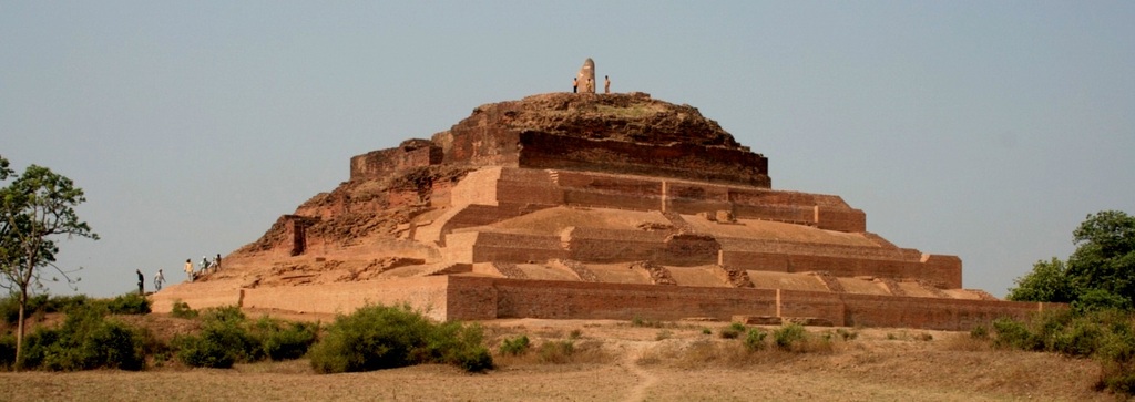
Kaushambi district is a district in the state of Uttar Pradesh in India. Manjhanpur is the district headquarters. The district was carved from Allahabad district on 4 April 1997. Manauri bajar connects Allahabad and Kaushambi districts by railway over a bridge on SH-95. Manjhanpur is south-west of Allahabad on the north bank of the Yamuna river, about from the city. It is surrounded by Chitrakoot district on the south, Pratapgarh district on the north, Allahabad district on the east and Fatehpur district on the west. Kaushambi is part of Allahabad division. The nearest railway station, in Bharwari, connects with Delhi, Allahabad, Kolkata, Gaya and Kanpur. Mythology and history Kaushambi was the capital of the ancient Indian Vatsa Mahajanapada, one of 16 such kingdoms. According to the Puranas, Vatsa was named after a Kāśī king. The ''Ramayana'' and the ''Mahabharata'' attribute the founding of its capital' Kauśāmbī, to a Chedi prince (Kuśa or Kuśāmba). The P ... [...More Info...] [...Related Items...] OR: [Wikipedia] [Google] [Baidu] |


