|
Devil's Gap Road
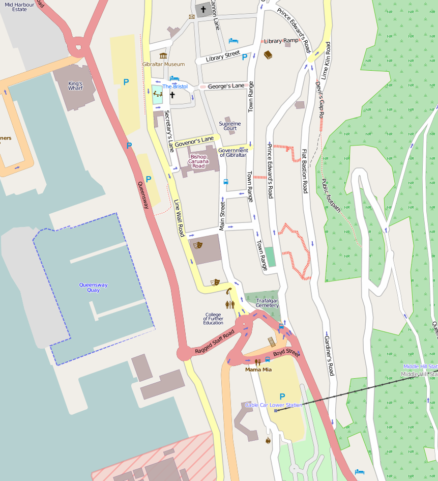
Devil's Gap Road (''Escalera del Monte'' in Spanish) is a street in the British Overseas Territory of Gibraltar. Description It lies between its junction with Flat Bastion Road in the southern direction and joins Baca's Passage in the northern direction. This street is the quickest route by foot from the city centre to the Upper Rock Nature Reserve The Gibraltar Nature Reserve (formerly the Upper Rock Nature Reserve) is a protected nature reserve in the British Overseas Territory of Gibraltar that covers over 40% of the country's land area. It was established as the Upper Rock Nature Rese .... The Devil's Gap Footpath leads up from where Devil's Gap Road meets Baca's Passage and joins Green Lane near Devil's Gap Battery in the nature reserve. Painting The street is also known as the ''Union Jack Steps'' or ''Referendum Steps'' and was originally painted in 1967 to celebrate Gibraltar's first sovereignty referendum of that year. In August 2011, the steps were repainted i ... [...More Info...] [...Related Items...] OR: [Wikipedia] [Google] [Baidu] |
Union Flag
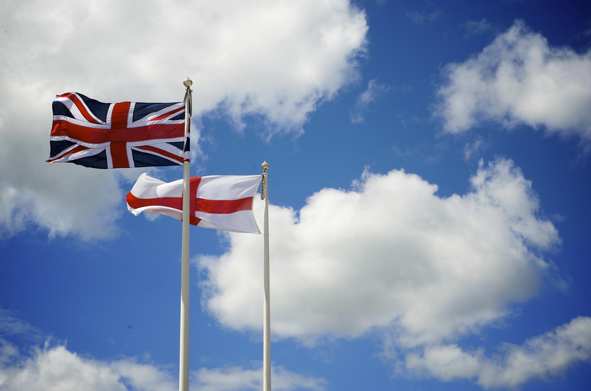
The Union Jack, or Union Flag, is the ''de facto'' national flag of the United Kingdom. Although no law has been passed making the Union Flag the official national flag of the United Kingdom, it has effectively become such through precedent. It is sometimes asserted that the term ''Union Jack'' properly refers only to naval usage, but this assertion was dismissed by the Flag Institute in 2013 following historical investigations. The flag has official status in Canada, by parliamentary resolution, where it is known as the Royal Union Flag. It is the national flag of all British overseas territories, being localities within the British state, or realm, although local flags have also been authorised for most, usually comprising the blue or red ensign with the Union Flag in the Flag terminology#Flag elements, canton and Defacement (flag), defaced with the distinguishing arms of the territory. These may be flown in place of, or along with (but taking precedence after) the national f ... [...More Info...] [...Related Items...] OR: [Wikipedia] [Google] [Baidu] |
1967 Gibraltar Sovereignty Referendum
The Gibraltar sovereignty referendum of 1967 was held on 10 September 1967, in which Gibraltarian citizens were asked whether they wished to pass under Spanish sovereignty, with Gibraltarians keeping their British citizenship and a special status for Gibraltar within Spain; or remain under British sovereignty, with its own self-governing institutions. Overview Further to resolution 2070 of the United Nations General Assembly that was approved on 16 December 1965, the governments of Spain and the United Kingdom started talks on Gibraltar in 1966. On 18 May 1966, the Spanish Minister of Foreign Affairs, Fernando Castiella made a formal proposal to Britain comprising three clauses: # The cancellation of the Treaty of Utrecht and the subsequent return of Gibraltar to Spain. # The presence of the British in the Royal Navy base in Gibraltar, its use being subject to a specific Anglo-Spanish agreement. # A "Personal Statute" for Gibraltarians, under United Nations guarantee, protecti ... [...More Info...] [...Related Items...] OR: [Wikipedia] [Google] [Baidu] |
Gibraltar
) , anthem = " God Save the King" , song = " Gibraltar Anthem" , image_map = Gibraltar location in Europe.svg , map_alt = Location of Gibraltar in Europe , map_caption = United Kingdom shown in pale green , mapsize = , image_map2 = Gibraltar map-en-edit2.svg , map_alt2 = Map of Gibraltar , map_caption2 = Map of Gibraltar , mapsize2 = , subdivision_type = Sovereign state , subdivision_name = , established_title = British capture , established_date = 4 August 1704 , established_title2 = , established_date2 = 11 April 1713 , established_title3 = National Day , established_date3 = 10 September 1967 , established_title4 = Accession to EEC , established_date4 = 1 January 1973 , established_title5 = Withdrawal from the EU , established_date5 = 31 January 2020 , official_languages = English , languages_type = Spoken languages , languages = , capital = Westside, Gibraltar (de facto) , coordinates = , largest_settlement_type = largest district , l ... [...More Info...] [...Related Items...] OR: [Wikipedia] [Google] [Baidu] |
Spanish Language
Spanish ( or , Castilian) is a Romance languages, Romance language of the Indo-European language family that evolved from colloquial Latin spoken on the Iberian peninsula. Today, it is a world language, global language with more than 500 million native speakers, mainly in the Americas and Spain. Spanish is the official language of List of countries where Spanish is an official language, 20 countries. It is the world's list of languages by number of native speakers, second-most spoken native language after Mandarin Chinese; the world's list of languages by total number of speakers, fourth-most spoken language overall after English language, English, Mandarin Chinese, and Hindustani language, Hindustani (Hindi-Urdu); and the world's most widely spoken Romance languages, Romance language. The largest population of native speakers is in Mexico. Spanish is part of the Iberian Romance languages, Ibero-Romance group of languages, which evolved from several dialects of Vulgar Latin in I ... [...More Info...] [...Related Items...] OR: [Wikipedia] [Google] [Baidu] |
British Overseas Territories
The British Overseas Territories (BOTs), also known as the United Kingdom Overseas Territories (UKOTs), are fourteen dependent territory, territories with a constitutional and historical link with the United Kingdom. They are the last remnants of the former British Empire and do not form part of the United Kingdom itself. The permanently inhabited territories are internally Self-governance, self-governing, with the United Kingdom retaining responsibility for Defence (military), defence and foreign relations. Three of the territories are inhabited only by a transitory population of military or scientific personnel. All but one of the rest are listed by the Special Committee on Decolonization, UN Special Committee on Decolonization as United Nations list of non-self-governing territories, non-self-governing territories. All fourteen have the Monarchy of the United Kingdom, British monarch as head of state. three territories (the Falkland Islands, Gibraltar and the Akrotiri an ... [...More Info...] [...Related Items...] OR: [Wikipedia] [Google] [Baidu] |
Flat Bastion Road
Flat Bastion Road is a road in Gibraltar, the British Overseas Territory at the southern end of the Iberian Peninsula. The road runs north–south, providing views of the city and Bay of Gibraltar. Previously known in Spanish as ''Senda del Moro'' ( en, Path of the Moor), the traditional Llanito name for the road is ''Cuesta de Mr. Bourne''. The road angles along the west side of the Rock of Gibraltar to the Flat Bastion, a fortification. Married quarters were built along the road. In the nineteenth century there were outbreaks of yellow fever in the 1820s and of diphtheria in the 1880s among the residents, apparently due to faulty sewers. Developments included, in the 1830s a school for poor children which remained in use as a school into the early twentieth century and a club where masked balls were held. In modern times the bastion's magazine has been refurbished for civilian use, the barracks have been converted into affordable housing, and parking has become an iss ... [...More Info...] [...Related Items...] OR: [Wikipedia] [Google] [Baidu] |
Upper Rock Nature Reserve
The Gibraltar Nature Reserve (formerly the Upper Rock Nature Reserve) is a protected nature reserve in the British Overseas Territory of Gibraltar that covers over 40% of the country's land area. It was established as the Upper Rock Nature Reserve in 1993 under the International Union for Conservation of Nature's category Ia ( strict nature reserve) and was last extended in 2013. It is known for its semi-wild population of Barbary macaques, and is an important resting point for migrating birds. Location Originally named the Upper Rock Nature Reserve, it was limited to the upper part of the Rock of Gibraltar, a long and narrow limestone peninsula that rises to a height of above sea level. The Rock is part of the Betic Cordillera, formed about 200 million years ago. From the crest of the rock there is a dramatic view of the area, including Spain across the Bay of Gibraltar and Jebel Musa of Morocco across the Strait of Gibraltar. It is an area of considerable natural beaut ... [...More Info...] [...Related Items...] OR: [Wikipedia] [Google] [Baidu] |
Footpaths Of Gibraltar
The footpaths of Gibraltar provide access to key areas of the Upper Rock Nature Reserve, a refuge for hundreds of species of flora and fauna which in some cases are found nowhere else in Europe. The reserve occupies the upper part of the Rock of Gibraltar, a long and narrow mountain that rises to a maximum height of above sea level, and constitutes around 40 per cent of Gibraltar's total land area. The unusual geology of the Rock of Gibraltar – a limestone peak adjoining a sandstone hinterland – provides a habitat for plants and animals, such as the Gibraltar candytuft and Barbary partridge, which are found nowhere else in mainland Europe.Guide to the Upper Rock Nature Reserve, p. 9 For many years, the Upper Rock was reserved exclusively for military use; it was fenced off for military purposes, but was decommissioned and converted into a nature reserve in 1993. The footpaths link many of the fortifications of Gibraltar. They were constructed from the 18th century onwards u ... [...More Info...] [...Related Items...] OR: [Wikipedia] [Google] [Baidu] |
Green Lane, Gibraltar
Green is the color between cyan and yellow on the visible spectrum. It is evoked by light which has a dominant wavelength of roughly 495570 nm. In subtractive color systems, used in painting and color printing, it is created by a combination of yellow and cyan; in the RGB color model, used on television and computer screens, it is one of the additive primary colors, along with red and blue, which are mixed in different combinations to create all other colors. By far the largest contributor to green in nature is chlorophyll, the chemical by which plants photosynthesize and convert sunlight into chemical energy. Many creatures have adapted to their green environments by taking on a green hue themselves as camouflage. Several minerals have a green color, including the emerald, which is colored green by its chromium content. During post-classical and early modern Europe, green was the color commonly associated with wealth, merchants, bankers, and the gentry, while red was r ... [...More Info...] [...Related Items...] OR: [Wikipedia] [Google] [Baidu] |
Devil's Gap Battery
Devil's Gap Battery is a coastal battery in the British Overseas Territory of Gibraltar, overlooking the Bay of Gibraltar near the westernmost limits of the Upper Rock Nature Reserve. History Called by the Spanish, ''Punta del Diablo'' en, Devil's Point, Devils Gap Battery stands on the escarpment above the city looking out across the bay at a height of above sea level. During the 1779-1783 Great Siege of Gibraltar it mounted at least one mortar, possibly more. In 1878 two RML 9 inch 12 ton guns were proposed and installed at the battery in June 1881, but later dismounted in 1900. In July 1896 work started on a new platform to the north of the battery for two QF 12 pounder 12 cwt naval Mark I guns which were ready on 31 August 1896. In June 1900, it was proposed to mount two BL 6 inch Mk VII naval guns on central pivot Mark II mountings with a range of capable of bearing on land batteries and on the bay. These were installed in 1902, with magazines and shelters added in Oct ... [...More Info...] [...Related Items...] OR: [Wikipedia] [Google] [Baidu] |


