|
Dapa, Valle Del Cauca
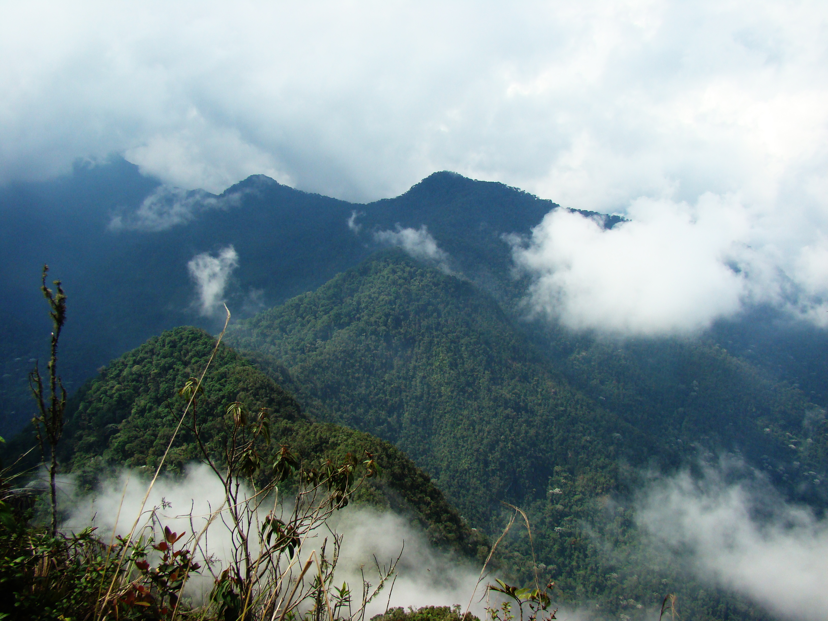
Dapa is a small village and area of weekend homes in the Valle del Cauca Department of west central Colombia. It is located in the mountains about 15 kilometers (9 miles) northwest of the city of Cali. It is a township within the Municipality of Yumbo. Geography and Access Dapa is located on the east slope of the Cordillera Occidental, Colombia , West Andes above the Cauca River Valley. The elevation ranges from in the foothills to along the highest ridges. The lower section is called ''Pilas de Dapa'' where the road crosses the Arroyohondo River and starts the climb up the mountain. The main population lives above which is divided up into several sections: ''Medio Dapa'' is located about halfway up the mountain and consists mainly of homes and farms. ''Miravalle'' is the main center of population farther up the mountain and has a police station, school, and several businesses, along with many homes and a church further along the road. ''Rincón Dapa'' is farther up t ... [...More Info...] [...Related Items...] OR: [Wikipedia] [Google] [Baidu] |
Colombia
Colombia (, ; ), officially the Republic of Colombia, is a country in South America with insular regions in North America—near Nicaragua's Caribbean coast—as well as in the Pacific Ocean. The Colombian mainland is bordered by the Caribbean Sea to the north, Venezuela to the east and northeast, Brazil to the southeast, Ecuador and Peru to the south and southwest, the Pacific Ocean to the west, and Panama to the northwest. Colombia is divided into 32 departments and the Capital District of Bogotá, the country's largest city. It covers an area of 1,141,748 square kilometers (440,831 sq mi), and has a population of 52 million. Colombia's cultural heritage—including language, religion, cuisine, and art—reflects its history as a Spanish colony, fusing cultural elements brought by immigration from Europe and the Middle East, with those brought by enslaved Africans, as well as with those of the various Amerindian civilizations that predate colonization. Spanish is th ... [...More Info...] [...Related Items...] OR: [Wikipedia] [Google] [Baidu] |
Cali
Santiago de Cali (), or Cali, is the capital of the Valle del Cauca department, and the most populous city in southwest Colombia, with 2,227,642 residents according to the 2018 census. The city spans with of urban area, making Cali the second-largest city in the country by area and the third most populous after Bogotá and Medellín. As the only major Colombian city with access to the Pacific Coast, Cali is the main urban and economic center in the south of the country, and has one of Colombia's fastest-growing economies. The city was founded on 25 July 1536 by the Spanish explorer Sebastián de Belalcázar. As a sporting center for Colombia, it was the host city for the 1971 Pan American Games. Cali also hosted the 1992 World Wrestling Championships, the 2013 edition of the World Games, the UCI Track Cycling World Championships in 2014, the World Youth Championships in Athletics in 2015 as well as the inaugural Junior Pan American Games in 2021 and the 2022 World Athletic ... [...More Info...] [...Related Items...] OR: [Wikipedia] [Google] [Baidu] |
Yumbo
Yumbo is a small, industrial city and municipality in western Colombia. It is located in the Valle del Cauca Department, just north of Cali. In 2019, it had a population of approximately 130,000 inhabitants. History Modern Yumbo was founded in 1536 by Miguel Muñoz. - Climate Yumbo has a relatively dry but extremely foggy and sunless ( |
Carretera Dapa
Carretera (Spanish "highway") may refer to: *''La Carretera'', album by Julio Iglesias 1995 * "La Carretera" (song), 2016 song by American singer Prince Royce See also *Carretera Central (other) *Carretera Austral The Carretera Austral (CH-7, ''in English: Southern Way'') is the name given to Chile's Route 7. The highway runs south for about from Puerto Montt to Villa O'Higgins, passing through rural Patagonia. Carretera Austral provides road access t ..., Chile * Carretera de Cádiz, one of the 11 districts of the city of Málaga, Spain {{dab ... [...More Info...] [...Related Items...] OR: [Wikipedia] [Google] [Baidu] |
Cordillera Occidental, Colombia
The Cordillera Occidental ( en, Western Ranges) is the lowest in elevation of the three branches of the Colombian Andes. The average altitude is and the highest peak is Cerro Tatamá at . The range extends from south to north dividing from the Colombian Massif in Nariño Department, passes north through Cauca, Valle del Cauca, Risaralda, Chocó, and Caldas Departments to the Paramillo Massif in Antioquia and Córdoba Departments. From this massif the range divides further to form the Serranías de Ayapel, San Jerónimo and Abibe. Only to recede into the Caribbean plain and the Sinú River valley. Geography The western part of the mountain range belongs to the Pacific region of Colombia and its Chocó–Darién moist forests ecoregion, with the San Juan River being the main watershed, while the eastern part belongs to the Cauca River basin. The northern and northwestern parts belong to the Atlantic Slope, with the Atrato and Sinú Rivers being the main waters ... [...More Info...] [...Related Items...] OR: [Wikipedia] [Google] [Baidu] |
Cauca River
The Cauca River () is a river in Colombia that lies between the Occidental and Central cordilleras. From its headwaters in southwestern Colombia near the city of Popayán, it joins the Magdalena River near Magangue in Bolivar Department, and the combined river eventually flows out into the Caribbean Sea. It has a length of to its junction with the Magdalena, for a total length of . from origin to seamouth. The river is under the supervision of the ''Cauca Regional Corporation'' and the ''Cauca Valley Regional Autonomous Corporation'', and is navigable for above its junction with the Magdalena. File:Rio cauca popayan.JPG File:Salvajina.jpg File:Río Cauca. Puente Anacaro (3). Cartago - Ansermanuevo, Valle, Colombia.JPG File:Río Cauca.JPG File:Puentes en La Pintada 01.jpg File:Puente de Occidente.JPG File:El río Cauca.jpg Environmental issues On November 18, 2007, Colombian newspaper '' El Tiempo'' reported that the river was receiving an average of 500 tons of residual was ... [...More Info...] [...Related Items...] OR: [Wikipedia] [Google] [Baidu] |
Chicoral, Valle Del Cauca
The area of Chicoral is located in the southernmost part of the township of Bitaco and within the municipality of La Cumbre in the Valle del Cauca Department of Colombia. It is home to the Hindú Tea Plantation, a major part of the Bitaco River Forest Reserve, and many small estates and farms. This region is only accessible by unpaved roads by way of La Cumbre from the north, the Cali-Buenaventura Road from the west and Dapa from the east through a forested pass at . The Bitaco River Forest Reserve was created in 1985 to protect a sizable portion of cloud forest and the headwaters of the Bitaco River, which flows northwest and drains into the Dagua River. The reserve is located on the west slope of the West Andes. This is an area of high biodiversity with a high number of bird species including the endemic and highly sought after multicolored tanager. Other important avian species include sickle-winged guan, scaled fruiteater, golden-winged manakin and purplish-mantled ... [...More Info...] [...Related Items...] OR: [Wikipedia] [Google] [Baidu] |
La Cumbre, Valle Del Cauca
La Cumbre (The Summit) is a town and municipality in Colombia, northwest of Cali, in the Valle del Cauca Department. It is located in the West Andes above the city of Yumbo. La Cumbre is known for its simplicity, lack of hustle and bustle and small-town way of life. Many day tourists from Cali travel to La Cumbre by car or tourist train. The weather is cooler, and considered a welcome respite from the sunny and often hot weather of Cali. The most important industry in the area is agriculture. Polito-Geographical Limits This municipality is surround by the following municipalities of Valle del Cauca Department: * North: Restrepo. * South: Yumbo and Cali. * East: Vijes * West: Dagua Areas of the Municipality The Corregimiento of Bitaco occupies the southernmost portion of the municipality. Within this area is the section called Chicoral which is home to the Hindú Tea Plantation and the Bitaco Forest Reserve. This area connects to the west with Dapa DAPA may refer to: * D ... [...More Info...] [...Related Items...] OR: [Wikipedia] [Google] [Baidu] |
Kilometer 18, Valle Del Cauca
Dagua () is a town and municipality located in the Department of Valle del Cauca, Colombia. History Dagua was founded in 1909. Corregimientos 1. Santa María 2. El Salado 3. El Chilcal 4. Providencia 5. El Danubio 6. La Cascada 7. La Elsa 8. El Queremal El Queremal is a town in the Dagua municipality, Valle del Cauca Department, Colombia. It is located about west of Cali and is at an elevation of . The town is situated on the upper part of the Old Cali-Buenaventura Road and is about from ... 9. El Limonar 10. Los Alpes 11. La Providencia 12. Atuncela 13. Loboguerrero 14. El Naranjo 15. Juntas 16. Zabaletas 17. El Piñal 18. Zelandia 19. El Rucio 20. Pepitas 21. Villahermosa 22. El Palmar 23. Borrero Ayerbe 24. El Carmen 25. San Bernardo 26. Jiguales 27. Kilómetro 18 29. San Vicente 30. Cisneros. 31. La Clorinda Municipalities of Valle del Cauca Department Populated places established in 1909 1909 establishments in Colombia [...More Info...] [...Related Items...] OR: [Wikipedia] [Google] [Baidu] |
Dapa Reserve
DAPA may refer to: * Defense Acquisition Program Administration, an executive branch of the South Korean government * Deferred Action for Parents of Americans, a U.S. deferred action immigration program announced on November 20, 2014 Dapa may refer to: * Dapa, Valle del Cauca Dapa is a small village and area of weekend homes in the Valle del Cauca Department of west central Colombia. It is located in the mountains about 15 kilometers (9 miles) northwest of the city of Cali. It is a township within the Municipality o ..., a village in Colombia * 4-hydroxy-tetrahydrodipicolinate synthase, an enzyme {{disambig ... [...More Info...] [...Related Items...] OR: [Wikipedia] [Google] [Baidu] |


