|
Daloa Airport
Daloa Airport is an airport serving Daloa, Côte d'Ivoire. See also *Transport in Côte d'Ivoire Ivory Coast invested remarkably in its transport system. Transport Infrastructures are much more developed than they are other West African countries despite a crisis that restrained their maintenance and development. Since its independence in 1 ... * * References OurAirports - Daloa Great Circle Mapper - Daloa* Google Earth Airports in Ivory Coast Buildings and structures in Sassandra-Marahoué District Daloa {{Côted'Ivoire-airport-stub ... [...More Info...] [...Related Items...] OR: [Wikipedia] [Google] [Baidu] |
Daloa
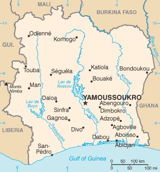
Daloa is a city in western Ivory Coast. It is the seat of both the Sassandra-Marahoué District and the Haut-Sassandra Region. It is also the seat of and a sub-prefectures of Ivory Coast, sub-prefecture of Daloa Department. Daloa is also a Communes of Ivory Coast, commune. In the 2014 census, the city had a population of 245,360, making it the third-largest city in the country. It lies to the west of Yamoussoukro, the capital of Ivory Coast. Daloa is an important trading centre, particularly for Cocoa bean, cocoa. The city is served by Daloa Airport and is home to the Roman Catholic Diocese of Daloa, with its cathedral at Cathédrale du Christ-Roi. History Civil War The town was repeatedly contested during the First Ivorian Civil War, which lasted from 2002 to 2004. Following the takeover of the town by the government on 16 October 2002, fifty civilians from the north were allegedly killed by government troops. Amnesty International described the killings as a "massacre", saying ... [...More Info...] [...Related Items...] OR: [Wikipedia] [Google] [Baidu] |
Côte D'Ivoire
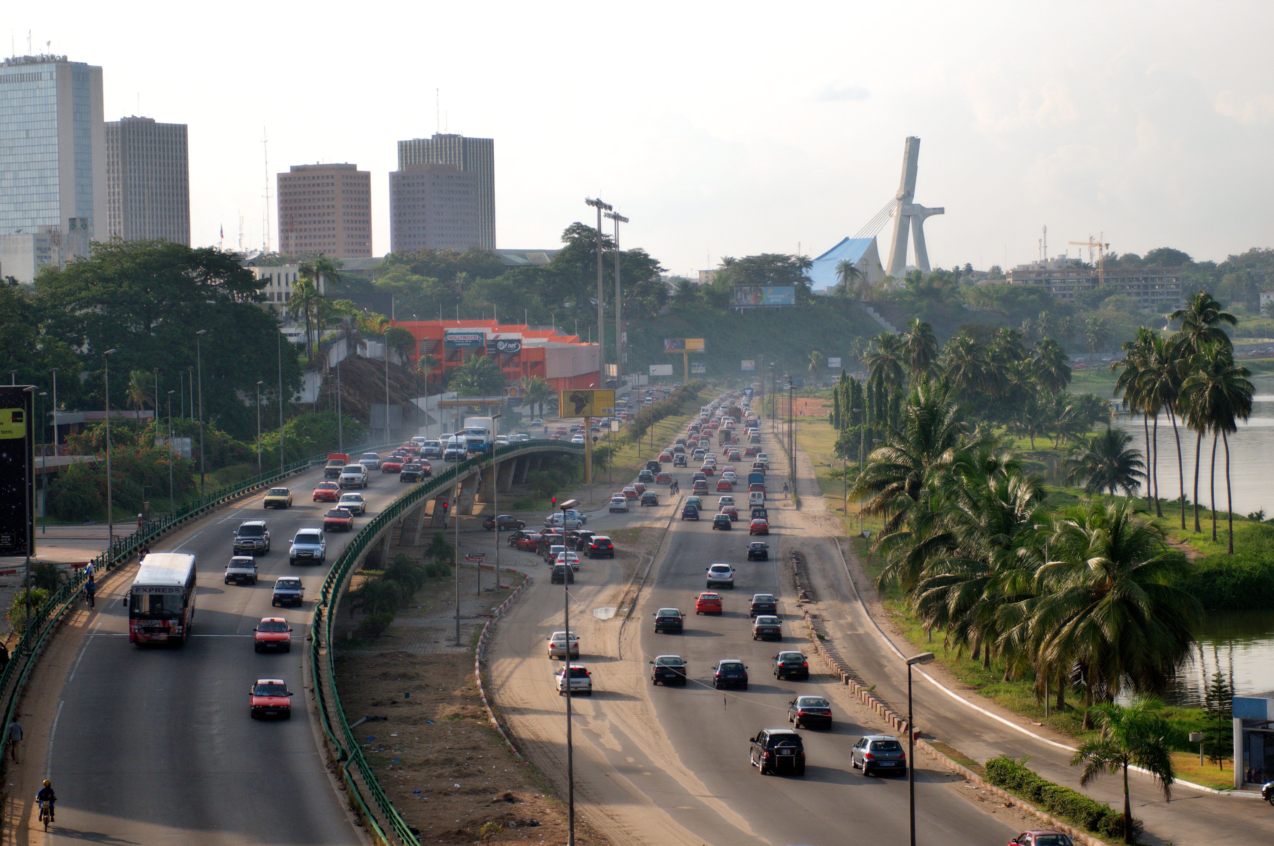
Ivory Coast, also known as Côte d'Ivoire, officially the Republic of Côte d'Ivoire, is a country on the southern coast of West Africa. Its capital is Yamoussoukro, in the centre of the country, while its largest city and economic centre is the port city of Abidjan. It borders Guinea to the northwest, Liberia to the west, Mali to the northwest, Burkina Faso to the northeast, Ghana to the east, and the Gulf of Guinea (Atlantic Ocean) to the south. Its official language is French, and indigenous languages are also widely used, including Bété, Baoulé, Dioula, Dan, Anyin, and Cebaara Senufo. In total, there are around 78 different languages spoken in Ivory Coast. The country has a religiously diverse population, including numerous followers of Christianity, Islam, and indigenous faiths. Before its colonization by Europeans, Ivory Coast was home to several states, including Gyaaman, the Kong Empire, and Baoulé. The area became a protectorate of France in 1843 and ... [...More Info...] [...Related Items...] OR: [Wikipedia] [Google] [Baidu] |
Transport In Côte D'Ivoire
Ivory Coast invested remarkably in its transport system. Transport Infrastructures are much more developed than they are other West African countries despite a crisis that restrained their maintenance and development. Since its independence in 1960, Ivory Coast put an emphasis on increasing and modernizing the transport network for human as well as for goods. Major infrastructures of diverse nature were built including railways, roads, waterways, and airports. In spite of the crisis, neighbor countries (Burkina Faso, Mali, Niger, and Guinea) still strongly depend on the Ivorian transport network for importing, exporting, and transiting their immigrants to Ivory Coast. Rail transport The nation's railway system is part of a 1 260 km long route that links the country to Burkina Faso and Niger. 1 156 km of railroad links Abidjan to Ouagadougou, capital of Burkina Faso. Built during colonial era by the firm Abidjan-Niger (RAN), this railroad freed several landlocked count ... [...More Info...] [...Related Items...] OR: [Wikipedia] [Google] [Baidu] |
Airports In Ivory Coast ...
List of airports in Ivory Coast (Côte d'Ivoire), sorted by location. __TOC__ List See also * Transport in Ivory Coast * List of airports by ICAO code: D#DI - Côte d'Ivoire (Ivory Coast) * Wikipedia: WikiProject Aviation/Airline destination lists: Africa#Côte d'Ivoire References * * External links * Lists of airports in Ivory Coast (Côte d'Ivoire): *Great Circle Mapper**World Aero Data {{Africa in topic, List of airports in Ivory Coast Airports Airports Ivory Coast Ivory Coast, also known as Côte d'Ivoire, officially the Republic of Côte d'Ivoire, is a country on the southern coast of West Africa. Its capital is Yamoussoukro, in the centre of the country, while its largest city and economic centre is ... [...More Info...] [...Related Items...] OR: [Wikipedia] [Google] [Baidu] |
Buildings And Structures In Sassandra-Marahoué District
A building, or edifice, is an enclosed structure with a roof and walls standing more or less permanently in one place, such as a house or factory (although there's also portable buildings). Buildings come in a variety of sizes, shapes, and functions, and have been adapted throughout history for a wide number of factors, from building materials available, to weather conditions, land prices, ground conditions, specific uses, monument, prestige, and aesthetic reasons. To better understand the term ''building'' compare the list of nonbuilding structures. Buildings serve several societal needs – primarily as shelter from weather, security, living space, privacy, to store belongings, and to comfortably live and work. A building as a shelter represents a physical division of the :Human habitats, human habitat (a place of comfort and safety) and the ''outside'' (a place that at times may be harsh and harmful). Ever since the first cave paintings, buildings have also become objects or ... [...More Info...] [...Related Items...] OR: [Wikipedia] [Google] [Baidu] |


