|
Cyclone Giri
Extremely Severe Cyclonic Storm Giri ( IMD designation: BOB 04, JTWC designation 04B, also known as Cyclone Giri) was a powerful tropical cyclone in terms of 1-minute sustained wind speed which caused catastrophic damage in parts of Myanmar in late October 2010. Originating from an area of low pressure over the Bay of Bengal on October 19, the system began as a weak depression 250 km (155 mi) south of Myanmar. Over the following few days, the depression underwent explosive intensification, reaching its peak intensity with winds of 195 km/h (120 mph 3-minute sustained) on October 22. Cyclone Giri made landfall roughly northwest of Kyaukpyu, shortly after peaking. Within hours of moving onshore, the system had substantially weakened. By the following day, Giri had degenerated into a tropical depression and the final advisory was issued on the storm. Unlike during Cyclone Nargis in 2008, the Government of Myanmar took steps to ensure the safety of resi ... [...More Info...] [...Related Items...] OR: [Wikipedia] [Google] [Baidu] |
Joint Typhoon Warning Center
The Joint typhoon Warning Center (JTWC) is a joint United States Navy – United States Air Force command in Pearl Harbor, Hawaii. The JTWC is responsible for the issuing of tropical cyclone warnings in the North-West Pacific Ocean, South Pacific Ocean, and Indian Ocean for all branches of the U.S. Department of Defense and other U.S. government agencies. Their warnings are intended for the protection of primarily military ships and aircraft as well as military installations jointly operated with other countries around the world. Its U.S. Navy components are aligned with the Naval Meteorology and Oceanography Command. History The origins of the Joint Typhoon Warning Center (JTWC) can be traced back to June 1945, when the Fleet Weather Center/Typhoon Tracking Center was established on the island of Guam, after multiple typhoons, including Typhoon Cobra of December 1944 and Typhoon Connie in June 1945, had caused a significant loss of men and ships. At this time the center ... [...More Info...] [...Related Items...] OR: [Wikipedia] [Google] [Baidu] |
Sittwe
Sittwe (; ; formerly Akyab) is the capital of Rakhine State, Myanmar (Burma). Sittwe, pronounced ''sait-tway'' in the Rakhine language, is located on an estuarial island created at the confluence of the Kaladan, Mayu, and Lay Mro rivers emptying into the Bay of Bengal. As of 2006 the city has 181,000 inhabitants. It is the administrative seat of Sittwe Township and Sittwe District. Etymology The name Sittwe, which literally means "the place where the war meets," is derived from the Burmese pronunciation of စစ်တွေ (pronounced ''Saittwe'' in Arakanese language). When the Burmese King Bodawpaya invaded the Mrauk U Kingdom in 1784, the Rakhine defenders encountered the Burmese force at the mouth of Kaladan river. In the ensuing battle, which was waged on both land and water, the Mrauk U forces were defeated. The place where the battle occurred came to be called ''Saittwe'' by the Rakhine, and colloquially as ''Sittwe'' by the Burmese. In early 1825, during the First ... [...More Info...] [...Related Items...] OR: [Wikipedia] [Google] [Baidu] |
Outflow (meteorology)
Outflow, in meteorology, is air that flows outwards from a storm system. It is associated with ridging, or anticyclonic flow. In the low levels of the troposphere, outflow radiates from thunderstorms in the form of a wedge of rain-cooled air, which is visible as a thin rope-like cloud on weather satellite imagery or a fine line on weather radar imagery. For observers on the ground, a thunderstorm outflow boundary often approaches in otherwise clear skies as a low, thick cloud that brings with it a gust front. Low-level outflow boundaries can disrupt the center of small tropical cyclones. However, outflow aloft is essential for the strengthening of a tropical cyclone. If this outflow is restricted or undercut, the tropical cyclone weakens. If two tropical cyclones are in close proximity, the upper-level outflow from the upwind system can limit the development of the other system. Thunderstorms For thunderstorms, outflow tends to indicate the development of a system. Large quan ... [...More Info...] [...Related Items...] OR: [Wikipedia] [Google] [Baidu] |
Rapid Deepening
In meteorology, rapid intensification is a situation where a tropical cyclone intensifies dramatically in a short period of time. The United States National Hurricane Center defines rapid intensification as an increase in the maximum sustained winds of a tropical cyclone of at least in a 24-hour period. Necessary conditions External In order for rapid intensification to occur, several conditions must be in place. Water temperatures must be extremely warm (near or above ), and water of this temperature must be sufficiently deep such that waves do not churn deeper cooler waters up to the surface. Wind shear must be low; when wind shear is high, the convection and circulation in the cyclone will be disrupted. Dry air can also limit the strengthening of tropical cyclones. Internal Usually, an anticyclone in the upper layers of the troposphere above the storm must also be present for extremely low surface pressures to develop. This is because air must be converging towards the low ... [...More Info...] [...Related Items...] OR: [Wikipedia] [Google] [Baidu] |
Category 1 Hurricane
Category, plural categories, may refer to: Philosophy and general uses *Categorization, categories in cognitive science, information science and generally *Category of being * ''Categories'' (Aristotle) *Category (Kant) *Categories (Peirce) *Category (Vaisheshika) *Stoic categories *Category mistake Mathematics * Category (mathematics), a structure consisting of objects and arrows * Category (topology), in the context of Baire spaces * Lusternik–Schnirelmann category, sometimes called ''LS-category'' or simply ''category'' * Categorical data, in statistics Linguistics * Lexical category, a part of speech such as ''noun'', ''preposition'', etc. *Syntactic category, a similar concept which can also include phrasal categories *Grammatical category, a grammatical feature such as ''tense'', ''gender'', etc. Other * Category (chess tournament) * Objective-C categories, a computer programming concept * Pregnancy category * Prisoner security categories in the United Kingdom * W ... [...More Info...] [...Related Items...] OR: [Wikipedia] [Google] [Baidu] |
Rapid Intensification
In meteorology, rapid intensification is a situation where a tropical cyclone intensifies dramatically in a short period of time. The United States National Hurricane Center defines rapid intensification as an increase in the maximum sustained winds of a tropical cyclone of at least in a 24-hour period. Necessary conditions External In order for rapid intensification to occur, several conditions must be in place. Water temperatures must be extremely warm (near or above ), and water of this temperature must be sufficiently deep such that waves do not churn deeper cooler waters up to the surface. Wind shear must be low; when wind shear is high, the convection and circulation in the cyclone will be disrupted. Dry air can also limit the strengthening of tropical cyclones. Internal Usually, an anticyclone in the upper layers of the troposphere above the storm must also be present for extremely low surface pressures to develop. This is because air must be converging towards the low ... [...More Info...] [...Related Items...] OR: [Wikipedia] [Google] [Baidu] |
Sea Surface Temperature
Sea surface temperature (SST), or ocean surface temperature, is the ocean temperature close to the surface. The exact meaning of ''surface'' varies according to the measurement method used, but it is between and below the sea surface. Air masses in the Earth's atmosphere are highly modified by sea surface temperatures within a short distance of the shore. Localized areas of heavy snow can form in bands downwind of warm water bodies within an otherwise cold air mass. Warm sea surface temperatures are known to be a cause of tropical cyclogenesis over the Earth's oceans. Tropical cyclones can also cause a cool wake, due to turbulent mixing of the upper of the ocean. SST changes diurnally, like the air above it, but to a lesser degree. There is less SST variation on breezy days than on calm days. In addition, ocean currents such as the Atlantic Multidecadal Oscillation (AMO), can affect SST's on multi-decadal time scales, a major impact results from the global thermohaline ci ... [...More Info...] [...Related Items...] OR: [Wikipedia] [Google] [Baidu] |
Coordinated Universal Time
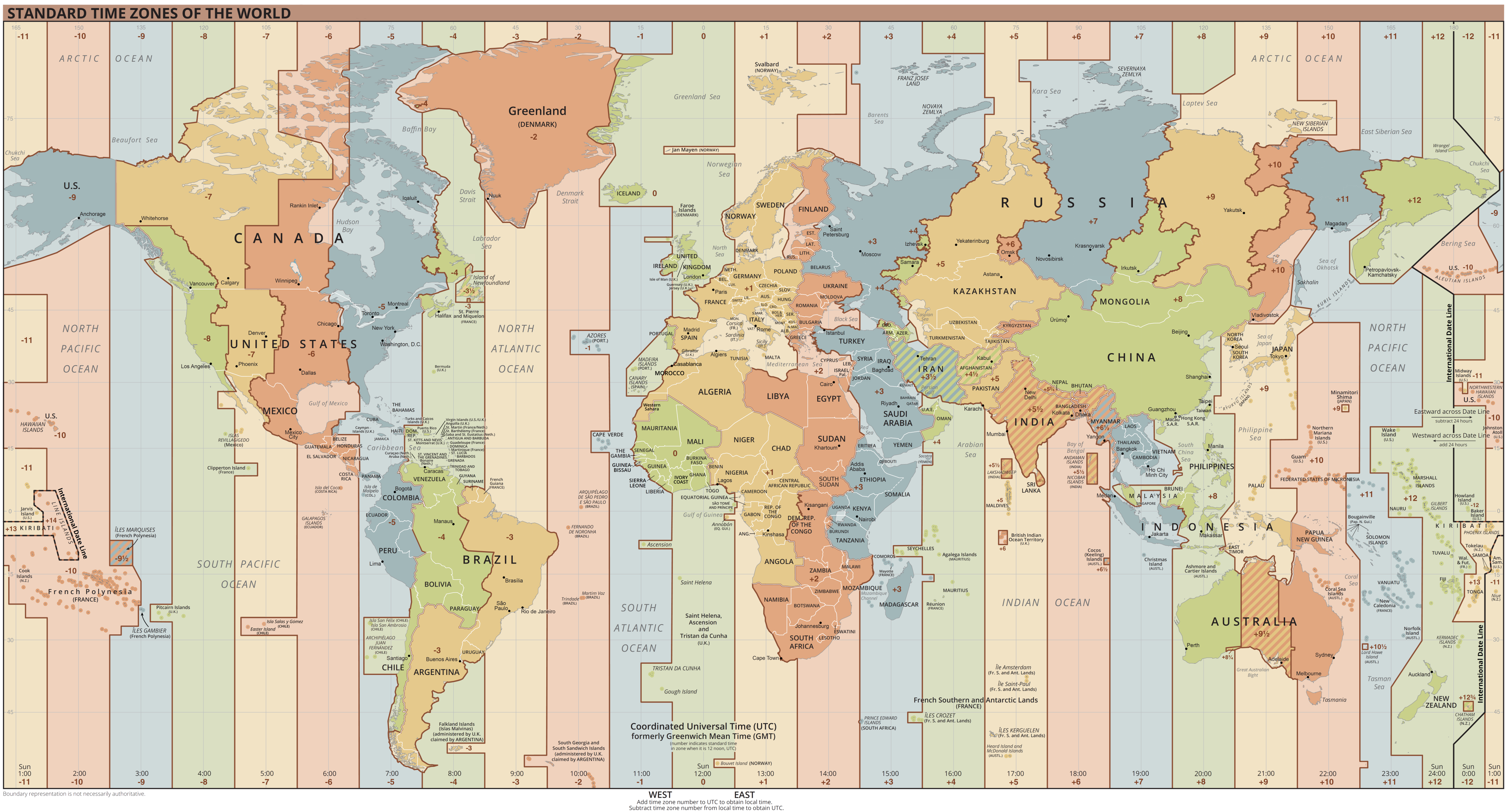
Coordinated Universal Time or UTC is the primary time standard by which the world regulates clocks and time. It is within about one second of mean solar time (such as UT1) at 0° longitude (at the IERS Reference Meridian as the currently used prime meridian) and is not adjusted for daylight saving time. It is effectively a successor to Greenwich Mean Time (GMT). The coordination of time and frequency transmissions around the world began on 1 January 1960. UTC was first officially adopted as CCIR Recommendation 374, ''Standard-Frequency and Time-Signal Emissions'', in 1963, but the official abbreviation of UTC and the official English name of Coordinated Universal Time (along with the French equivalent) were not adopted until 1967. The system has been adjusted several times, including a brief period during which the time-coordination radio signals broadcast both UTC and "Stepped Atomic Time (SAT)" before a new UTC was adopted in 1970 and implemented in 1972. This change also a ... [...More Info...] [...Related Items...] OR: [Wikipedia] [Google] [Baidu] |
Ridge (meteorology)
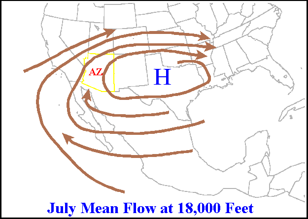
A ridge or barometric ridge is a term in meteorology describing an elongated area of relatively high atmospheric pressure compared to the surrounding environment, without being a closed circulation. It is associated with an area of maximum anticyclonic curvature of wind flow. The ridge originates in the center of an anticyclone and sandwiched between two low-pressure areas, and the locus of the maximum curvature is called the ''ridge line''. This phenomenon is the opposite of a trough. Description Ridges can be represented in two ways: * On surface weather maps, the pressure isobars form contours where the maximum pressure is found along the axis of the ridge. * In upper-air maps, geopotential height isohypses form similar contours where the maximum defines the ridge. Related weather Given the direction of the winds around an anticyclonic circulation and the fact that weather systems move from west to east: *ahead of an upper-ridge, the airflow that comes from the polar regi ... [...More Info...] [...Related Items...] OR: [Wikipedia] [Google] [Baidu] |
Equator
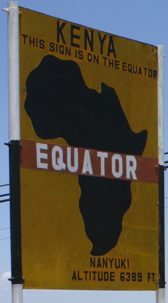
The equator is a circle of latitude, about in circumference, that divides Earth into the Northern and Southern hemispheres. It is an imaginary line located at 0 degrees latitude, halfway between the North and South poles. The term can also be used for any other celestial body that is roughly spherical. In spatial (3D) geometry, as applied in astronomy, the equator of a rotating spheroid (such as a planet) is the parallel (circle of latitude) at which latitude is defined to be 0°. It is an imaginary line on the spheroid, equidistant from its poles, dividing it into northern and southern hemispheres. In other words, it is the intersection of the spheroid with the plane perpendicular to its axis of rotation and midway between its geographical poles. On and near the equator (on Earth), noontime sunlight appears almost directly overhead (no more than about 23° from the zenith) every day, year-round. Consequently, the equator has a rather stable daytime temperature throug ... [...More Info...] [...Related Items...] OR: [Wikipedia] [Google] [Baidu] |
Eye (cyclone)
The eye is a region of mostly calm weather at the center of tropical cyclones. The eye of a storm is a roughly circular area, typically in diameter. It is surrounded by the ''eyewall'', a ring of towering thunderstorms where the most severe weather and highest winds occur. The cyclone's lowest barometric pressure occurs in the eye and can be as much as 15 percent lower than the pressure outside the storm. In strong tropical cyclones, the eye is characterized by light winds and clear skies, surrounded on all sides by a towering, symmetric eyewall. In weaker tropical cyclones, the eye is less well defined and can be covered by the central dense overcast, an area of high, thick clouds that show up brightly on satellite imagery. Weaker or disorganized storms may also feature an eyewall that does not completely encircle the eye or have an eye that features heavy rain. In all storms, however, the eye is the location of the storm's minimum barometric pressure—where the atmospheric pr ... [...More Info...] [...Related Items...] OR: [Wikipedia] [Google] [Baidu] |


