|
Cryne Corse Mounth
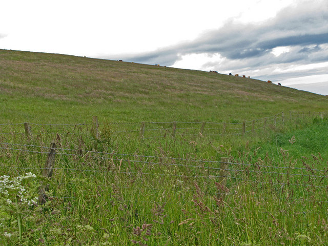
Cryne Corse Mounth is an old droving road which ran south across the high ground from the Dee valley in Aberdeenshire, eastern Scotland. Much of the route is now afforested. It is one of a number of old tracks which passed over the Mounth, an eastern extension of the Grampian Mountains. The route departs the modern A957 road at a sharp bend at Spyhill and climbs steeply to the vicinity of Red Beard's Well near the Durris transmitting station. The well itself is named from the leader of a gang of highwaymen who lay in wait for travellers on this route. At its south end the route meets the public road near Cleuchead north of Glenbervie. Almost all of the route now lies within an area of conifer plantations, known in part as Fetteresso Forest. Edward I is said to have used the route in 1296, as subsequently did William Wallace. Cattle were driven along the route to Herscha Hill, north of Fordoun Fordoun ( gd, Fordun) (Pronounced "For-Dun") is a parish and village in Aberd ... [...More Info...] [...Related Items...] OR: [Wikipedia] [Google] [Baidu] |
Drovers' Road
A drovers' road, drove ''roador droveway is a route for droving livestock on foot from one place to another, such as to market or between summer and winter pasture (see transhumance). Many drovers' roads were ancient routes of unknown age; others are known to date back to medieval or more recent times. Description Drovers' roads are often wider than other roads, able to accommodate large herds or flocks. Packhorse ways were quite narrow as the horses moved in single file, whereas drove roads were at least and up to wide.Addison (1980), Pp. 70-78. In the United Kingdom, where many original drovers' roads have been converted into single carriageway metalled roads, unusually wide verges often give an indication of the road's origin. In Wales, the start of many droveways, drovers' roads are often recognisable by being deeply set into the countryside, with high earth walls or hedges. The most characteristic feature of these roads is the occasional sharp turn in the road, which p ... [...More Info...] [...Related Items...] OR: [Wikipedia] [Google] [Baidu] |
Edward I Of England
Edward I (17/18 June 1239 – 7 July 1307), also known as Edward Longshanks and the Hammer of the Scots, was King of England and Lord of Ireland from 1272 to 1307. Concurrently, he ruled the duchies of Aquitaine and Gascony as a vassal of the French king. Before his accession to the throne, he was commonly referred to as the Lord Edward. The eldest son of Henry III, Edward was involved from an early age in the political intrigues of his father's reign, which included a rebellion by the English barons. In 1259, he briefly sided with a baronial reform movement, supporting the Provisions of Oxford. After reconciliation with his father, however, he remained loyal throughout the subsequent armed conflict, known as the Second Barons' War. After the Battle of Lewes, Edward was held hostage by the rebellious barons, but escaped after a few months and defeated the baronial leader Simon de Montfort at the Battle of Evesham in 1265. Within two years the rebellion was extin ... [...More Info...] [...Related Items...] OR: [Wikipedia] [Google] [Baidu] |
Droving Roads
Droving is the practice of walking livestock over long distances. It is a type of herding. Droving stock to market—usually on foot and often with the aid of dogs—has a very long history in the Old World. An owner might entrust an agent to deliver stock to market and bring back the proceeds. There has been droving since people in cities found it necessary to source food from distant supplies. Description Droving is the practice of moving livestock over long distances by walking them " on the hoof". Droving is used for moving large herds over long distances, sometimes several hundred kilometers. It was carried out by shepherds. The earliest written evidence about shepherds and their dogs dates back to the 14th century. Thousands of cattle were moved along the roads of Europe and Great Britain, and later sheep, goats, pigs and even geese and turkeys. The journey from pasture to market, slaughterhouse, or buyer could take anywhere from a few weeks to a few months. The herd moved ... [...More Info...] [...Related Items...] OR: [Wikipedia] [Google] [Baidu] |
Palladius (bishop Of Ireland)
Palladius ( fl. AD 408–431; died 457/461) was the first bishop of the Christians of Ireland, preceding Saint Patrick. It is possible that some elements of their life stories were later conflated in Irish tradition. Palladius was a deacon and member of one of the prominent families in Gaul. Pope Celestine I consecrated him a bishop and sent him to Ireland "to the ''Scotti'' believing in Christ". Armorica The Palladii were thought to be amongst the most noble families of Gaul, and several of them held high ranks in the Church of Gaul. Palladius was the son of Exuperantius of Poitiers, of whom the contemporary pagan poet Rutilius Claudius Namatianus wrote on his 416 voyage: "Then on the eve of going I send back to his studies and the city Palladius, the hope and honour of my race. That eloquent youth had been sent of late from the lands of the Gauls to learn the laws of the Roman courts. My son in affection and kinsman by blood, he holds the fondest ties of my regard. Even now h ... [...More Info...] [...Related Items...] OR: [Wikipedia] [Google] [Baidu] |
Cattle Fair
Cattle (''Bos taurus'') are large, domesticated, cloven-hooved, herbivores. They are a prominent modern member of the subfamily Bovinae and the most widespread species of the genus ''Bos''. Adult females are referred to as cows and adult males are referred to as bulls. Cattle are commonly raised as livestock for meat (beef or veal, see beef cattle), for milk (see dairy cattle), and for hides, which are used to make leather. They are used as riding animals and draft animals ( oxen or bullocks, which pull carts, plows and other implements). Another product of cattle is their dung, which can be used to create manure or fuel. In some regions, such as parts of India, cattle have significant religious significance. Cattle, mostly small breeds such as the Miniature Zebu, are also kept as pets. Different types of cattle are common to different geographic areas. Taurine cattle are found primarily in Europe and temperate areas of Asia, the Americas, and Australia. Zebus (al ... [...More Info...] [...Related Items...] OR: [Wikipedia] [Google] [Baidu] |
Fordoun
Fordoun ( gd, Fordun) (Pronounced "For-Dun") is a parish and village in Aberdeenshire, Scotland. Fothirdun (possibly "the lower place"), as it was historically known, was an important area in the Howe of the Mearns. Fordoun and Auchenblae, together with their immediate districts form the Parish of Fordoun with the Parish Church in the vicinity of the original settlement, now absorbed by Auchenblae. In the 19th Century Fordoun railway station was opened approximately 3 miles to the South East of Fordoun Church and the original settlement. A village grew at the site of the station (opened in November 1849 and closed in June 1956), where there were also a number of shops, but only a seasonal farm shop remains. In the time since the founding of the railway station the village formerly known as Fordoun Station has come to be known simply as Fordoun and the site of the original settlement has been absorbed by Auchenblae. People from Fordoun * John of Fordun (d. c. 1384), Scotti ... [...More Info...] [...Related Items...] OR: [Wikipedia] [Google] [Baidu] |
Herscha Hill
Herscha Hill is an elevated landform in Aberdeenshire, Scotland. Neolithic The Neolithic period, or New Stone Age, is an Old World archaeological period and the final division of the Stone Age. It saw the Neolithic Revolution, a wide-ranging set of developments that appear to have arisen independently in several p ... archaeological finds have been made at this location.Aberdeenshire, 2008 References * Aberdeenshire Council archeological sites: Herscha Hill, retrieved Aug. 200 Line notes {{Aberdeenshire-stub Archaeological sites in Aberdeenshire Stone Age sites in Scotland Neolithic Scotland ... [...More Info...] [...Related Items...] OR: [Wikipedia] [Google] [Baidu] |
William Wallace
Sir William Wallace ( gd, Uilleam Uallas, ; Norman French: ; 23 August 1305) was a Scottish knight who became one of the main leaders during the First War of Scottish Independence. Along with Andrew Moray, Wallace defeated an English army at the Battle of Stirling Bridge in September 1297. He was appointed Guardian of Scotland and served until his defeat at the Battle of Falkirk in July 1298. In August 1305, Wallace was captured in Robroyston, near Glasgow, and handed over to King Edward I of England, who had him hanged, drawn and quartered for high treason and crimes against English civilians. Since his death, Wallace has obtained an iconic status far beyond his homeland. He is the protagonist of Blind Harry's 15th-century epic poem '' The Wallace'' and the subject of literary works by Jane Porter and Sir Walter Scott, and of the Academy Award-winning film '' Braveheart''. Background William Wallace was a member of the lesser nobility, but little is definitely known of ... [...More Info...] [...Related Items...] OR: [Wikipedia] [Google] [Baidu] |
Fetteresso Forest
The Fetteresso Forest is a woodland that is principally coniferous situated in the Mounth range of the Grampian Mountains in Aberdeenshire, Scotland. The forest has a number of prominent mountain peaks including the Hill of Blacklodge and Craiginour peak. A good overlook for viewing the forest from the north side lies on an unnamed tarmack road which leads north from the Slug Road to the Raedykes Roman site. The Cowie Water flows through and drains much of the forest. To the north of the easternmost part of the forest is the archaeological site Raedykes Roman Camp, as well as Cowton Burn. The Slug Road runs along much of the northeast perimeter of Fetteresso Forest. Notable features in this vicinity include Dunnottar Castle, Fetteresso Castle, Bogjurgan Hill and Muchalls Castle Muchalls Castle stands overlooking the North Sea in the countryside of Kincardine and Mearns, Aberdeenshire, Scotland. The lower course is a well-preserved Romanesque, double-groined 13th-cent ... [...More Info...] [...Related Items...] OR: [Wikipedia] [Google] [Baidu] |
River Dee, Aberdeenshire
The River Dee ( gd, Uisge Dhè) is a river in Aberdeenshire, Scotland. It rises in the Cairngorms and flows through southern Aberdeenshire to reach the North Sea at Aberdeen. The area it passes through is known as Deeside, or Royal Deeside in the region between Braemar and Banchory because Queen Victoria came for a visit there in 1848 and greatly enjoyed herself. She and her husband, Prince Albert, built Balmoral Castle there which replaced an older castle. Deeside is a popular area for tourists, due to the combination of scenic beauty and historic and royal associations. It is part of the Cairngorms National Park, and the Deeside and Lochnagar National Scenic Area. The Dee is popular with anglers and is one of the most famous salmon fishing rivers in the world. The New Statistical Account of Scotland attributed the name Dee as having been used as early as the second century AD in the work of the Alexandrian geographer Claudius Ptolemy, as ''Δηοῦα'' (=Deva), meaning ... [...More Info...] [...Related Items...] OR: [Wikipedia] [Google] [Baidu] |
Glenbervie
Glenbervie (Scottish Gaelic: ''Gleann Biorbhaidh'', Scots: ''Bervie'') is located in the north east of Scotland in the Howe o' the Mearns, one mile from the village of Drumlithie and eight miles south of Stonehaven in Aberdeenshire. The river Bervie runs through the village. The rural area is the location of Glenbervie House and estate. The parish was formerly named Overbervie.History of Glenbervie G H Kinnear, Montrose, 1895, retrieved 10 July 2017 The population fell from a peak of 1307 in 1796 to 887 in 1895. Many of the villagers had immigrated, especially the young to the nearby cities and towns. The in Glenbervie is the final resting plac ... [...More Info...] [...Related Items...] OR: [Wikipedia] [Google] [Baidu] |
Durris Transmitting Station
The Durris transmitting station is a broadcasting and telecommunications facility, situated close to the town of Stonehaven, within Durris Forest, within the area also known historically as Kincardineshire (). It is owned and operated by Arqiva, and is the tallest structure in Scotland. History It is also a feature in Durris Primary School's newest logo created in 2000 (the logo shows the mast on the hill with the sun and three trees). It can be seen from the summit of Mither Tap, near Insch, Aberdeenshire and can also be spotted at night on the road down from the Lecht Ski Centre. Construction It has a high guyed steel lattice mast, built by J. L. Eve Construction. It was constructed in 1966. 38-year-old Thomas Sutherland of Blairgowrie died in its construction on Monday 24 October 1966, falling 175 ft from 300 ft up the mast; the company had a regional office in Edinburgh Transmissions Its coverage includes north east Scotland, from St. Andrews St ... [...More Info...] [...Related Items...] OR: [Wikipedia] [Google] [Baidu] |


