|
Crawford County, Arkansas
Crawford County is a County (United States), county located in the Ozarks region of the U.S. state of Arkansas. As of the 2010 United States Census, 2010 census, the population was 61,948, making it the 12th-most populous of Arkansas's 75 counties. The county seat and largest city is Van Buren, Arkansas, Van Buren. Crawford County was formed on October 18, 1820, from the former Lovely County, Arkansas, Lovely County and Indian Territory, and was named for William H. Crawford, the United States Secretary of War in 1815. Located largely within the Ozarks, the southern border of the county is the Arkansas River, placing the extreme southern edge of the county in the Arkansas River Valley. The frontier county became an early crossroads, beginning with a California Gold Rush and developing into the Butterfield Overland Mail, American Civil War, Civil War trails and railroads such as the St. Louis and San Francisco Railway, the Little Rock and Fort Smith Railroad, and the St. Louis, Ir ... [...More Info...] [...Related Items...] OR: [Wikipedia] [Google] [Baidu] |
Van Buren Historic District
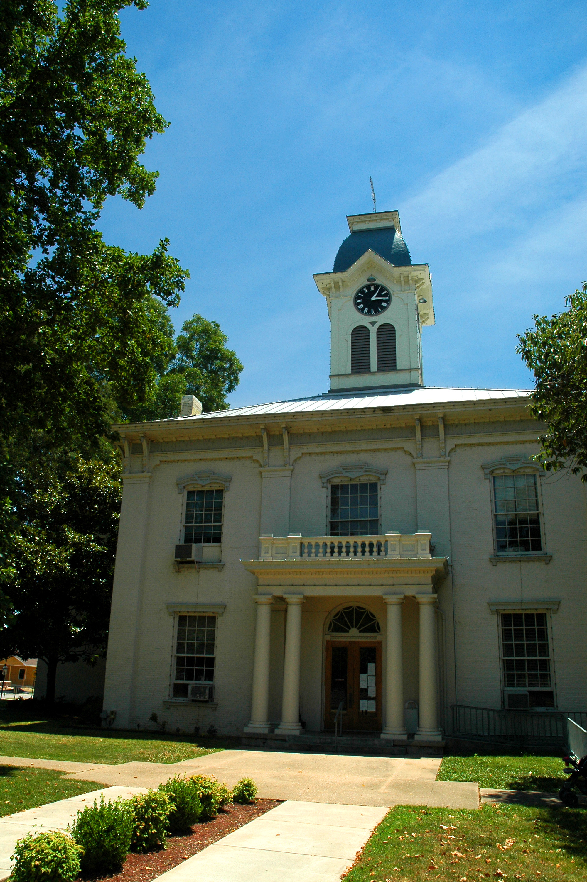
The Van Buren Historic District encompasses eight blocks of historic buildings along Main Street in Van Buren, Arkansas. Many of the structures are pre-1920 Victorian and Italianate buildings closely related to the history of commerce in the city. Positioned between the city's train depot and the Arkansas River, the businesses constituting the Van Buren Historic District have played a vital role in the history and economy of the city and region. The district was placed on the National Register of Historic Places as a National Historic District on April 30, 1976. Properties in the district Crawford County Courthouse The Crawford County Courthouse, originally built in 1842, is the oldest operating courthouse west of the Mississippi River. Following a fire in 1876, the courthouse was rebuilt using the original walls that survived the blaze. Doric columns, a three-story clock tower with bell, cast roof rises and a classic portico constitute the building's facade. Wings flank the b ... [...More Info...] [...Related Items...] OR: [Wikipedia] [Google] [Baidu] |
Interstate 40 In Arkansas
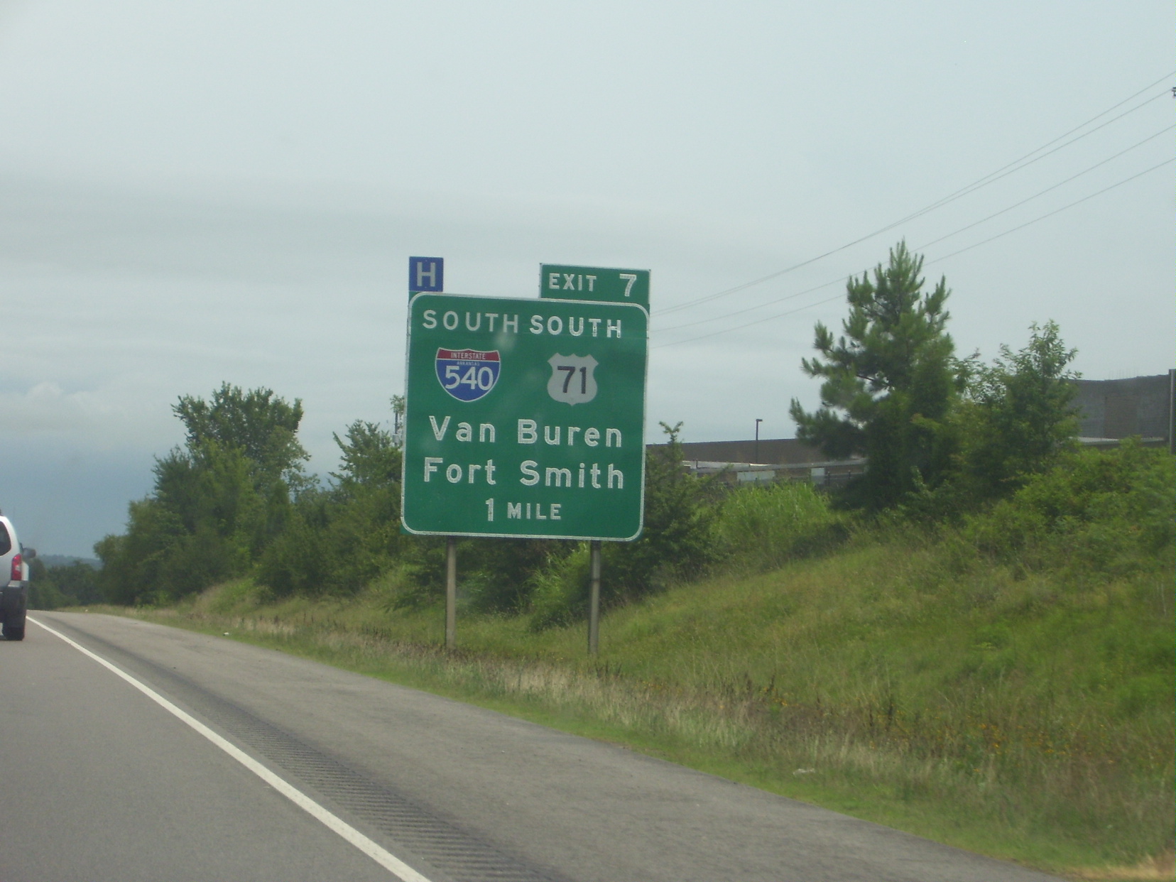
Interstate 40 (I-40) is an east–west Interstate Highway that has a section in the U.S. state of Arkansas, connecting Oklahoma to Tennessee. The route enters Arkansas from the west just north of the Arkansas River near Dora. It travels eastward across the northern portion of the state, connecting the cities of Fort Smith, Clarksville, Russellville, Morrilton, Conway, North Little Rock, Forrest City, and West Memphis. I-40 continues into Tennessee, heading through Memphis. The highway has major junctions with I-540 at Van Buren (the main highway connecting to Fort Smith), I-49 at Alma (the main highway connecting to Fayetteville and Bentonville), I-30 in North Little Rock (the Interstate linking south to Texarkana and Dallas, Texas), and I-55 to Blytheville. For the majority of its routing through Arkansas, I-40 follows the historic alignment of two separate U.S. Highways. From Oklahoma to Little Rock, I-40 generally follows U.S. Highway 64 through the Oza ... [...More Info...] [...Related Items...] OR: [Wikipedia] [Google] [Baidu] |
Highway 162 (Arkansas)
Highway 162 (AR 162, Ark. 162, and Hwy. 162) is a designation for two east–west state highways in Crawford County, Arkansas. One segment of runs east from Highway 59 in Cedarville to Crawford County Road 25 (Hobbtown Rd) at Hobbtown. A second route of begins at US 64/ US 71B in Van Buren and runs east to Interstate 40/ US 71/US 71B (I-40/US 71/US 71B) in Alma. Both routes are maintained by the Arkansas State Highway and Transportation Department (AHTD). Route description Cedarville to Hobbtown Highway 162 begins at Highway 59 in Cedarville. The route heads east before ending and becoming Crawford CR 24/Hobbtown Road just after a bridge over East Cedar Creek. Van Buren to Alma The route begins at US 64/US 71B in Van Buren in the southeast portion of the city. The route runs due east, passing underneath I-540/ US 71 with no interchange. It continues east through Kibler to Alma. History The segment between Van Buren and Alma wa ... [...More Info...] [...Related Items...] OR: [Wikipedia] [Google] [Baidu] |
Arkansas 162
Highway 162 (AR 162, Ark. 162, and Hwy. 162) is a designation for two east–west state highways in Crawford County, Arkansas. One segment of runs east from Highway 59 in Cedarville to Crawford County Road 25 (Hobbtown Rd) at Hobbtown. A second route of begins at US 64/ US 71B in Van Buren and runs east to Interstate 40/ US 71/US 71B (I-40/US 71/US 71B) in Alma. Both routes are maintained by the Arkansas State Highway and Transportation Department (AHTD). Route description Cedarville to Hobbtown Highway 162 begins at Highway 59 in Cedarville. The route heads east before ending and becoming Crawford CR 24/Hobbtown Road just after a bridge over East Cedar Creek. Van Buren to Alma The route begins at US 64/US 71B in Van Buren in the southeast portion of the city. The route runs due east, passing underneath I-540/ US 71 with no interchange. It continues east through Kibler to Alma. History The segment between Van Buren and Alma wa ... [...More Info...] [...Related Items...] OR: [Wikipedia] [Google] [Baidu] |
Highway 60 (Arkansas)
Arkansas Highway 60 (AR 60, Ark. 60, Hwy. 60) is a state highway that exists in five separate sections in Arkansas. The longest and most well-known segment of runs from Highway 28 in Plainview east to U.S. Route 65B (US 65B) in Conway. A segment in western Logan County of begins at the Old Highway 10 at the Sebastian County line and runs east to Highway 10. A third segment of begins at Highway 252 near Lavaca and runs east to Highway 41 at Peter Pender. A fourth segment runs from US 64 and runs across Interstate 40/ Interstate 540 (I-40/I-540) to Highway 282. A fifth route of begins at Highway 282 near Rudy and runs north to County Road 23 (CR 23). Route description Crawford County Rudy to CR 23 The longer section of Highway 60 in Crawford County is long. The route runs north from Highway 282 at Rudy to terminate at Crawford County Road 23. US 64 to Highway 282 The shorter section of Highway 60 ... [...More Info...] [...Related Items...] OR: [Wikipedia] [Google] [Baidu] |
Arkansas 60
Arkansas Highway 60 (AR 60, Ark. 60, Hwy. 60) is a state highway that exists in five separate sections in Arkansas. The longest and most well-known segment of runs from Highway 28 in Plainview east to U.S. Route 65B (US 65B) in Conway. A segment in western Logan County of begins at the Old Highway 10 at the Sebastian County line and runs east to Highway 10. A third segment of begins at Highway 252 near Lavaca and runs east to Highway 41 at Peter Pender. A fourth segment runs from US 64 and runs across Interstate 40/ Interstate 540 (I-40/I-540) to Highway 282. A fifth route of begins at Highway 282 near Rudy and runs north to County Road 23 (CR 23). Route description Crawford County Rudy to CR 23 The longer section of Highway 60 in Crawford County is long. The route runs north from Highway 282 at Rudy to terminate at Crawford County Road 23. US 64 to Highway 282 The shorter section of Highway 60 ... [...More Info...] [...Related Items...] OR: [Wikipedia] [Google] [Baidu] |
Highway 59 (Arkansas)
Arkansas Highway 59 is a north–south state highway in Northwest Arkansas. The route runs from Arkansas Highway 22 in Barling north to the Missouri state line through Van Buren, the county seat of Crawford County. Highway 59 parallels US 59 (in Oklahoma) between Siloam Springs and Fort Smith. Since US 59 goes through Arkansas, AR 59 is the only Arkansas state highway to share its numbering with a federal highway that goes through Arkansas. Route description The route begins in Barling at AR 22. The route runs north to enter Van Buren, crossing I-540 and briefly concurring with US 64. The concurrency begins near the Joseph Starr Dunham House and before crossing Interstate 40. The route exits town northbound, intersecting rural highways AR 162 and AR 220 in Cedarville and crossing Lee Creek on the historic Lee Creek Bridge. At this time, AR 59 is running through the Boston Mountains subdivision of The Ozarks. North of Cedarville, AR 59 curves west toward Oklahoma, co ... [...More Info...] [...Related Items...] OR: [Wikipedia] [Google] [Baidu] |
Arkansas 59
Arkansas Highway 59 is a north–south state highway in Northwest Arkansas. The route runs from Arkansas Highway 22 in Barling north to the Missouri state line through Van Buren, the county seat of Crawford County. Highway 59 parallels US 59 (in Oklahoma) between Siloam Springs and Fort Smith. Since US 59 goes through Arkansas, AR 59 is the only Arkansas state highway to share its numbering with a federal highway that goes through Arkansas. Route description The route begins in Barling at AR 22. The route runs north to enter Van Buren, crossing I-540 and briefly concurring with US 64. The concurrency begins near the Joseph Starr Dunham House and before crossing Interstate 40. The route exits town northbound, intersecting rural highways AR 162 and AR 220 in Cedarville and crossing Lee Creek on the historic Lee Creek Bridge. At this time, AR 59 is running through the Boston Mountains subdivision of The Ozarks. North of Cedarville, AR 59 curves west toward Oklahoma, co ... [...More Info...] [...Related Items...] OR: [Wikipedia] [Google] [Baidu] |
Interstate 49
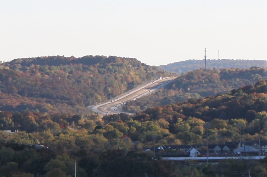
Interstate 49 (I-49) is a north–south Interstate Highway that exists in multiple segments: the original portion entirely within the state of Louisiana with an additional signed portion extending from I-220 in Shreveport to the Arkansas state line, three newer sections in Arkansas, and a new section that opened in Missouri. Its southern terminus is in Lafayette, Louisiana, at I-10 while its northern terminus is in Kansas City, Missouri, at I-435 and I-470. Portions of the remaining roadway in Louisiana, Arkansas, and Texas, which will link Kansas City with New Orleans, are in various stages of planning or construction. Although not part of the original 1957 Interstate Highway plan, residents of Missouri, Arkansas, and Louisiana began campaigning for the highway in 1965 via the "US 71 - I-29 Association". The campaign called for I-29 to be extended south from Kansas City to New Orleans following much of the route along U.S. Route 71 (US 71). The plan called for cr ... [...More Info...] [...Related Items...] OR: [Wikipedia] [Google] [Baidu] |
I-49 (AR 1957)
Interstate 49 (I-49) is a north–south Interstate Highway that exists in multiple segments: the original portion entirely within the state of Louisiana with an additional signed portion extending from I-220 in Shreveport to the Arkansas state line, three newer sections in Arkansas, and a new section that opened in Missouri. Its southern terminus is in Lafayette, Louisiana, at I-10 while its northern terminus is in Kansas City, Missouri, at I-435 and I-470. Portions of the remaining roadway in Louisiana, Arkansas, and Texas, which will link Kansas City with New Orleans, are in various stages of planning or construction. Although not part of the original 1957 Interstate Highway plan, residents of Missouri, Arkansas, and Louisiana began campaigning for the highway in 1965 via the "US 71 - I-29 Association". The campaign called for I-29 to be extended south from Kansas City to New Orleans following much of the route along U.S. Route 71 (US 71). The plan called for ... [...More Info...] [...Related Items...] OR: [Wikipedia] [Google] [Baidu] |
Interstate 40
Interstate 40 (I-40) is a major east–west Interstate Highway running through the south-central portion of the United States. At a length of , it is the third-longest Interstate Highway in the country, after I-90 and I-80. From west to east, it passes through California, Arizona, New Mexico, Texas, Oklahoma, Arkansas, Tennessee, and North Carolina. Its western end is at I-15 in Barstow, California, while its eastern end is at a concurrency of U.S. Route 117 (US 117) and North Carolina Highway 132 (NC 132) in Wilmington, North Carolina. Major cities served by the interstate include Flagstaff, Arizona; Albuquerque, New Mexico; Amarillo, Texas; Oklahoma City, Oklahoma; Little Rock, Arkansas; Memphis, Nashville, and Knoxville in Tennessee; and Asheville, Winston-Salem, Greensboro, Durham, Raleigh, and Wilmington in North Carolina. Much of the western part of I-40, from Barstow to Oklahoma City, parallels or overlays the historic U.S. Route 66. East of Oklaho ... [...More Info...] [...Related Items...] OR: [Wikipedia] [Google] [Baidu] |
I-40 (AR 1957)
Interstate 40 (I-40) is a major east–west Interstate Highway running through the south-central portion of the United States. At a length of , it is the third-longest Interstate Highway in the country, after I-90 and I-80. From west to east, it passes through California, Arizona, New Mexico, Texas, Oklahoma, Arkansas, Tennessee, and North Carolina. Its western end is at I-15 in Barstow, California, while its eastern end is at a concurrency of U.S. Route 117 (US 117) and North Carolina Highway 132 (NC 132) in Wilmington, North Carolina. Major cities served by the interstate include Flagstaff, Arizona; Albuquerque, New Mexico; Amarillo, Texas; Oklahoma City, Oklahoma; Little Rock, Arkansas; Memphis, Nashville, and Knoxville in Tennessee; and Asheville, Winston-Salem, Greensboro, Durham, Raleigh, and Wilmington in North Carolina. Much of the western part of I-40, from Barstow to Oklahoma City, parallels or overlays the historic U.S. Route 66. East of Ok ... [...More Info...] [...Related Items...] OR: [Wikipedia] [Google] [Baidu] |


