|
Crap Masegn
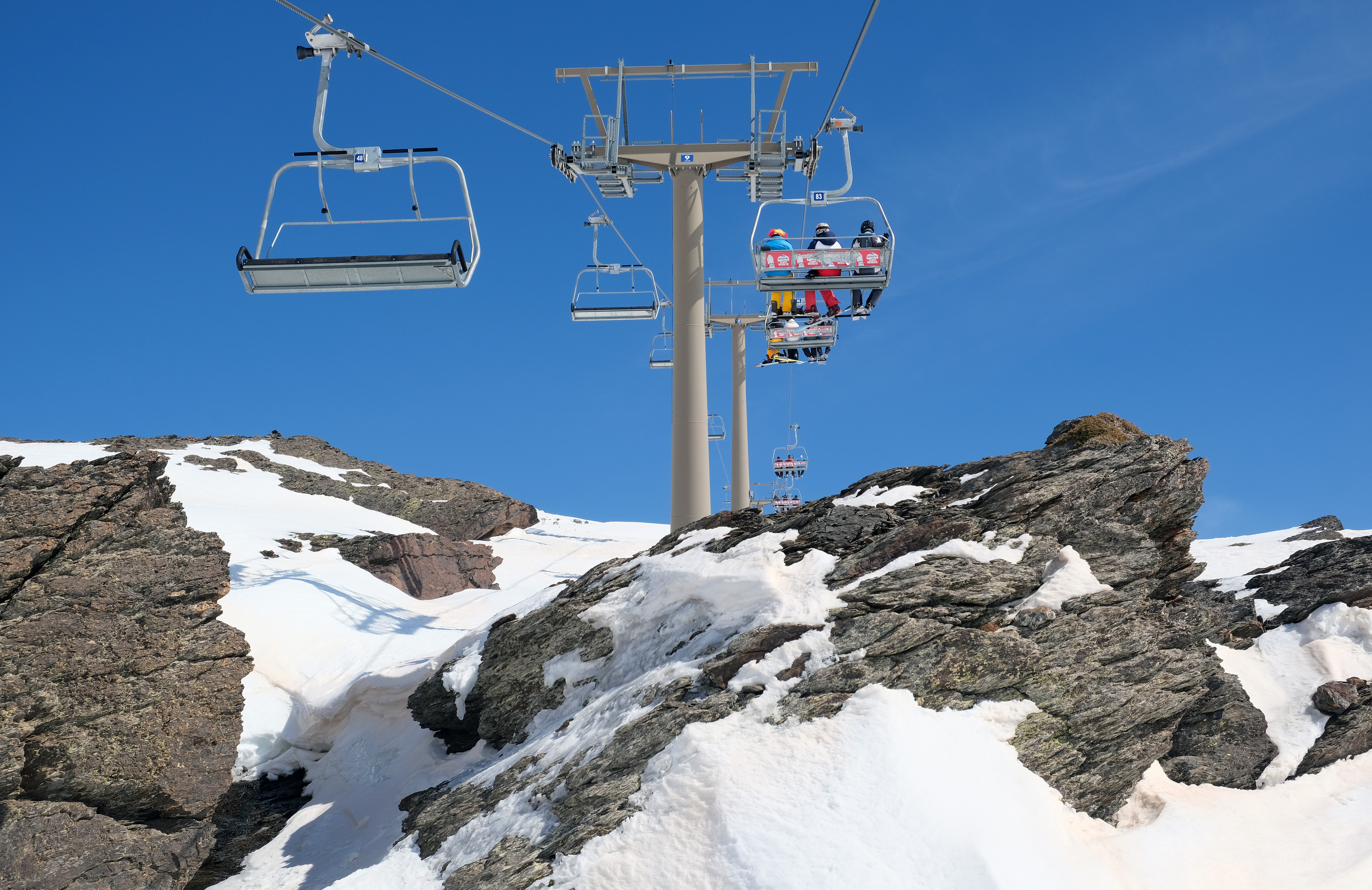
The Crap Masegn is a mountain of the Glarus Alps, located near Flims in the canton of Graubünden, Switzerland. It lies south of the Vorab. Territorially it divides on the municipal areas of Falera on its eastern face, a narrow southern stripe of Ladir and Ruschein on its western face. There is a station of an aerial cableway of the same name which is nowhere near this peak but one kilometer southeast, on the nameless junction of the two ridges of ''Crest Da Tiarms'' and ''Crest La Siala''. There is a chairlift and a gondola lift ending there as well, all of them belonging to the skiing resort of ''Flims-Laax-Falera'' which uses the name of Laax only for winter marketing. See also *List of mountains of Switzerland accessible by public transport This is a list of mountains of Switzerland above 800 metres whose summits are accessible by public transport. This list includes mountains with a topographic prominence of at least 30 metres that have a station above the height of t ... [...More Info...] [...Related Items...] OR: [Wikipedia] [Google] [Baidu] |
Swisstopo
Swisstopo is the official name for the Swiss Federal Office of Topography (in German language, German: ''Bundesamt für Landestopografie''; French language, French: ''Office fédéral de topographie''; Italian language, Italian: ''Ufficio federale di topografia''; Romansh language, Romansh: ''Uffizi federal da topografia''), Switzerland's national mapping agency. The current name was made official in 2002. It had been in use as the domain name for the institute's homepage, swisstopo.ch, since 1997. Maps The main class of products produced by Swisstopo are topographical maps on seven different Scale (map), scales. Swiss maps have been praised for their accuracy and quality. Regular maps * 1:25.000. This is the most detailed map, useful for many purposes. Those are popular with tourists, especially for famous areas like Zermatt and St. Moritz. These maps cost CHF 13.50 each (2004). 208 maps on this scale are published at regular intervals. The first map published on this scale ... [...More Info...] [...Related Items...] OR: [Wikipedia] [Google] [Baidu] |
Ladir
Ladir is a former municipality in the district of Surselva in the Swiss canton of Graubünden. On 1 January 2014 the former municipalities of Ladir, Castrisch, Ilanz, Luven, Pitasch, Riein, Ruschein, Schnaus, Sevgein, Duvin, Pigniu, Rueun and Siat merged into the new municipality of Ilanz/Glion.Nomenklaturen – Amtliches Gemeindeverzeichnis der Schweiz accessed 13 December 2014 History Ladir is first mentioned about 850 as ''Leitura''.Geography Before the merger, Ladir had a total area of . Of this area, 50.3% is used for agricultural purposes, while 42.2% is forested. Of the rest of the land, 2.6% is settled (buildings or roads) and the remainder (4.9%) is non-pr ...[...More Info...] [...Related Items...] OR: [Wikipedia] [Google] [Baidu] |
Mountains Of The Alps
This page tabulates only the most prominent mountains of the Alps, selected for having a topographic prominence of ''at least'' , and all of them exceeding in height. Although the list contains 537 summits, some significant alpine mountains are necessarily excluded for failing to meet the stringent prominence criterion. The list of these most prominent mountains is continued down to 2500 m elevation at List of prominent mountains of the Alps (2500–2999 m) and down to 2000 m elevation on List of prominent mountains of the Alps (2000–2499 m). All such mountains are located in either France, Italy, Switzerland, Liechtenstein, Austria, Germany or Slovenia, even in some lower regions. Together, these three lists include all 44 ultra-prominent peaks of the Alps, with 19 ultras over 3000m on this page. For a definitive list of all 82 the highest peaks of the Alps, as identified by the International Climbing and Mountaineering Federation (UIAA), and often referred to as the 'Alpi ... [...More Info...] [...Related Items...] OR: [Wikipedia] [Google] [Baidu] |
List Of Mountains Of Switzerland Accessible By Public Transport
This is a list of mountains of Switzerland above 800 metres whose summits are accessible by public transport. This list includes mountains with a topographic prominence of at least 30 metres that have a station above the height of their key col and within 120 metres (height difference) from the summit. The station can be reached by cable car, funicular, railway or bus. This list notably includes the Klein Matterhorn and the Säntis, respectively the highest and the most prominentInformation retrieved on 5 March 2014 froCore Europe 50 Most Prominent Peaks (peakbagger.com)an/ref> peaks of Europe with public transport access. It also includes the Chasseral, the most isolated summit of the country accessible to pedestrians. This list does not include ski lifts. For a list of ski areas, see List of ski areas and resorts in Switzerland. For a general list of mountains, see List of mountains of Switzerland. List See also *List of aerial tramways in Switzerland *List of funiculars ... [...More Info...] [...Related Items...] OR: [Wikipedia] [Google] [Baidu] |
Gondola Lift
A gondola lift is a means of cable transport and type of aerial lift which is supported and propelled by cables from above. It consists of a loop of steel wire rope that is strung between two stations, sometimes over intermediate supporting towers. The cable is driven by a bullwheel in a terminal, which is typically connected to an engine or electric motor. It is often considered a ''continuous system'' since it features a haul rope which continuously moves and circulates around two terminal stations. In contrast, an aerial tramway operates solely with fixed grips and simply shuttles back and forth between two end terminals. The capacity, cost, and functionality of a gondola lift will differ dramatically depending on the combination of cables used for support and haulage and the type of grip (detachable or fixed). Because of the proliferation of such systems in the Alps, the it, Cabinovia and french: Télécabine are also used in English-language texts. The systems m ... [...More Info...] [...Related Items...] OR: [Wikipedia] [Google] [Baidu] |
Chairlift
An elevated passenger ropeway, or chairlift, is a type of aerial lift, which consists of a continuously circulating steel wire rope loop strung between two end terminals and usually over intermediate towers, carrying a series of chairs. They are the primary onhill transport at most ski areas (in such cases referred to as 'ski lifts'), but are also found at amusement parks, various tourist attractions, and increasingly in urban transport. Depending on carrier size and loading efficiency, a passenger ropeway can move up to 4000 people per hour, and the fastest lifts achieve operating speeds of up to or . The two-person double chair, which for many years was the workhorse of the ski industry, can move roughly 1200 people per hour at rope speeds of up to . The four person detachable chairlift ("high-speed quad") can transport 2400 people per hour with an average rope speed of . Some bi and tri cable elevated ropeways and reversible tramways achieve much greater operating speeds ... [...More Info...] [...Related Items...] OR: [Wikipedia] [Google] [Baidu] |
Aerial Cableway
An aerial tramway, sky tram, cable car, ropeway, aerial tram, telepherique, or seilbahn is a type of aerial lift which uses one or two stationary ropes for support while a third moving rope provides propulsion. With this form of lift, the grip of an aerial tramway cabin is fixed onto the propulsion rope and cannot be decoupled from it during operations. In comparison to gondola lifts, aerial tramways generally provide lower line capacities and higher wait times. Terminology Because of the proliferation of such systems in the Alpine regions of Europe, the French and German names, ''téléphérique'' and ''Seilbahn'', respectively, are often also used in an English language context. ''Cable car'' is the usual term in British English, as in British English the word ''tramway'' generally refers to a railed street tramway while in American English, ''cable car'' may additionally refer to a cable-pulled street tramway with detachable vehicles; e.g., San Francisco's cable cars. ... [...More Info...] [...Related Items...] OR: [Wikipedia] [Google] [Baidu] |
Ruschein
Ruschein (, ) is a former municipality in the district of Surselva in the canton of Graubünden in Switzerland. Its official language is the Sursilvan dialect of Romansh. On 1 January 2014 the former municipalities of Ruschein, Castrisch, Ilanz, Ladir, Luven, Pitasch, Riein, Schnaus, Sevgein, Duvin, Pigniu, Rueun and Siat merged into the new municipality of Ilanz/Glion.Nomenklaturen – Amtliches Gemeindeverzeichnis der Schweiz accessed 13 December 2014 History Ruschein is first mentioned in 765 as ''Rucene''.Geography [...More Info...] [...Related Items...] OR: [Wikipedia] [Google] [Baidu] |
Falera
Falera is a municipality in the Surselva Region in the Swiss canton of Graubünden. Falera is a part of the ''Alpenarena'' along with the towns of Flims and Laax and is the most secluded of the three. History Falera is a town of rich culture and history. In 1800 B.C., a settlement was started on the Mutta. This came during the Bronze Age and was very significant in the early development of what today is Switzerland. The village is first mentioned in 765 as ''Falariae''. While the first actual mention of a church in Falera was in 840-841. However, the current church was not built until 1491. The church was built on the foot of the Mutta and was named after St. Remigius. Around the church are stone pillars (megaliths or menhirs), arranged geometrically, that are said to date around 1500 B.C. Later, in the year 1903, another church was built. This church was built directly in the village and was named the Herz-Jesu-Kirche or "Heart of Jesus Church" . It, along with the origin ... [...More Info...] [...Related Items...] OR: [Wikipedia] [Google] [Baidu] |
Vorab
The Vorab is a mountain of the Glarus Alps, located on the border between the cantons of Glarus and Graubünden. The summit (3,028 metres) is also named ''Bündner Vorab'' to distinguish it from a lower summit (3,018 metres) named ''Glarner Vorab''. A glacier runs down its eastern face where the valley continues a moderate inclination down towards Flims, where it can be seen for example from Caumasee. It cannot be seen from the adjacent municipalities on the south though. The northwestern face however consists of a sheer drop towards Elm. Territorially it divides on the municipal areas of Laax on its eastern face, a narrow southern stripe within Siat and Elm on its northwestern face. The secondary peaks that belong to the massive include also the municipalities of Ruschein and Panix. Since 1979 there is a terminal station of a platter lift near the Glarner Vorab. This comes up from the terminal station of a gondola lift ending at the edge of the glacier, all of these installa ... [...More Info...] [...Related Items...] OR: [Wikipedia] [Google] [Baidu] |
Flims
Flims ( rm, Flem) is a municipality in the Imboden Region in the Swiss canton of Graubünden. The town of Flims is dominated by the Flimserstein which one can see from almost anywhere in the area. Flims consists of the village of Flims (called Flims Dorf) and the hamlets of Fidaz and Scheia as well as Flims-Waldhaus, the initial birthplace of tourism in Flims, where most of the hotels were built before and after around 1900. Geography Flims has an area of . Of this area, 33.7% is used for agricultural purposes, while 28.9% is forested. Of the rest of the land, 3.6% is settled (buildings or roads) and the remainder (33.9%) is non-productive (rivers, glaciers or mountains). Before 2017, the municipality was located in the Trin sub-district, of the Imboden district, after 2017 it was part of the Imboden Region. Flims is located on a terrace north of the Rhine valley, forming the Ruinaulta gorge here. The country-side has numerous streams and lakes north of the village, from ... [...More Info...] [...Related Items...] OR: [Wikipedia] [Google] [Baidu] |


