|
Crackington Haven
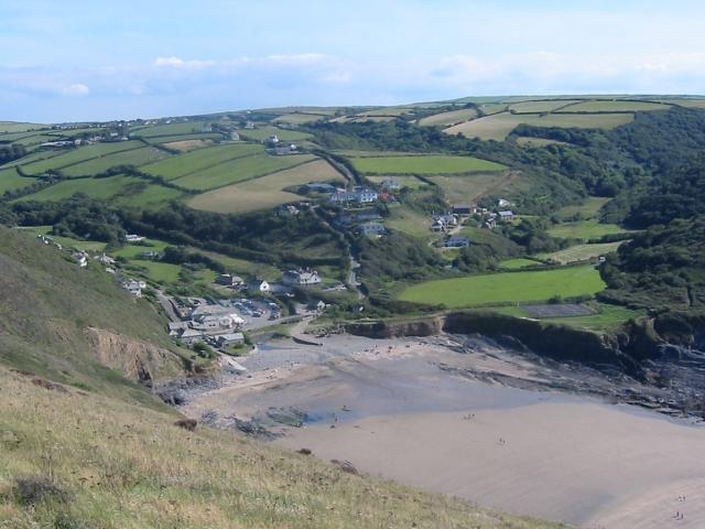
Crackington Haven ( kw, Porthkragen, meaning "sandstone cove") is a coastal village in Cornwall, England, United Kingdom. It is in the civil parish of St Gennys at at the head of a cove on the Atlantic coast. The village is seven miles (11 km) south-southwest of Bude and four miles (7 km) north-northeast of Boscastle.Ordnance Survey: Landranger map sheet 190 ''Bude & Clovelly'' Middle Crackington and Higher Crackington are associated settlements. They are situated on the hill southeast of Crackington Haven, half-a-mile and one mile distant respectively. Geography Crackington Haven is popular with tourists, walkers and geology students. The surrounding cliffs are well known for their visible folded sedimentary rock formations. The village gives its name to the Crackington formation, a sequence of Carboniferous sandstones and grey shales. The village has two café-style tea rooms, and a pub called the Coombe Barton Inn in a building which was originally the house ... [...More Info...] [...Related Items...] OR: [Wikipedia] [Google] [Baidu] |
Sandstone
Sandstone is a clastic sedimentary rock composed mainly of sand-sized (0.0625 to 2 mm) silicate grains. Sandstones comprise about 20–25% of all sedimentary rocks. Most sandstone is composed of quartz or feldspar (both silicates) because they are the most resistant minerals to weathering processes at the Earth's surface. Like uncemented sand, sandstone may be any color due to impurities within the minerals, but the most common colors are tan, brown, yellow, red, grey, pink, white, and black. Since sandstone beds often form highly visible cliffs and other topographic features, certain colors of sandstone have been strongly identified with certain regions. Rock formations that are primarily composed of sandstone usually allow the percolation of water and other fluids and are porous enough to store large quantities, making them valuable aquifers and petroleum reservoirs. Quartz-bearing sandstone can be changed into quartzite through metamorphism, usually related to ... [...More Info...] [...Related Items...] OR: [Wikipedia] [Google] [Baidu] |
Beaches Of Cornwall
A beach is a landform alongside a body of water which consists of loose particles. The particles composing a beach are typically made from rock, such as sand, gravel, shingle, pebbles, etc., or biological sources, such as mollusc shells or coralline algae. Sediments settle in different densities and structures, depending on the local wave action and weather, creating different textures, colors and gradients or layers of material. Though some beaches form on inland freshwater locations such as lakes and rivers, most beaches are in coastal areas where wave or current action deposits and reworks sediments. Erosion and changing of beach geologies happens through natural processes, like wave action and extreme weather events. Where wind conditions are correct, beaches can be backed by coastal dunes which offer protection and regeneration for the beach. However, these natural forces have become more extreme due to climate change, permanently altering beaches at very rapid ... [...More Info...] [...Related Items...] OR: [Wikipedia] [Google] [Baidu] |
Boscastle Flood Of 2004
The 2004 Boscastle flood ( kw, An Lanwes Kastel Boterel 2004) occurred on Monday, 16 August 2004 in the two villages of Boscastle and Crackington Haven in Cornwall, England, United Kingdom. The villages suffered extensive damage after flash floods caused by an exceptional amount of rain that fell over eight hours that afternoon. The flood in Boscastle was filmed and extensively reported but the floods in Crackington Haven and Rocky Valley were not mentioned beyond the local news. The floods were the worst in local memory. A study commissioned by the Environment Agency from hydraulics consulting firm HR Wallingford concluded that it was among the most extreme ever experienced in Britain. The peak flow was about 140 m3/s, between 5:00 pm and 6:00 pm BST. The annual chance of this (or a greater) flood in any one year is about 1 in 400. The probability each year of the heaviest three-hour rainfall is about 1 in 1300 (although rainfall probability is not the same as flood ... [...More Info...] [...Related Items...] OR: [Wikipedia] [Google] [Baidu] |
Otterham
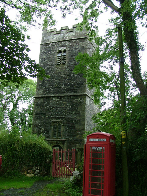
Otterham ( kw, Prasotri) is a village and a civil parish in north Cornwall, England, United Kingdom. The village is situated approximately south of Bude and north of Camelford.Ordnance Survey: Landranger map sheet 190 ''Bude & Clovelly'' Otterham Mill, Otterham Down and Otterham Station (''see below'') are neighbouring settlements to Otterham village; all take the name from the River Ottery which rises in the parish. The parish is in the Hundred of Lesnewth and Deanery of Trigg Major. It is in the Registration District of Camelford and belongs to the Boscastle group of Anglican parishes. Otterham parish is bounded to the north by St Gennys, to the east by Warbstow, to the south by Davidstow and to the west by St Juliot. The parish is rural with small hamlets and farmsteads spread fairly evenly across it: the population of the parish in the 2001 census was 228. The parish church of St Denis at is in Otterham village and has a 40 ft tower housing three bells. The church ... [...More Info...] [...Related Items...] OR: [Wikipedia] [Google] [Baidu] |
North Cornwall Railway
The North Cornwall Railway was a railway line running from Halwill in Devon to Padstow in Cornwall via Launceston, Cornwall, Launceston, Camelford and Wadebridge, a distance of . Opened in the last decade of the nineteenth century, it was part of a drive by the London and South Western Railway (LSWR) to develop holiday traffic to Cornwall. The LSWR had opened a line connecting Exeter with Holsworthy in 1879, and by encouraging the North Cornwall Railway it planned to create railway access to previously inaccessible parts of the northern coastal area. "There are few more fascinating lines than the one which leads to North Cornwall from Okehampton" says T.W.E. Roche in his popular tribute to the network of railway lines operated by the London and South Western Railway (LSWR) in North and West Devon and North Cornwall. History First railways In the nineteenth century, Padstow was an important fishing port, but it was hampered by lack of land communication with its markets. The B ... [...More Info...] [...Related Items...] OR: [Wikipedia] [Google] [Baidu] |
Robert, Count Of Mortain
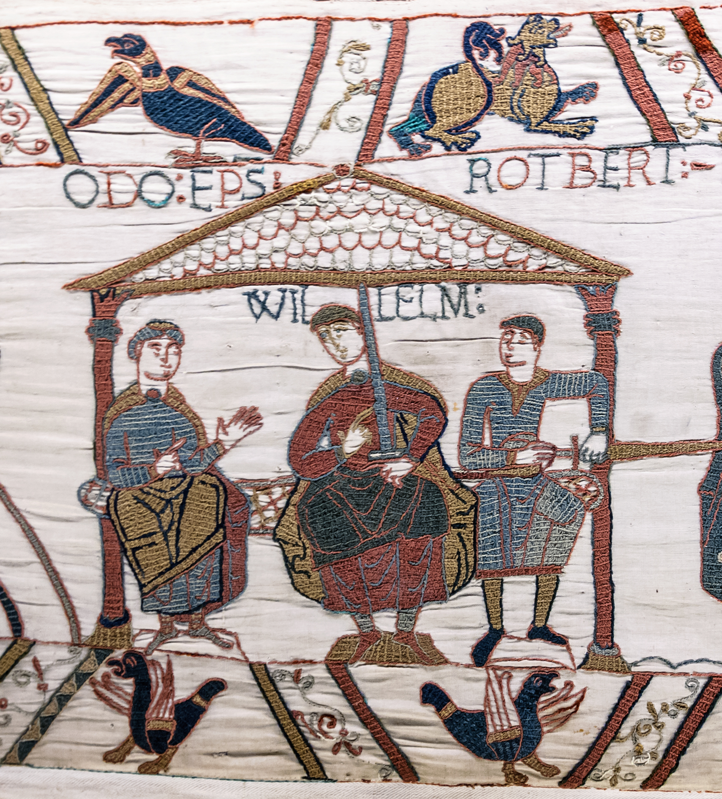
Robert, Count of Mortain, 2nd Earl of Cornwall (–) was a Norman nobleman and the half-brother (on their mother's side) of King William the Conqueror. He was one of the very few proven companions of William the Conqueror at the Battle of Hastings and as recorded in the Domesday Book of 1086 was one of the greatest landholders in his half-brother's new Kingdom of England. Life Robert was the son of Herluin de Conteville and Herleva of Falaise and brother of Odo of Bayeux.Detlev Schwennicke, ''Europäische Stammtafeln: Stammtafeln zur Geschichte der Europäischen Staaten'', Neue Folge, Band III Teilband 4 (Marburg, Germany: Verlag von J. A. Stargardt, 1989), Tafel 694B Robert was born in Normandy, a half-brother of William the Conqueror. and was probably not more than a year or so younger than his brother Odo, born . About 1035, Herluin, as Vicomte of Conteville, along with his wife Herleva and Robert, founded Grestain Abbey. Count of Mortain Around 1049 his brother Duke Willia ... [...More Info...] [...Related Items...] OR: [Wikipedia] [Google] [Baidu] |
Cornwall Area Of Outstanding Natural Beauty
The Cornwall Area of Outstanding Natural Beauty covers in Cornwall, England, UK; that is, about 27% of the total area of the county. It comprises 12 separate areas, designated under the National Parks and Access to the Countryside Act 1949 for special landscape protection. Of the areas, eleven cover stretches of coastline; the twelfth is Bodmin Moor. The areas are together treated as a single Area of Outstanding Natural Beauty (AONB). Section 85 of the Countryside and Rights of Way Act 2000 places a duty on all relevant authorities when discharging any function affecting land within an AONB to have regard to the purpose of conserving and enhancing natural beauty. Section 89 places a statutory duty on Local Planning Authorities with an AONB within their administrative area to produce a 5-year management plan. Designation The areas were designated in 1959, except for the Camel estuary which was added in 1981. [...More Info...] [...Related Items...] OR: [Wikipedia] [Google] [Baidu] |
Weatherhill, Craig
Craig Weatherhill (1950 or 1951 – 18 or 19 July 2020) was a Cornish antiquarian, novelist and writer on the history, archaeology, place names and mythology of Cornwall. Weatherhill attended school in Falmouth, where his parents ran a sports shop. He played football for a number of local clubs, including Mawnan, and played as goalkeeper for the county football team. Between 1972 and 1974, Weatherhill served with the RAF, training as a cartographer. He was discharged after a serious back injury. He worked as a planning officer, architectural designer and historic conservation expert in local government and private practice. Under the tutelage of historian P.A.S. Pool he conducted archaeological surveys of West Cornwall. Weatherhill was also a Conservation Officer at Penwith District Council. He contributed to the BBC's Radyo Kernow, in particular to the series ''The Tinners' Way'' and ''Beachcombers''. In 1981 Weatherhill was made a Bard of Gorsedh Kernow for services to Corn ... [...More Info...] [...Related Items...] OR: [Wikipedia] [Google] [Baidu] |
Shale
Shale is a fine-grained, clastic sedimentary rock formed from mud that is a mix of flakes of clay minerals (hydrous aluminium phyllosilicates, e.g. kaolin, Al2 Si2 O5( OH)4) and tiny fragments (silt-sized particles) of other minerals, especially quartz and calcite.Blatt, Harvey and Robert J. Tracy (1996) ''Petrology: Igneous, Sedimentary and Metamorphic'', 2nd ed., Freeman, pp. 281–292 Shale is characterized by its tendency to split into thin layers ( laminae) less than one centimeter in thickness. This property is called '' fissility''. Shale is the most common sedimentary rock. The term ''shale'' is sometimes applied more broadly, as essentially a synonym for mudrock, rather than in the more narrow sense of clay-rich fissile mudrock. Texture Shale typically exhibits varying degrees of fissility. Because of the parallel orientation of clay mineral flakes in shale, it breaks into thin layers, often splintery and usually parallel to the otherwise indistinguishable beddin ... [...More Info...] [...Related Items...] OR: [Wikipedia] [Google] [Baidu] |
Carboniferous
The Carboniferous ( ) is a geologic period and system of the Paleozoic that spans 60 million years from the end of the Devonian Period million years ago ( Mya), to the beginning of the Permian Period, million years ago. The name ''Carboniferous'' means "coal-bearing", from the Latin '' carbō'' ("coal") and '' ferō'' ("bear, carry"), and refers to the many coal beds formed globally during that time. The first of the modern 'system' names, it was coined by geologists William Conybeare and William Phillips in 1822, based on a study of the British rock succession. The Carboniferous is often treated in North America as two geological periods, the earlier Mississippian and the later Pennsylvanian. Terrestrial animal life was well established by the Carboniferous Period. Tetrapods (four limbed vertebrates), which had originated from lobe-finned fish during the preceding Devonian, became pentadactylous in and diversified during the Carboniferous, including early amphibian line ... [...More Info...] [...Related Items...] OR: [Wikipedia] [Google] [Baidu] |


Saunders_Quarry-1.jpg)


