|
Cowlyd Tramway
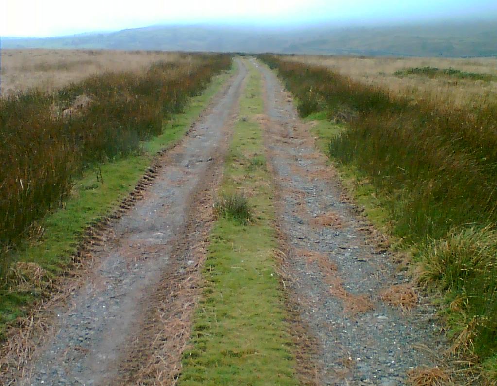
The Cowlyd Tramway was a narrow gauge railway line used to convey men and materials to Llyn Cowlyd Reservoir, near Trefriw in northern Wales during the enlargement of the dam, and thereafter for maintenance purposes. History Llyn Cowlyd had been a reservoir since 1908, owned by the Conwy and Colwyn Bay Joint Water Supply Board. By 1915 rights to water extraction were also held by the Aluminium Corporation and the North Wales Power and Traction Co. Ltd., both of Dolgarrog, and a severe drought in this year prompted the decision to increase water reserves by building a much higher dam. Construction of the Cowlyd Tramway began in 1916, and reached Llyn Cowlyd the following year. The dam was completed in December 1921, being built entirely from rock quarried from the adjacent mountainside, and was opened the following year in more favourable weather. The tramway was essentially a branch line of the former Eigiau Tramway, built originally as a standard gauge tramway to ... [...More Info...] [...Related Items...] OR: [Wikipedia] [Google] [Baidu] |
Dolgarrog
Dolgarrog is a village and community (Wales), community in Conwy County Borough, in Wales, situated between Llanrwst and Conwy, very close to the Conwy River. The village is well known for its industrial history since the 18th century and the Llyn Eigiau, Eigiau dam disaster, which occurred in 1925. The population was 414 at the 2001 Census, increasing to 446 at the 2011 Census. The community extends up to, and includes part of, Llyn Cowlyd in the Carneddau. The village is served by Dolgarrog railway station, a halt on the other side of the river Conwy, although the bridge allowing access to the station is slated for closure. Surf Snowdonia, the world's first commercial artificial surfing lake, is located in Dolgarrog on the site of the old aluminium factory. Across the valley is the crag of Cadair Ifan Goch. Etymology The name Dolgarrog derives from Welsh language, Welsh dôl (water-meadow) and carrog (torrent) and reflects the fact that a number of streams descend s ... [...More Info...] [...Related Items...] OR: [Wikipedia] [Google] [Baidu] |
Afon Ddu (Cowlyd)
(Welsh for ''black river'') is the name of several rivers in Snowdonia in north-west Wales: * The largest of these flows from Llyn Cowlyd on the south-eastern edge of the Carneddau range to join the river Conwy, passing Pont Dolgarrog on the B5106 road, just south of the village of Dolgarrog. The gorge cut by the river at this point is popular for gorge walking, the river passing at this point through a Site of Special Scientific Interest for broadleaved woodland and a number of rare species of plant. * Another is a stream draining the south-eastern slopes of Drum and Foel-fras, mountains in the Carneddau mountain range. It is a tributary of Afon Dulyn, itself is a tributary of the river Conwy. * A third is a stream flowing north-west from Bwlch y Ddeufaen. It is a tributary of the Afon Llanfairfechan, joining it immediately above the village of Llanfairfechan. * A fourth is a tributary of the River Dysynni in the northern Dysynni Valley, famed for Craig y Deryn __NOTOC__ ... [...More Info...] [...Related Items...] OR: [Wikipedia] [Google] [Baidu] |
British Industrial Narrow Gauge Railways
British industrial narrow-gauge railways are narrow-gauge railways in the United Kingdom and the Isle of Man that were primarily built to serve one or more industries. Some offered passenger services for employees or workmen, but they did not run public passenger trains. They are categorized by the primary industry they served. Quarrying and mining Heavy industry Engineering works Power generation Power stations were some of the last regular users of industrial steam locomotives in the United Kingdom, although most of these were standard gauge. However, several power generation facilities used narrow-gauge railways. Refineries Steel works File:Statfold Barn Railway - diesel locomotive (geograph 3911882).jpg, Preserved Shotton steelworks locomotive Zinc smelting Construction industry Contractor depots Many construction contractors maintained depots that included narrow-gauge equipment in store and under repair. While some of these were tempora ... [...More Info...] [...Related Items...] OR: [Wikipedia] [Google] [Baidu] |
Porthmadog
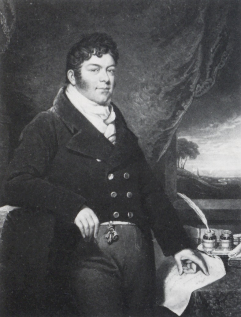
Porthmadog (; ), originally Portmadoc until 1974 and locally as "Port", is a Welsh coastal town and community in the Eifionydd area of Gwynedd and the historic county of Caernarfonshire. It lies east of Criccieth, south-west of Blaenau Ffestiniog, north of Dolgellau and south of Caernarfon. The community population of 4,185 in the 2011 census was put at 4,134 in 2019. It grew in the 19th century as a port for local slate, but as the trade declined, it continued as a shopping and tourism centre, being close to Snowdonia National Park and the Ffestiniog Railway. The 1987 National Eisteddfod was held there. It includes nearby Borth-y-Gest, Morfa Bychan and Tremadog. History Porthmadog came about after William Madocks built a sea wall, the ''Cob'', in 1808–1811 to reclaim much of Traeth Mawr from the sea for farming use. Diversion of the Afon Glaslyn caused it to scour out a new natural harbour deep enough for small ocean-going sailing ships,John Dobson and Roy Woods, ''Ffe ... [...More Info...] [...Related Items...] OR: [Wikipedia] [Google] [Baidu] |
Caernarfon
Caernarfon (; ) is a royal town, community and port in Gwynedd, Wales, with a population of 9,852 (with Caeathro). It lies along the A487 road, on the eastern shore of the Menai Strait, opposite the Isle of Anglesey. The city of Bangor is to the north-east, while Snowdonia fringes Caernarfon to the east and south-east. Carnarvon and Caernarvon are Anglicised spellings that were superseded in 1926 and 1974 respectively. Abundant natural resources in and around the Menai Strait enabled human habitation in prehistoric Britain. The Ordovices, a Celtic tribe, lived in the region during the period known as Roman Britain. The Roman fort Segontium was established around AD 80 to subjugate the Ordovices during the Roman conquest of Britain. The Romans occupied the region until the end of Roman rule in Britain in 382, after which Caernarfon became part of the Kingdom of Gwynedd. In the late 11th century, William the Conqueror ordered the construction of a motte-and-bailey cas ... [...More Info...] [...Related Items...] OR: [Wikipedia] [Google] [Baidu] |
Llanberis Lake Railway
The Llanberis Lake Railway ( cy, Rheilffordd Llyn Padarn) is a narrow gauge heritage railway that runs for along the northern shore of Llyn Padarn in north Wales in the Snowdonia National Park. The starting point is the village of Llanberis at the eastern end of the lake (), with the western terminus at Pen Llyn in the Padarn Country Park (). The return journey takes around 60 minutes. History Early proposals The Llanberis Lake Railway runs along part of the trackbed of the defunct Padarn Railway, a gauge line which connected the quarry with Y Felinheli (Port Dinorwic) on the Menai Strait. The Padarn Railway closed in October 1961 and was lifted between 16 May 1962 and February 1963. Following the closure of the Padarn Railway, various plans were made to open a gauge tourist railway on the trackbed. The first serious attempt was made by G. Ward, a local resident, who proposed a railway that would circle Llyn Padarn using the trackbeds of the British Rail Llanberis b ... [...More Info...] [...Related Items...] OR: [Wikipedia] [Google] [Baidu] |
Welsh Highland Railway
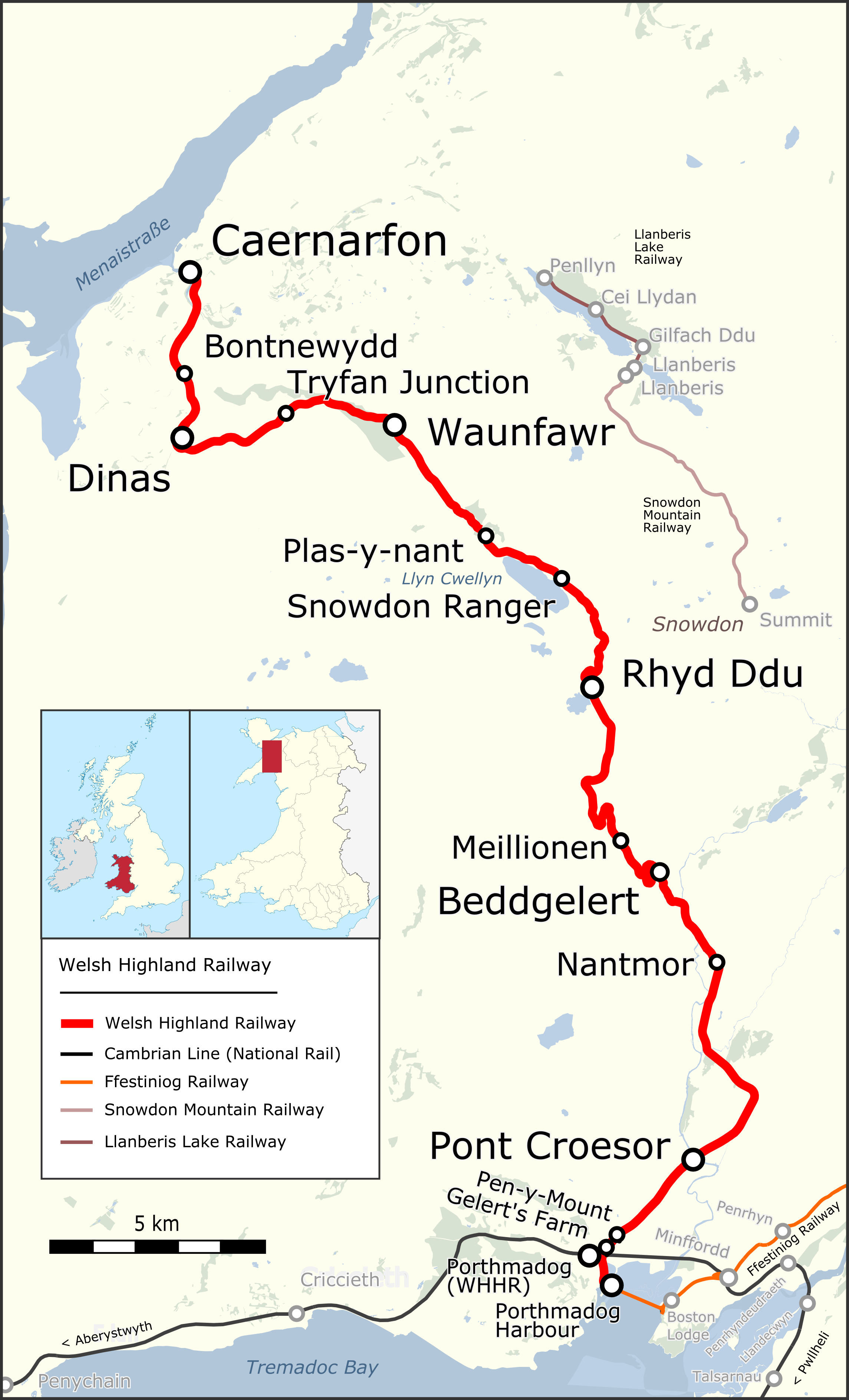
The Welsh Highland Railway (WHR) or Rheilffordd Eryri is a long, restored narrow gauge heritage railway in the Welsh county of Gwynedd, operating from Caernarfon to Porthmadog, and passing through a number of popular tourist destinations including Beddgelert and the Aberglaslyn Pass. At Porthmadog it connects with the Ffestiniog Railway and to the short Welsh Highland Heritage Railway. In Porthmadog it uses the United Kingdom's only mixed gauge flat rail crossing. The restoration, which had the civil engineering mainly built by contractors and the track mainly built by volunteers, received a number of awards. Originally running from , near Caernarfon, to ,Boyd (1972), pages=283 the current line includes an additional section from Dinas to Caernarfon. The original line also had a branch to and the slate quarries around Moel Tryfan, which has not been restored. (This branch forms a footpath "rail trail", the lower section of which has been resurfaced and supplied with heri ... [...More Info...] [...Related Items...] OR: [Wikipedia] [Google] [Baidu] |
Sir Robert McAlpine & Sons
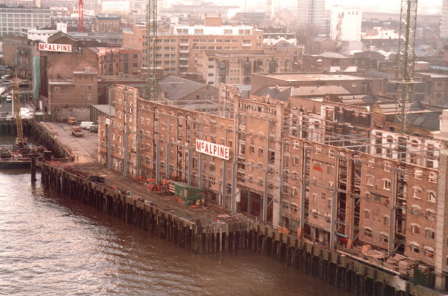
Sir Robert McAlpine Limited is a family-owned building and civil engineering company based in Hemel Hempstead, England. It carries out engineering and construction in the infrastructure, heritage, commercial, arena and stadium, healthcare, education and nuclear sectors. History Robert McAlpine was born in 1847 in the Scottish village of Newarthill near Motherwell. From the age of seven he worked in the nearby coal mines, leaving at 16 to become an apprentice bricklayer. Later, working for an engineer, he progressed to being foreman before starting to work on his own account at the age of 22 (1869). He had no capital other than that he could earn himself and his first contract involving the employment of other men had to be financed by borrowing £11 from the butcher. From there, McAlpine enjoyed rapid success; the early contracts centred on his own trade of bricklaying and by 1874 he was the owner of two brickyards and an employer of 1,000 men.J Saxon Childers, Robert McAlpine ... [...More Info...] [...Related Items...] OR: [Wikipedia] [Google] [Baidu] |
Penrhyn Quarry
The Penrhyn quarry is a slate quarry located near Bethesda, North Wales. At the end of the nineteenth century it was the world's largest slate quarry; the main pit is nearly long and deep, and it was worked by nearly 3,000 quarrymen. It has since been superseded in size by slate quarries in China, Spain and the USA. Penrhyn is still Britain's largest slate quarry but its workforce is now nearer 200. History The first reference to slate extraction at Penrhyn is from 1570, when the quarry is mentioned in a Welsh poem. The quarry was developed in the 1770s by Richard Pennant, later Baron Penrhyn. Much of his early working was for local use only as no large scale transport infrastructure was developed until Pennant's involvement. From then on, slates from the quarry were transported to the sea at Port Penrhyn on the narrow gauge Penrhyn Quarry Railway built in 1798, one of the earliest railway lines. In the 19th century the Penrhyn Quarry, along with the Dinorwic quarry, dom ... [...More Info...] [...Related Items...] OR: [Wikipedia] [Google] [Baidu] |
Orenstein & Koppel
Orenstein & Koppel (normally abbreviated to "O&K") was a major Germany, German engineering company specialising in railway vehicles, escalators, and heavy equipment. It was founded on April 1, 1876 in Berlin by Benno Orenstein and Arthur Koppel. Originally a general engineering company, O&K soon started to specialise in the manufacture of railway vehicles. The company also manufactured heavy equipment and escalators. O&K pulled out of the railway business in 1981. Its escalator-manufacturing division was spun off to the company's majority shareholder at the time, Krupp, Friedrich Krupp AG Hoesch-Krupp, in 1996, leaving the company to focus primarily on construction machines. The construction-equipment business was sold to New Holland Construction, at the time part of the Fiat Group, in 1999. Founding and railway work The Orenstein & Koppel Company was a mechanical engineering, mechanical-engineering firm that first entered the railway-construction field, building locomotives a ... [...More Info...] [...Related Items...] OR: [Wikipedia] [Google] [Baidu] |
Cefn Cyfarwydd
Cefn Cyfarwydd is a ridge in Conwy county borough, north Wales. It is located above the village of Trefriw on the western side of the Conwy valley, and dramatically separates Cwm Cowlyd and the rugged mountains of the Carneddau from the greener, lusher Conwy valley. The Welsh word ''cyfarwydd'' can mean either "familiar" (adj.) or "a story-teller, guide or expert" (noun). ''Cefn'' means "ridge". 'Cefn Cyfarwydd' therefore translates as either "familiar ridge" or "story-teller's ridge". Extent The ridge reaches some 500m in height, and covers an area of some 8 square kilometres, broadly 4 km long by 2 km wide. It runs in a largely SW - NE direction, and is relatively flat-topped, resulting in some wet pools and boggy patches, even in the summer months. Much of it is heathery moorland. To the north-west it slopes down steeply to Llyn Cowlyd, and to the south-east to Llyn Crafnant and the Crafnant valley where, in places, these slopes have been forested. T ... [...More Info...] [...Related Items...] OR: [Wikipedia] [Google] [Baidu] |


.jpg)


