|
Courland Peninsula
The Courland Peninsula (, German: ''Kurland'') is a historical and cultural region in western Latvia in the north-western part of Courland. Fourteen coastal villages on the peninsula make of the Livonian core area. It is bordered by the Baltic Sea in the West, the Irbe Strait in the North and the Gulf of Riga in the East. It covers northwestern Latvia. The Courland Peninsula was the site of the Courland Pocket of World War II. See also * Courland Pocket The Courland Pocket (Blockade of the Courland army group), (german: Kurland-Kessel)/german: Kurland-Brückenkopf (Courland Bridgehead), lv, Kurzemes katls (Courland Cauldron) or ''Kurzemes cietoksnis'' (Courland Fortress)., group=lower-alpha ... References {{coord, 57.2667, N, 22.2500, E, source:wikidata, display=title Peninsulas of Europe Courland ... [...More Info...] [...Related Items...] OR: [Wikipedia] [Google] [Baidu] |
Kurzeme LocMap
Kurzeme is the Latvian name for Courland, a historical and cultural region of Latvia. It may also refer to: * Kurzemes guberņa, the Latvian name of Courland Governorate * Kurzeme Planning Region, a planning region of Latvia * Kurzeme Statistical Region, a statistical region of Latvia * Kurzeme Province, a province in Republic of Latvia (1918–1940) * Kurzeme District, Riga, an administrative district of Riga, Latvia * Courland (Saeima constituency) Courland ( lv, Kurzeme; russian: Курземе) is one of the five multi-member constituencies of the Saeima, the national legislature of Latvia. The constituency was established in 1922 when the Saeima was established following Latvia's indepen ..., constituency of the Saeima, the national legislature of Latvia, known as Kurzeme in Latvian See also * Courland (other) {{geodis ... [...More Info...] [...Related Items...] OR: [Wikipedia] [Google] [Baidu] |
Latvia
Latvia ( or ; lv, Latvija ; ltg, Latveja; liv, Leţmō), officially the Republic of Latvia ( lv, Latvijas Republika, links=no, ltg, Latvejas Republika, links=no, liv, Leţmō Vabāmō, links=no), is a country in the Baltic region of Northern Europe. It is one of the Baltic states; and is bordered by Estonia to the north, Lithuania to the south, Russia to the east, Belarus to the southeast, and shares a maritime border with Sweden to the west. Latvia covers an area of , with a population of 1.9 million. The country has a temperate seasonal climate. Its capital and largest city is Riga. Latvians belong to the ethno-linguistic group of the Balts; and speak Latvian, one of the only two surviving Baltic languages. Russians are the most prominent minority in the country, at almost a quarter of the population. After centuries of Teutonic, Swedish, Polish-Lithuanian and Russian rule, which was mainly executed by the local Baltic German aristocracy, the independent R ... [...More Info...] [...Related Items...] OR: [Wikipedia] [Google] [Baidu] |
Courland
Courland (; lv, Kurzeme; liv, Kurāmō; German and Scandinavian languages: ''Kurland''; la, Curonia/; russian: Курляндия; Estonian: ''Kuramaa''; lt, Kuršas; pl, Kurlandia) is one of the Historical Latvian Lands in western Latvia. The largest city is Liepāja, the third largest city in Latvia. The regions of Semigallia and Selonia are sometimes considered as part of Courland as they were formerly held by the same duke. Geography and climate Situated in western Latvia, Courland roughly corresponds to the former Latvian districts of Kuldīga, Liepāja, Saldus, Talsi, Tukums and Ventspils. When combined with Semigallia and Selonia, Courland's northeastern boundary is the Daugava, which separates it from the regions of Latgale and Vidzeme. To the north, Courland's coast lies along the Gulf of Riga. On the west it is bordered by the Baltic Sea, and on the south by Lithuania. It lies between 55° 45′ and 57° 45′ North and 21° and 27° East. The name is also ... [...More Info...] [...Related Items...] OR: [Wikipedia] [Google] [Baidu] |
Livonians
The Livonians, or Livs ( Livonian: ''līvlizt''; Estonian: ''liivlased''; Latvian: ''līvi'', ''lībieši''), are a Balto-Finnic people indigenous to northern and northwestern Latvia. Livonians historically spoke Livonian, a Uralic language closely related to Estonian and related to Finnish. The last person to have learned and spoken Livonian as a mother tongue, Grizelda Kristiņa, died in 2013, making Livonian a dormant language. As of 2010, there were approximately 30 people who had learned it as a second language. Historical, social and economic factors, together with an ethnically dispersed population, have resulted in the decline of the Livonian population, with only a small group surviving in the 21st century. In 2011, there were 250 people who claimed Livonian ethnicity in Latvia. History Prehistory The exact date of migration of Livonians to the region has been disputed. "The Livonians claim to have inhabited their present homeland for over 5,000 years." "The Finni ... [...More Info...] [...Related Items...] OR: [Wikipedia] [Google] [Baidu] |
Baltic Sea
The Baltic Sea is an arm of the Atlantic Ocean that is enclosed by Denmark, Estonia, Finland, Germany, Latvia, Lithuania, Poland, Russia, Sweden and the North and Central European Plain. The sea stretches from 53°N to 66°N latitude and from 10°E to 30°E longitude. A marginal sea of the Atlantic, with limited water exchange between the two water bodies, the Baltic Sea drains through the Danish Straits into the Kattegat by way of the Øresund, Great Belt and Little Belt. It includes the Gulf of Bothnia, the Bay of Bothnia, the Gulf of Finland, the Gulf of Riga and the Bay of Gdańsk. The " Baltic Proper" is bordered on its northern edge, at latitude 60°N, by Åland and the Gulf of Bothnia, on its northeastern edge by the Gulf of Finland, on its eastern edge by the Gulf of Riga, and in the west by the Swedish part of the southern Scandinavian Peninsula. The Baltic Sea is connected by artificial waterways to the White Sea via the White Sea–Baltic Canal and to the German ... [...More Info...] [...Related Items...] OR: [Wikipedia] [Google] [Baidu] |
Irbe Strait
Irbe Strait, also known as Irben Strait ( et, Kura kurk, lv, Irbes jūras šaurums, liv, Sūr mer), forms the main exit out of the Gulf of Riga to the Baltic Sea, between the Sõrve Peninsula forming the southern end of the island Saaremaa in Estonia and Courland Peninsula in Latvia. It is wide at its narrowest point. A shipping channel has been dredged along its southern shore to allow larger ships to pass. See also Saunags. Irbe is also the name of a coastal river on Courland Peninsula. It follows the coastline of the Irbe strait, flowing south-west to north-east, reaching the Baltic sea in the Irbe strait near cape Kolka, in the Slītere national park. on ''google.com/maps''. Its ... [...More Info...] [...Related Items...] OR: [Wikipedia] [Google] [Baidu] |
Gulf Of Riga
The Gulf of Riga, Bay of Riga, or Gulf of Livonia ( lv, Rīgas līcis, et, Liivi laht) is a bay of the Baltic Sea between Latvia and Estonia. The island of Saaremaa (Estonia) partially separates it from the rest of the Baltic Sea. The main connection between the gulf and the Baltic Sea is the Irbe Strait. The Gulf of Riga, as a sub-basin of the Baltic, also includes the Väinameri Sea in the West Estonian archipelago. Geography Extent The International Hydrographic Organization defines the Gulf of Riga's western limit as "A line running from Lyser Ort (57°34'N), in Latvia, to the South extreme of Œsel Island, through this island to Pammerort (22°34'E), thence to Enmast Point, the S extreme of Dagö, through Dagö to Takhkona Point, the North extreme thereof, and on to Spithamn Point in Estonia". Islands Major islands in the gulf include Saaremaa, Kihnu, and Ruhnu, which are all controlled by Estonia. Kihnu covers an area of . Saaremaa island is responsible for ... [...More Info...] [...Related Items...] OR: [Wikipedia] [Google] [Baidu] |
Courland Pocket
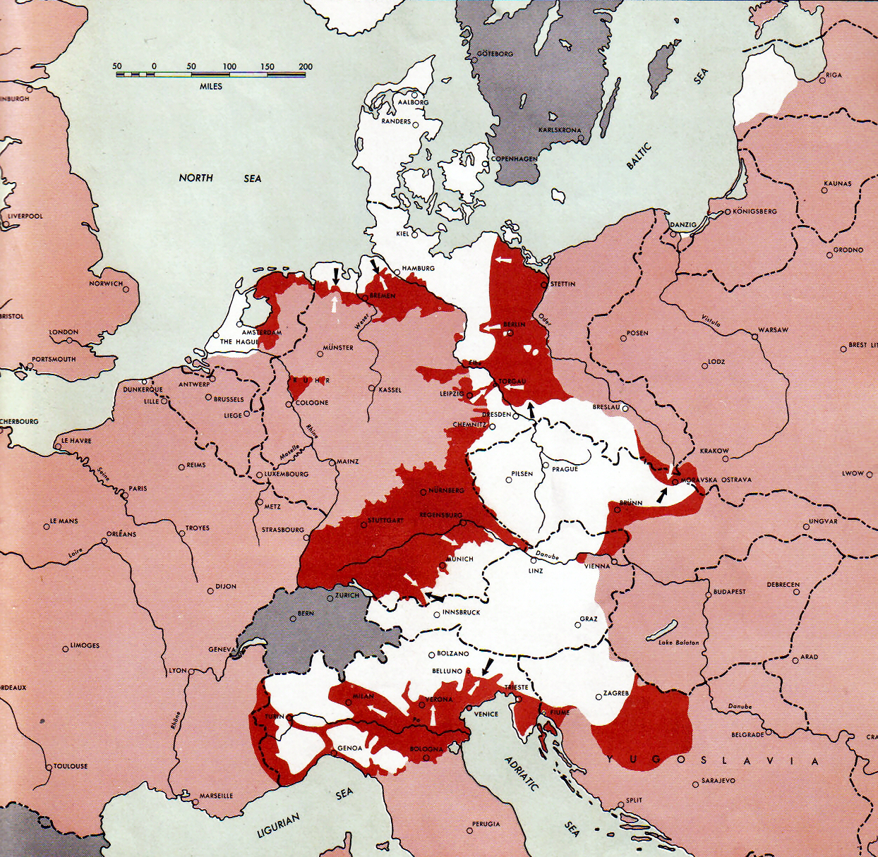
The Courland Pocket (Blockade of the Courland army group), (german: Kurland-Kessel)/german: Kurland-Brückenkopf (Courland Bridgehead), lv, Kurzemes katls (Courland Cauldron) or ''Kurzemes cietoksnis'' (Courland Fortress)., group=lower-alpha was an area of the Courland Peninsula where Army Group North of Nazi Germany and the Reichskommissariat Ostland were cut off and surrounded by the Red Army for almost a year, lasting from July 1944 until 10 May 1945. The pocket was created during the Red Army's Baltic Offensive, when forces of the 1st Baltic Front reached the Baltic Sea near Memel (Klaipėda) during its lesser Memel Offensive Operation phases. This action isolated the German Army Group North from the rest of the German forces, having been pushed from the south by the Red Army, standing in a front between Tukums and Libau in Latvia, with the Baltic Sea in the West, the Irbe Strait in the North and the Gulf of Riga in the East behind the Germans. Renamed Army Group Courl ... [...More Info...] [...Related Items...] OR: [Wikipedia] [Google] [Baidu] |
Peninsulas Of Europe
A peninsula (; ) is a landform that extends from a mainland and is surrounded by water on most, but not all of its borders. A peninsula is also sometimes defined as a piece of land bordered by water on three of its sides. Peninsulas exist on all continents. The size of a peninsula can range from tiny to very large. The largest peninsula in the world is the Arabian Peninsula. Peninsulas form due to a variety of causes. Etymology Peninsula derives , which is translated as 'peninsula'. itself was derived , or together, 'almost an island'. The word entered English in the 16th century. Definitions A peninsula is usually defined as a piece of land surrounded on most, but not all sides, but is sometimes instead defined as a piece of land bordered by water on three of its sides. A peninsula may be bordered by more than one body of water, and the body of water does not have to be an ocean or a sea. A piece of land on a very tight river bend or one between two rivers is sometimes ... [...More Info...] [...Related Items...] OR: [Wikipedia] [Google] [Baidu] |


.jpg)

