|
Cottonwood Canyon Road
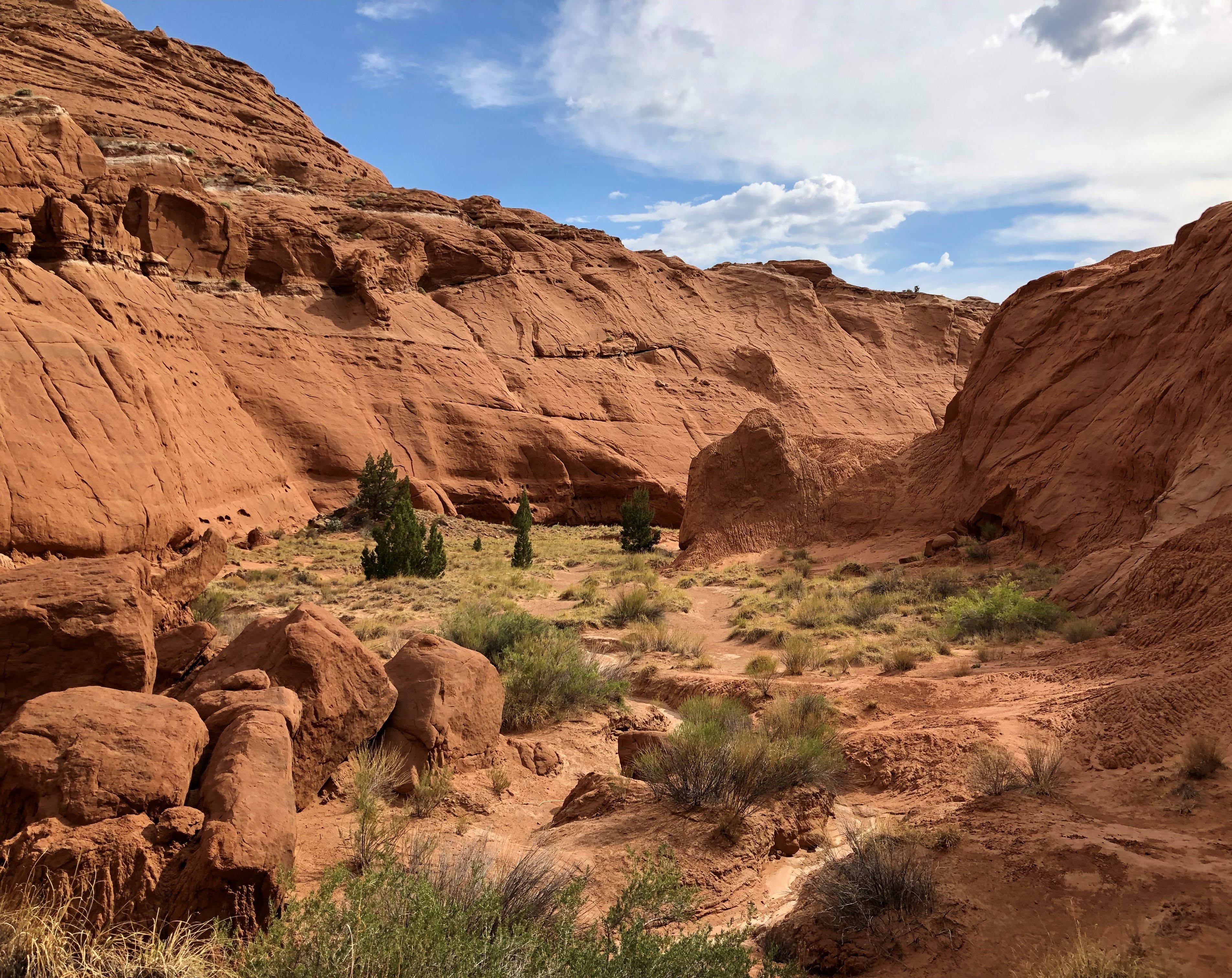
Road 400 (Cottonwood Canyon Road) is a scenic dirt road in Kane County, Utah, United States that connects U.S. Route 89 (US-89) with South Kodachrome Road (which, within a few more miles connects with Cannonville and Utah State Route 12). The road traverses portions of Grand Staircase–Escalante National Monument offering a unique view into the heart of the Monument. This road is considered impassable in wet weather and high clearance vehicles are recommended. Views Patient drivers of this road will be rewarded with a closer look at spectacular natural features, including one known as the Cockscomb. Topography here is on a more intimate scale, and formations are varied and colorful. Additionally there are notable hiking trails accessed along the route such as Hackberry Canyon, the Cottonwood Narrows, and Round Valley Draw. Other attractions located on the northern end of the road include Grosvenor Arch and Kodachrome Basin State Park, more reliably accessed from Canno ... [...More Info...] [...Related Items...] OR: [Wikipedia] [Google] [Baidu] |
Dirt Road
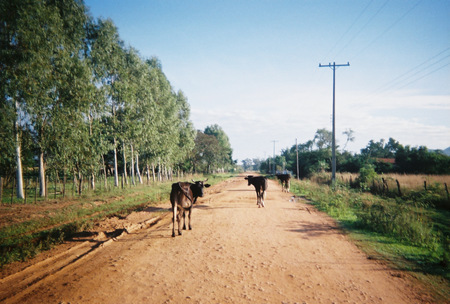
A dirt road or track is a type of unpaved road not paved with asphalt, concrete, brick, or stone; made from the native material of the land surface through which it passes, known to highway engineers as subgrade material. Dirt roads are suitable for vehicles; a narrower path for pedestrians, animals, and possibly small vehicles would be called a dirt track—the distinction is not well-defined. Unpaved roads with a harder surface made by the addition of material such as gravel and aggregate (stones), might be referred to as dirt roads in common usage but are distinguished as improved roads by highway engineers. (Improved unpaved roads include gravel roads, laterite roads, murram roads and macadamized roads.) Compared to a gravel road, a dirt road is not usually graded regularly to produce an enhanced camber to encourage rainwater to drain off the road, and drainage ditches at the sides may be absent. They are unlikely to have embankments through low-lying areas. This lea ... [...More Info...] [...Related Items...] OR: [Wikipedia] [Google] [Baidu] |
Bureau Of Land Management
The Bureau of Land Management (BLM) is an agency within the United States Department of the Interior responsible for administering federal lands. Headquartered in Washington DC, and with oversight over , it governs one eighth of the country's landmass. President Harry S. Truman created the BLM in 1946 by combining two existing agencies: the General Land Office and the Grazing Service. The agency manages the federal government's nearly of subsurface mineral estate located beneath federal, state and private lands severed from their surface rights by the Homestead Act of 1862. Most BLM public lands are located in these 12 western states: Alaska, Arizona, California, Colorado, Idaho, Montana, Nevada, New Mexico, Oregon, Utah, Washington and Wyoming. The mission of the BLM is "to sustain the health, diversity, and productivity of the public lands for the use and enjoyment of present and future generations." Originally BLM holdings were described as "land nobody wanted" because home ... [...More Info...] [...Related Items...] OR: [Wikipedia] [Google] [Baidu] |
Shale
Shale is a fine-grained, clastic sedimentary rock formed from mud that is a mix of flakes of clay minerals (hydrous aluminium phyllosilicates, e.g. kaolin, Al2 Si2 O5( OH)4) and tiny fragments (silt-sized particles) of other minerals, especially quartz and calcite.Blatt, Harvey and Robert J. Tracy (1996) ''Petrology: Igneous, Sedimentary and Metamorphic'', 2nd ed., Freeman, pp. 281–292 Shale is characterized by its tendency to split into thin layers ( laminae) less than one centimeter in thickness. This property is called '' fissility''. Shale is the most common sedimentary rock. The term ''shale'' is sometimes applied more broadly, as essentially a synonym for mudrock, rather than in the more narrow sense of clay-rich fissile mudrock. Texture Shale typically exhibits varying degrees of fissility. Because of the parallel orientation of clay mineral flakes in shale, it breaks into thin layers, often splintery and usually parallel to the otherwise indistinguishable beddin ... [...More Info...] [...Related Items...] OR: [Wikipedia] [Google] [Baidu] |
Silt
Silt is granular material of a size between sand and clay and composed mostly of broken grains of quartz. Silt may occur as a soil (often mixed with sand or clay) or as sediment mixed in suspension with water. Silt usually has a floury feel when dry, and lacks plasticity when wet. Silt also can be felt by the tongue as granular when placed on the front teeth (even when mixed with clay particles). Silt is a common material, making up 45% of average modern mud. It is found in many river deltas and as wind-deposited accumulations, particularly in central Asia, north China, and North America. It is produced in both very hot climates (through such processes as collisions of quartz grains in dust storms) and very cold climates (through such processes as glacial grinding of quartz grains.) Loess is soil rich in silt which makes up some of the most fertile agricultural land on Earth. However, silt is very vulnerable to erosion, and it has poor mechanical properties, making construction ... [...More Info...] [...Related Items...] OR: [Wikipedia] [Google] [Baidu] |
Mudstone
Mudstone, a type of mudrock, is a fine-grained sedimentary rock whose original constituents were clays or muds. Mudstone is distinguished from '' shale'' by its lack of fissility (parallel layering).Blatt, H., and R.J. Tracy, 1996, ''Petrology.'' New York, New York, W. H. Freeman, 2nd ed, 529 pp. The term ''mudstone'' is also used to describe carbonate rocks (limestone or dolomite) that are composed predominantly of carbonate mud. However, in most contexts, the term refers to siliciclastic mudstone, composed mostly of silicate minerals. The NASA Curiosity rover has found deposits of mudstone on Mars that contain organic substances such as propane, benzene and toluene. Definition There is not a single definition of mudstone that has gained general acceptance,Boggs 2006, p.143 though there is wide agreement that mudstones are fine-grained sedimentary rocks, composed mostly of silicate grains with a grain size less than . Individual grains this size are too small to be disting ... [...More Info...] [...Related Items...] OR: [Wikipedia] [Google] [Baidu] |
Sandstone
Sandstone is a clastic sedimentary rock composed mainly of sand-sized (0.0625 to 2 mm) silicate grains. Sandstones comprise about 20–25% of all sedimentary rocks. Most sandstone is composed of quartz or feldspar (both silicates) because they are the most resistant minerals to weathering processes at the Earth's surface. Like uncemented sand, sandstone may be any color due to impurities within the minerals, but the most common colors are tan, brown, yellow, red, grey, pink, white, and black. Since sandstone beds often form highly visible cliffs and other topographic features, certain colors of sandstone have been strongly identified with certain regions. Rock formations that are primarily composed of sandstone usually allow the percolation of water and other fluids and are porous enough to store large quantities, making them valuable aquifers and petroleum reservoirs. Quartz-bearing sandstone can be changed into quartzite through metamorphism, usually related to ... [...More Info...] [...Related Items...] OR: [Wikipedia] [Google] [Baidu] |
Clay
Clay is a type of fine-grained natural soil material containing clay minerals (hydrous aluminium phyllosilicates, e.g. kaolin, Al2 Si2 O5( OH)4). Clays develop plasticity when wet, due to a molecular film of water surrounding the clay particles, but become hard, brittle and non–plastic upon drying or firing. Most pure clay minerals are white or light-coloured, but natural clays show a variety of colours from impurities, such as a reddish or brownish colour from small amounts of iron oxide. Clay is the oldest known ceramic material. Prehistoric humans discovered the useful properties of clay and used it for making pottery. Some of the earliest pottery shards have been dated to around 14,000 BC, and clay tablets were the first known writing medium. Clay is used in many modern industrial processes, such as paper making, cement production, and chemical filtering. Between one-half and two-thirds of the world's population live or work in buildings made with clay, often ... [...More Info...] [...Related Items...] OR: [Wikipedia] [Google] [Baidu] |
Kodachrome Basin State Park
Kodachrome Basin is a state park of Utah, United States. It is situated above sea level, south of Utah Route 12, and southeast of Bryce Canyon National Park. It is accessible from the north from Cannonville by a paved road and from the south by Road 400, a dirt road from the Page, Arizona area to Cannonville, passable for most vehicles in dry conditions. A longer but paved route to Tropic from the south is also available via US-89 and SR-12. Geology The geologic interests of the park are sandstone spires and columns called sand pipes, believed to be found nowhere else on earth. Differing geological explanations of the features in Kodachrome Basin State Park exist. One explanation is that the area was once similar to Yellowstone National Park with hot springs and geysers, which eventually filled up with sediment and solidified. Through time, the Entrada sandstone surrounding the solidified geysers eroded, leaving large sand pipes. Sixty-seven sand pipes ranging from two to ... [...More Info...] [...Related Items...] OR: [Wikipedia] [Google] [Baidu] |
Grosvenor Arch
Grosvenor Arch is a unique sandstone double arch located within Grand Staircase–Escalante National Monument in southern Kane County, Utah, United States. It is named to honor Gilbert Hovey Grosvenor (1875–1966), a president of the National Geographic Society The National Geographic Society (NGS), headquartered in Washington, D.C., United States, is one of the largest non-profit scientific and educational organizations in the world. Founded in 1888, its interests include geography, archaeology, and ..., publishers of the National Geographic Magazine. Located in northern Kane County, it is close to and south of Kodachrome Basin State Park and is accessed from the north or south via Road 400, a dirt road that traverses Cottonwood Canyon in the western portion of the national monument. The site is well maintained and has an outhouse restroom and cement benches. There is a concrete sidewalk that goes almost to the base of the arch which is handicap accessible. Refe ... [...More Info...] [...Related Items...] OR: [Wikipedia] [Google] [Baidu] |


Saunders_Quarry-1.jpg)
