|
Corson, South Dakota
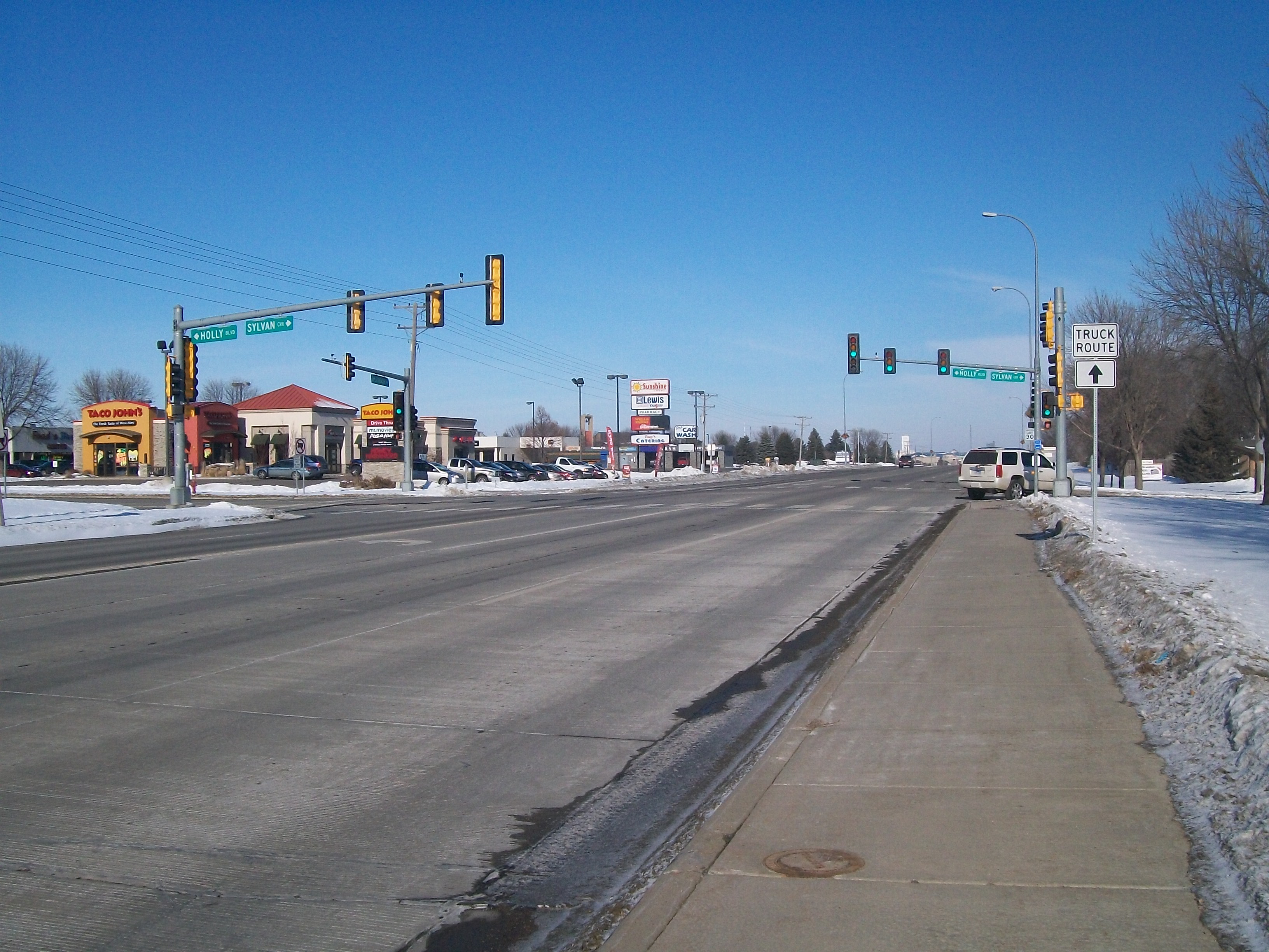
Corson is an unincorporated community in Brandon Township, Minnehaha County, South Dakota, United States with a population of 70. It lies immediately north of Interstate 90 and Brandon on South Dakota Highway 11. Once mainly a railroad and farming community, it is becoming an industrial area supporting the county. Sioux Falls is located west-southwest of the community. It is served by the BNSF Railway Company. Etymology Corson is named for Henry Tabor Corson (1838–1914), a resident of Sioux Falls, South Dakota, instrumental in constructing the Willmar and Sioux Falls Railway into Sioux Falls Transportation Interstate 90 is the town's major east–west route, and it connects the community to Sioux Falls. South Dakota Highway 11 South Dakota Highway 11 (SD 11) is a state highway in eastern South Dakota, United States. It connects the northern part of the Sioux City metropolitan area with the Sioux Falls metropolitan area. The highway originally traveled on ... [...More Info...] [...Related Items...] OR: [Wikipedia] [Google] [Baidu] |
South Dakota Highway 11
South Dakota Highway 11 (SD 11) is a state highway in eastern South Dakota, United States. It connects the northern part of the Sioux City metropolitan area with the Sioux Falls metropolitan area. The highway originally traveled on the current path of SD 115 in Sioux Falls and Dell Rapids, and ended north of Elkton. In the 1930s, SD 11 was shifted to its current alignment; part of the highway became SD 13. The southern segment was added between 1962 and 1971. Part of the highway in Sioux Falls was changed in early 1990s. The segment between SD 46 and US 18 was added in the 1990s. Route description SD 11 is defined by South Dakota Codified Law §31-4-131. According to this statute, the segment of the road between SD 50 and SD 48 is currently not a portion of the highway. The segment of the highway in Sioux Falls from 85th Street through the concurrency with SD 42, as well as the segment from the Madison Street intersec ... [...More Info...] [...Related Items...] OR: [Wikipedia] [Google] [Baidu] |
South Dakota
South Dakota (; Sioux language, Sioux: , ) is a U.S. state in the West North Central states, North Central region of the United States. It is also part of the Great Plains. South Dakota is named after the Lakota people, Lakota and Dakota people, Dakota Sioux Native Americans in the United States, Native American tribes, who comprise a large portion of the population with nine Indian reservation, reservations currently in the state and have historically dominated the territory. South Dakota is the List of U.S. states and territories by area, seventeenth largest by area, but the List of U.S. states and territories by population, 5th least populous, and the List of U.S. states and territories by population density, 5th least densely populated of the List of U.S. states, 50 United States. As the southern part of the former Dakota Territory, South Dakota became a state on November 2, 1889, simultaneously with North Dakota. They are the 39th and 40th states admitted to the union; Pr ... [...More Info...] [...Related Items...] OR: [Wikipedia] [Google] [Baidu] |
List Of Counties In South Dakota
There are 66 counties in the U.S. state of South Dakota with FIPS codes. Todd County and Oglala Lakota County are the only counties in South Dakota which do not have their own county seats. Hot Springs in Fall River County serves as the administrative center for Oglala Lakota County. Winner in Tripp County serves as the administrative center for Todd County. These are two of six counties in South Dakota which are entirely within an Indian reservation. (The other four counties are Bennett, Corson, Dewey, and Ziebach.) South Dakota's postal abbreviation is SD and its FIPS state code is 46. __TOC__ Table of counties Former names * Shannon County: renamed Oglala Lakota County in 2015 * Boreman County: Renamed Corson County in 1909 * Mandan County: Renamed Lawrence County * Pratt County: Renamed Jones County Former counties * Armstrong County (1883–1952): Created by Dakota Territory as Pyatt County in ... [...More Info...] [...Related Items...] OR: [Wikipedia] [Google] [Baidu] |
Minnehaha County, South Dakota
Minnehaha County is a county on the eastern border of the state of South Dakota. As of the 2020 census, the population was 197,214, making it the state's most populous county. It contains over 20% of the state's population. Its county seat is Sioux Falls, South Dakota's largest city. The county was created in 1862 and organized in 1868. Its name was derived from the Sioux word ''Mnihaha,'' meaning "rapid water," or "waterfall" (often incorrectly translated as "laughing water"). Minnehaha County is part of the Sioux Falls Metropolitan Statistical Area, the state's largest. Geography Minnehaha County lies on the east side of South Dakota. Its eastern boundary abuts Minnesota as well as the northern and western boundaries of Iowa. The Big Sioux River flows south-southeast through the east central part of the county. Its terrain consists of rolling hills, devoted to agriculture except around built-up areas, and dotted with lakes and ponds in its western portion. Its terrain gene ... [...More Info...] [...Related Items...] OR: [Wikipedia] [Google] [Baidu] |
Township
A township is a kind of human settlement or administrative subdivision, with its meaning varying in different countries. Although the term is occasionally associated with an urban area, that tends to be an exception to the rule. In Australia, Canada, Scotland and parts of the United States, the term refers to settlements too small or scattered to be considered urban. Australia ''The Australian National Dictionary'' defines ''township'' as: "A site reserved for and laid out as a town; such a site at an early stage of its occupation and development; a small town". The term refers purely to the settlement; it does not refer to a unit of government. Townships are governed as part of a larger council (such as that of a shire, district or city) or authority. Canada In Canada, two kinds of township occur in common use. *In Eastern Canada, a township is one form of the subdivision of a county. In Canadian French, this is a . Townships are referred to as "lots" in Prince Edward ... [...More Info...] [...Related Items...] OR: [Wikipedia] [Google] [Baidu] |
Unincorporated Community
An unincorporated area is a region that is not governed by a local municipal corporation. Widespread unincorporated communities and areas are a distinguishing feature of the United States and Canada. Most other countries of the world either have no unincorporated areas at all or these are very rare: typically remote, outlying, sparsely populated or uninhabited areas. By country Argentina In Argentina, the provinces of Chubut, Córdoba, Entre Ríos, Formosa, Neuquén, Río Negro, San Luis, Santa Cruz, Santiago del Estero, Tierra del Fuego, and Tucumán have areas that are outside any municipality or commune. Australia Unlike many other countries, Australia has only one level of local government immediately beneath state and territorial governments. A local government area (LGA) often contains several towns and even entire metropolitan areas. Thus, aside from very sparsely populated areas and a few other special cases, almost all of Australia is part of an LGA. Uninc ... [...More Info...] [...Related Items...] OR: [Wikipedia] [Google] [Baidu] |
Interstate 90 In South Dakota
Interstate 90 (I-90) in the US state of South Dakota traverses east–west through the southern half of the state. Route description I-90 enters South Dakota in Lawrence County as a four-lane divided highway. It enters concurrently with US Highway 14 (US 14) and passes through the town of Spearfish, where it shares another concurrency with US 85 from exit 10 to exit 17. From there it passes several miles north and east of the tourist town of Deadwood before entering Meade County, going just to the west of Sturgis. Another concurrency is with South Dakota Highway 34 (SD 34) from exit 23 at Whitewood to exit 30, the west exit of Sturgis, where there starts a concurrency with SD 79. The freeway generally passes along the north and east edges of the Black Hills. The route then enters Pennington County, where it passes through the northern edge of Rapid City, gateway to the Black Hills and the nearest passing to Mount Rushm ... [...More Info...] [...Related Items...] OR: [Wikipedia] [Google] [Baidu] |
Brandon, South Dakota
Brandon is a city in Minnehaha County, South Dakota, United States. Brandon is located five miles east of Sioux Falls. The population was 11,048 as of the 2020 census. History A post office called Brandon has been in operation since 1878. The city took its name from Brandon Township. Geography Brandon is located at (43.591580, -96.580685), along the Big Sioux River and Split Rock Creek. According to the United States Census Bureau, the city has a total area of , of which is land and is water. Demographics As of the census of 2010, there were 8,785 people, 3,118 households, and 2,417 families residing in the city. The population density was . There were 3,238 housing units at an average density of . The racial makeup of the city was 96.8% White, 0.6% African American, 0.5% Native American, 0.6% Asian, 0.3% from other races, and 1.2% from two or more races. Hispanic or Latino of any race were 1.2% of the population. There were 3,118 households, of which 48.2% had childre ... [...More Info...] [...Related Items...] OR: [Wikipedia] [Google] [Baidu] |
Sioux Falls, South Dakota
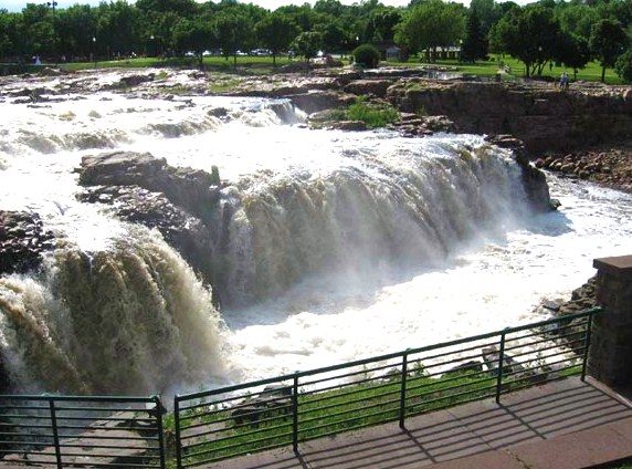
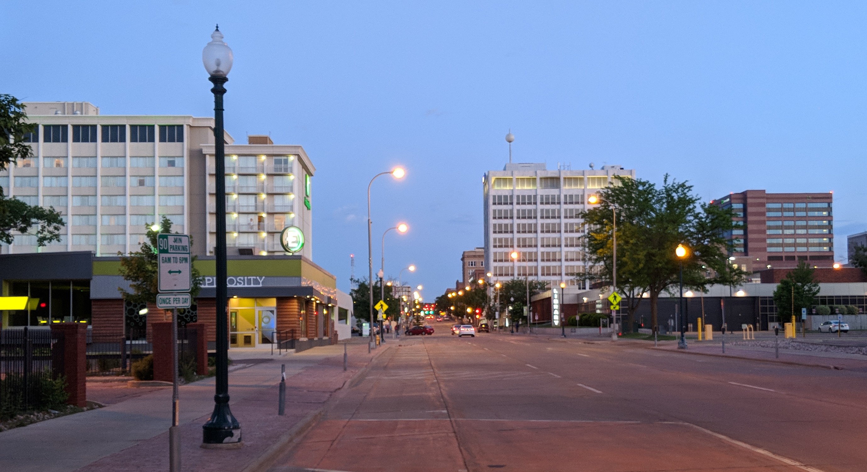
Sioux Falls () is the most populous city in the U.S. state of South Dakota and the 130th-most populous city in the United States. It is the county seat of Minnehaha County and also extends into Lincoln County to the south, which continues up to the Iowa state line. As of 2020, Sioux Falls had a population of 192,517, which was estimated in 2022 to have increased to 202,600. The Sioux Falls metro area accounts for more than 30% of the state's population. Chartered in 1856 on the banks of the Big Sioux River, the city is situated in the rolling hills at the junction of interstates 29 and 90. History The history of Sioux Falls revolves around the cascades of the Big Sioux River. The falls were created about 14,000 years ago during the last ice age. The lure of the falls has been a powerful influence. Ho-Chunk, Ioway, Otoe, Missouri, Omaha (and Ponca at the time), Quapaw, Kansa, Osage, Arikira, Dakota, and Cheyenne people inhabited and settled the region previous to Europea ... [...More Info...] [...Related Items...] OR: [Wikipedia] [Google] [Baidu] |
BNSF Railway Company
BNSF Railway is one of the largest freight railroads in North America. One of seven North American Class I railroads, BNSF has 35,000 employees, of track in 28 states, and nearly 8,000 locomotives. It has three transcontinental routes that provide rail connections between the western and eastern United States. BNSF trains traveled over in 2010, more than any other North American railroad. The BNSF Railway Company is the principal operating subsidiary of parent company Burlington Northern Santa Fe, LLC. Headquartered in Fort Worth, Texas, the railroad's parent company is a wholly owned subsidiary of Berkshire Hathaway, Inc., of Omaha, Nebraska. The current CEO is Kathryn Farmer. According to corporate press releases, the BNSF Railway is among the top transporters of intermodal freight in North America. It also hauls bulk cargo, including enough coal to generate around 25% of the electricity produced in the United States. The creation of BNSF started with the formation of ... [...More Info...] [...Related Items...] OR: [Wikipedia] [Google] [Baidu] |
Willmar And Sioux Falls Railway
The Willmar and Sioux Falls Railway ran between Sioux Falls, South Dakota, and Willmar, Minnesota Willmar is a city in, and the county seat of, Kandiyohi County, Minnesota, United States. The population was 21,015 at the 2020 census. History Agricultural expansion and the establishment of Willmar as a division point on the Great Northern .... The railroad was built by E. A. Sherman and John M. Spicer of Willmar, under the direction of James J. Hill of the Great Northern Railway. Sherman and Spicer located, named, and platted all of the towns along the line for a distance of 149 miles.History of Dakota Territory by George W. Kingsbury (1915), page 482–9 The line was sold to the Great Northern Railroad on July 1, 1907. References Minnesota railroads Transportation in Minnehaha County, South Dakota Transportation in Sioux Falls, South Dakota Great Northern Railway (U.S.) subsidiaries Defunct South Dakota railroads Defunct Minnesota railroads Transportation in Ka ... [...More Info...] [...Related Items...] OR: [Wikipedia] [Google] [Baidu] |
Corson SD , one of the four principal kings that have power on the seventy-two demons
{{disambiguation, geo ...
Corson may refer to: Places ;United States * Corson County, South Dakota * Corson, South Dakota * Corson Inlet, a strait on the southern coast of New Jersey * Corson's Inlet State Park, New Jersey ;Other * Corson, the main street of Linköping University's Campus Valla, Östergötland, Sweden Others * Corson (surname) * USS ''Corson'' (AVP-37), a United States Navy seaplane tender in commission from 1944 to 1946 and from 1951 to 1956 * Corson (singer), French singer, songwriter * Corson (demon) In demonology, Corson is one of the four principal kings that have power over the seventy-two demons that are supposedly constrained by King Solomon, according to the Lesser Key of Solomon. Corson is not to be conjured except on great occasions. ... [...More Info...] [...Related Items...] OR: [Wikipedia] [Google] [Baidu] |


.jpg)


