|
Cordillera Province (Bolivia)
Cordillera is a province in the Santa Cruz Department, Bolivia. Its capital is Lagunillas. Geography This area of the Santa Cruz Chaco occupies the southern part of the department, is the largest province of the country, geographically defined as the Gran Chaco and that extends to the departments of Tarija and Chuquisaca and even the republics of Paraguay and Argentina. Characteristics of dry weather, warm day and cold at night. The name of this province is due to its topography, being the largest province in the department and the country. Bounded on the north by the provinces of Chiquitos and Andrés Ibáñez. The south by the Republic of Paraguay and the department of Chuquisaca. The east by the Germán Busch province. To the West and the department of Chuquisaca province Vallegrande Florida and has a surface area of 86,245 km2 occupying 23.3% of the total area of the department, being the largest province of the country Its height above sea level is: 1240 m has a population: ... [...More Info...] [...Related Items...] OR: [Wikipedia] [Google] [Baidu] |
Flag Of Bolivia
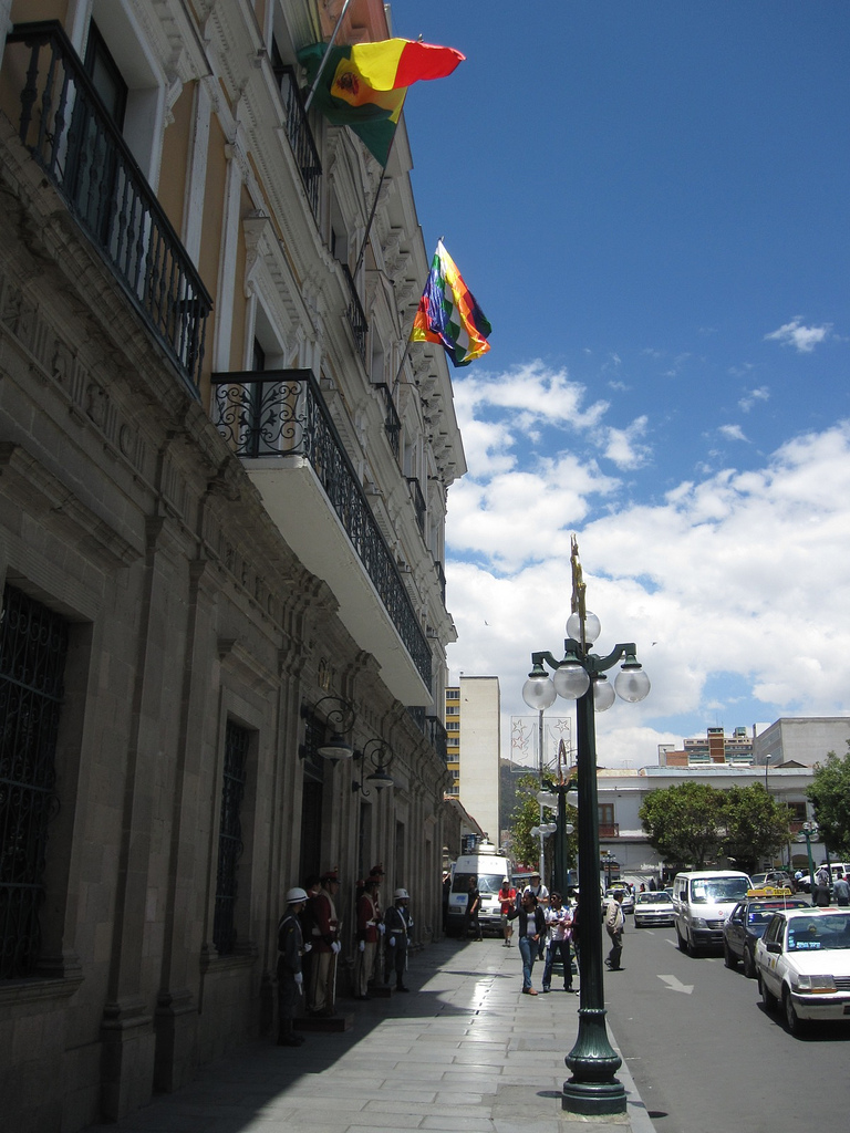
The flag of Bolivia is the national flag of the Bolivia, Plurinational State of Bolivia. It was originally adopted in 1851. The state and war flag is a horizontal tricolour (flag), tricolor of red, yellow and green with the Coat of Arms of Bolivia, Bolivian coat of arms in the center. According to one source, the red stands for Bolivia's brave soldiers, while the green symbolizes soil fertility, fertility and yellow the nation's mineral deposits. Since 2009 the Wiphala also holds the status of ''dual flag'' in the country. According to the revised Constitution of Bolivia of 2009, the Wiphala is considered a national symbol of Bolivia (along with the flag, national anthem, Coat of arms of Bolivia, coat of arms, the cockade; Cantua buxifolia, kantuta flower and patujú flower). Despite its landlocked status, Bolivia has a naval ensign used by navy vessels on rivers and lakes. It consists of a blue field with the state flag in the Flag terminology, canton bordered by nine small y ... [...More Info...] [...Related Items...] OR: [Wikipedia] [Google] [Baidu] |
Bolivia
, image_flag = Bandera de Bolivia (Estado).svg , flag_alt = Horizontal tricolor (red, yellow, and green from top to bottom) with the coat of arms of Bolivia in the center , flag_alt2 = 7 × 7 square patchwork with the (top left to bottom right) diagonals forming colored stripes (green, blue, purple, red, orange, yellow, white, green, blue, purple, red, orange, yellow, from top right to bottom left) , other_symbol = , other_symbol_type = Dual flag: , image_coat = Escudo de Bolivia.svg , national_anthem = " National Anthem of Bolivia" , image_map = BOL orthographic.svg , map_width = 220px , alt_map = , image_map2 = , alt_map2 = , map_caption = , capital = La Paz Sucre , largest_city = , official_languages = Spanish , languages_type = Co-official languages , languages ... [...More Info...] [...Related Items...] OR: [Wikipedia] [Google] [Baidu] |
Departments Of Bolivia
Bolivia is a unitary state consisting of nine departments ( es, departamentos). Departments are the primary subdivisions of Bolivia, and possess certain rights under the Constitution of Bolivia. Each department is represented in the Plurinational Legislative Assembly—a bicameral legislature consisting of the Senate and the Chamber of Deputies. Each department is represented by four Senators, while Deputies are awarded to each department in proportion to their total population. Out of the nine departments, La Paz was originally the most populous, with 2,706,351 inhabitants as of 2012 but the far eastern department of Santa Cruz has since surpassed it by 2020; Santa Cruz also claims the title as the largest, encompassing . Pando is the least populated, with a population of 110,436. The smallest in area is Tarija, encompassing . Departments Former Departments By population Notes See also * ISO 3166-2:BO, the ISO codes for the departments of Bolivia. * Bolivi ... [...More Info...] [...Related Items...] OR: [Wikipedia] [Google] [Baidu] |
Santa Cruz Department, Bolivia
Santa Cruz () is the largest of the nine constituent departments of Bolivia, occupying about one-third (33.74%) of the country's territory. With an area of , it is slightly smaller than Japan or the US state of Montana. It is located in the eastern part of the country, sharing borders in the north and east with Brazil and with Paraguay in the south. In the 2012 census, it reported a population of 3,412,921, making it the most populated department. The capital is the city of Santa Cruz de la Sierra. The department is one of the wealthiest departments in Bolivia, with huge reserves of natural gas. Besides, it has experienced the highest increase of economic growth during the last 50 years in Bolivia and South America. Government and administration According to the current Constitution, the highest authority in the department lies with the governor. The former figure of prefect was appointed by the President of the Republic till 2005, when the prefect for the first time was ... [...More Info...] [...Related Items...] OR: [Wikipedia] [Google] [Baidu] |
Municipalities Of Bolivia
Municipalities in Bolivia are administrative divisions of the entire national territory governed by local elections. Municipalities are the third level of administrative divisions, below departments and provinces. Some of the provinces consist of only one municipality. In these cases the municipalities are identical to the provinces they belong to. History of governance Municipalities in Bolivia are each led by a mayor, an executive office. Mayors were appointed by the national government from 1878 to 1942 and from 1949 to 1987. Local elections were held under the 1942 municipal code, which was in force until 1991. The 1985 Organic Law of Municipalities restored local elections for mayor and created a legislative body, the municipal council. In 1994, the entire territory of Bolivia was merged into municipalities, where previously only urban areas were organized as municipalities. As an effect of decentralization through the 1994 Law of Popular Participation the number of municip ... [...More Info...] [...Related Items...] OR: [Wikipedia] [Google] [Baidu] |
Cantons Of Bolivia
On the level below municipalities, Bolivia is divided into 1374 cantons A canton is a type of administrative division of a country. In general, cantons are relatively small in terms of area and population when compared with other administrative divisions such as counties, departments, or provinces. Internationally, t ... (''cantones''). Subdivisions of Bolivia {{bolivia-geo-stub ... [...More Info...] [...Related Items...] OR: [Wikipedia] [Google] [Baidu] |
Lagunillas, Santa Cruz
Lagunillas is a location in the Santa Cruz Department, Bolivia, Santa Cruz Department in Bolivia. It is the seat of the Lagunillas Municipality, Bolivia, Lagunillas Municipality, the first Municipalities of Bolivia, municipal section of the Cordillera Province (Bolivia), Cordillera Province. References {{Santa_Cruz Department Populated places in Santa Cruz Department (Bolivia) ... [...More Info...] [...Related Items...] OR: [Wikipedia] [Google] [Baidu] |
Province
A province is almost always an administrative division within a country or sovereign state, state. The term derives from the ancient Roman ''Roman province, provincia'', which was the major territorial and administrative unit of the Roman Empire, Roman Empire's territorial possessions outside Roman Italy, Italy. The term ''province'' has since been adopted by many countries. In some countries with no actual provinces, "the provinces" is a metaphorical term meaning "outside the capital city". While some provinces were produced artificially by Colonialism, colonial powers, others were formed around local groups with their own ethnic identities. Many have their own powers independent of central or Federation, federal authority, especially Provinces of Canada, in Canada and Pakistan. In other countries, like Provinces of China, China or Administrative divisions of France, France, provinces are the creation of central government, with very little autonomy. Etymology The English langu ... [...More Info...] [...Related Items...] OR: [Wikipedia] [Google] [Baidu] |
Santa Cruz Department (Bolivia)
Santa Cruz () is the largest of the nine constituent departments of Bolivia, occupying about one-third (33.74%) of the country's territory. With an area of , it is slightly smaller than Japan or the US state of Montana. It is located in the eastern part of the country, sharing borders in the north and east with Brazil and with Paraguay in the south. In the 2012 census, it reported a population of 3,412,921, making it the most populated department. The capital is the city of Santa Cruz de la Sierra. The department is one of the wealthiest departments in Bolivia, with huge reserves of natural gas. Besides, it has experienced the highest increase of economic growth during the last 50 years in Bolivia and South America. Government and administration According to the current Constitution, the highest authority in the department lies with the governor. The former figure of prefect was appointed by the President of the Republic till 2005, when the prefect for the first time was e ... [...More Info...] [...Related Items...] OR: [Wikipedia] [Google] [Baidu] |
Kaa-Iya Del Gran Chaco National Park And Integrated Management Natural Area
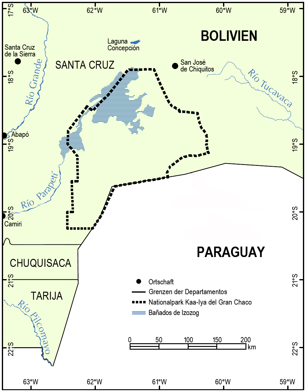
Kaa-Iya del Gran Chaco National Park and Integrated Management Natural Area (''Parque Nacional y Area Natural de Manejo Integrado Kaa-Iya del Gran Chaco)'' is the biggest national park in Bolivia and one of the largest in South America. It is a protected area in the region of the Gran Chaco and has a larger surface area than Belgium. It is situated in the south of Santa Cruz Department on the border with Paraguay in the Cordillera Province ( Charagua Municipality) and Chiquitos Province (Pailón and San José de Chiquitos municipalities). Etymology Kaa-Iya is a term from Guarani mythology which means "mountain owners", or a place where riches are found, in the sense of abundance of natural resources and the relationship between man and nature. Geography *Area: 3,441,115 hectares (34,411.15 km2) *Altitude: between 100 and 839 meters above sea level. *Rainfall: 1,400 to 400 mm annually. *Hydrology: The principal river is the Parapetí, among many others. *Coo ... [...More Info...] [...Related Items...] OR: [Wikipedia] [Google] [Baidu] |
Otuquis National Park And Integrated Management Natural Area
Otuquis National Park and Integrated Management Natural Area, (''Parque Nacional y Área Natural de Manejo Integrado Otuquis'' (''PN-ANMI Otuquis'') or ''Parque Nacional y ANMI Pantanal de Otuquis''), is a national park in the Pantanal ecoregion of southeastern Bolivia. It is named after the Otuke indigenous people who inhabit the region. Geography It is located in the extreme southeast of the Santa Cruz Department on the borders with Brazil and Paraguay, within the provinces Germán Busch and Cordillera. It comprises a total area of , corresponding to the category national park and to the category "Integrated Management Natural Area". Nature This park is known for its sightings of marsh deer, capybara, spectacled caiman, caiman lizards and the yellow anaconda. Jaguars, pumas, pampas cats, ocelots, lesser anteaters and other mammals also found here in healthy populations. Otuquis National Park is popular for birders when millions of birds flock here to feed on huge schools of ... [...More Info...] [...Related Items...] OR: [Wikipedia] [Google] [Baidu] |
Provinces Of Santa Cruz Department (Bolivia)
A province is almost always an administrative division within a country or state. The term derives from the ancient Roman ''provincia'', which was the major territorial and administrative unit of the Roman Empire's territorial possessions outside Italy. The term ''province'' has since been adopted by many countries. In some countries with no actual provinces, "the provinces" is a metaphorical term meaning "outside the capital city". While some provinces were produced artificially by colonial powers, others were formed around local groups with their own ethnic identities. Many have their own powers independent of central or federal authority, especially in Canada and Pakistan. In other countries, like China or France, provinces are the creation of central government, with very little autonomy. Etymology The English word ''province'' is attested since about 1330 and derives from the 13th-century Old French , which itself comes from the Latin word , which referred to the sphere ... [...More Info...] [...Related Items...] OR: [Wikipedia] [Google] [Baidu] |


