|
Coolidge Corner
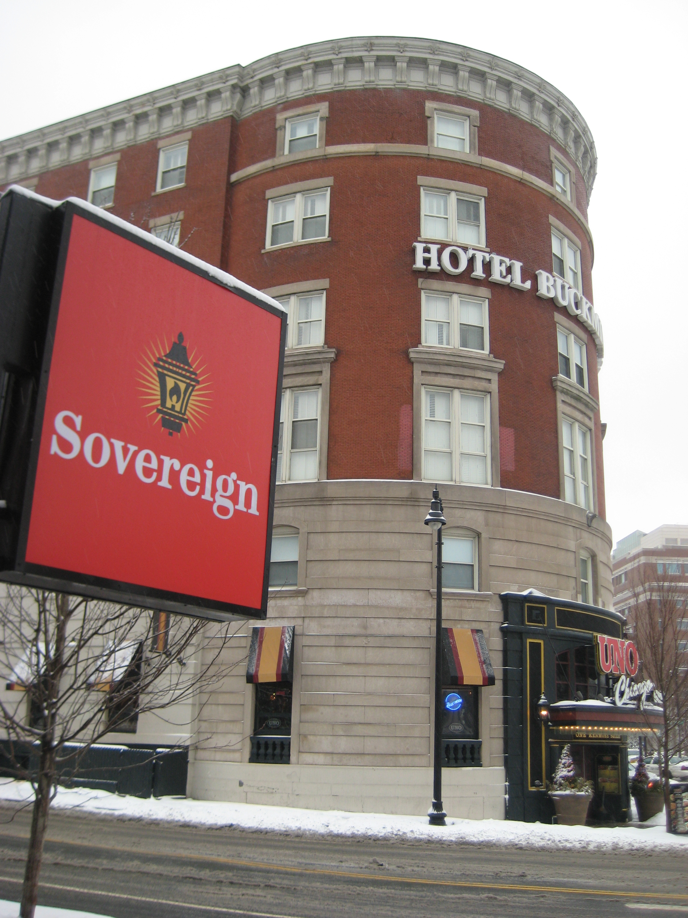
Coolidge Corner is a neighborhood of Brookline, Massachusetts, centered on the intersection of Beacon Street and Harvard Street. The neighborhood takes its name from the Coolidge & Brother general store that opened in 1857 at that intersectionOlson Pehlke, Linda:Coolidge Corner", ''Our Town Brookline'' magazine, 2005. URL retrieved 2011-01-11. at the site of today's S.S. Pierce building, which was for many years the only commercial business in north Brookline.Liss, Ken (Brookline Historical Society)Who is Coolidge Corner named after? November 2010. URL retrieved 2011-01-11. Culture Coolidge Corner developed as a transit-oriented streetcar suburb, and retains a pedestrian-friendly, walking around feel. Many popular coffee shops, pharmacies, small independent boutiques, an independent bookstore, and independent restaurants are located there, as well as a few retail chain stores. In recent years, an influx of national bank chains has taken over several prime storefronts, detra ... [...More Info...] [...Related Items...] OR: [Wikipedia] [Google] [Baidu] |
Neighborhood
A neighbourhood (British English, Irish English, Australian English and Canadian English) or neighborhood (American English; see spelling differences) is a geographically localised community within a larger city, town, suburb or rural area, sometimes consisting of a single street and the buildings lining it. Neighbourhoods are often social communities with considerable face-to-face interaction among members. Researchers have not agreed on an exact definition, but the following may serve as a starting point: "Neighbourhood is generally defined spatially as a specific geographic area and functionally as a set of social networks. Neighbourhoods, then, are the spatial units in which face-to-face social interactions occur—the personal settings and situations where residents seek to realise common values, socialise youth, and maintain effective social control." Preindustrial cities In the words of the urban scholar Lewis Mumford, "Neighbourhoods, in some annoying, inchoate fashi ... [...More Info...] [...Related Items...] OR: [Wikipedia] [Google] [Baidu] |
Art Deco
Art Deco, short for the French ''Arts Décoratifs'', and sometimes just called Deco, is a style of visual arts, architecture, and product design, that first appeared in France in the 1910s (just before World War I), and flourished in the United States and Europe during the 1920s and 1930s. Through styling and design of the exterior and interior of anything from large structures to small objects, including how people look (clothing, fashion and jewelry), Art Deco has influenced bridges, buildings (from skyscrapers to cinemas), ships, ocean liners, trains, cars, trucks, buses, furniture, and everyday objects like radios and vacuum cleaners. It got its name after the 1925 Exposition internationale des arts décoratifs et industriels modernes (International Exhibition of Modern Decorative and Industrial Arts) held in Paris. Art Deco combined modern styles with fine craftsmanship and rich materials. During its heyday, it represented luxury, glamour, exuberance, and faith in socia ... [...More Info...] [...Related Items...] OR: [Wikipedia] [Google] [Baidu] |
Edward Devotion School
The Florida Ruffin Ridley School, formerly known as the Coolidge Corner School and the Edward Devotion School or Devo, is a public K-8 school located at 345 Harvard Street, Brookline, Massachusetts, United States. It is a part of Public Schools of Brookline. The school was founded in 1892 on land formerly owned by Edward Devotion (1621-1685) and later by his grandson, another Edward Devotion (1667-1744). The land was purchased by the town from a later owner. The Devotions' 18th-century house is preserved by the Brookline Historical Society and stands amidst part of its original gardens in the school's forecourt. Demographics The school is attended by over 800 students from pre-kindergarten to eighth grade, and is the largest of eight public elementary schools in Brookline. The school emphasizes diversity, with English being a second language to over one third of the student body, among which about 40% are English Language learners. Roughly 37% of students are non-white or mult ... [...More Info...] [...Related Items...] OR: [Wikipedia] [Google] [Baidu] |
List Of Key MBTA Bus Routes
Key bus routes of the Massachusetts Bay Transportation Authority (MBTA) system are 15 routes that have high ridership and higher frequency standards than other bus lines, according to the 2004 MBTA Service Policy. Together, they account for roughly 40% of the MBTA's total bus ridership. These key bus routes ensure basic geographic coverage with frequent service in the densest areas of Boston, and connect to other MBTA services to give access to other areas throughout the region. In recognition of their function as part of the backbone MBTA service, the key bus routes have been added to newer basic route maps installed in subway stations and other public locations. These schematic route maps show the rail rapid transit routes, bus rapid transit routes, commuter rail services, and key bus routes. The key routes have been treated as a distinct category for the purpose of service improvement, such as trial runs of late-night service, and due to the high volume of passenger traffic the ... [...More Info...] [...Related Items...] OR: [Wikipedia] [Google] [Baidu] |
Harvard Square
Harvard Square is a triangular plaza at the intersection of Massachusetts Avenue, Brattle Street and John F. Kennedy Street near the center of Cambridge, Massachusetts, United States. The term "Harvard Square" is also used to delineate the business district and Harvard University surrounding that intersection, which is the historic center of Cambridge. Adjacent to Harvard Yard, the historic heart of Harvard University, the Square (as it is sometimes called, locally) functions as a commercial center for Harvard students, as well as residents of western Cambridge, the western and northern neighborhoods and the inner suburbs of Boston. The Square is served by Harvard station, a major MBTA Red Line subway and a bus transportation hub. In an extended sense, the name "Harvard Square" can also refer to the entire neighborhood surrounding this intersection for several blocks in each direction. The nearby Cambridge Common has become a park area with a playground, baseball field, and ... [...More Info...] [...Related Items...] OR: [Wikipedia] [Google] [Baidu] |
Dudley Square
Nubian Square (formerly Dudley Square) is the primary commercial center of the Roxbury neighborhood of Boston, Massachusetts, located at the intersection of Dudley Street and Washington Street. It has long been the center of African American culture in Boston, prior to which the area was primarily Jewish. For most of the twentieth century, the square was a multi-mode transportation hub, centered at Dudley station, now Nubian station of the Washington Street Elevated, which closed in 1987. Several streetcar lines radiated to surrounding neighborhoods from the elevated station. It is now a substantial bus terminal and terminus for the MBTA's bus rapid transit Silver Line. History In the colonial and post-revolutionary periods, Washington Street was the only connection between Shawmut Peninsula, on which Old Boston was located, and the mainland. Nubian Square is located on the mainland side of what was the Washington Street isthmus, an area known as The Neck. At the time, it ... [...More Info...] [...Related Items...] OR: [Wikipedia] [Google] [Baidu] |
Kenmore Square
Kenmore Square is a square in Boston, Massachusetts, United States, consisting of the intersection of several main avenues (including Beacon Street and Commonwealth Avenue) as well as several other cross streets, and Kenmore station, an MBTA subway stop. Kenmore Square is close to or abuts Boston University and Fenway Park, and it features Lansdowne Street, a center of Boston nightlife, and the Citgo sign. It is also the eastern terminus of U.S. Route 20, the longest U.S. Highway. History In early Colonial times the land that is now Kenmore Square was an uninhabited corner of the mainland where the narrow Charles River fed into the wide, marshy Back Bay. It was part of the colonial settlement of Boston until 1705, when the hamlet of Muddy River incorporated as the independent town of Brookline. The land ended up in Brookline because the Muddy River - several blocks to the east - formed the eastern border of the new city. An 1821 map shows the area known as Sewell's Point, ... [...More Info...] [...Related Items...] OR: [Wikipedia] [Google] [Baidu] |
Green Line C Branch
The C branch, also called the Beacon Street Line or Cleveland Circle Line, is one of four branches of the Massachusetts Bay Transportation Authority's Green Line (MBTA), Green Line light rail system in the Boston, Massachusetts metropolitan area. The line begins at Cleveland Circle (MBTA station), Cleveland Circle in the Brighton, Massachusetts, Brighton neighborhood of Boston, Massachusetts, Boston and runs on the surface through Brookline, Massachusetts, Brookline along the median (highway), median of Beacon Street (Boston), Beacon Street. Reentering Boston, the line goes underground through the St. Mary's Street incline and joins the Green Line B branch, B and Green Line D branch, D branches at Kenmore (MBTA station), Kenmore. Trains run through the Boylston Street subway to Copley (MBTA station), Copley where the Green Line E branch, E branch joins, then continue through the Tremont Street subway to downtown Boston. The C branch has terminated at Government Center station (MBTA ... [...More Info...] [...Related Items...] OR: [Wikipedia] [Google] [Baidu] |
MBTA
The Massachusetts Bay Transportation Authority (abbreviated MBTA and known colloquially as "the T") is the public agency responsible for operating most public transportation services in Greater Boston, Massachusetts. The MBTA transit network includes the MBTA subway with three metro lines (the Blue, Orange, and Red lines), two light rail lines (the Green and Ashmont–Mattapan lines), and a five-line bus rapid transit system (the Silver Line); MBTA bus local and express service; the twelve-line MBTA Commuter Rail system, and several ferry routes. In , the system had a ridership of , or about per weekday as of , of which the rapid transit lines averaged and the light rail lines , making it the fourth-busiest rapid transit system and the third-busiest light rail system in the United States. As of , average weekday ridership of the commuter rail system was , making it the sixth-busiest commuter rail system in the U.S. The MBTA is the successor of several previous public a ... [...More Info...] [...Related Items...] OR: [Wikipedia] [Google] [Baidu] |
Coolidge Corner (MBTA Station)
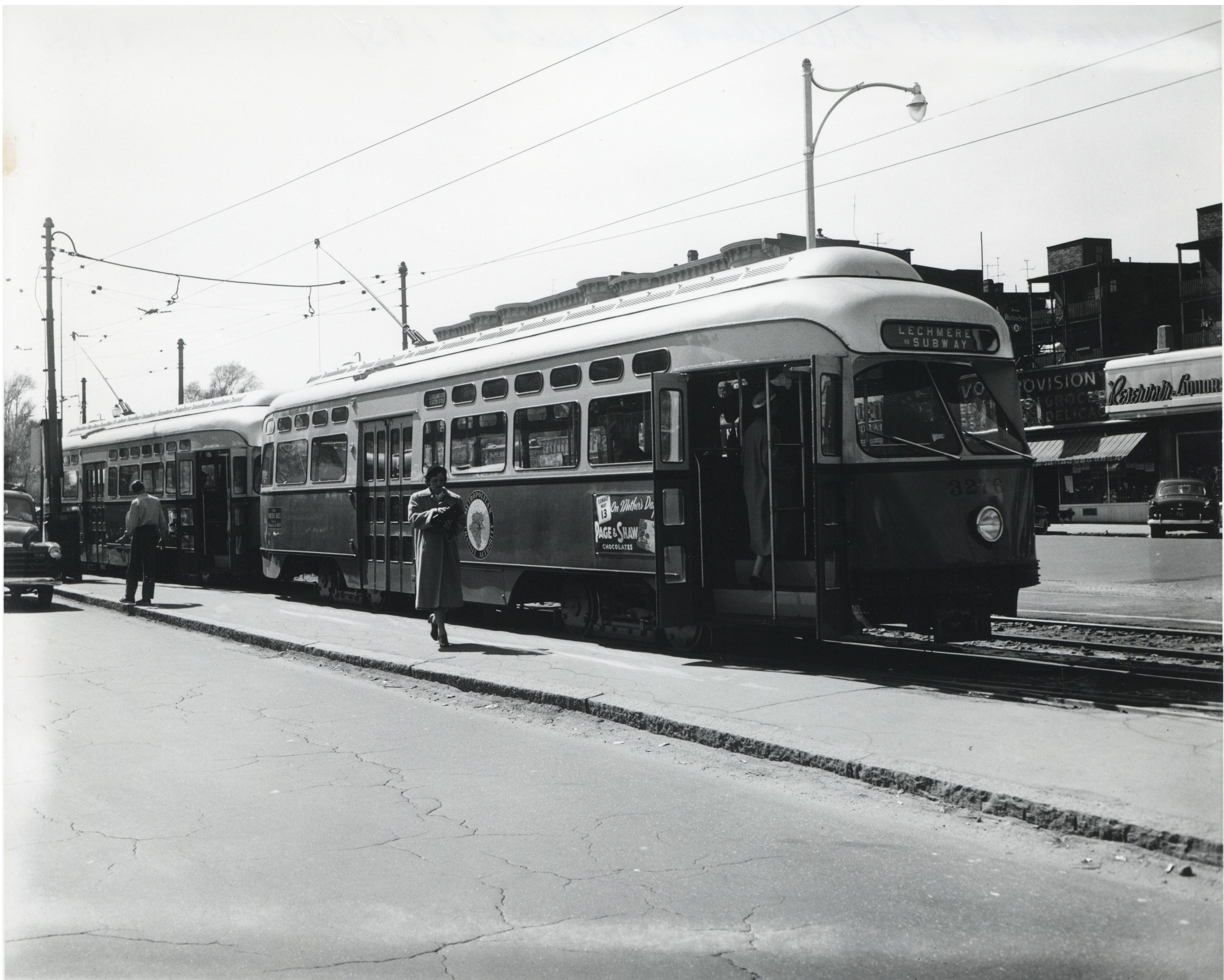
Coolidge Corner station is a light rail stop on the MBTA Green Line C branch, located at the intersection of Beacon Street and Harvard Street in the Coolidge Corner neighborhood of Brookline, Massachusetts. With 3,440 daily boardings by a 2011 count, it had more than twice the ridership of any other surface station on the branch. History Horsecar service on the Beacon Street line began between Coolidge Corner and downtown Boston on June 1, 1888. Electrified service began between Allston and downtown Boston via Coolidge Corner on January 3, 1889. Service was extended west from Coolidge Corner to Reservoir on January 12, and from Allston to the next day. On February 3, 1900, the Boston Elevated Railway (BERy) established Coolidge Corner as a designated transfer point, where passengers could transfer between the Reservoir and Oak Square branches. The town approved the construction of shelters at the stop in November 1900, and they were completed in 1901. Each is long with a -lo ... [...More Info...] [...Related Items...] OR: [Wikipedia] [Google] [Baidu] |
MBTA 3711 At Coolidge Corner, February 2005
The Massachusetts Bay Transportation Authority (abbreviated MBTA and known colloquially as "the T") is the public agency responsible for operating most public transportation services in Greater Boston, Massachusetts. The MBTA transit network includes the MBTA subway with three metro lines (the Blue, Orange, and Red lines), two light rail lines (the Green and Ashmont–Mattapan lines), and a five-line bus rapid transit system (the Silver Line); MBTA bus local and express service; the twelve-line MBTA Commuter Rail system, and several ferry routes. In , the system had a ridership of , or about per weekday as of , of which the rapid transit lines averaged and the light rail lines , making it the fourth-busiest rapid transit system and the third-busiest light rail system in the United States. As of , average weekday ridership of the commuter rail system was , making it the sixth-busiest commuter rail system in the U.S. The MBTA is the successor of several previous public an ... [...More Info...] [...Related Items...] OR: [Wikipedia] [Google] [Baidu] |
Farmer's Market
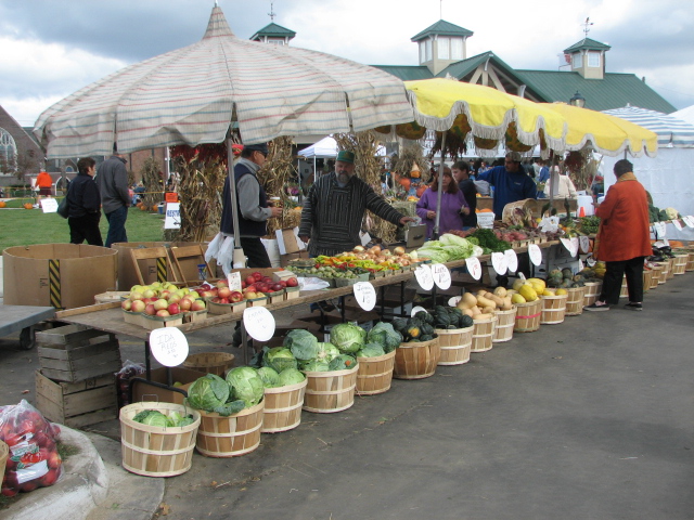
A farmers' market (or farmers market according to the AP stylebook, also farmer's market in the Cambridge Dictionary) is a physical retail marketplace intended to sell foods directly by farmers to consumers. Farmers' markets may be indoors or outdoors and typically consist of booths, tables or stands where farmers sell their produce, live livestock, animals and plants, and sometimes prepared foods and beverages. Farmers' markets exist in many countries worldwide and reflect the local culture and economy. The size of the market may be just a few stalls or it may be as large as several city blocks. Due to their nature, they tend to be less rigidly regulated than retail produce shops. They are distinguished from Marketplaces#Types, public markets, which are generally housed in permanent structures, open year-round, and offer a variety of non-farmer/non-producer vendors, packaged foods and non-food products. History The current concept of a farmers' market is similar to past conc ... [...More Info...] [...Related Items...] OR: [Wikipedia] [Google] [Baidu] |

_interior.jpg)


