|
Coolgarriv
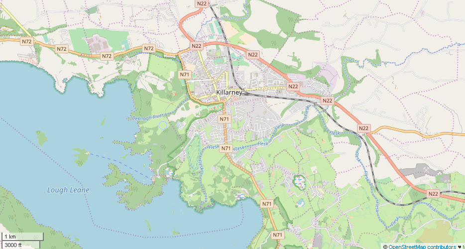
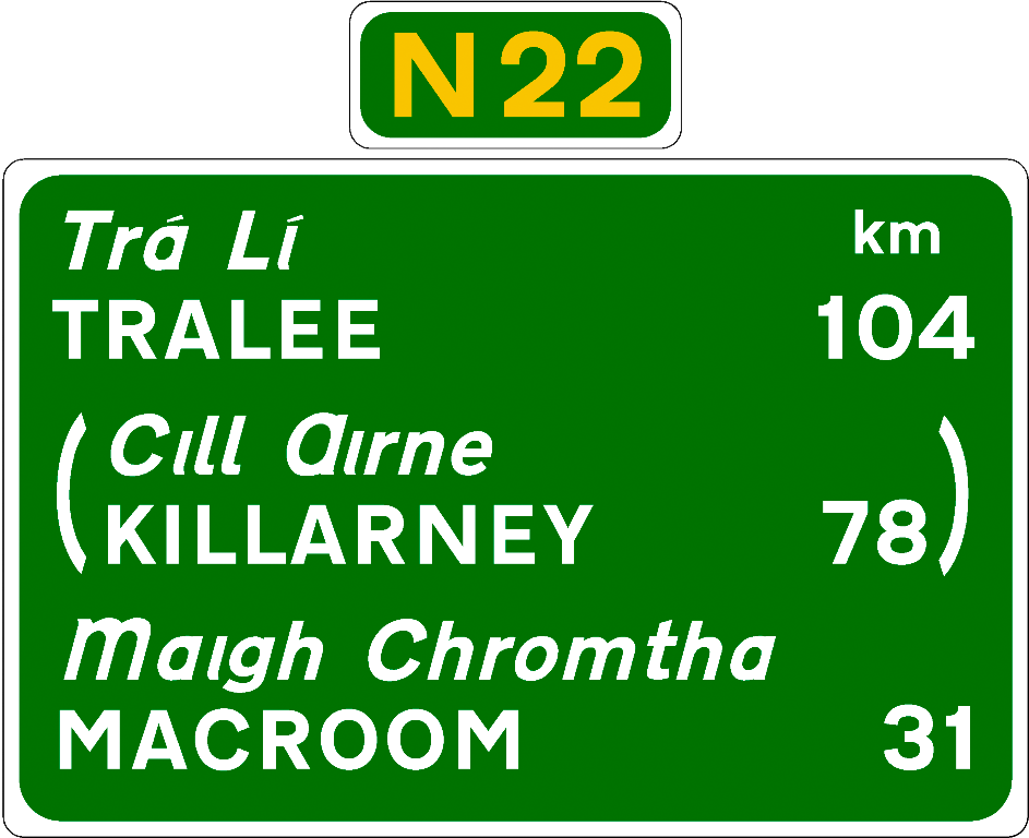
Coolgarriv () is a townland on the outskirts of Killarney, County Kerry, Ireland. It is located on Madam's Hill, overlooking Killarney in the nearby valley. It is bordered by Aghadoe and Knockasarnett townlands. Coolgarriv is part of Fossa parish, in the Diocese of Kerry. Transport The main N22 Tralee-Killarney-Cork road goes through Coolgarriv. Branching off from this is the Killarney-Ballyhar-Firies road. The Mallow–Killarney–Tralee rail line passes through Coolgarriv and the nearest railway station is Killarney railway station. See also * List of townlands of County Kerry This is a sortable table of the approximately 2,756 townlands in County Kerry, Republic of Ireland, Ireland. References [...More Info...] [...Related Items...] OR: [Wikipedia] [Google] [Baidu] |
List Of Townlands Of County Kerry
This is a sortable table of the approximately 2,756 townlands in County Kerry, Ireland. Retrieved: 2010-09-01. Duplicate names occur where there is more than one townland with the same name in the county. Names marked in bold typeface are towns and villages, and the word ''Town'' appears for those entries in the Acres column. Townland list References {{reflist |
Fossa, County Kerry
Fossa () is a village and parish in County Kerry, Ireland, north of the Lakes of Killarney. Townlands in Fossa parish: * Aghadoe * Coolgarriv Notable people *David Clifford (1999–) *Paudie Clifford (1996-) * Michael Fassbender (1977–), born in Heidelberg Heidelberg (; Palatine German language, Palatine German: ''Heidlberg'') is a city in the States of Germany, German state of Baden-Württemberg, situated on the river Neckar in south-west Germany. As of the 2016 census, its population was 159,914 ..., lived in Fossa See also * List of towns and villages in Ireland References Towns and villages in County Kerry {{Kerry-geo-stub ... [...More Info...] [...Related Items...] OR: [Wikipedia] [Google] [Baidu] |
Republic Of Ireland
Ireland ( ga, Éire ), also known as the Republic of Ireland (), is a country in north-western Europe consisting of 26 of the 32 counties of the island of Ireland. The capital and largest city is Dublin, on the eastern side of the island. Around 2.1 million of the country's population of 5.13 million people resides in the Greater Dublin Area. The sovereign state shares its only land border with Northern Ireland, which is part of the United Kingdom. It is otherwise surrounded by the Atlantic Ocean, with the Celtic Sea to the south, St George's Channel to the south-east, and the Irish Sea to the east. It is a unitary, parliamentary republic. The legislature, the , consists of a lower house, ; an upper house, ; and an elected President () who serves as the largely ceremonial head of state, but with some important powers and duties. The head of government is the (Prime Minister, literally 'Chief', a title not used in English), who is elected by the Dáil and appointed by ... [...More Info...] [...Related Items...] OR: [Wikipedia] [Google] [Baidu] |
County Kerry
County Kerry ( gle, Contae Chiarraí) is a county in Ireland. It is located in the South-West Region and forms part of the province of Munster. It is named after the Ciarraige who lived in part of the present county. The population of the county was 155,258 at the 2022 census, A popular tourist destination, Kerry's geography is defined by the MacGillycuddy's Reeks mountains, the Dingle, Iveragh and Beara peninsulas, and the Blasket and Skellig islands. It is bordered by County Limerick to the north-east and Cork County to the south and south-east. Geography and subdivisions Kerry is the fifth-largest of Ireland's 32 traditional counties by area and the 16th-largest by population. It is the second-largest of Munster's six counties by area, and the fourth-largest by population. Uniquely, it is bordered by only two other counties: County Limerick to the east and County Cork to the south-east. The county town is Tralee although the Catholic diocesan seat is Killarney, whi ... [...More Info...] [...Related Items...] OR: [Wikipedia] [Google] [Baidu] |
Townland
A townland ( ga, baile fearainn; Ulster-Scots: ''toonlann'') is a small geographical division of land, historically and currently used in Ireland and in the Western Isles in Scotland, typically covering . The townland system is of Gaelic origin, pre-dating the Norman invasion, and most have names of Irish origin. However, some townland names and boundaries come from Norman manors, plantation divisions, or later creations of the Ordnance Survey.Connolly, S. J., ''The Oxford Companion to Irish History, page 577. Oxford University Press, 2002. ''Maxwell, Ian, ''How to Trace Your Irish Ancestors'', page 16. howtobooks, 2009. The total number of inhabited townlands in Ireland was 60,679 in 1911. The total number recognised by the Irish Place Names database as of 2014 was 61,098, including uninhabited townlands, mainly small islands. Background In Ireland a townland is generally the smallest administrative division of land, though a few large townlands are further divided into h ... [...More Info...] [...Related Items...] OR: [Wikipedia] [Google] [Baidu] |
Killarney
Killarney ( ; ga, Cill Airne , meaning 'church of sloes') is a town in County Kerry, southwestern Ireland. The town is on the northeastern shore of Lough Leane, part of Killarney National Park, and is home to St Mary's Cathedral, Ross Castle, Muckross House and Abbey, the Lakes of Killarney, MacGillycuddy's Reeks, Purple Mountain, Mangerton Mountain, Paps Mountain, the Gap of Dunloe and Torc Waterfall. Its natural heritage, history and location on the Ring of Kerry make Killarney a popular tourist destination. Killarney won the Best Kept Town award in 2007, in a cross-border competition jointly organised by the Department of the Environment and the Northern Ireland Amenity Council. In 2011, it was named Ireland's tidiest town and the cleanest town in the country by Irish Business Against Litter. History Early history and development Killarney featured prominently in early Irish history, with religious settlements playing an important part of its recorded history. Its fi ... [...More Info...] [...Related Items...] OR: [Wikipedia] [Google] [Baidu] |
Aghadoe
Aghadoe (Irish: ''Achadh an Dá Eó'') is a large townland overlooking the town and lakes of Killarney in Ireland. Officially it is also a parish, although the parish is larger than the area normally associated with the name. The area is famous for its views of the lakes and islands, including Innisfallen. The ruins of 13th century Parkavonear Castle and of Aghadoe Cathedral, an old Romanesque church in ruins, make the spot popular with tourists and archaeologists. History Aghadoe takes its name from ''Achadh an Dá Eó'', which is Irish for "the place of the two yew trees". During the Irish Famine, the abbey or church of Aghadoe's churchyard was the designated burial site for famine and fever victims. London editor Charles Mackay travelled to Killarney in the summer of 1849 and notes that the churchyard itself was small (less than one acre), with a corner reserved for burials from Killarney's workhouse. It was "one of three where paupers are interred". From 1846 to 1849 M ... [...More Info...] [...Related Items...] OR: [Wikipedia] [Google] [Baidu] |
Diocese Of Kerry
The Diocese of Kerry ( ga, Deoise Chiarraí) is a Roman Catholic diocese in south-western Ireland, one of six suffragan dioceses in the ecclesiastical province of Cashel and Emly. The cathedral church of the diocese is St Mary's Cathedral in Killarney, County Kerry. The incumbent bishop of the diocese is Raymond Browne. History The diocese was established in the sixth century as the Diocese of Ardfert and Aghadoe. Its name was changed to the Diocese of Kerry on 20 December 1952. Geography There are 53 parishes in the diocese, which are divided between two civil counties: 44 in County Kerry and nine in County Cork. The parishes are grouped into 12 pastoral areas, formerly known as deaneries. As of April 2018, there were 54 priests in the diocese, six of whom were under the age of 50. Aside from the cathedral town of Killarney, the main towns in the diocese are Castleisland, Kenmare, Listowel, Millstreet, and Tralee. Ordinaries The following is a list of bishops since ... [...More Info...] [...Related Items...] OR: [Wikipedia] [Google] [Baidu] |
N22 Road (Ireland)
The N22 road is a national primary road in Ireland which goes through counties Kerry and Cork, from Tralee in the west through Killarney, Macroom and Ballincollig to Cork City in the east. Improvements Sections of the N22 were upgraded in the late 20th and early 21st century. During the 1980s and 1990s, a section between Killarney and the border with County Cork was rebuilt and widened. An auxiliary climbing lane has been provided on the steep grade sections. The late 1980s saw a bypass of Killarney. In 2004, the Ballincollig bypass west of Cork city was completed. This is an dual carriageway road built to Motorway standards that connects with the N40 Cork South Ring Road. In 2005, of the road between Tralee and Farranfore was upgraded. This added to a section opened in 2002. In August 2013, a new section of road was added as part of the Tralee N22/ N69 bypass project at Ballingrelagh replacing the section of road where the N22 originally ended at the N21 John ... [...More Info...] [...Related Items...] OR: [Wikipedia] [Google] [Baidu] |
Killarney Railway Station
Killarney railway station is a station on the Mallow to Tralee line serving the town of Killarney in County Kerry. It is situated next to the bus station and Killarney Outlet Centre. Adjacent to the station on the approach road is the Great Southern Hotel which was built for the railway in 1854 and was owned by CIE until 1984. The station has a moderately large stone building on the southside of the main platform, and a short overall roof. Since the platform was extended during the Mallow-Tralee mini-CTC scheme very little of the main platform is covered. There is also a bay serving the south face of the main platform which is several carriage lengths shorter than the main platform and terminates in buffer stops just short of the main station building. The former freight yard is opposite the main buildings on the northside of the station. Trains running from Mallow to Tralee calling at Killarney run into either the main platform or the bay platform then reverse into the ... [...More Info...] [...Related Items...] OR: [Wikipedia] [Google] [Baidu] |
Townlands Of County Kerry
A townland ( ga, baile fearainn; Ulster-Scots: ''toonlann'') is a small geographical division of land, historically and currently used in Ireland and in the Western Isles in Scotland, typically covering . The townland system is of Gaelic origin, pre-dating the Norman invasion, and most have names of Irish origin. However, some townland names and boundaries come from Norman manors, plantation divisions, or later creations of the Ordnance Survey.Connolly, S. J., ''The Oxford Companion to Irish History, page 577. Oxford University Press, 2002. ''Maxwell, Ian, ''How to Trace Your Irish Ancestors'', page 16. howtobooks, 2009. The total number of inhabited townlands in Ireland was 60,679 in 1911. The total number recognised by the Irish Place Names database as of 2014 was 61,098, including uninhabited townlands, mainly small islands. Background In Ireland a townland is generally the smallest administrative division of land, though a few large townlands are further divided into hu ... [...More Info...] [...Related Items...] OR: [Wikipedia] [Google] [Baidu] |
_2.jpg)


.jpg)
