|
Congresbury
Congresbury is a village and civil parish on the northwestern slopes of the Mendip Hills in North Somerset, England, which in 2011 had a population of 3,497. It lies on the A370 between Junction 21 of the M5 and Bristol Airport, south of Bristol city centre, and east of Weston-super-Mare. The Congresbury Yeo river flows through the village. The parish includes the hamlet of Brinsea. The nearest railway station is Yatton, with trains provided by Great Western Railway, but Congresbury once had its own railway station on the Cheddar Valley Line from Yatton to Wells. It was also the starting point for the Wrington Vale Light Railway, which went to nearby Wrington and Blagdon. History Congresbury is named after St Congar, who is said to have performed three miracles in the area. The second part of the name is thought to come from ''burh'' meaning fortified place. The remains of an Iron Age hill fort at Cadbury Hill have been discovered, as well as a Roman villa, temple and ... [...More Info...] [...Related Items...] OR: [Wikipedia] [Google] [Baidu] |
Church Of St Andrew, Congresbury
The Anglican Church of St Andrew in Congresbury, Somerset, England dates from the 13th century and has been designated as a Grade I listed building. Congresbury is named after St Congar, who is said to have performed three miracles in the area. The second part of the name is thought to come from ''burh'' meaning fortified place. The archaeologist Mick Aston identified an Anglo-Saxon sculpture of St Congar which is believed to have come from St Andrews Church, and which is now in the Museum of Somerset in Taunton. The present church was consecrated by Bishop Jocelin of Wells on 11 July 1215. The church was remodelled in the 15th century, in a Perpendicular style; further restorations followed in 1825, 1856 and 1950–2. The nave includes pillars with decorated stone corbels supporting the wooden roof timbers and carved bosses. The organ, which was rebuilt in 1967 is in the chancel. The Merle chapel was formerly known as the Chapel of St Congar. The font is Norman. The tower ... [...More Info...] [...Related Items...] OR: [Wikipedia] [Google] [Baidu] |
Wrington Vale Light Railway
The Wrington Vale Light Railway was a railway from Congresbury on the Cheddar Valley line to Blagdon, and serving villages in the Yeo Valley, North Somerset, England. Construction of the line started in 1897 and it opened in 1901. Never more than a purely local line, it closed to passengers in 1931, and completely in 1963. History Construction The first attempt to build a railway line in this part of North Somerset took place in 1882, when an Act was obtained (on 18 August) incorporating the Radstock, Wrington & Congresbury Junction Railway, which was to run from Farrington Gurney on the Bristol and North Somerset Railway to Congresbury through Wrington. However sufficient capital could not be raised, and the company was dissolved in 1886. The Light Railways Act of 1896 was passed with the intention of enabling low-cost local railways to be built, and a line from Blagdon to Congresbury was promoted. At this time the Bristol Waterworks Company were building a reservoir at ... [...More Info...] [...Related Items...] OR: [Wikipedia] [Google] [Baidu] |
Congar Of Congresbury
Saint Congar (also Cumgar or Cungar; cy, Cyngar; Latin: Concarius) ( – 27 November 520), was a Welsh abbot and supposed bishop in Somerset, then in the British kingdom of Somerset, now in England. Congar grew up in Pembrokeshire and travelled across the Bristol Channel to found a monastery on Cadbury Hill at Congresbury in Somerset. He gave his name to this village and to the parish church at Badgworth. This supposedly became the centre of a bishopric which preceded the Diocese of Bath and Wells. Legend has it that his staff took root when he thrust it into the ground and the resulting yew tree can be seen to this day. He later returned to Wales, but died on a pilgrimage to Jerusalem. The parish of Congresbury claimed to have enshrined Congar's body during the Middle Ages, and mentioned it in several pilgrim guides. There appear to have been no rival claimants for his relics. Congresbury itself is first mentioned in Asser's ''Life of Alfred'' as a derelict Celtic monastery, ... [...More Info...] [...Related Items...] OR: [Wikipedia] [Google] [Baidu] |
Cadbury Hill
Cadbury Hill is a small hill, mostly in the civil parish of Congresbury, overlooking the village of Yatton in North Somerset. On its summit stands an Iron Age hill fort, which is a Scheduled Ancient Monument. Background Hill forts developed in the Late Bronze and Early Iron Age, roughly the start of the 1st millennium BC. The reason for their emergence in Britain, and their purpose, has been a subject of debate. It has been argued that they could have been military sites constructed in response to invasion from continental Europe, sites built by invaders, or a military reaction to social tensions caused by an increasing population and consequent pressure on agriculture. The dominant view since the 1960s has been that the increasing use of iron led to social changes in Britain. Deposits of iron ore were located in different places to the tin and copper ore necessary to make bronze, and as a result trading patterns shifted and the old elites lost their economic and social s ... [...More Info...] [...Related Items...] OR: [Wikipedia] [Google] [Baidu] |
Cheddar Valley Line
The Cheddar Valley line was a railway line in Somerset, England, running between Yatton and Witham. It was opened in parts: the first section connecting Shepton Mallet to Witham, later extended to Wells, was built by the East Somerset Railway from 1858. Later the Bristol and Exeter Railway built their branch line from Yatton to Wells, but the two lines were prevented for a time from joining up. Eventually the gap was closed, and the line became a simple through line, operated by the Great Western Railway. The line became known as ''The Strawberry Line'' because of the volume of locally-grown strawberries that it carried. It closed in 1963. Sections of the former trackbed have been opened as the ''Strawberry Line Trail'', which runs from Yatton to Cheddar. The southern section operates as a heritage railway using the name East Somerset Railway. History Main line railways Important inland market towns suddenly found themselves at a huge disadvantage when trunk railways connected ... [...More Info...] [...Related Items...] OR: [Wikipedia] [Google] [Baidu] |
Congresbury Yeo
The River Yeo (often referred to as the Congresbury Yeo, after the village of Congresbury, through which it flows, to avoid confusion with other similarly named rivers) is a river which flows through North Somerset, England. River course The river rises in the centre of Compton Martin village, in the district of Bath and North East Somerset, as a spring which feeds the village duckpond. From there it flows past the village of Ubley and enters Blagdon Lake (created in the 1890s by damming the river) just north of the village of Blagdon. From the lake the river flows south of Wrington and Iwood, where there were once a series of watermills along its banks. Its route then takes it around the northern outskirts of Congresbury, and across the North Somerset Levels roughly parallel to the A370 road, past the site of a Roman villa before crossing under the M5 motorway and emptying into the Severn Estuary in Woodspring Bay, downstream from Clevedon and west of the village of Kin ... [...More Info...] [...Related Items...] OR: [Wikipedia] [Google] [Baidu] |
Congresbury Railway Station
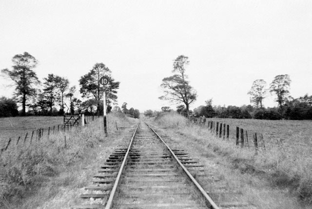
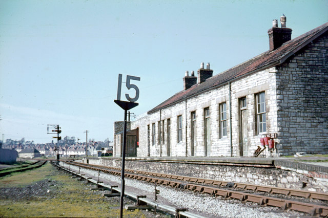
Congresbury railway station was a station located at Congresbury on the Bristol and Exeter Railway's Cheddar Valley line in Somerset and the junction for the Wrington Vale Light Railway to Blagdon. The station was opened with the broad gauge line to Cheddar on 3 August 1869 as a single-platform station. The railway was extended to Wells in 1870, converted to standard gauge in the mid-1870s and then linked up to the East Somerset Railway to provide through services from Yatton to Witham in 1878. Congresbury was remodelled as a two-platform station when the Wrington Vale line opened in 1901; with a few exceptions, though, trains on both lines started at Yatton, the junction with the main Bristol and Exeter line. The station was host to a GWR camp coach from 1936 to 1939. A camping coach was also positioned here by the Western Region from 1952 to 1962. The Wrington line shut to passenger traffic on 14 September 1931. The Yatton to Witham line closed to passengers on 9 Sep ... [...More Info...] [...Related Items...] OR: [Wikipedia] [Google] [Baidu] |
Yatton
Yatton is a village and civil parish within the unitary authority of North Somerset, which falls within the ceremonial county of Somerset, England. It is located south-west of Bristol. Its population in 2011 was 7,552. The parish includes Claverham, a small village which was originally a farming hamlet. The origins of the village and its name are unclear; however, there is evidence of Iron Age hill fort and a Roman villa in the area. The arrival of the railway in the 19th century and more recent road building have led to expansion of the village with Yatton now acting as a home to many commuters, while also supporting manufacturing industry and commerce. The village is located on the North Somerset Levels, where the low-lying land, a mixture of peat, estuarine alluvium and low hills of sand and gravel, is crossed by a myriad of watercourses, providing a habitat for several scarce species. St Mary's Church dates from the 14th century and there are a range of other places of w ... [...More Info...] [...Related Items...] OR: [Wikipedia] [Google] [Baidu] |
Yatton Railway Station
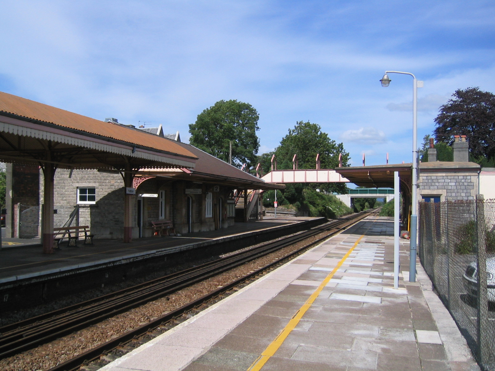
Yatton railway station, on the Bristol to Exeter line, is in the village of Yatton in North Somerset, England. It is west of Bristol Temple Meads railway station, and from London Paddington. Its three-letter station code is YAT. It was opened in 1841 by the Bristol and Exeter Railway, and served as a junction station for trains to Clevedon and Cheddar, but these lines closed in the 1960s. The station, which has two platforms, is managed by Great Western Railway, the seventh company to be responsible for the station, and the third franchise since privatisation in 1997. They provide all train services at the station, mainly hourly services between and , and between and . The line is not currently electrified, and there is local support for electrification as an extension of the Great Western Main Line upgrade programme. A community centre and café was opened at the station in 2011. Description The station is located in the north end of the village of Yatton, North Somers ... [...More Info...] [...Related Items...] OR: [Wikipedia] [Google] [Baidu] |
North Somerset
North Somerset is a unitary authorities of England, unitary district in Somerset, South West England. Whilst its area covers part of the Ceremonial counties of England, ceremonial county of Somerset, it is administered independently of the non-metropolitan county. Its administrative headquarters is in the town hall in Weston-super-Mare. North Somerset, which was renamed from the Woodspring district in 1996, borders the city and county of Bristol and the local government areas of Bath and North East Somerset, Mendip District, Mendip and Sedgemoor. The area comprises the parliamentary constituencies of Weston-super-Mare (UK Parliament constituency), Weston-super-Mare and North Somerset (UK Parliament constituency), North Somerset. History Between 1 April 1974 and 31 March 1996, this area was the Woodspring Districts of England, district of the county of Avon (named after Woodspring Priory, an isolated medieval church near the coast just north east of Weston-super-Mare). The dist ... [...More Info...] [...Related Items...] OR: [Wikipedia] [Google] [Baidu] |
Weston-super-Mare (UK Parliament Constituency)
Weston-super-Mare is a constituency represented in the House of Commons of the UK Parliament since 2005 by John Penrose, a Conservative. History The seat was created under the Representation of the People Act 1918. Its forerunner was the North Somerset division created in 1885. The by-election of 1934 was triggered by the acceptance of the appointment of Lord Erskine to the position of Governor of Madras Presidency, that of 1958 by the death of Ian Orr-Ewing and that of 1969 by the death of David Webster. ;Political history The seat has alternated in representation between 1992 and 2005: in the election of 1997 the fresh Conservative candidate, Margaret Daly failed to hold the seat which led to Weston Super Mare's first marginal majority since 1923, obtained by Brian Cotter, a Liberal Democrat. Between 1997 and 2010, all the majorities in the constituency were lower than 3,000 votes, remaining strongly marginal and seeing in 2005 Cotter lose the seat to John Penrose. Follow ... [...More Info...] [...Related Items...] OR: [Wikipedia] [Google] [Baidu] |
A370 Road
The A370 is a primary road in England running from the A4 Bath Road, near Bristol Temple Meads railway station to Weston-super-Mare before continuing to the village of East Brent in Somerset. A more direct route from Bristol to East Brent is the A38. Route Within Bristol urban area, the road begins at Bath Road roundabout, at the busy junction with A4 near Temple Meads. It then follows the new cut of River Avon west to Cumberland basin, via Bedminster. From here on, it begins to head south-westwards out of the city. It first bypasses Long Ashton, then passes through Flax Bourton, Backwell, Brockley, Cleeve, Congresbury and Hewish, beyond which it crosses the M5 motorway at Junction 21. The road then enters Weston-super-Mare: a dual carriageway extends most of the way, by passing the built-up area, including Junction 21 Enterprise Area to the east of the town. Previously the route of the A370 passed through Worle. On reaching the waterfront, the road turns south to run part ... [...More Info...] [...Related Items...] OR: [Wikipedia] [Google] [Baidu] |


