|
Concord Fault
The Concord Fault is a geologic fault in the San Francisco Bay Area. The reason it is called that is because it is located under the city of Concord. It is connected to, and considered to be part of, the same fault zone as the Green Valley fault, which lies just a few miles to the north across the Suisun Bay. The fault is situated at the east of West Napa Fault and extends from Mount Diablo to the Carquinez Strait, an approximately 11 mile long distance. Like most other faults in this area, the Concord Fault is a strike-slip fault, moving approximately 2.7 to 3.6 millimeters a year. Seismic activity Currently, it is considered to be under a high stress level and therefore has a higher chance of a major earthquake happening. There have been earthquakes on this fault before. On October 23, 1955, a 5.4 magnitude quake caused about 1 million dollars in damage (about 8.7 million today) and one death. The last large earthquake linked to this fault occurred over 400 years ago. Dange ... [...More Info...] [...Related Items...] OR: [Wikipedia] [Google] [Baidu] |
Geologic Map
A geologic map or geological map is a special-purpose map made to show various geological features. Rock units or geologic strata are shown by color or symbols. Bedding planes and structural features such as faults, folds, are shown with strike and dip or trend and plunge symbols which give three-dimensional orientations features. Stratigraphic contour lines may be used to illustrate the surface of a selected stratum illustrating the subsurface topographic trends of the strata. Isopach maps detail the variations in thickness of stratigraphic units. It is not always possible to properly show this when the strata are extremely fractured, mixed, in some discontinuities, or where they are otherwise disturbed. Symbols Lithologies Rock units are typically represented by colors. Instead of (or in addition to) colors, certain symbols can be used. Different geologic mapping agencies and authorities have different standards for the colors and symbols to be used for rocks of differ ... [...More Info...] [...Related Items...] OR: [Wikipedia] [Google] [Baidu] |
Fault (geology)
In geology, a fault is a planar fracture or discontinuity in a volume of rock across which there has been significant displacement as a result of rock-mass movements. Large faults within Earth's crust result from the action of plate tectonic forces, with the largest forming the boundaries between the plates, such as the megathrust faults of subduction zones or transform faults. Energy release associated with rapid movement on active faults is the cause of most earthquakes. Faults may also displace slowly, by aseismic creep. A ''fault plane'' is the plane that represents the fracture surface of a fault. A ''fault trace'' or ''fault line'' is a place where the fault can be seen or mapped on the surface. A fault trace is also the line commonly plotted on geologic maps to represent a fault. A ''fault zone'' is a cluster of parallel faults. However, the term is also used for the zone of crushed rock along a single fault. Prolonged motion along closely spaced faults can blur the ... [...More Info...] [...Related Items...] OR: [Wikipedia] [Google] [Baidu] |
San Francisco Bay Area
The San Francisco Bay Area, often referred to as simply the Bay Area, is a populous region surrounding the San Francisco, San Pablo, and Suisun Bay estuaries in Northern California. The Bay Area is defined by the Association of Bay Area Governments to include the nine counties that border the aforementioned estuaries: Alameda, Contra Costa, Marin, Napa, San Mateo, Santa Clara, Solano, Sonoma, and San Francisco. Other definitions may be either smaller or larger, and may include neighboring counties that do not border the bay such as Santa Cruz and San Benito (more often included in the Central Coast regions); or San Joaquin, Merced, and Stanislaus (more often included in the Central Valley). The core cities of the Bay Area are San Francisco, San Jose, and Oakland. Home to approximately 7.76 million people, Northern California's nine-county Bay Area contains many cities, towns, airports, and associated regional, state, and national parks, connected by a comp ... [...More Info...] [...Related Items...] OR: [Wikipedia] [Google] [Baidu] |
Concord, California
Concord ( ) is the largest city in Contra Costa County, California. According to an estimate completed by the United States Census Bureau, the city had a population of 129,295 in 2019 making it the eighth largest city in the San Francisco Bay Area. Founded in 1869 as Todos Santos by Don Salvio Pacheco II, a noted Californio ranchero, the name was later changed to Concord. The city is a major regional suburban East Bay center within the San Francisco Bay Area, and is east of San Francisco. History The valleys north of Mount Diablo were inhabited by the Miwok people, who hunted elk and fished in the numerous streams flowing from the mountain into the San Francisco Bay. It is important to note Miwok and other indigenous people still live within city limits. In 1772, Spanish explorers began to cross the area but did not settle there. In 1834, the Mexican land grant Rancho Monte del Diablo at the base of Mount Diablo was granted to Salvio Pacheco (for whom the nearby town ... [...More Info...] [...Related Items...] OR: [Wikipedia] [Google] [Baidu] |
Suisun Bay
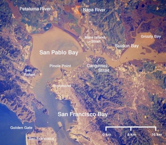
Suisun Bay ( ; Wintun for "where the west wind blows") is a shallow tidal estuary (a northeastern extension of the San Francisco Bay) in Northern California. It lies at the confluence of the Sacramento River and San Joaquin River, forming the entrance to the Sacramento–San Joaquin River Delta, an inverted river delta. To the west, Suisun Bay is drained by the Carquinez Strait, which connects to San Pablo Bay, a northern extension of San Francisco Bay. Suisun Marsh, the tidal marsh land to the north, is the largest marsh in California. Grizzly Bay forms a northern extension of Suisun Bay. Suisun Bay is directly north of Contra Costa County. The bay was named in 1811, after the Suisunes, a Patwin tribe of Wintun Indians. The Central Pacific Railroad built a train ferry that operated between Benicia and Port Costa, California, from 1879 to 1930. The ferry boats ''Solano'' and ''Contra Costa'' were removed from service when the nearby Martinez railroad bridge was completed in ... [...More Info...] [...Related Items...] OR: [Wikipedia] [Google] [Baidu] |
West Napa Fault
The West Napa Fault is a long geologic fault in Napa County, in the North Bay (San Francisco Bay Area), North Bay region of the San Francisco Bay Area in northern California. It is believed to be the northern extension of the Calaveras Fault in the East Bay (San Francisco Bay Area), East Bay region. It has been mapped as a Late Pleistocene-Holocene active fault, and is considered to be predominantly a Fault (geology)#Strike-slip faults, right lateral strike-slip fault. The fault was discovered in 1976 by Gene Boudreau, a ground water drilling specialist from Sebastopol, California, Sebastopol. Earthquakes The West Napa Fault is a likely source for the magnitude 6.0 2014 South Napa earthquake, South Napa earthquake that hit Napa County on August 24, 2014. Seismologists were not able to determine the exact fault on which the quake occurred, because faults are usually identified by their expression on the surface. The epicenter for the 2000 Yountville earthquake which occurred on ... [...More Info...] [...Related Items...] OR: [Wikipedia] [Google] [Baidu] |
Mount Diablo
Mount Diablo is a mountain of the Diablo Range, in Contra Costa County, California, Contra Costa County of the eastern San Francisco Bay Area in Northern California. It is south of Clayton, California, Clayton and northeast of Danville, California, Danville. It is an isolated upthrust peak of , visible from most of the San Francisco Bay Area. Mount Diablo appears from many angles to be a double pyramid and has many subsidiary peaks. The largest and closest is North Peak, the other half of the double pyramid, which is nearly as high in elevation at , and is about northeast of the main summit. The mountain is within the boundaries of Mount Diablo State Park, which is administered by California State Parks. Geography The summit is accessible by foot, bicycle, or motor vehicle. Road access is via North Gate Road or South Gate Road. Also you can hike in various places in Mount Diablo. Mount Diablo State Park The peak is in Mount Diablo State Park, a state park of about . The ... [...More Info...] [...Related Items...] OR: [Wikipedia] [Google] [Baidu] |
Carquinez Strait
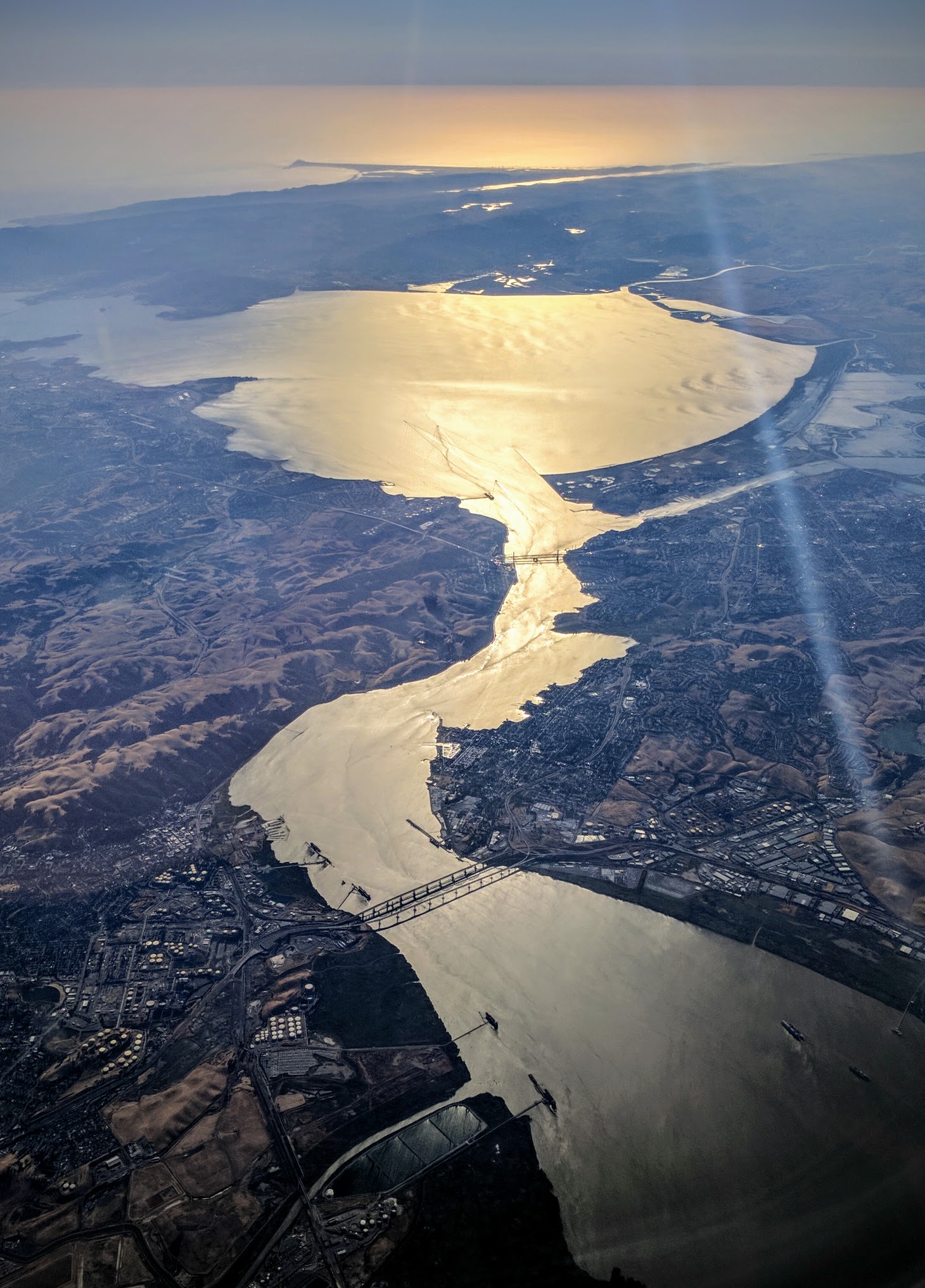
The Carquinez Strait (; Spanish: ''Estrecho de Carquinez'') is a narrow tidal strait in Northern California. It is part of the tidal estuary of the Sacramento and the San Joaquin rivers as they drain into the San Francisco Bay. The strait is long and connects Suisun Bay, which receives the waters of the combined rivers, with San Pablo Bay, a northern extension of the San Francisco Bay. The strait formed in prehistoric times, near the close of one of the past ice ages, when the Central Valley was a vast inland lake. Melting ice from the Sierra Nevada raised the water level while seismic activity created a new outlet to the Pacific Ocean, draining the lake into the ocean and exposing the valley floors. History Andrei Sarna-Wojcicki, a geologist emeritus of the US Geological Survey (USGS), estimates that the Carquinez Strait was likely formed about 640,000 to 700,000 years ago, while much of modern California was emerging from an ice age. The present Sacramento Valley and San J ... [...More Info...] [...Related Items...] OR: [Wikipedia] [Google] [Baidu] |
Earthquakes
An earthquake (also known as a quake, tremor or temblor) is the shaking of the surface of the Earth resulting from a sudden release of energy in the Earth's lithosphere that creates seismic waves. Earthquakes can range in intensity, from those that are so weak that they cannot be felt, to those violent enough to propel objects and people into the air, damage critical infrastructure, and wreak destruction across entire cities. The seismic activity of an area is the frequency, type, and size of earthquakes experienced over a particular time period. The seismicity at a particular location in the Earth is the average rate of seismic energy release per unit volume. The word ''tremor'' is also used for non-earthquake seismic rumbling. At the Earth's surface, earthquakes manifest themselves by shaking and displacing or disrupting the ground. When the epicenter of a large earthquake is located offshore, the seabed may be displaced sufficiently to cause a tsunami. Earthquakes ca ... [...More Info...] [...Related Items...] OR: [Wikipedia] [Google] [Baidu] |
Richter Magnitude Scale
The Richter scale —also called the Richter magnitude scale, Richter's magnitude scale, and the Gutenberg–Richter scale—is a measure of the strength of earthquakes, developed by Charles Francis Richter and presented in his landmark 1935 paper, where he called it the "magnitude scale". This was later revised and renamed the local magnitude scale, denoted as ML or . Because of various shortcomings of the original scale, most seismological authorities now use other similar scales such as the moment magnitude scale () to report earthquake magnitudes, but much of the news media still erroneously refers to these as "Richter" magnitudes. All magnitude scales retain the logarithmic character of the original and are scaled to have roughly comparable numeric values (typically in the middle of the scale). Due to the variance in earthquakes, it is essential to understand the Richter scale uses logarithms simply to make the measurements manageable (i.e., a magnitude 3 quake factors ... [...More Info...] [...Related Items...] OR: [Wikipedia] [Google] [Baidu] |
United States Geological Survey
The United States Geological Survey (USGS), formerly simply known as the Geological Survey, is a scientific agency of the United States government. The scientists of the USGS study the landscape of the United States, its natural resources, and the natural hazards that threaten it. The organization's work spans the disciplines of biology, geography, geology, and hydrology. The USGS is a fact-finding research organization with no regulatory responsibility. The agency was founded on March 3, 1879. The USGS is a bureau of the United States Department of the Interior; it is that department's sole scientific agency. The USGS employs approximately 8,670 people and is headquartered in Reston, Virginia. The USGS also has major offices near Lakewood, Colorado, at the Denver Federal Center, and Menlo Park, California. The current motto of the USGS, in use since August 1997, is "science for a changing world". The agency's previous slogan, adopted on the occasion of its hundredt ... [...More Info...] [...Related Items...] OR: [Wikipedia] [Google] [Baidu] |
East Bay (San Francisco Bay Area)
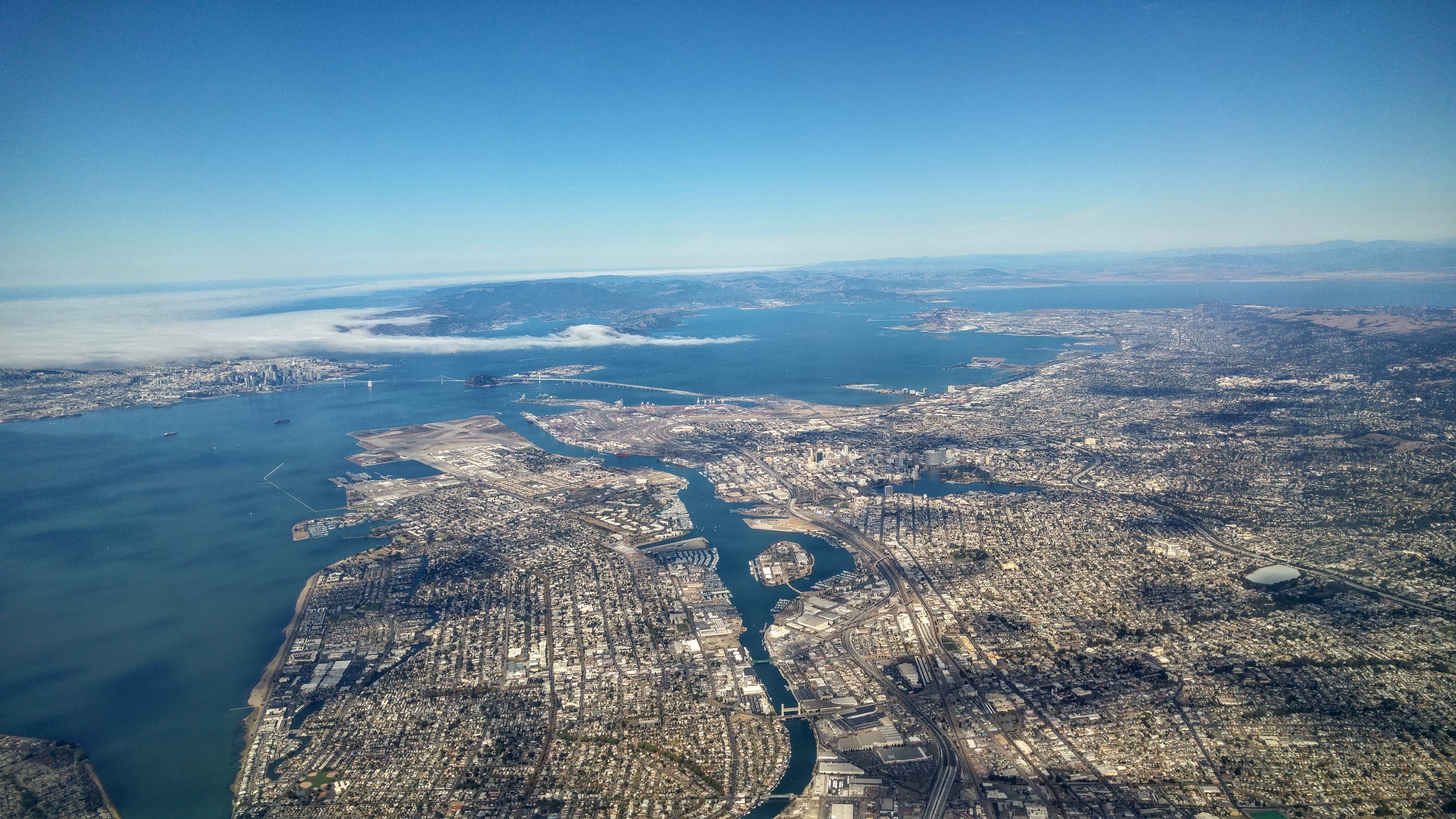
The East Bay is the eastern region of the San Francisco Bay Area and includes cities along the eastern shores of the San Francisco Bay and San Pablo Bay. The region has grown to include inland communities in Alameda and Contra Costa counties. With a population of roughly 2.5 million in 2010, it is the most populous subregion in the Bay Area. Oakland is the largest city in the East Bay and the third largest in the Bay Area. The city serves as a major transportation hub for the U.S. West Coast, and its port is the largest in Northern California. Increased population has led to the growth of large edge cities such as Alameda, Concord, Emeryville, Fremont, Livermore, Pleasanton, San Ramon and Walnut Creek. History and development Although initial development in the larger Bay Area focused on San Francisco, the coastal East Bay came to prominence in the middle of the nineteenth century as the part of the Bay Area most accessible by land from the east. The Transcontinental Rai ... [...More Info...] [...Related Items...] OR: [Wikipedia] [Google] [Baidu] |


