|
Compass-1
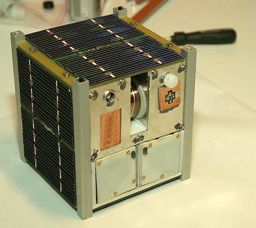
Compass-1 (also known as Compass One) is a German amateur CubeSat picosatellite, built and operated in the late 2000s by Aachen University of Applied Science. It was launched by the Indian Space Research Organisation, aboard a PSLV rocket as a secondary payload to the CartoSat-2A primary spacecraft on 28 April 2008. It was launched into a Geocentric orbit with an altitude of 597 km. Its primary mission is remote sensing; however, it also contains some technology demonstration experiments regarding the use of small satellites and GPS tracking. On 10 August 2008, the satellite developed a problem and switched into "emergency mode". Initial attempts to rectify this problem failed; however, normal operations were resumed on 10 September, with help from amateur radio operators around the world. Overview Most of the objectives for Compass-1 were focused on the evaluation and testing of CubeSats and new technologies. It was made using scratch-built software, hardware, and parts, e ... [...More Info...] [...Related Items...] OR: [Wikipedia] [Google] [Baidu] |
Cartosat-2A
Cartosat-2A is an Earth observation satellite in a Sun-synchronous orbit and the third of the Cartosat series of satellites. The satellite is the thirteenth satellite in the Indian Remote Sensing (IRS) satellite series to be built, launched by the Indian Space Research Organisation. Launch It was launched by the Polar Satellite Launch Vehicle ( PSLV-C9) on 28 April 2008, «t 03:54:00 UTC, along with the 87 kg Indian Mini Satellite (IMS-1) and eight nano research satellites belonging to research facilities. The CanX-2 and the CanX-6 of Canada, the AAUSAT-2 of Denmark, the Compass-1 and the Rubin-8 of Germany, the CUTE-1.7 of Japan, and the Delfi-C3 of the Netherlands. IMS-1 satellite The IMS-1 satellite is a Ministry of Defence mission for the Government of India. It is a dedicated satellite for the Indian Armed Forces (IAF) which is in the process of establishing an Aerospace Command. Payload The satellite carries a panchromatic (PAN) camera capable of taki ... [...More Info...] [...Related Items...] OR: [Wikipedia] [Google] [Baidu] |
Remote Sensing
Remote sensing is the acquisition of information about an object or phenomenon without making physical contact with the object, in contrast to in situ or on-site observation. The term is applied especially to acquiring information about Earth and other planets. Remote sensing is used in numerous fields, including geography, land surveying and most Earth science disciplines (e.g. hydrology, ecology, meteorology, oceanography, glaciology, geology); it also has military, intelligence, commercial, economic, planning, and humanitarian applications, among others. In current usage, the term ''remote sensing'' generally refers to the use of satellite- or aircraft-based sensor technologies to detect and classify objects on Earth. It includes the surface and the atmosphere and oceans, based on propagated signals (e.g. electromagnetic radiation). It may be split into "active" remote sensing (when a signal is emitted by a satellite or aircraft to the object and its reflection detected by ... [...More Info...] [...Related Items...] OR: [Wikipedia] [Google] [Baidu] |
Global Positioning System
The Global Positioning System (GPS), originally Navstar GPS, is a satellite-based radionavigation system owned by the United States government and operated by the United States Space Force. It is one of the global navigation satellite systems (GNSS) that provides geolocation and time information to a GPS receiver anywhere on or near the Earth where there is an unobstructed line of sight to four or more GPS satellites. It does not require the user to transmit any data, and operates independently of any telephonic or Internet reception, though these technologies can enhance the usefulness of the GPS positioning information. It provides critical positioning capabilities to military, civil, and commercial users around the world. Although the United States government created, controls and maintains the GPS system, it is freely accessible to anyone with a GPS receiver. The GPS project was started by the U.S. Department of Defense in 1973. The first prototype spacecraft was lau ... [...More Info...] [...Related Items...] OR: [Wikipedia] [Google] [Baidu] |
CubeSats
A CubeSat is a class of miniaturized satellite based around a form factor consisting of cubes. CubeSats have a mass of no more than per unit, and often use commercial off-the-shelf (COTS) components for their electronics and structure. CubeSats are put into orbit by deployers on the International Space Station, or launched as secondary payloads on a launch vehicle. , more than 1,600 CubeSats have been launched. In 1999, California Polytechnic State University (Cal Poly) professor Jordi Puig-Suari and Bob Twiggs, a professor at Stanford University Space Systems Development Laboratory, developed the CubeSat specifications to promote and develop the skills necessary for the design, manufacture, and testing of small satellites intended for low Earth orbit (LEO) that perform a number of scientific research functions and explore new space technologies. Academia accounted for the majority of CubeSat launches until 2013, when more than half of launches were for non-academic purposes, and ... [...More Info...] [...Related Items...] OR: [Wikipedia] [Google] [Baidu] |
Spacecraft Launched In 2008
A spacecraft is a vehicle or machine designed to fly in outer space. A type of artificial satellite, spacecraft are used for a variety of purposes, including communications, Earth observation, meteorology, navigation, space colonization, planetary exploration, and transportation of humans and cargo. All spacecraft except single-stage-to-orbit vehicles cannot get into space on their own, and require a launch vehicle (carrier rocket). On a sub-orbital spaceflight, a space vehicle enters space and then returns to the surface without having gained sufficient energy or velocity to make a full Earth orbit. For orbital spaceflights, spacecraft enter closed orbits around the Earth or around other celestial bodies. Spacecraft used for human spaceflight carry people on board as crew or passengers from start or on orbit (space stations) only, whereas those used for robotic space missions operate either autonomously or telerobotically. Robotic spacecraft used to support scientific res ... [...More Info...] [...Related Items...] OR: [Wikipedia] [Google] [Baidu] |
Student Satellites
A student is a person enrolled in a school or other educational institution. In the United Kingdom and most commonwealth countries, a "student" attends a secondary school or higher (e.g., college or university); those in primary or elementary schools are "pupils". Africa Nigeria In Nigeria, education is classified into four system known as a 6-3-3-4 system of education. It implies six years in primary school, three years in junior secondary, three years in senior secondary and four years in the university. However, the number of years to be spent in university is mostly determined by the course of study. Some courses have longer study length than others. Those in primary school are often referred to as pupils. Those in university, as well as those in secondary school, are referred to as students. The Nigerian system of education also has other recognized categories like the polytechnics and colleges of education. The Polytechnic gives out National Diploma and Higher Nation ... [...More Info...] [...Related Items...] OR: [Wikipedia] [Google] [Baidu] |
COMPASS-2
COMPASS-2 (also known as DragSail-CubeSat) is the second satellite developed by students from FH Aachen and RWTH Aachen University. It has a sail to increase its drag coefficient, and was launched (with a number of other satellites) in 2017 by means of a Polar Satellite Launch Vehicle The Polar Satellite Launch Vehicle (PSLV) is an expendable medium-lift launch vehicle designed and operated by the Indian Space Research Organisation (ISRO). It was developed to allow India to launch its Indian Remote Sensing (IRS) satellites .... References External links FH Aachen site compass 2 {{authority control CubeSats Student satellites RWTH Aachen University Satellites of Germany ... [...More Info...] [...Related Items...] OR: [Wikipedia] [Google] [Baidu] |
List Of CubeSats
The following is a list of CubeSats, nanosatellites used primarily by universities for research missions, typically in low Earth orbits. Some CubeSats became their country's first national satellite. The extensivNanosatellite and CubeSat Databaselists nearly 4,000 CubeSats and NanoSats have been launched since 1998. The organization forecasts that 2080 nanosats will launch within the next 6 years. Research and development * SBUDNIC was launched to test Arduino Nano and other commercial off-the-shelf technology in space, using a simple, open-source design. * An ambitious project is the QB50, an international network of 50 CubeSats for multi-point by different universities and other teams, ''in-situ'' measurements in the lower thermosphere (90–350 km) and re-entry research. QB50 is an initiative of the von Karman Institute and is funded by the European Union. Double-unit ("2-U") CubeSats (10x10x20 cm) are foreseen, with one unit (the 'functional' unit) providing the usual sat ... [...More Info...] [...Related Items...] OR: [Wikipedia] [Google] [Baidu] |
AAUSAT-II
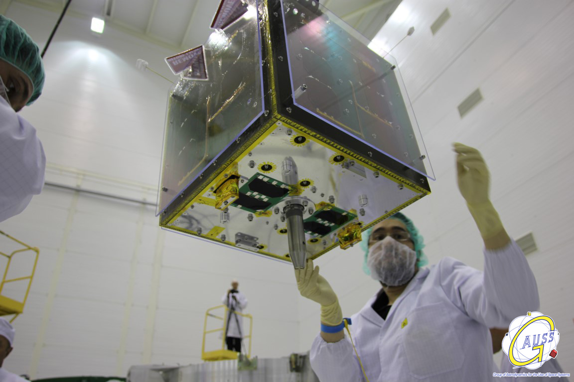
AAUSAT-II (Aalborg University CubeSat no 2), is the second student-built CubeSat built and operated by students from Aalborg University in Denmark. It was launched 28 April 2008 05:53:51 UTC from Satish Dhawan Space Centre in India on a Polar Satellite Launch Vehicle (PSLV) launch vehicle. AAUSAT-II carries a gamma radiation sensor. Educational objective The primary purpose of construction of satellites at the University of Aalborg is to give the students engineering capabilities beyond what is normally achieved within a masters program. History Student satellite activities at Aalborg University (AAU) started in 2003 as a result of AAU's involvement in the first pure Danish research satellite, Ørsted, which was successfully launched in 1999. AAUSAT-II's predecessor was AAU CubeSat which was constructed in the period 2001-2003 and was launched 30 June 2003. The project started in the summer 2003. The construction of AAUSAT-II began in 2005. Operations After the launch ... [...More Info...] [...Related Items...] OR: [Wikipedia] [Google] [Baidu] |
Delfi-C3
Delfi-C3 is a CubeSat satellite constructed by students at the Delft University of Technology in the Netherlands. It is a 3-unit CubeSat, and was launched at 03:53:42 on 28 April 2008, as part of the NLS-4 mission, aboard a PSLV rocket, from the Second Launch Pad at the Satish Dhawan Space Centre in India. The launch was contracted by ISRO, through Antrix Corporation and UTIAS. The satellite's primary mission is technology demonstration and development. It is carrying new types of solar cells, a solar sensor for TNO Science and Industry, and a high-efficiency amateur radio transceiver experiment. Delfi-C3 does not contain batteries, as the experiments are dependent on the sun. She is the fourth Dutch Satellite, after ANS, IRAS and SLOSHSAT. It is the first Dutch university Satellite and is based on a 3-Unit CubeSat. Some other mission characteristics include: * No active attitude control * 1200Bd BPSK VHF downlink * Linear transponder The Delfi-C3 ground segment consists of ... [...More Info...] [...Related Items...] OR: [Wikipedia] [Google] [Baidu] |
Telemetry
Telemetry is the in situ data collection, collection of measurements or other data at remote points and their automatic data transmission, transmission to receiving equipment (telecommunication) for monitoring. The word is derived from the Greek language, Greek roots ''tele'', "remote", and ''metron'', "measure". Systems that need external instructions and data to operate require the counterpart of telemetry, telecommand. Although the term commonly refers to wireless data transfer mechanisms (e.g., using radio, ultrasonic, or Infrared#Communications, infrared systems), it also encompasses data transferred over other media such as a telephone or computer network, optical link or other wired communications like power line carriers. Many modern telemetry systems take advantage of the low cost and ubiquity of GSM networks by using SMS to receive and transmit telemetry data. A ''telemeter'' is a physical device used in telemetry. It consists of a sensor, a transmission path, and a ... [...More Info...] [...Related Items...] OR: [Wikipedia] [Google] [Baidu] |


