|
Columbia Park, Minneapolis
Columbia Park is a neighborhood in the Northeast community in Minneapolis. Its boundaries are 37th Avenue NE to the north, Central Avenue to the east, 27th Avenue NE to the south, and both University Avenue & Saint Anthony Parkway streets to the west. Location and characteristics Columbia Park is an L-shaped neighborhood whose boundaries are 37th Avenue NE (the border between Minneapolis and Columbia Heights) to the north, Central Avenue to the east, 27th Avenue NE and St. Anthony Boulevard to the south and University Avenue, 4th Street NE and the Mississippi River to the west. It is named after three related items: Columbia Park itself (located within its borders), the park's acquisition in 1892 (the so-called "Columbian" year celebrating the 400th anniversary of Christopher Columbus's arrival in the New World) and the adjacent suburb of Columbia Heights. Much of the area of Columbia Park is the park itself with residential areas situated north and west of it and industrial an ... [...More Info...] [...Related Items...] OR: [Wikipedia] [Google] [Baidu] |
Neighborhoods Of Minneapolis
The U.S. City, U.S. city of Minneapolis is officially defined by the Minneapolis City Council as divided into eleven communities, each containing multiple official neighborhoods. Informally, there are city areas with colloquial labels. Residents may also group themselves by their city street suffixes, North, Northeast, South, Southeast, and Southwest. Description General areas The local community defines several general areas based on the directional suffixes added to streets in the city. These city areas do not necessarily correlate with official community or neighborhood definitions. Downtown Minneapolis refers to the street grid area aligned on a diagonal with the Mississippi River bend, as opposed to the true north-south grid orientation. The area north of downtown on the west bank of the Mississippi River is considered North Minneapolis. The part of Minneapolis on the east bank of the Mississippi River is divided by East Hennepin Avenue into Northeast and Southeast, app ... [...More Info...] [...Related Items...] OR: [Wikipedia] [Google] [Baidu] |
Mississippi River
The Mississippi River is the second-longest river and chief river of the second-largest drainage system in North America, second only to the Hudson Bay drainage system. From its traditional source of Lake Itasca in northern Minnesota, it flows generally south for to the Mississippi River Delta in the Gulf of Mexico. With its many tributaries, the Mississippi's watershed drains all or parts of 32 U.S. states and two Canadian provinces between the Rocky and Appalachian mountains. The main stem is entirely within the United States; the total drainage basin is , of which only about one percent is in Canada. The Mississippi ranks as the thirteenth-largest river by discharge in the world. The river either borders or passes through the states of Minnesota, Wisconsin, Iowa, Illinois, Missouri, Kentucky, Tennessee, Arkansas, Mississippi, and Louisiana. Native Americans have lived along the Mississippi River and its tributaries for thousands of years. Most were hunter-ga ... [...More Info...] [...Related Items...] OR: [Wikipedia] [Google] [Baidu] |
Fridley, Minnesota
Fridley is a city in Anoka County, Minnesota, United States. Its population was 29,590 at the 2020 census. Fridley was incorporated in 1949 as a village, and became a city in 1957. It is part of the Minneapolis–Saint Paul metropolitan area as a "first-ring" or "inner-ring" suburb its northern part. Fridley borders Minneapolis to the southwest. Neighboring first-ring suburbs are Columbia Heights to the south and Brooklyn Center to the west, across the Mississippi River. Geography and climate According to the United States Census Bureau, the city has an area of , of which are land and is covered by water. The city lies within a narrow portion of the southernmost part of Anoka County. It is longer north–south along the path of the Mississippi River, and the highways that follow the river. It is narrower east/west in the portion between the Mississippi River and Spring Lake Park. Fridley borders the cities of Coon Rapids and Blaine to the north; Spring Lake Park to the ... [...More Info...] [...Related Items...] OR: [Wikipedia] [Google] [Baidu] |
Holland, Minneapolis
Holland is a neighborhood in the Northeast community in Minneapolis. Location and characteristics Holland's boundaries are 27th Avenue NE to the north, Central Avenue to the east, 19th and 17th Avenues NE to the south, and University Avenue NE to the west. It is named after Josiah G. Holland, an American educator, novelist and poet. Much of the neighborhood is smaller residential housing dating from before 1920. During the early 20th century it was a common destination for immigrants from Eastern Europe, some of whom worked at the Shoreham Yards railroad complex north of the neighborhood. Today it is considered part of the Northeast Minneapolis Arts District as it has gradually transformed to include more small businesses, restaurants, art galleries and workspaces. Landmarks The neighborhood is home to Edison High School, the nearby Jackson Square Park and the Northeast Branch of the Hennepin County Library. A strip of land on the north side of 27th Avenue NE has been dedica ... [...More Info...] [...Related Items...] OR: [Wikipedia] [Google] [Baidu] |
Marshall Terrace, Minneapolis
Marshall Terrace is a neighborhood in the Northeast community in Minneapolis. Location and characteristics Marshall Terrace's boundaries are Saint Anthony Parkway to the north, 4th Street and University Avenue to the east, Lowry Avenue to the south, and the Mississippi River to the west. It is named for former Minnesota governor William Rainey Marshall. Much of Marshall Terrace is reserved for industrial use with utilities and industries situated along the western border and railroad tracks along the east. Its housing was developed in the early 20th century to provide homes for those working in nearby industries and is concentrated in the central part of the neighborhood. The housing stock consists largely of smaller single family homes. Landmarks Marshall Terrace has two parks located along the Mississippi River: Marshall Terrace Park and Marshall Terrace Gardens. The Grand Rounds Scenic Byway also runs along St. Anthony Parkway on the neighborhood's northern border. Transpor ... [...More Info...] [...Related Items...] OR: [Wikipedia] [Google] [Baidu] |
Audubon Park, Minneapolis
The Audubon Park neighborhood is located in the Northeast community in Minneapolis. Audubon Park is one of ten neighborhoods in Ward 1 of Minneapolis, which is represented on the Minneapolis City Council by Councilmember Elliot Payne. The neighborhood is bounded by Saint Anthony Parkway to the north, NE Stinson Parkway to the east, NE Lowry Avenue to the south, and Central Avenue to the west. Stinson Parkway and St. Anthony Parkway are both part of the Grand Rounds National Scenic Byway. Stinson Parkway is also the city's border with St. Anthony. Audubon Park is also the name of the only city park located entirely within the boundaries of the Audubon Park neighborhood. The park and neighborhood are named in honor of John James Audubon, a great American naturalist and ornithologist. A majority of the houses in this relatively hilly neighborhood were built in the 1940s. References External linksMinneapolis Neighborhood Profile - Audubon Park [...More Info...] [...Related Items...] OR: [Wikipedia] [Google] [Baidu] |
Waite Park, Minneapolis
Waite Park is a neighborhood in the Northeast community in Minneapolis, Minnesota. Its boundaries are 37th Avenue NE to the north, NE Stinson Boulevard to the East, Saint Anthony Parkway to the south, and NE Central Avenue to the west. It is the furthest northeast neighborhood within Minneapolis. The neighborhood is within Minneapolis's first ward and falls under the jurisdiction of the second precinct of the Minneapolis Police Department. History Waite Park was among the last areas of northeast Minneapolis to be developed into urban neighborhoods in the last part of the nineteenth century. The area was mostly farmland until the 1880s and 1890s. The completion of Saint Anthony Parkway through the neighborhood in 1924 increased the pace of development. Although many of the homes in the neighborhood were built in the decades between the completion of the parkway and World War II, the neighborhood was not fully developed until the postwar housing boo The neighborhood is named aft ... [...More Info...] [...Related Items...] OR: [Wikipedia] [Google] [Baidu] |
Bike Paths
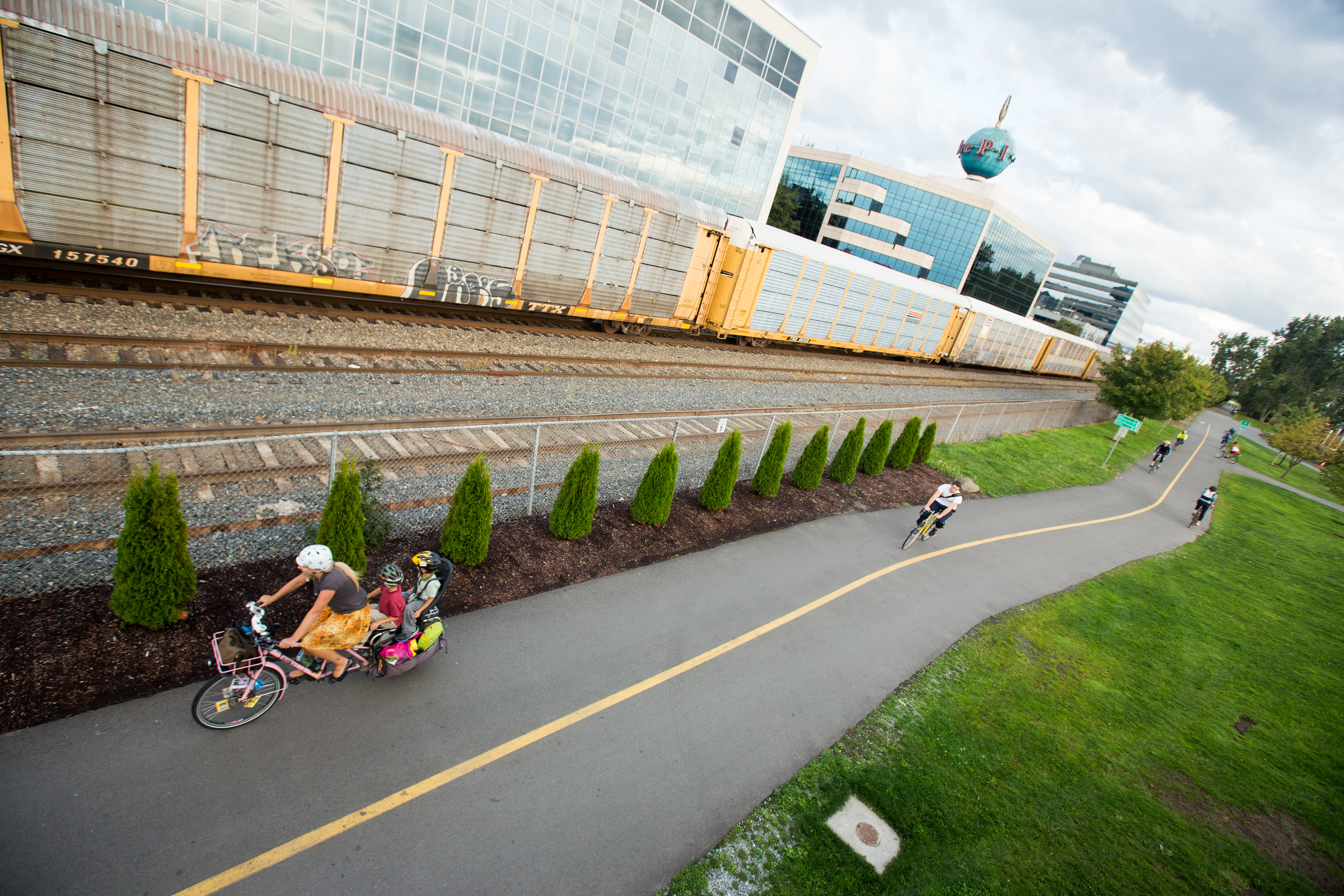
A bike path is a bikeway separated from motorized traffic and dedicated to cycling or shared with pedestrians or other non-motorized users. In the US a bike path sometimes encompasses ''shared use paths'', "multi-use path", or "Class III bikeway" is a paved path that has been designated for use by cyclists outside the right of way of a public road. It may or may not have a center divider or stripe to prevent head-on collisions. In the UK, a ''shared-use footway'' or ''multi-use path'' is for use by both cyclists and pedestrians. Bike paths with independent rights-of-way Bike paths that follow independent rights-of-way are often used to promote recreational cycling. In Northern European countries, cycling tourism represents a significant proportion of overall tourist activity. Extensive interurban bike path networks can be found in countries such as Denmark or the Netherlands, which has had a national system of cycle routes since 1993. These networks may use routes dedicated exc ... [...More Info...] [...Related Items...] OR: [Wikipedia] [Google] [Baidu] |
Metro Transit (Minnesota)
Metro Transit is the primary public transportation operator in the Minneapolis–Saint Paul area of the U.S. state of Minnesota and the largest operator in the state. Although Metro Transit is one of the smallest transit systems for a large metropolitan area in the United States, it is ranked as one of the best. In , the system had a ridership of , or about per weekday as of . The system is a division of the Metropolitan Council, the region's metropolitan planning organization (MPO), carrying 90% to 95% of the transit riders in the region on a combined network of regular-route buses, light rail and commuter rail. The remainder of Twin Cities transit ridership is generally split among suburban "opt-out" carriers operating out of cities that have chosen not to participate in the Metro Transit network. The biggest opt-out providers are Minnesota Valley Transit Authority (MVTA), Maple Grove Transit and Southwest Transit (SW Transit). The University of Minnesota also operates a ... [...More Info...] [...Related Items...] OR: [Wikipedia] [Google] [Baidu] |
Colonial Revival Architecture
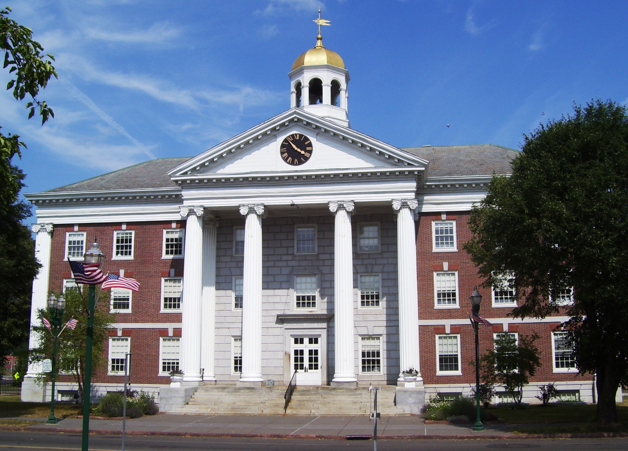
The Colonial Revival architectural style seeks to revive elements of American colonial architecture. The beginnings of the Colonial Revival style are often attributed to the Centennial Exhibition of 1876, which reawakened Americans to the architectural traditions of their colonial past. Fairly small numbers of Colonial Revival homes were built c. 1880–1910, a period when Queen Anne-style architecture was dominant in the United States. From 1910–1930, the Colonial Revival movement was ascendant, with about 40% of U.S. homes built during this period in the Colonial Revival style. In the immediate post-war period (c. 1950s–early 1960s), Colonial Revival homes continued to be constructed, but in simplified form. In the present-day, many New Traditional homes draw from Colonial Revival styles. While the dominant influences in Colonial Revival style are Georgian and Federal architecture, Colonial Revival homes also draw, to a lesser extent, from the Dutch Colonial ... [...More Info...] [...Related Items...] OR: [Wikipedia] [Google] [Baidu] |
Tudor Revival Architecture
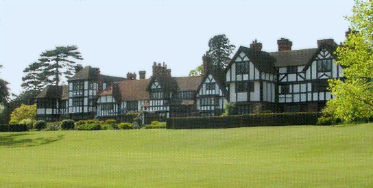
Tudor Revival architecture (also known as mock Tudor in the UK) first manifested itself in domestic architecture in the United Kingdom in the latter half of the 19th century. Based on revival of aspects that were perceived as Tudor architecture, in reality it usually took the style of English vernacular architecture of the Middle Ages that had survived into the Tudor period. The style later became an influence elsewhere, especially the British colonies. For example, in New Zealand, the architect Francis Petre adapted the style for the local climate. In Singapore, then a British colony, architects such as R. A. J. Bidwell pioneered what became known as the Black and White House. The earliest examples of the style originate with the works of such eminent architects as Norman Shaw and George Devey, in what at the time was considered Neo-Tudor design. Tudorbethan is a subset of Tudor Revival architecture that eliminated some of the more complex aspects of Jacobethan in favour of m ... [...More Info...] [...Related Items...] OR: [Wikipedia] [Google] [Baidu] |
New World
The term ''New World'' is often used to mean the majority of Earth's Western Hemisphere, specifically the Americas."America." ''The Oxford Companion to the English Language'' (). McArthur, Tom, ed., 1992. New York: Oxford University Press, p. 33: "[16c: from the feminine of ''Americus'', the Latinized first name of the explorer Amerigo Vespucci (1454–1512). The name ''America'' first appeared on a map in 1507 by the German cartographer Martin Waldseemüller, referring to the area now called Brazil]. Since the 16c, a name of the western hemisphere, often in the plural ''Americas'' and more or less synonymous with ''the New World''. Since the 18c, a name of the United States of America. The second sense is now primary in English: ... However, the term is open to uncertainties: ..." The term gained prominence in the early 16th century, during Europe's Age of Discovery, shortly after the Italian explorer Amerigo Vespucci concluded that America (now often called ''the Am ... [...More Info...] [...Related Items...] OR: [Wikipedia] [Google] [Baidu] |


