|
Colne Water
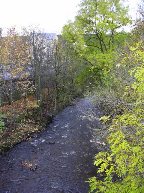
Colne Water is a river in eastern Lancashire. It is approximately long and has a catchment area excluding its major tributaries (the River Laneshaw, Wycoller Beck, Trawden Brook and Wanless Water) of . Colne Water is formed at the Covey Bridge near Laneshaw Bridge by the confluence of the River Laneshaw and Wycoller Beck. From there, the river runs in a westerly direction toward the town of Colne, collecting Trawden Brook at Cottontree. It continues through Colne's south valley, meeting Church Clough Brook in the Waterside area and passing under the East Lancashire railway line viaduct and the A56 Burnley Road at Primet Bridge. It is joined by Guy Syke at the Greenfield Bridge and passes the town's sewage works as it leaves, shortly afterwards collecting Wanless Water and then Swinden Clough just before it passes under the Leeds and Liverpool Canal. It joins Pendle Water at the Lowerford part of Barrowford, just after the M65 motorway The M65 is a motorway in Lancashi ... [...More Info...] [...Related Items...] OR: [Wikipedia] [Google] [Baidu] |
Colne Water From Bridge Street - Geograph
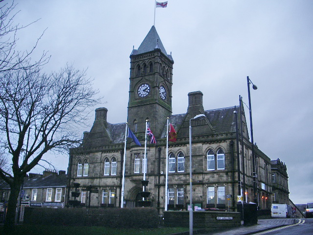
Colne () is a market town and civil parish in the Borough of Pendle in Lancashire, England. Located northeast of Nelson, north-east of Burnley, east of Preston and west of Leeds. The town should not be confused with the unrelated Colne Valley around the River Colne near Huddersfield in West Yorkshire. Colne is close to the southern entrance to the Aire Gap, the lowest crossing of the Pennine watershed. The M65 terminates west of the town and from here two main roads take traffic onwards towards the Yorkshire towns of Skipton (A56) and Keighley (A6068). Colne railway station is the terminus of the East Lancashire railway line. Colne adjoins the Pendle parishes of Foulridge, Laneshaw Bridge, Trawden Forest, Nelson, Barrowford and Blacko. History Settlement in the area can be traced back to the Stone Age. A Mesolithic camp site, a Bronze Age burial site and stone tools from the Bronze and Stone Ages have been discovered at nearby Trawden. There are also the remains of an ... [...More Info...] [...Related Items...] OR: [Wikipedia] [Google] [Baidu] |
Cottontree And Winewall, Lancashire
Cottontree and Winewall are two hamlets situated in the civil parish of Trawden Forest in Pendle, Lancashire. They are adjacent to one other and located between the towns of Colne and Trawden. Cottontree is generally situated in the valley along the road that connects the two towns. Winewall is generally on the hillside overlooking Cottontree. The road that runs between Cottontree and Winewall connects to Laneshaw Bridge, Wycoller and is an alternative route to Trawden. Until 2001 Winewall had one of England's last Inghamite chapels. See also * *Listed buildings in Trawden Forest Trawden Forest is a civil parish in Pendle, Lancashire, England. It contains 39 listed buildings that are recorded in the National Heritage List for England. Of these, six are at Grade II*, the middle grade, and the others are at Grade&nb ... References External links : : Mike Baker Website - Info & Photos of Cottontree & Winewall* ttps://web.archive.org/web/20110711035520/http://www1 ... [...More Info...] [...Related Items...] OR: [Wikipedia] [Google] [Baidu] |
Rivers Of Lancashire
A river is a natural flowing watercourse, usually freshwater, flowing towards an ocean, sea, lake or another river. In some cases, a river flows into the ground and becomes dry at the end of its course without reaching another body of water. Small rivers can be referred to using names such as creek, brook, rivulet, and rill. There are no official definitions for the generic term river as applied to geographic features, although in some countries or communities a stream is defined by its size. Many names for small rivers are specific to geographic location; examples are "run" in some parts of the United States, "burn" in Scotland and northeast England, and "beck" in northern England. Sometimes a river is defined as being larger than a creek, but not always: the language is vague. Rivers are part of the water cycle. Water generally collects in a river from precipitation through a drainage basin from surface runoff and other sources such as groundwater recharge, springs, a ... [...More Info...] [...Related Items...] OR: [Wikipedia] [Google] [Baidu] |
Brittonic Languages
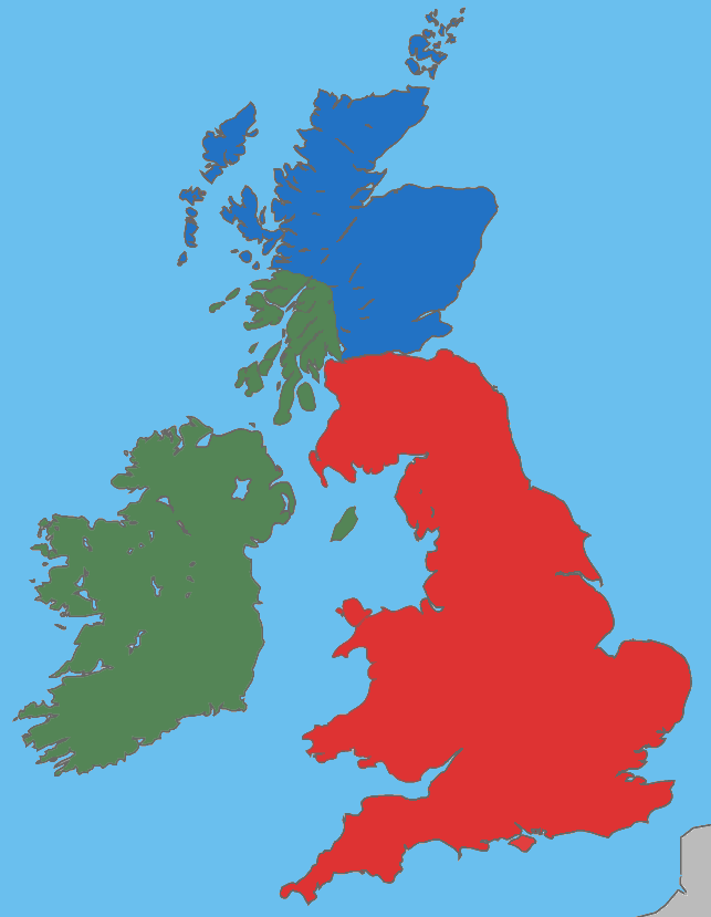
The Brittonic languages (also Brythonic or British Celtic; cy, ieithoedd Brythonaidd/Prydeinig; kw, yethow brythonek/predennek; br, yezhoù predenek) form one of the two branches of the Insular Celtic language family; the other is Goidelic. The name ''Brythonic'' was derived by Welsh Celticist John Rhys from the Welsh word , meaning Ancient Britons as opposed to an Anglo-Saxon or Gael. The Brittonic languages derive from the Common Brittonic language, spoken throughout Great Britain during the Iron Age and Roman period. In the 5th and 6th centuries emigrating Britons also took Brittonic speech to the continent, most significantly in Brittany and Britonia. During the next few centuries the language began to split into several dialects, eventually evolving into Welsh, Cornish, Breton, Cumbric, and probably Pictish. Welsh and Breton continue to be spoken as native languages, while a revival in Cornish has led to an increase in speakers of that language. Cumbric and Pictish are ... [...More Info...] [...Related Items...] OR: [Wikipedia] [Google] [Baidu] |
M65 Motorway
The M65 is a motorway in Lancashire, England. It runs from just south of Preston through the major junction of the M6 and M61 motorways, east past Darwen, Blackburn, Accrington, Burnley, Brierfield, Nelson and ends at Colne. History The M65 was opened in the following sections: *Junctions 1a to 6 M6 to Whitebirk in 1997 *Junctions 6 to 7 (Whitebirk to Accrington/Hyndburn) in 1984 *Junctions 7 to 10 (Hyndburn to Burnley) in 1983 *Junctions 10 to 12 (Burnley to Brierfield) in 1981 *Junctions 12 to 13 (Brierfield to Nelson) in 1983 *Junctions 13 to 14 (Nelson to Colne) in 1988 The first section of the motorway was opened in 1981, connecting Burnley to Brierfield. Over the years, several extensions were made, the largest being the link from Whitebirk to the M6 and M61 motorways in 1997. This extension was the scene of a standoff between construction security workers and protesters forming part of the environmental direct action movement. Protesters occupied abandoned bui ... [...More Info...] [...Related Items...] OR: [Wikipedia] [Google] [Baidu] |
Barrowford
Barrowford () is a large village and civil parish in the Pendle district of Lancashire, England. It is situated to the north of Nelson on the other side of the M65 motorway, and forms part of the Nelson conurbation. It also comprises the area of Lowerford (not to be confused with its neighbour Higherford). The parish has a population of 6,171. The community is located near the Forest of Bowland, an Area of Outstanding Natural Beauty while the Borough of Pendle is at the southern edge of the Yorkshire Dales. Barrowford is situated on the Nelson, Lancashire, Marsden–Gisburn–Long Preston Turnpike trust, turnpike. One of the original toll houses, dating from 1804 to 1805, can still be seen at the junction with the road to Colne, complete with a reproduction of the table of tolls which were paid. The toll house was restored in the 1980s and is owned by the trust which operates nearby Pendle Heritage Centre. Barrowford is located about half a mile from the Leeds and Liverpool Cana ... [...More Info...] [...Related Items...] OR: [Wikipedia] [Google] [Baidu] |
Pendle Water
Pendle Water is a minor river in Lancashire, England. Rising on Pendle Hill, Pendle Water cuts a deep valley between Barley Moor and Spence Hill where it feeds into the reservoirs of ''Upper'' and ''Lower Ogden''. Upon exiting the lower reservoir Pendle Water flows east through the villages of Barley and Roughlee before collecting Blacko Water which drains the Admergill Valley at Water Meetings near Wheathead, one mile west of the village of Blacko. The river then flows south through Higherford and Barrowford where it is joined by Colne Water. It collects Walverden Water as it passes the site of Nelson and Colne College. From this point onwards, the river flows west past the ''Lomeshaye Industrial Estate'' alongside the Leeds and Liverpool Canal towards its confluence with the River Calder in Reedley Hallows, which is northwest of Burnley. Pendle Water once supplied water to the ''Burnley Water Treatment Works'' which is situated on Wood End Lane. Flooding Incidents On Tues ... [...More Info...] [...Related Items...] OR: [Wikipedia] [Google] [Baidu] |
Leeds And Liverpool Canal
The Leeds and Liverpool Canal is a canal in Northern England, linking the cities of Leeds and Liverpool. Over a distance of , crossing the Pennines, and including 91 locks on the main line. The Leeds and Liverpool Canal has several small branches, and in the early 21st century a new link was constructed into the Liverpool docks system. History Background In the mid-18th century the growing towns of Yorkshire, including Leeds, Wakefield and Bradford, were trading increasingly. While the Aire and Calder Navigation improved links to the east for Leeds, links to the west were limited. Bradford merchants wanted to increase the supply of limestone to make lime for mortar and agriculture using coal from Bradford's collieries and to transport textiles to the Port of Liverpool. On the west coast, traders in the busy port of Liverpool wanted a cheap supply of coal for their shipping and manufacturing businesses and to tap the output from the industrial regions of Lancashire. Inspired by ... [...More Info...] [...Related Items...] OR: [Wikipedia] [Google] [Baidu] |
A56 Road
The A56 is a road in England which extends between the city of Chester in Cheshire and the village of Broughton in North Yorkshire. The road contains a mixture of single and dual carriageway sections, and traverses environments as diverse as the dense urban sprawl of inner city Manchester and the lightly populated region of rural east Lancashire. The road includes a short section of trunk road between the end of the M66 motorway near Ramsbottom and the M65 motorway west of Burnley. Route description The road begins as Frodsham Street in the centre of Chester at its junction with Foregate Street A51 and heads north-eastwards out of the city. Just outside the city, the A56 crosses Junction 12 of the M53 motorway, continuing in a north easterly direction. The road passes through the towns and villages of Mickle Trafford, Dunham on the Hill, Helsby and Frodsham whilst roughly paralleling the course of the south side of the M56 motorway. After leaving Frodsham, the A56 crosses th ... [...More Info...] [...Related Items...] OR: [Wikipedia] [Google] [Baidu] |
East Lancashire Line
The East Lancashire line is a railway line in the Lancashire region of England, which runs between Preston and Colne, through Blackburn, Accrington, Burnley (Barracks and Central) and Nelson. The line formerly ran onto Skipton but this closed in 1970. It is operated by Northern. Services on this line stop at every station on the line, although Pleasington, Hapton and Burnley Barracks are now request stops only. It was designated by the Department for Transport as a community rail line in November 2006. History The line was built by the Blackburn and Preston Railway and the Blackburn, Burnley, Accrington and Colne Extension Railway. Both companies were absorbed by the East Lancashire Railway on 3 August 1846 and 21 July 1845 respectively. The East Lancashire Railway was, in turn, absorbed by the Lancashire and Yorkshire Railway on 13 May 1859. The line connected end-on at Colne with the Leeds and Bradford Extension Railway's line to and Bradford. This link closed in 1 ... [...More Info...] [...Related Items...] OR: [Wikipedia] [Google] [Baidu] |
Colne
Colne () is a market town and civil parish in the Borough of Pendle in Lancashire, England. Located northeast of Nelson, north-east of Burnley, east of Preston and west of Leeds. The town should not be confused with the unrelated Colne Valley around the River Colne near Huddersfield in West Yorkshire. Colne is close to the southern entrance to the Aire Gap, the lowest crossing of the Pennine watershed. The M65 terminates west of the town and from here two main roads take traffic onwards towards the Yorkshire towns of Skipton (A56) and Keighley (A6068). Colne railway station is the terminus of the East Lancashire railway line. Colne adjoins the Pendle parishes of Foulridge, Laneshaw Bridge, Trawden Forest, Nelson, Barrowford and Blacko. History Settlement in the area can be traced back to the Stone Age. A Mesolithic camp site, a Bronze Age burial site and stone tools from the Bronze and Stone Ages have been discovered at nearby Trawden. There are also the remains of an I ... [...More Info...] [...Related Items...] OR: [Wikipedia] [Google] [Baidu] |
River
A river is a natural flowing watercourse, usually freshwater, flowing towards an ocean, sea, lake or another river. In some cases, a river flows into the ground and becomes dry at the end of its course without reaching another body of water. Small rivers can be referred to using names such as Stream#Creek, creek, Stream#Brook, brook, rivulet, and rill. There are no official definitions for the generic term river as applied to Geographical feature, geographic features, although in some countries or communities a stream is defined by its size. Many names for small rivers are specific to geographic location; examples are "run" in some parts of the United States, "Burn (landform), burn" in Scotland and northeast England, and "beck" in northern England. Sometimes a river is defined as being larger than a creek, but not always: the language is vague. Rivers are part of the water cycle. Water generally collects in a river from Precipitation (meteorology), precipitation through a ... [...More Info...] [...Related Items...] OR: [Wikipedia] [Google] [Baidu] |


