|
Coldingham
Coldingham ( sco, Cowjum) is a village and parish in Scottish Borders, on Scotland's southeast coastline, north of Eyemouth. Parish The parish lies in the east of the Lammermuir district. It is the second-largest civil parish by area in Berwickshire county, after Lauder.Coldingham - Parish and Priory, by Adam Thomson (minister at Coldstream), publ by Craighead, Galashiels,1908. P.20 It is bounded on the north-west by the North Sea, on the east by the parish of Eyemouth, on the south-east by Ayton on the south by Chirnside and Bunkle, on the west by Abbey St Bathans and on the north by Cockburnspath. Ordnance Gazetteer of Scotland, by Francis Groome, 2nd edition publ. 1896. Article on Coldingham Besides the village of Coldingham, the parish contains the villages of: *St Abbs (formerly Coldingham Shore) * Reston * Auchencrow *Grantshouse The civil parish is divided between the Community Council areas of Coldingham, St Abbs, Reston and Auchencrow, and Grantshouse. It was in ... [...More Info...] [...Related Items...] OR: [Wikipedia] [Google] [Baidu] |
Coldingham Priory
Coldingham Priory was a house of Benedictine monks. It lies on the south-east coast of Scotland, in the village of Coldingham, Berwickshire. Coldingham Priory was founded in the reign of David I of Scotland, although his older brother and predecessor King Edgar of Scotland had granted the land of Coldingham to the Church of Durham in 1098, and a church was constructed by him and presented in 1100. The first prior of Coldingham is on record by the year 1147, although it is likely that the foundation was much earlier. The earlier monastery at Coldingham was founded by St Æbbe sometime c. AD 640. Although the monastery was largely destroyed by Oliver Cromwell in 1650, some remains of the priory exist, the choir of which forms the present parish church of Coldingham and is serviced by the Church of Scotland. Early Middle Ages St Æbbe the Elder Early life Æbbe was born c. AD 615 into both royal houses of Northumbria, the daughter of King Æthelfrith of Bernicia, (the first kin ... [...More Info...] [...Related Items...] OR: [Wikipedia] [Google] [Baidu] |
Coldingham Parish Map
Coldingham ( sco, Cowjum) is a village and parish in Scottish Borders, on Scotland's southeast coastline, north of Eyemouth. Parish The parish lies in the east of the Lammermuir district. It is the second-largest civil parish by area in Berwickshire county, after Lauder.Coldingham - Parish and Priory, by Adam Thomson (minister at Coldstream), publ by Craighead, Galashiels,1908. P.20 It is bounded on the north-west by the North Sea, on the east by the parish of Eyemouth, on the south-east by Ayton, Scottish Borders, Ayton on the south by Chirnside and Bonkyl Kirk, Bunkle, on the west by Abbey St Bathans and on the north by Cockburnspath. Ordnance Gazetteer of Scotland, by Francis Groome, 2nd edition publ. 1896. Article on Coldingham Besides the village of Coldingham, the parish contains the villages of: *St Abbs (formerly Coldingham Shore) *Reston, Scottish Borders, Reston *Auchencrow *Grantshouse The civil parish is divided between the Community Council areas of Coldingham, ... [...More Info...] [...Related Items...] OR: [Wikipedia] [Google] [Baidu] |
Coldingham Bay
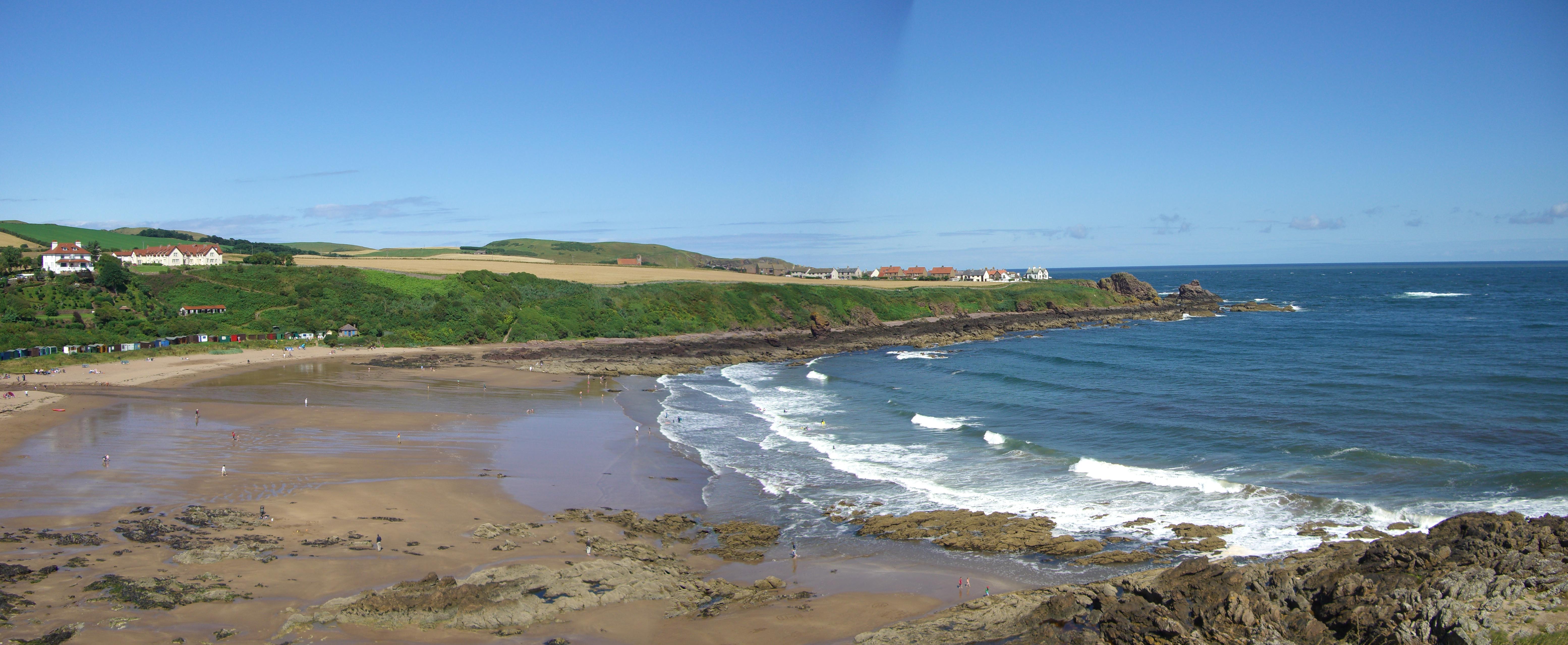
Coldingham Bay is an inlet in the North Sea coast, just over three kilometres north of the town of Eyemouth in the Scottish Borders area of Scotland. It is situated at grid reference and is easily reached by a minor road which leaves the B6438 road at Coldingham. The Beach Coldingham Sands is the name of the large beach in the Bay. It attracts many visitors, and on busy days there can be over 1000 visitors on the beach.Scottish Borders Council. Gives details of Homeli Knoll and states there are 55 beach huts and can be over 1000 daily visitors. Coldingham Sands is a sandy seashore, which is a rare occurrence on 's rocky coast. The beach was awarded the prestigious [...More Info...] [...Related Items...] OR: [Wikipedia] [Google] [Baidu] |
Æbbe Of Coldingham
Æbbe, also called Tabbs, (c. 615 – 683) was an Anglian abbess and noblewoman. She was the daughter of Æthelfrith, king of Bernicia from c. 593 to 616. She founded monasteries at Ebchester and St Abb's Head near Coldingham in Scotland. Life Early life Æbbe was the daughter of King Æthelfrith of Bernicia and Acha of Deira. Her brothers were Oswald of Northumbria and Oswiu. Æthelfrith invaded the neighbouring kingdom of Deira in 604, and deposed the heir, Acha's brother Edwin, who fled into exile. Æthelfrith was the first Bernician king to also rule Deira, giving him an important place in the history of the later Kingdom of Northumbria. Edwin took refuge in the court of King Rædwald of East Anglia, and with his support in 616, raised an army against Æthelfrith. Edwin's forces defeated and killed Æthelfrith, and Edwin gained the throne of Bernicia and Deira. The kingdom was no longer safe for Æthelfrith's children, as they presented potential rival claims to Edwin ... [...More Info...] [...Related Items...] OR: [Wikipedia] [Google] [Baidu] |
St Abbs
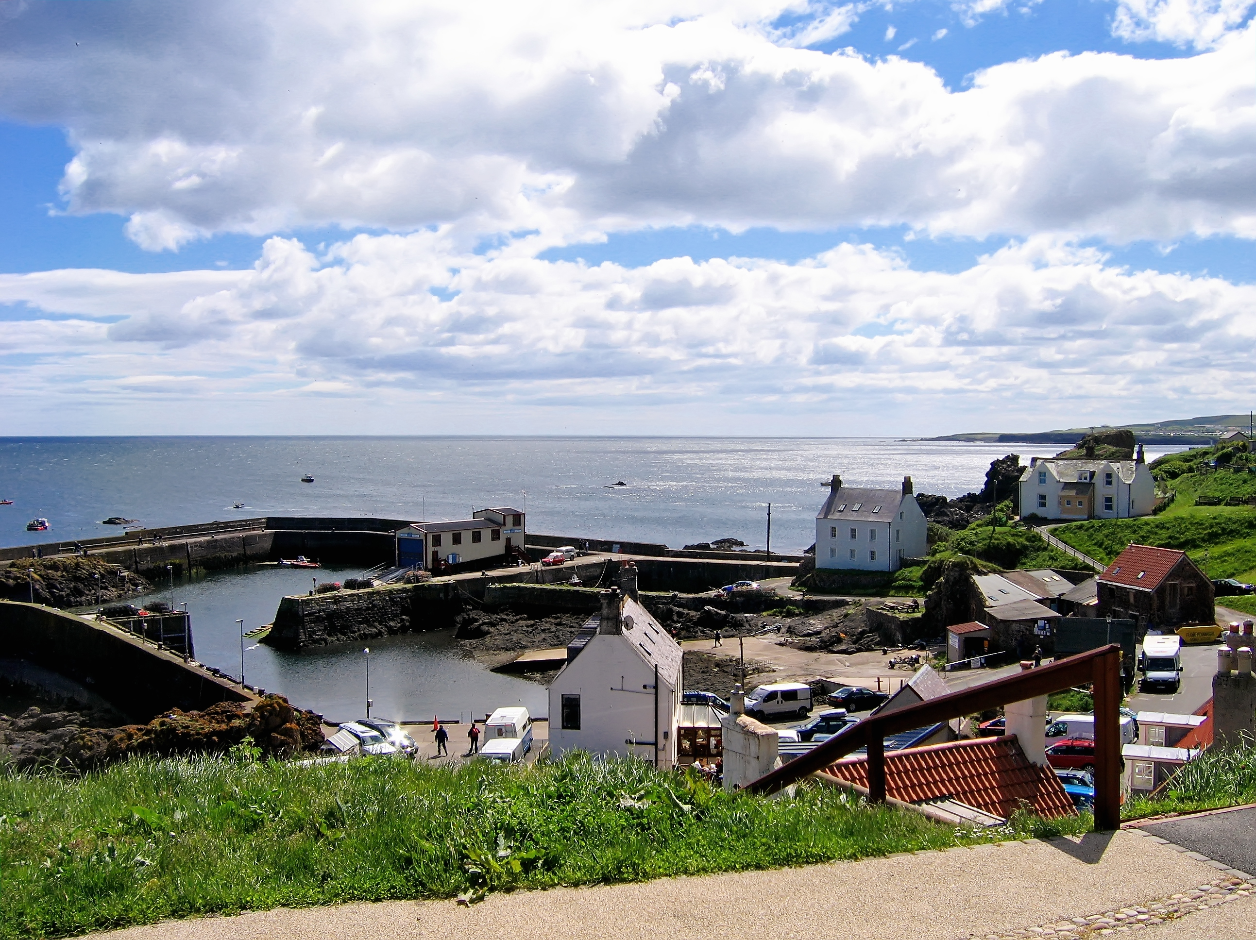
St Abbs is a small fishing village on the southeastern coast of Scotland, within the Coldingham parish of Scottish Borders. The village was originally known as ''Coldingham Shore'', the name St Abbs being adopted in the 1890s. The new name was derived from St Abb's Head, a rocky promontory located to the north of the village, itself named after the 7th-century saint Æbbe of Coldingham. History St Abbs was originally called Coldingham Shore. Prior to any buildings the fishermen who worked their boats from the beach resided at Fisher's Brae in Coldingham. These fishermen had to carry their fishing gear one and a half miles down a path to where their fishing vessels were tied up. The path is now known as the Creel Path; creel is the local name for a lobster pot. The first building in St Abbs was constructed in about the middle of the 18th century followed later by a row of five cottages. This first row of houses was constructed in a traditional Scottish style with a centra ... [...More Info...] [...Related Items...] OR: [Wikipedia] [Google] [Baidu] |
Eyemouth
Eyemouth ( sco, Heymooth) is a small town and civil parish in Berwickshire, in the Scottish Borders area of Scotland. It is east of the main north–south A1 road and north of Berwick-upon-Tweed. The town's name comes from its location at the mouth of the Eye Water river. The Berwickshire coastline consists of high cliffs over deep clear water with sandy coves and picturesque harbours. A fishing port, Eyemouth holds a yearly Herring Queen Festival. Notable buildings in the town include Gunsgreen House and a cemetery watch-house built to stand guard against the Resurrectionists (body snatchers). Many of the features of a traditional fishing village are preserved in the narrow streets and ' vennels'. Eyemouth is not far from the small villages of Ayton, Reston, St Abbs, Coldingham, and Burnmouth, all in Berwickshire. The coast offers opportunities for birdwatching, walking, fishing and diving. Accommodation includes several hotels, B&Bs and a holiday park. History Fo ... [...More Info...] [...Related Items...] OR: [Wikipedia] [Google] [Baidu] |
Berwickshire
Berwickshire ( gd, Siorrachd Bhearaig) is a historic county, registration county and lieutenancy area in south-eastern Scotland, on the English border. Berwickshire County Council existed from 1890 until 1975, when the area became part of the Borders region, with most of the historic county becoming part of the lower-tier Berwickshire district. Berwickshire district was abolished in 1996, when all the districts in the Borders region merged to become the Scottish Borders council area. The county takes its name from Berwick-upon-Tweed, its original county town, which was part of Scotland at the time of the county's formation in the twelfth century, but became part of England in 1482 after several centuries of swapping back and forth between the two kingdoms. After the loss of Berwick, Duns and Greenlaw both served as county town at different periods. The low-lying part of Berwickshire between the Tweed and the Lammermuirs is known as "the Merse", from an old Scots word for a ... [...More Info...] [...Related Items...] OR: [Wikipedia] [Google] [Baidu] |
Scottish Borders
The Scottish Borders ( sco, the Mairches, 'the Marches'; gd, Crìochan na h-Alba) is one of 32 council areas of Scotland. It borders the City of Edinburgh, Dumfries and Galloway, East Lothian, Midlothian, South Lanarkshire, West Lothian and, to the south-west, south and east, the English counties of Cumbria and Northumberland. The administrative centre of the area is Newtown St Boswells. The term Scottish Borders, or normally just "the Borders", is also used to designate the areas of southern Scotland and northern England that bound the Anglo-Scottish border. Geography The Scottish Borders are in the eastern part of the Southern Uplands. The region is hilly and largely rural, with the River Tweed flowing west to east through it. The highest hill in the region is Broad Law in the Manor Hills. In the east of the region, the area that borders the River Tweed is flat and is known as 'The Merse'. The Tweed and its tributaries drain the entire region with the river flowi ... [...More Info...] [...Related Items...] OR: [Wikipedia] [Google] [Baidu] |
Ecgfrith Of Northumbria
Ecgfrith (; ang, Ecgfrið ; 64520 May 685) was the King of Deira from 664 until 670, and then King of Northumbria from 670 until his death in 685. He ruled over Northumbria when it was at the height of its power, but his reign ended with a disastrous defeat at the Battle of Nechtansmere against the Picts of Fortriu in which he lost his life. Early life Ecgfrith was born in 645 to king Oswiu and Eanflæd his queen. At about the age of 10 Ecgfrith was held as a hostage at the court of Queen Cynewise after her husband king Penda of Mercia invaded Northumbria in 655. Penda was eventually defeated and killed in the Battle of the Winwaed by Oswiu, a victory which greatly enhanced Northumbrian power. To secure his hegemony over other English kingdoms Oswiu arranged a marriage between Ecgfrith and Æthelthryth, a daughter of Anna of East Anglia. Ecgfrith was then made king of Deira in 664 after his half-brother Alhfrith had rebelled against Oswiu earlier that year. King of Northumbria ... [...More Info...] [...Related Items...] OR: [Wikipedia] [Google] [Baidu] |
Oldhamstocks
Oldhamstocks or Aldhamstocks ("old dwelling place") is a civil parish and small village in the east of East Lothian, Scotland, adjacent to the Scottish Borders and overlooking the North Sea . It is located south-east of Dunbar and has a population of 193. The church was consecrated by Bishop David de Bernham, 19 October 1242. Its chancel is a fine example of late Gothic — probably fifteenth-century work. The summer Gala Day hosts activities such as sporting events. There is also judging of vegetables, plants and artwork. Prior to 1891 the parish was also partly in Berwickshire and had a detached portion at Butterdean of 1417 acres. The detached portion was transferred to Coldingham, Berwickshire, while the main part of the parish is now wholly within East Lothian. In 1650 Oliver Cromwell spent a night in the village prior to defeating the Scots at the Battle of Dunbar. Notable people * John Broadwood (1732–1812), piano The piano is a stringed keyboard instrument ... [...More Info...] [...Related Items...] OR: [Wikipedia] [Google] [Baidu] |
Reston, Scottish Borders
Reston is a village located in the southeast of Scotland, in Berwickshire, Scottish Borders region. The village lies on the western bank of the Eye Water. Location It is located on the East Coast Main Line railway, which runs between London King's Cross and Edinburgh Waverley. Reston was once the location of the railway station and junction between the Berwickshire Railway and the ECML. Both the Berwickshire Railway and Reston station closed in the 1960s. However the reopening of Reston station was approved and construction began in March 2021. A study published in 2013 proposed that and stations be reopened. Reston station re-opened on 23 May 2022 following completion of a £20m redevelopment. The A1 (Great North Road) runs to the east of the village. Population The current population is about 450. See also *List of places in the Scottish Borders *List of places in East Lothian *List of places in Midlothian *List of places in West Lothian ''Map of places in West Loth ... [...More Info...] [...Related Items...] OR: [Wikipedia] [Google] [Baidu] |
Auchencrow
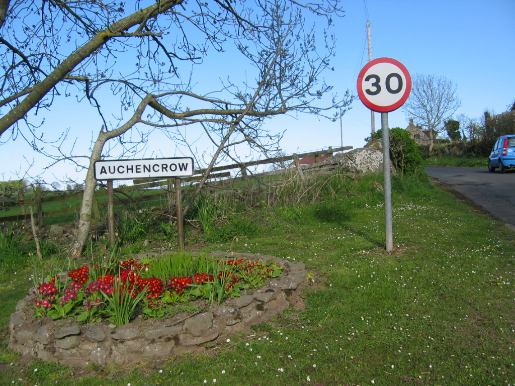
Auchencrow ( gd, Allt na Crà) is a small village in the Scottish Borders area of Scotland, by the Lammermuir range of hills, and near Reston. Etymology Around 1210, the village was referred to as Aldenegraue. It had become Aldencraw by the end of the 13th century, then Adincraw by the start of the 17th century, Auchincraw by 1771, and Auchencrow by 1860. The modern name, Auchencrow, tends to obscure the question of origins. A Gaelic origin is accepted by Watson (1926, 138) and Nicholaisen (1976, 138). It is thought that the meaning is "achadh na crà", or "field of the tree or trees". This is apparently contradicted by the 12th-century name-form ‘Alden-’, also preserved, for example, in four 13th-century Durham charters. Mac an Tàilleir suggests the form ''Aldenacraw'' may be derived from a name for the watercourse (such as the Gaelic ''Allt na Crà'', "stream of the salmon trap") rather than the settlement itself. Something like ‘Halden’s Grave’ or ‘Halden’s ... [...More Info...] [...Related Items...] OR: [Wikipedia] [Google] [Baidu] |


